Skiag Bridge
Geological Conservation Review site | GCR #901 | Structural and Metamorphic Geology | Moine
Geological Conservation Review site | GCR #901 | Structural and Metamorphic Geology | Moine
Scotland's geosites are chosen because of their local, national or international importance. Take only photos, leave only footprints: avoid causing any damage to this site. You can walk almost anywhere in Scotland without the need to ask permission or keep to paths, but you have a responsibility to care for your own safety, to respect people's privacy and peace of mind and to cause no damage.
The right of access does not extend to quarries, building sites or any land where public access is prohibited, or to the collection of geological samples.
Accessible area, much used for student mapping, that displays intricate repetitions of Cambrian stratigraphic units.
The imbricate zone involving Cambrian strata within the Sole Thrust Sheet is particularly well-developed in this site, stream sections demonstrating as many as thirteen tectonically repeated sequences of Fucoid Beds, Serpulite Grit and Durness Limestone within a third of a mile. At Skiag Bridge, and southwards towards Inchnadamph, the Sole Thrust Plane lies within or above the Grudaidh dolomite of the Durness Formation, but near Achmore it cuts downwards into the underlying Fucoid Beds, remaining at this lower horizon northwards to Loch Glencoul. The site thus provides what is perhaps the clearest demonstration of the development of a step or ramp within a thrust plane and as such has an important bearing upon our understanding of the evolution and propagation of thrusts within the Moine Thrust Belt in particular and thrust zones in general.
There are no access notes yet.
There are no safety notes yet.
There are no site highlights yet.
There are no further information notes yet.
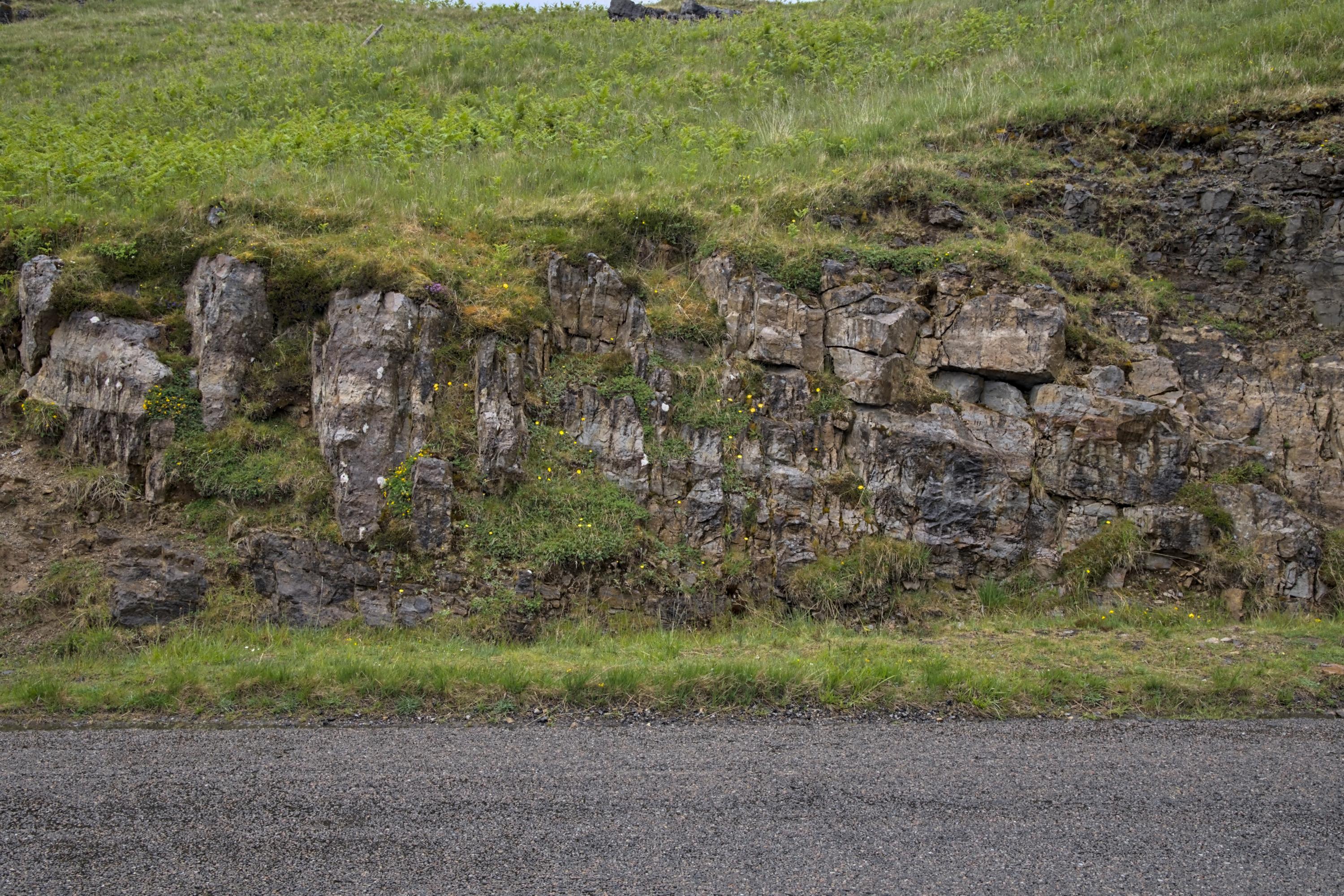
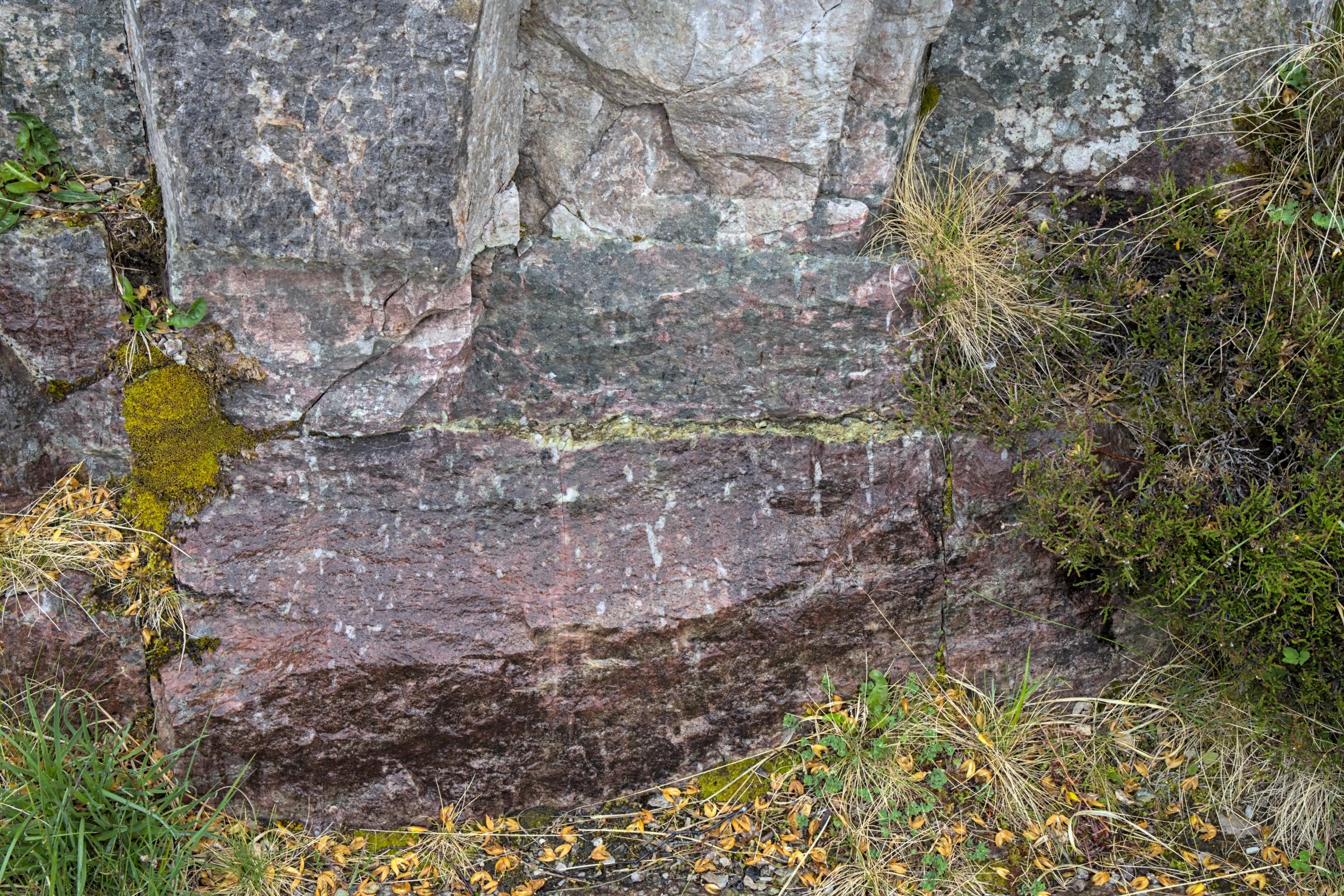
The conformity between Salterella Grit Member (uppermost part of the Ardvreck Group) and Ghrudaidh Formation (lowermost part of the Durness Group - dark grey outcrop just below the grass line at the right) marks the transition from clastic sedimentation (quartz arenites) to carbonate deposition (dolostones).
Location: about 400m southeast of the road junction (car park nearby)
Alex Gabriel
May 31, 2025
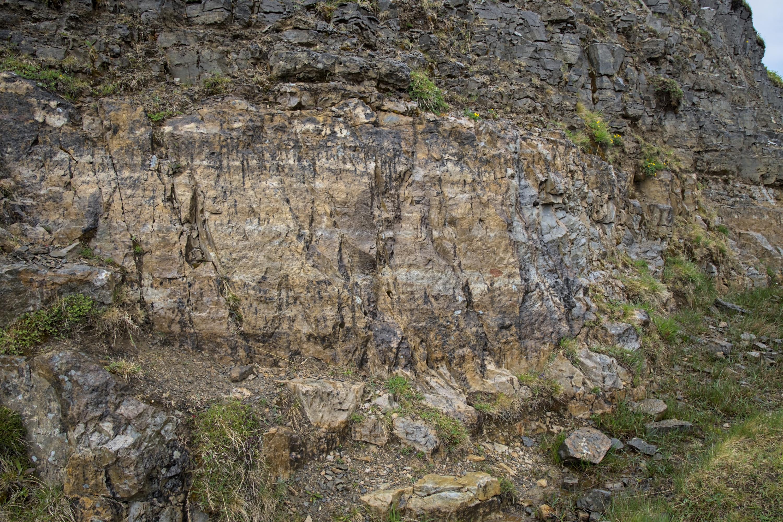
The Salterella Grit Member (An t-Sron Formation) was deposited in a period of marine regression. It contains Skolithios burrows and Salterella fossils.
Location: around 380m southeast of the road junction (car park nearby)
Alex Gabriel
May 31, 2025
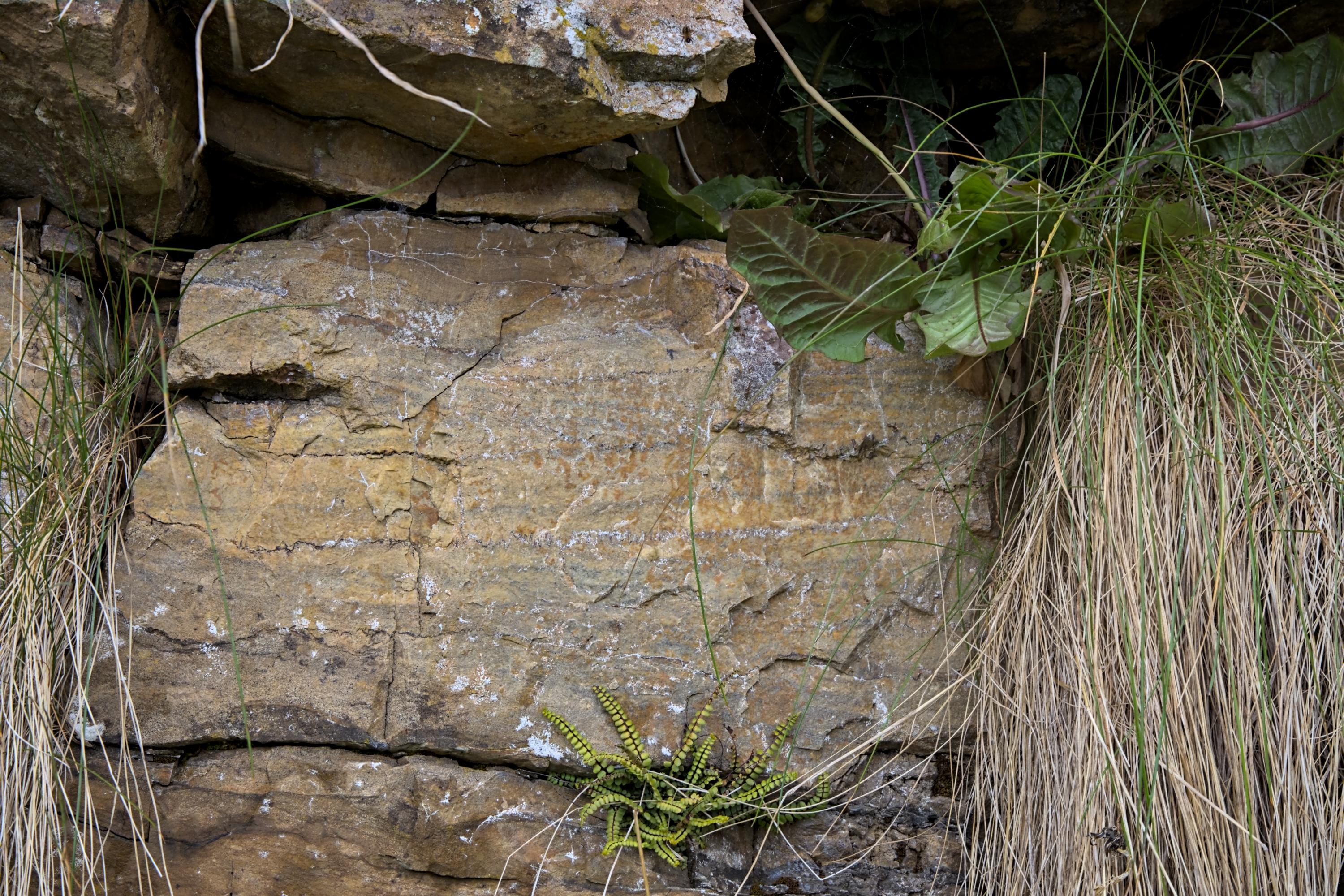
Outcrop of the Fucoid Beds Member (An t-Sron Formation) - roadside detail
Location: about 175m southeast of the road junction
Alex Gabriel
May 31, 2025
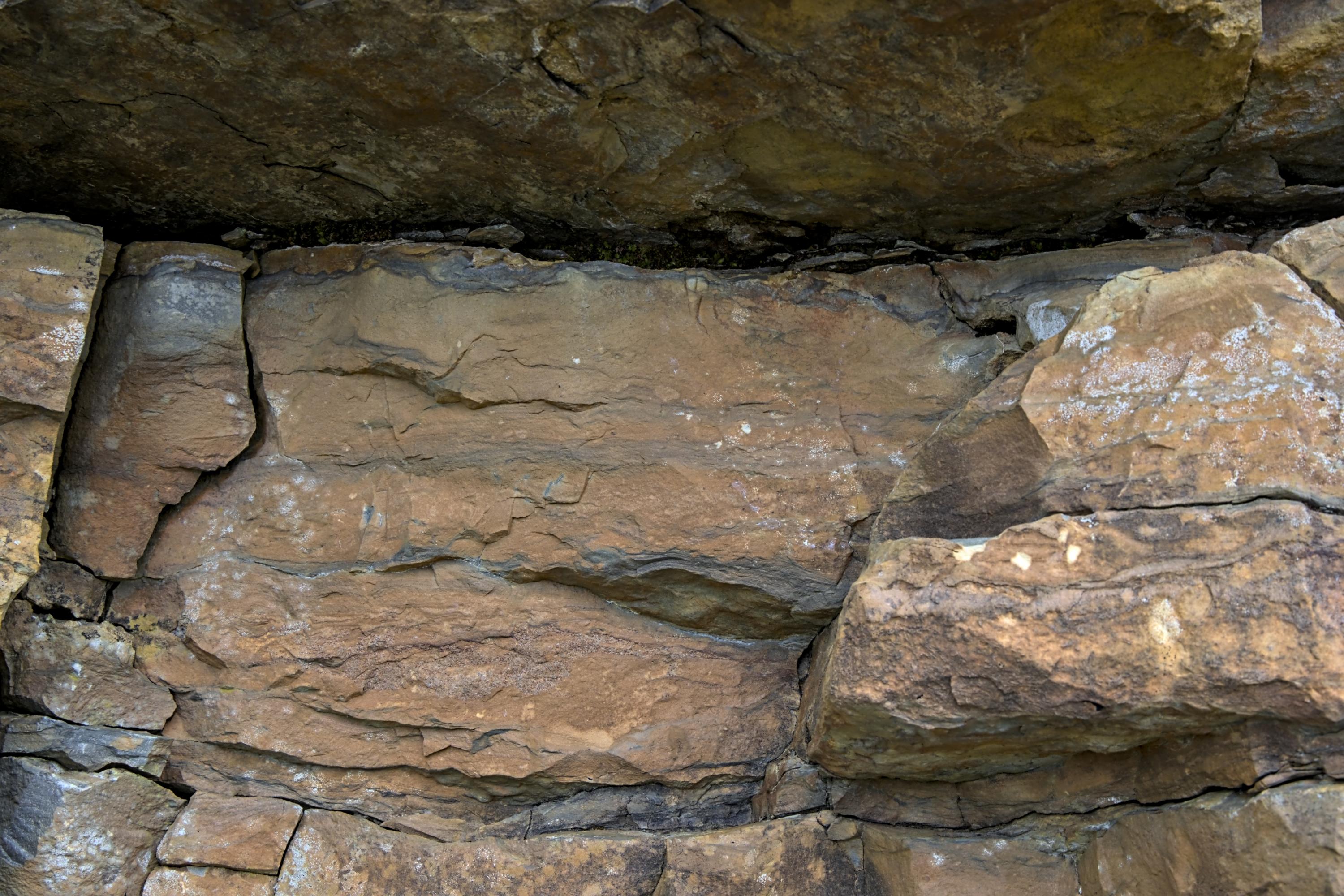
Outcrop of the Fucoid Beds Member - dolomitic siltstone with faint hummocky cross-stratification formed in relatively shallow marine conditions
Location: about 175m southeast of the road junction
Alex Gabriel
May 31, 2025
Outcrop of the Pipe Rock Member (Eriboll Formation) - detail from the base of the road cutting. The tabular cross-bedding is obscured by white Skolithos burrows and red iron oxide. Seams of green mudstone (center of image) may divide individual beds.
Location: about 45m north of the road junction
Alex Gabriel
May 31, 2025
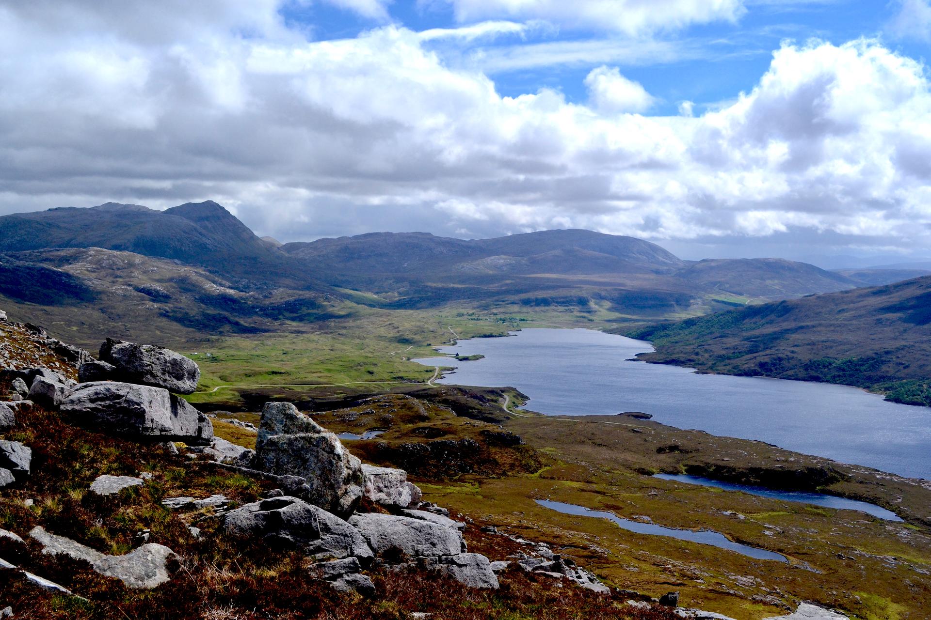
Looking onto Loch Assynt. The Skiag Bridge site lies just beyond the road intersection in the centre of the view.
Rob Butler