An Ard
Geological Conservation Review site | GCR #2435 | Structural and Metamorphic Geology | Lewisian
Geological Conservation Review site | GCR #2435 | Structural and Metamorphic Geology | Lewisian
Scotland's geosites are chosen because of their local, national or international importance. Take only photos, leave only footprints: avoid causing any damage to this site. You can walk almost anywhere in Scotland without the need to ask permission or keep to paths, but you have a responsibility to care for your own safety, to respect people's privacy and peace of mind and to cause no damage.
The right of access does not extend to quarries, building sites or any land where public access is prohibited, or to the collection of geological samples.
The headland of An Ard is the type locality for the late Archaean-early Proterozoic Ard Gneiss. The gneisses are foliated granodiorite and tonalite sheets emplaced within the metasedimentary rocks (Charlestown schists) and amphibolites of the Loch Maree Group.
The headland includes a variety of rock types which are visible along the coast line and at a few sites on the higher ground. The Ard Gneiss consisted of granitic sheets originally intruded into the rocks of the Loch Maree Group at 1903 Ma. The rocks were subsequently deformed and metamorphosed during the Laxfordian metamorphic event. They lie within the Gairloch Shear Zone and have a prominent foliation and lineation. The amphibolites in the Loch Maree Group are tough, green-black rocks, originally ocean-floor basalts. Here they have nearly vertical foliation with occasional paler feldspar-rich bands and are cross-cut by later quartz and feldspar veins. The Charleston schists were originally sedimentary rocks, now altered to hornblende and mica schists. The Ard Gneiss has small feldspar lenses (augen).
Parking is available at the Golf Club car park [NG 8071 7564] from where a path leads to Gaineamh Mhor beach. There is also a car park at Charlestown harbour [NG 8093 7519]. The An Dun headland at the south end of the beach is accessible at low tide. Alternatively a path runs along the top of the beach to An Ard headland, from where there is a path to Charlestown harbour. The shoreline of An Ard is not easily accessible but the footpath to the harbour does expose bedrock along some of its length, so that gneiss and amphibolite is visible. There are excellent exposures along the road to the pier at Charlestown although care should be taken, as materials are stored behind the buildings and sheds.
https://www.youtube.com/watch?v=mTOQHjz6cOk
‘Precambrian geology and the Gairloch map’ is a YouTube video by Rob Butler describing the geological history of the Loch Maree Group with examples from the Gairloch area.
There are no safety notes yet.
There are no site highlights yet.
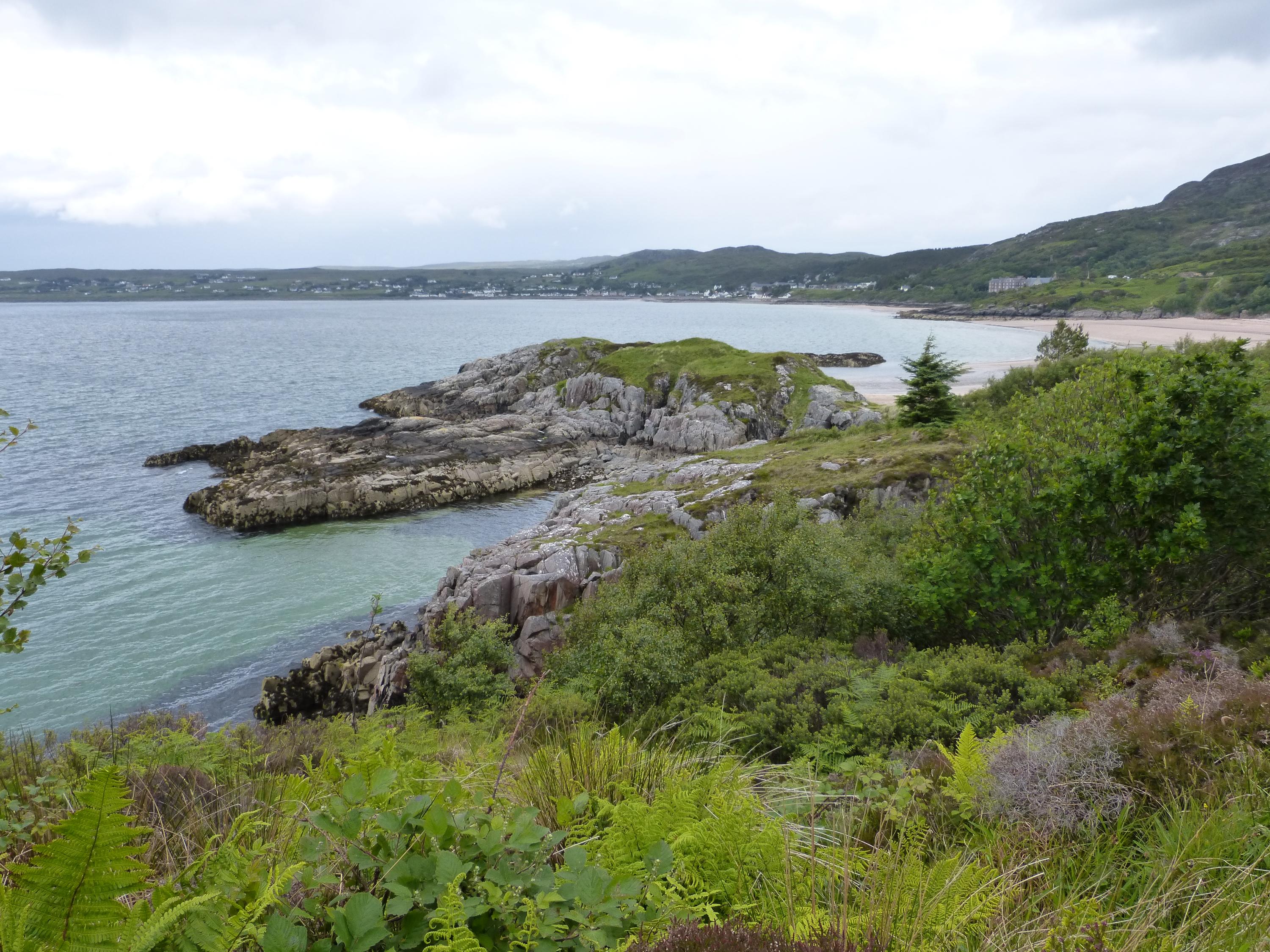
The view of An Dun peninsula from the footpath across the An Ard headland shows the differential resistance of the two rock types which form the headland. The higher area is part of a thick amphibolite sheet which trends north-west to south-east and which has a complex junction with the Ard Gneiss, exposed on the platform to the left of An Dun and in the cliffs below the footpath.
Alison Tymon
June 8, 2024
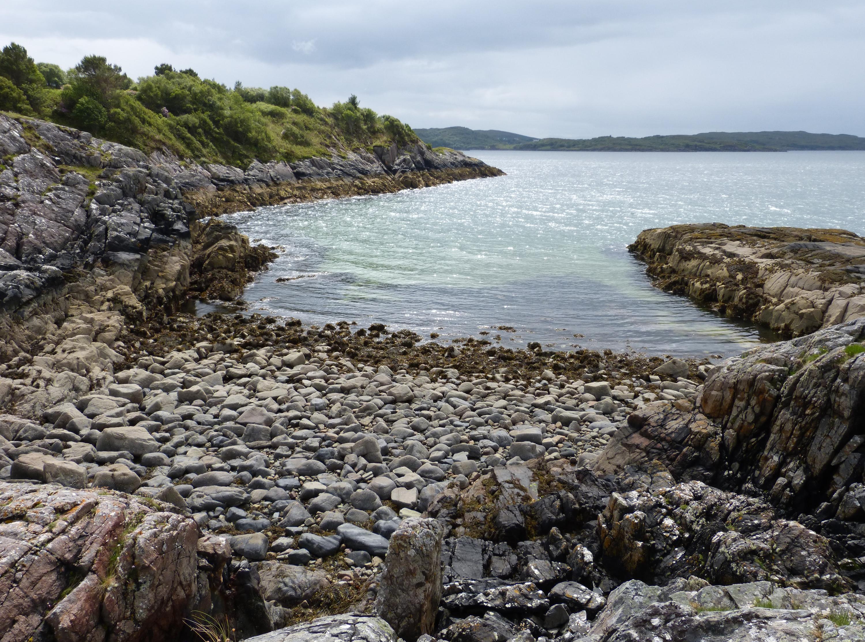
From the amphibolite exposure at the neck of An Dun, the view across the northern shore of the An Ard headland shows Ard Gneiss in the cliffs.
Alison Tymon
June 8, 2024
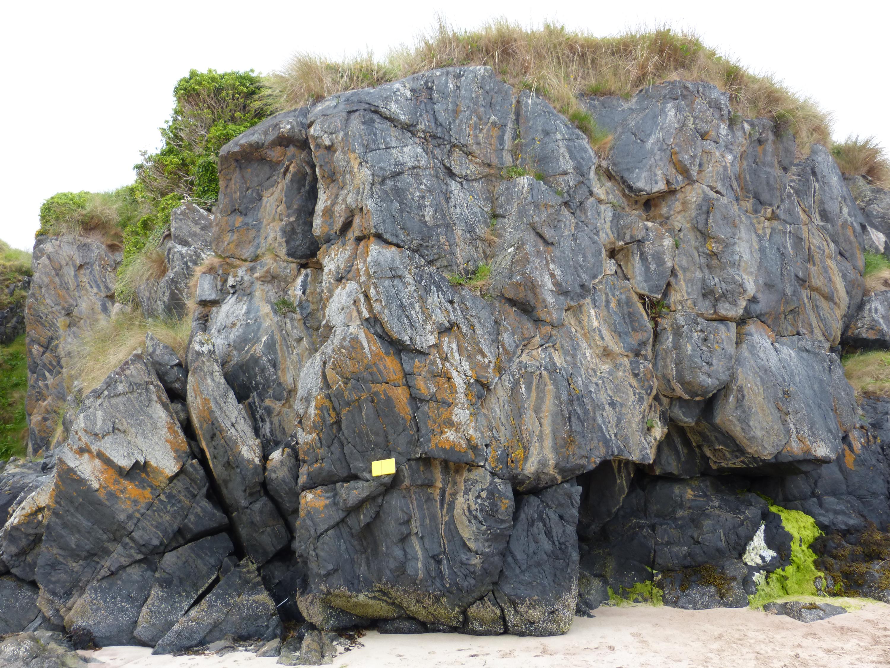
The cliffs on the east side of An Dun show good exposures of the amphibolite sheets at mid-tide level. The foliated green/black rock has thin quartz and feldspar veins. The field note book is 20 cm long.
Alison Tymon
June 8, 2024
There are occasional veins of granitic material in the amphibolites, related to the complex contacts with the adjacent Ard Gneiss.
Alison Tymon
June 8, 2024
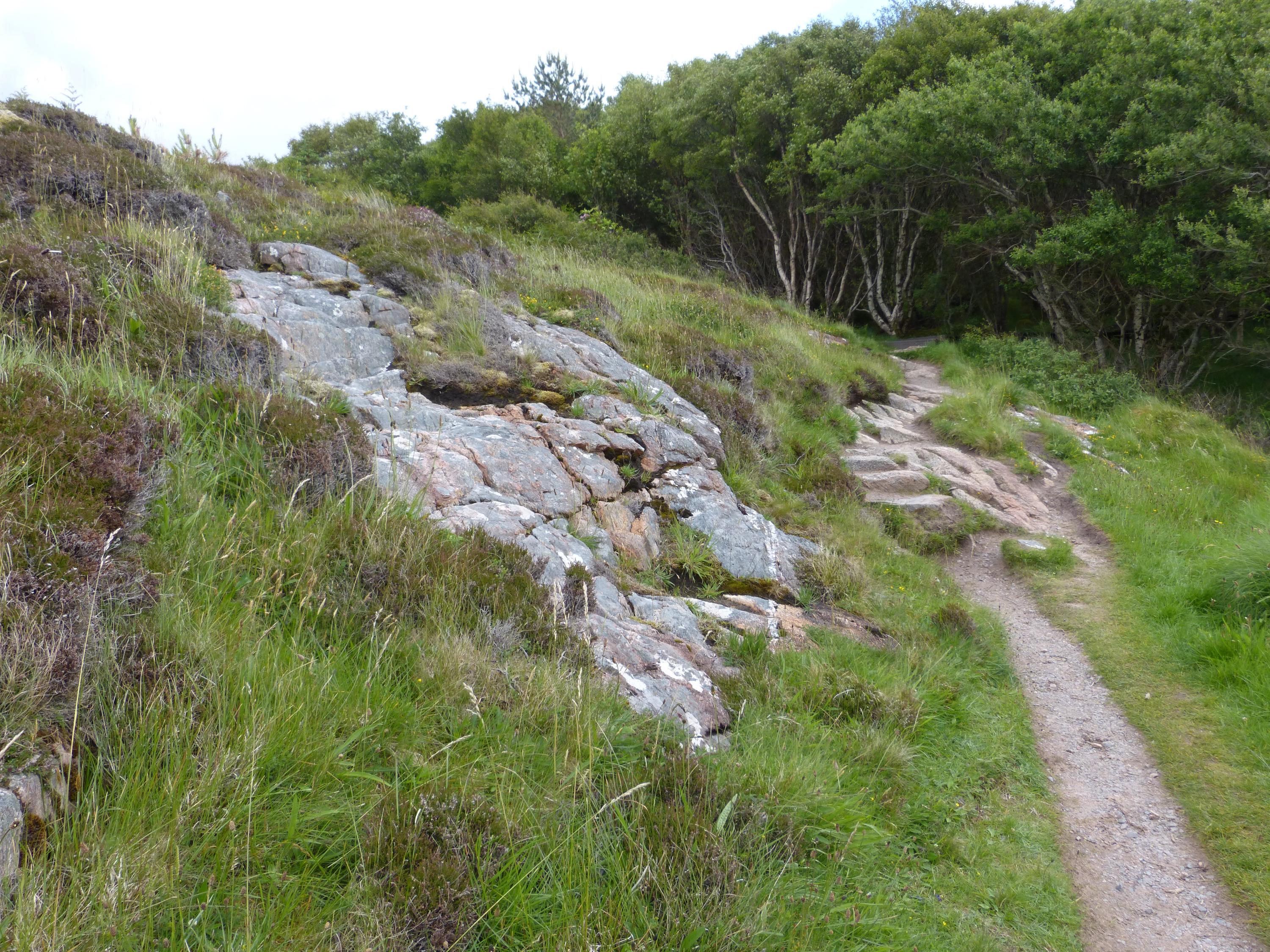
On the footpath over the An Ard headland to Charlestown harbour, there is a good exposure of the highly tectonised junction between the amphibolite sheet and the Ard Gneiss.
Alison Tymon
June 8, 2024
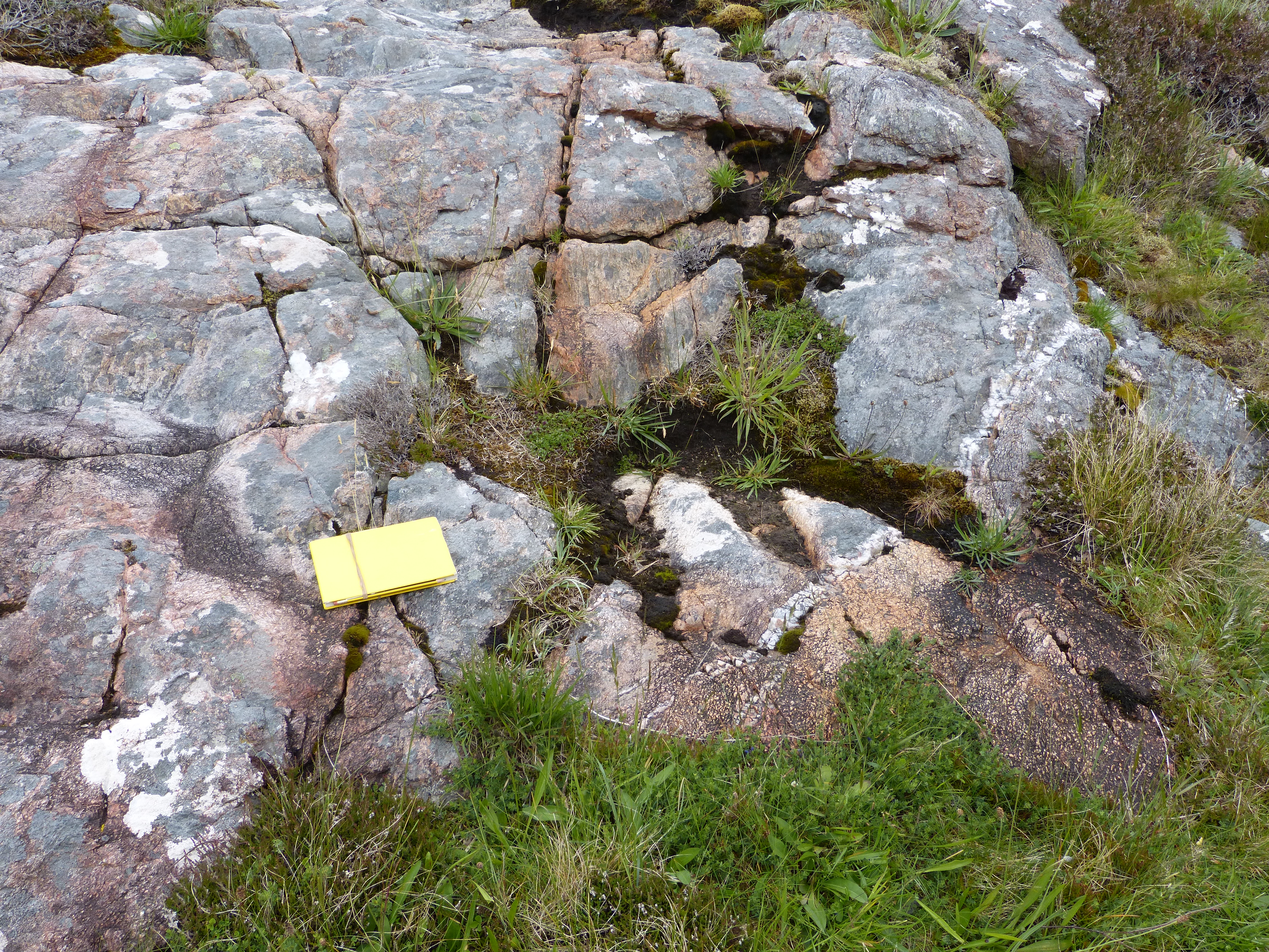
A close-up of the Ard Gneiss/amphibolite exposure shows highly irregular inclusions of pink micro-augen gneiss mixed with grey-weathering amphibolite, with veins of quartz cutting through both rocks.
Alison Tymon
June 8, 2024
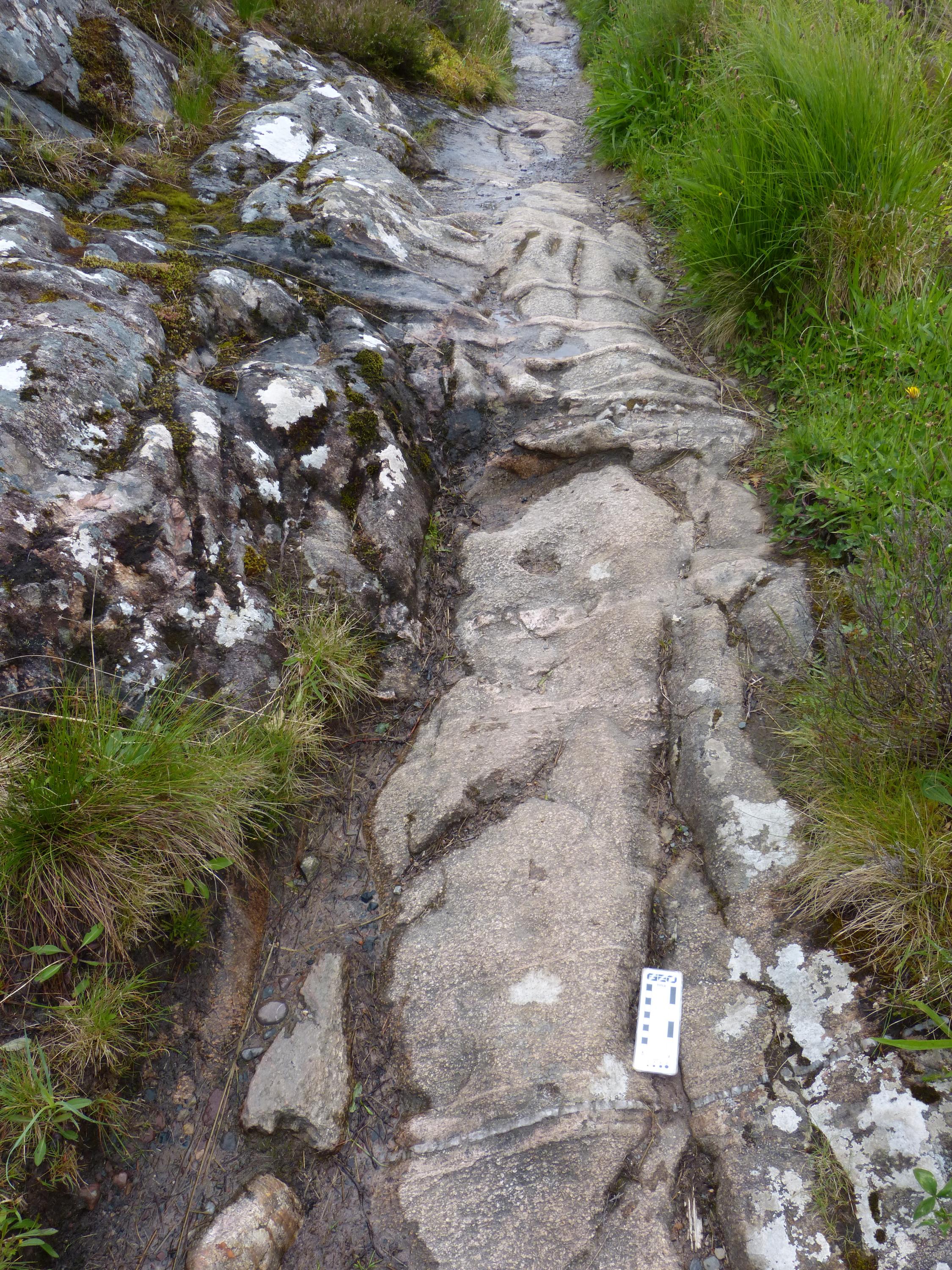
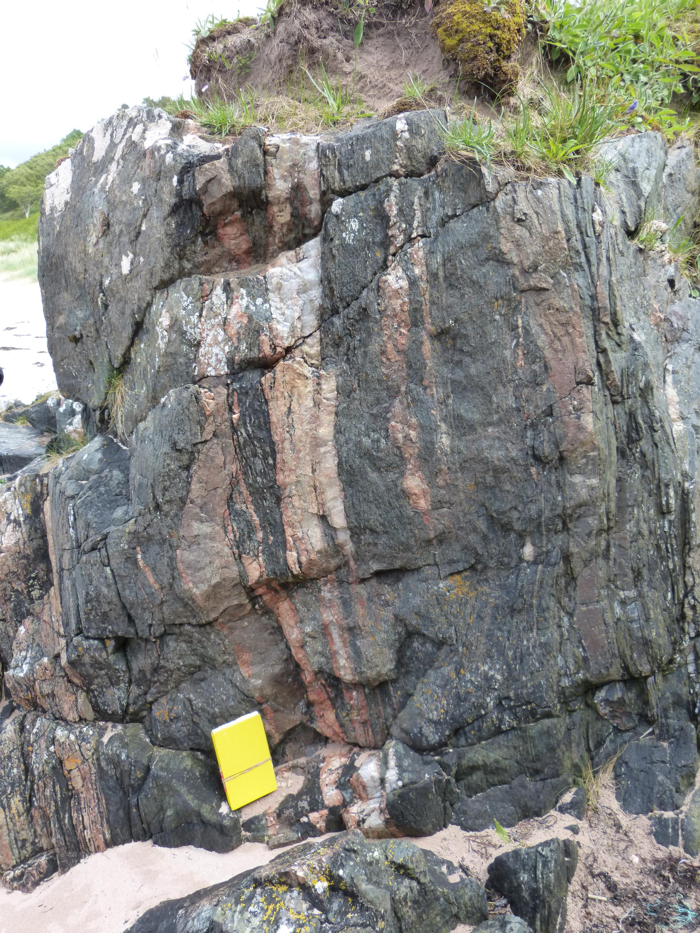
Exposures of Ard Gneiss are seen in the footpath across the headland. There are frequent, roughly parallel quartz-feldspathic veins up to 10 cm wide, with occasional quartz veins, as seen in this exposure. The scale card is 15 cm long.
Alison Tymon
June 10, 2024
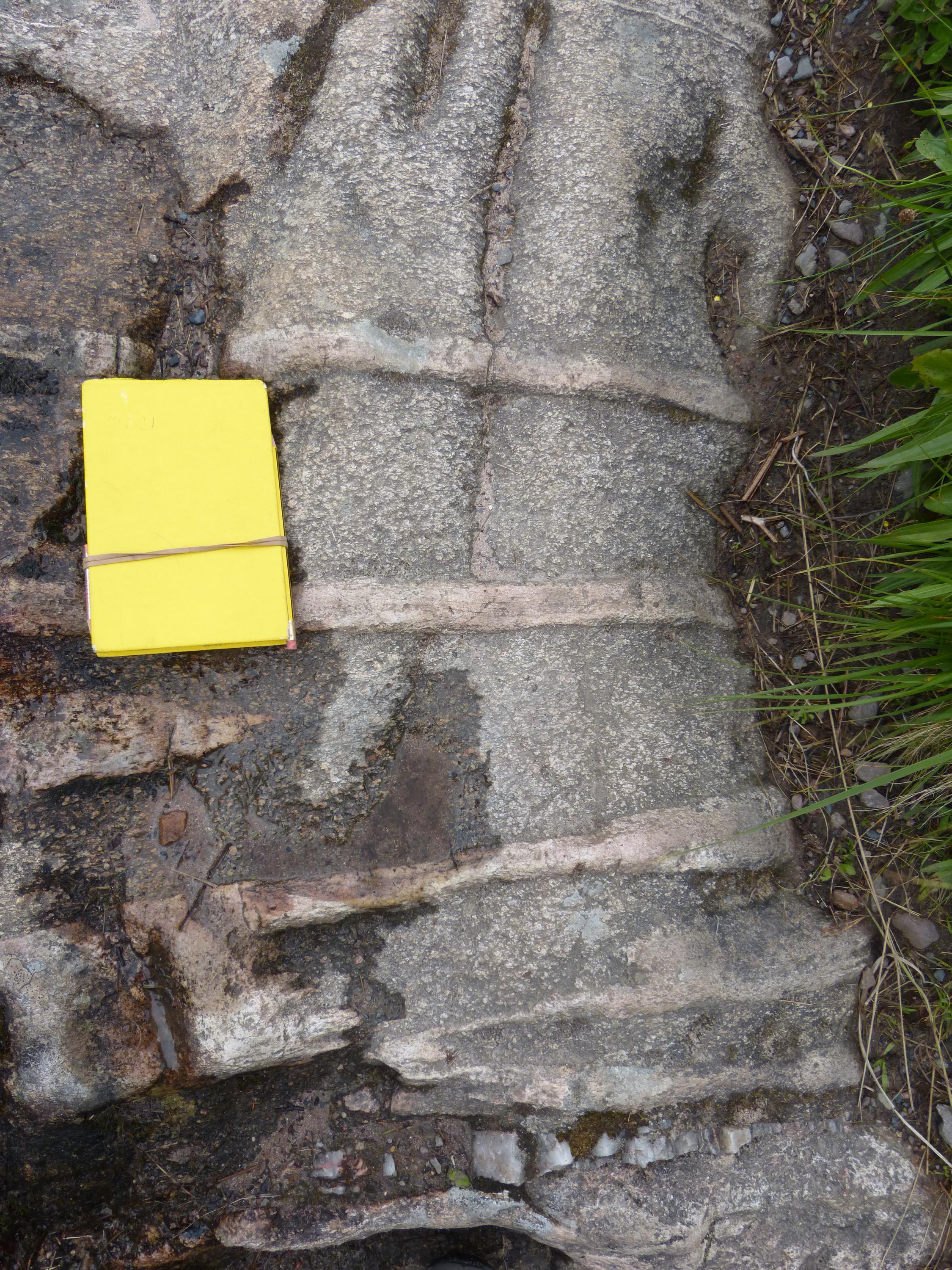
A closer view shows that the gneiss has a pinkish matrix with cream-coloured augen of feldspar with a rough foliation.
Alison Tymon
June 10, 2024
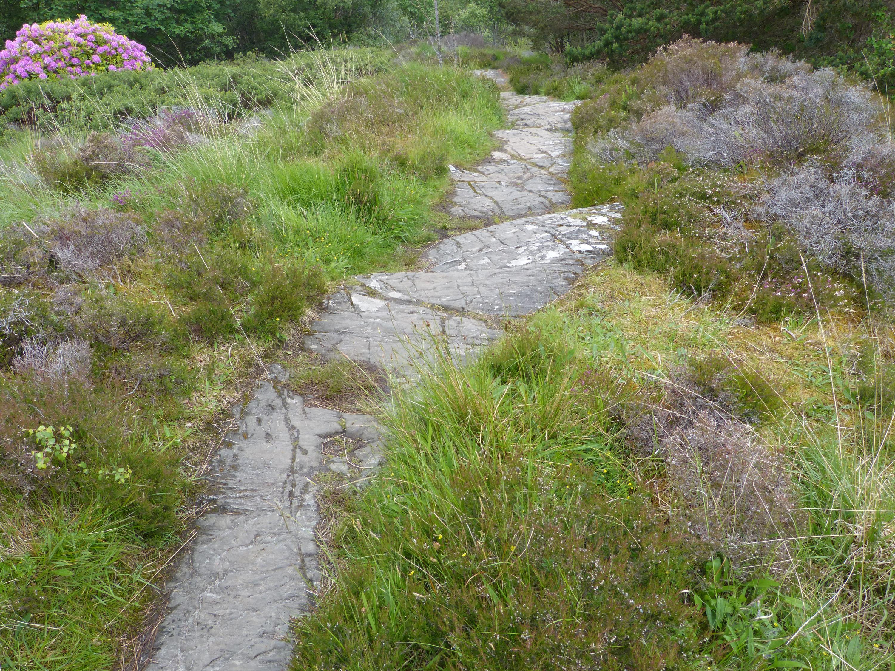
The footpath across An Ard crosses alternations of pale Ard Gneiss and dark amphibolite. Six metres of ice-scoured amphibolite are seen here; other exposures along the path show small-scale, intensely folded pale veins.
Alison Tymon
June 8, 2024
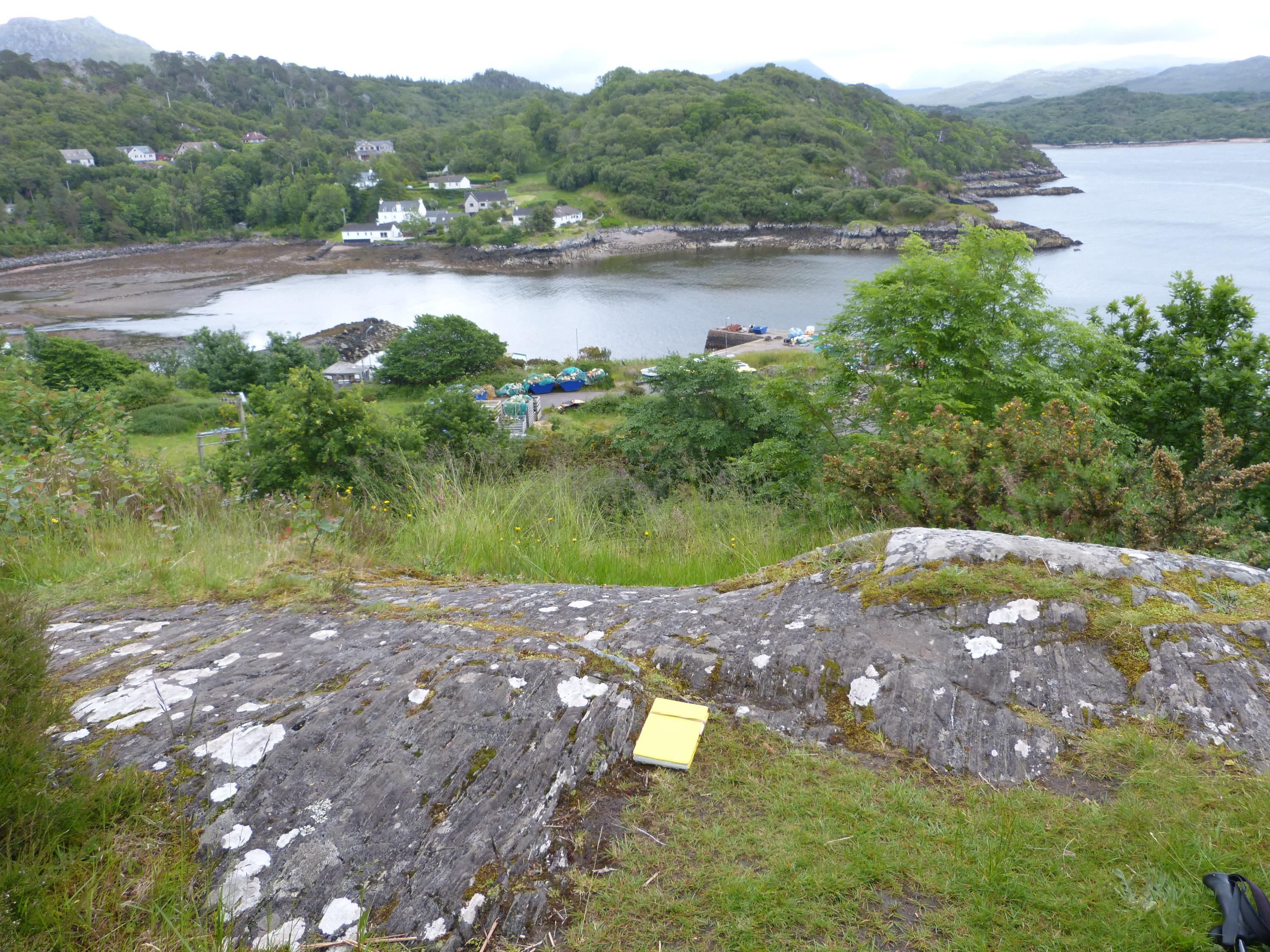
A viewpoint from the footpath above the bay looks over the harbour at Charlestown from an exposure of amphibolite. The wooded slope opposite is a continuation of the Loch Maree Group rocks of the An Ard headland.
Alison Tymon
June 8, 2024
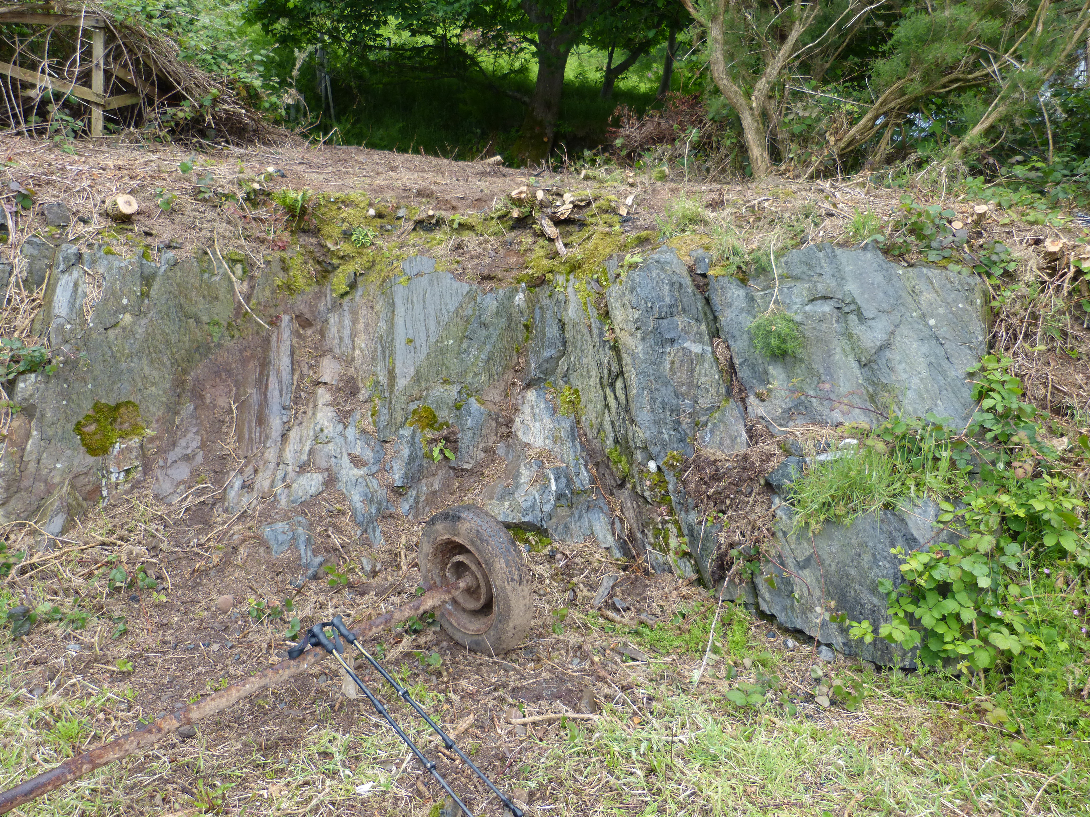
Between two buildings on the harbour road is an exposure of dark sub-vertical foliated rocks with extensive alteration to green minerals. The rocks appear to be highly altered metasediments, the semipelitic Charlestown Schists of the Loch Maree Group.
Alison Tymon
June 8, 2024
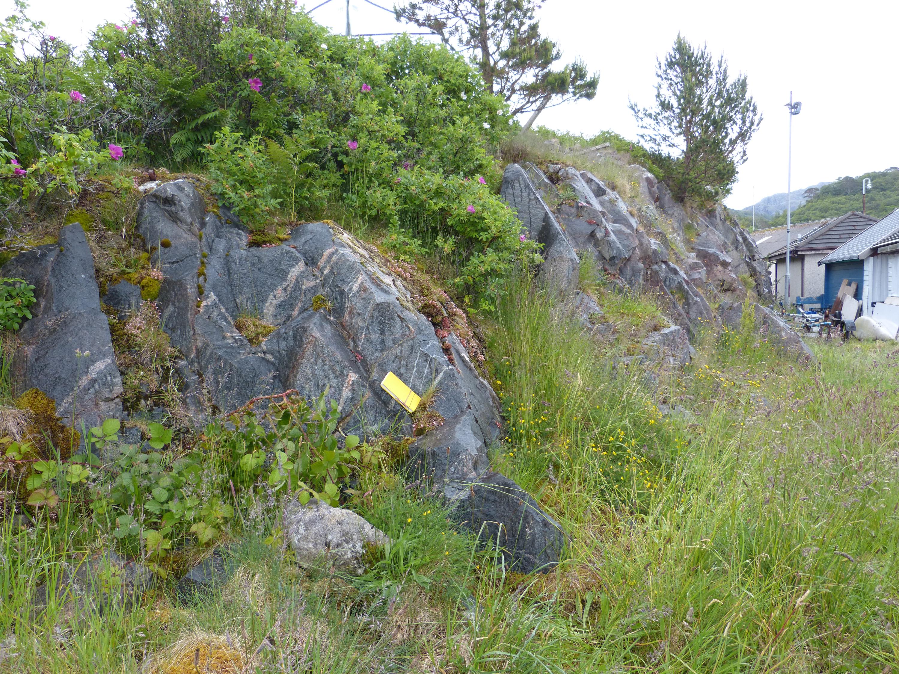
Near the end of the pier at Charlestown, exposures of amphibolite with quartz and feldspar veins can be seen.
Alison Tymon
June 8, 2024