Munlochy Valley
Geological Conservation Review site | GCR #1954 | Quaternary Geology | Quaternary of Scotland
Geological Conservation Review site | GCR #1954 | Quaternary Geology | Quaternary of Scotland
Scotland's geosites are chosen because of their local, national or international importance. Take only photos, leave only footprints: avoid causing any damage to this site. You can walk almost anywhere in Scotland without the need to ask permission or keep to paths, but you have a responsibility to care for your own safety, to respect people's privacy and peace of mind and to cause no damage.
The right of access does not extend to quarries, building sites or any land where public access is prohibited, or to the collection of geological samples.
Late Glacial and Flandrian (Holocene) Shoreline Successions
Munlochy Bay is a key site for studies of late-glacial and Flandrian changes in relative sea-level. It provides unique morphological evidence for three late-glacial beaches and five Flandrian beaches and also stratigraphic evidence for the Main Late- glacial Shoreline, a possible Flandrian storm surge layer and the culmination of the Main Post-glacial Shoreline.
Although this circa 3,000m site is cut by public roads, the subtle nature of late-glacial and Holocene shoreline remnants makes them ideal for viewing from vantage points around the perimeter of the site.
Public parking is available off the A832 at NH6574 5376 and the Forestry Commission Scotland carpark off the B9161 at NH6478 5209.
From these two locations, viewpoints can be accessed from which almost the entire site can be seen.
Full GCR Description is available through the above link.
Chapter 7: Inverness Area pages 204 - 207 of the Geological Conservation Review Series for the Quaternary of Scotland refers.
The parking off the A832 allows most of the low-lying Flandrian/Holocene area of interest to be viewed from the disused railway embankment.
The late-glacial shorelines are better seen from from a vantage point a few hundred northwest from the parking off the B9161 from a field entrance at NH6462 5225.
The site is noted for the high number of raised marine levels, the majority represented as clear landscape features. These include Lateglacial terraces at ~29 m and ~17m with others adjacent to the site at 27m, ~25m. ~ 18m, and ~15m, and Flandrian terraces cascading from 8m to 2.2m down the 3km length of the Munlochy Valley.
1. Both the A832 and B9161 are busy roads.
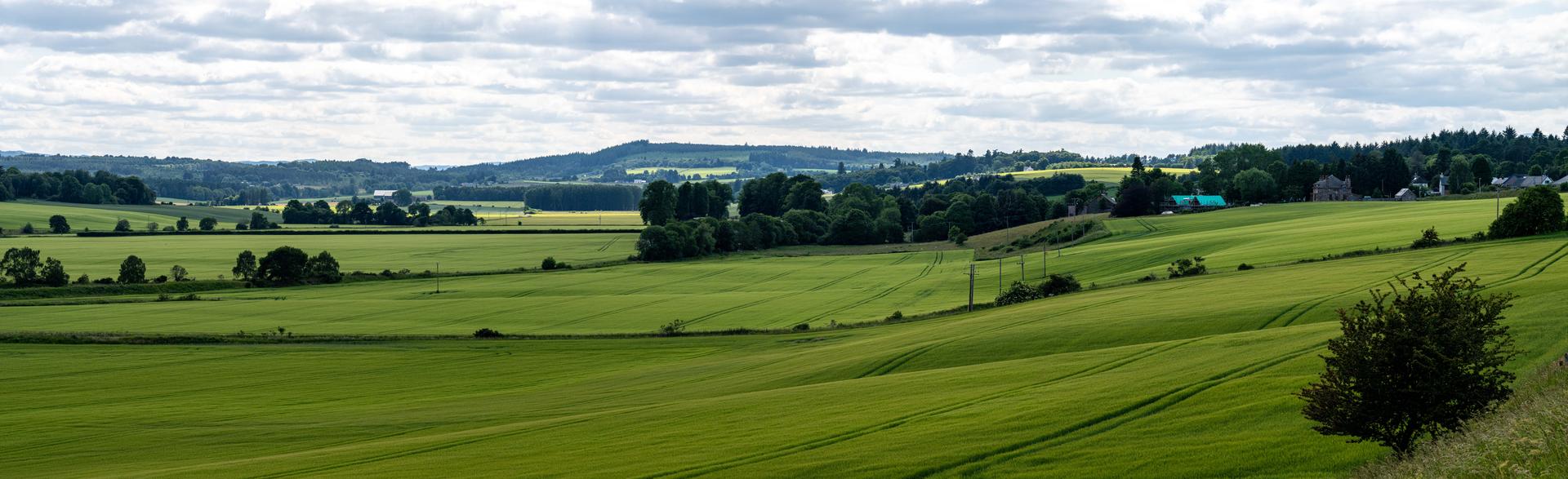
#1: Panorama from NH 6574 5378. This view encompasses almost all of the Holocene marine terraces from the 8m terrace below the stand of trees, middle distance slightly left of centre, to those below the powerlines in the foreground, right of centre.
Andy Leggatt
June 21, 2023
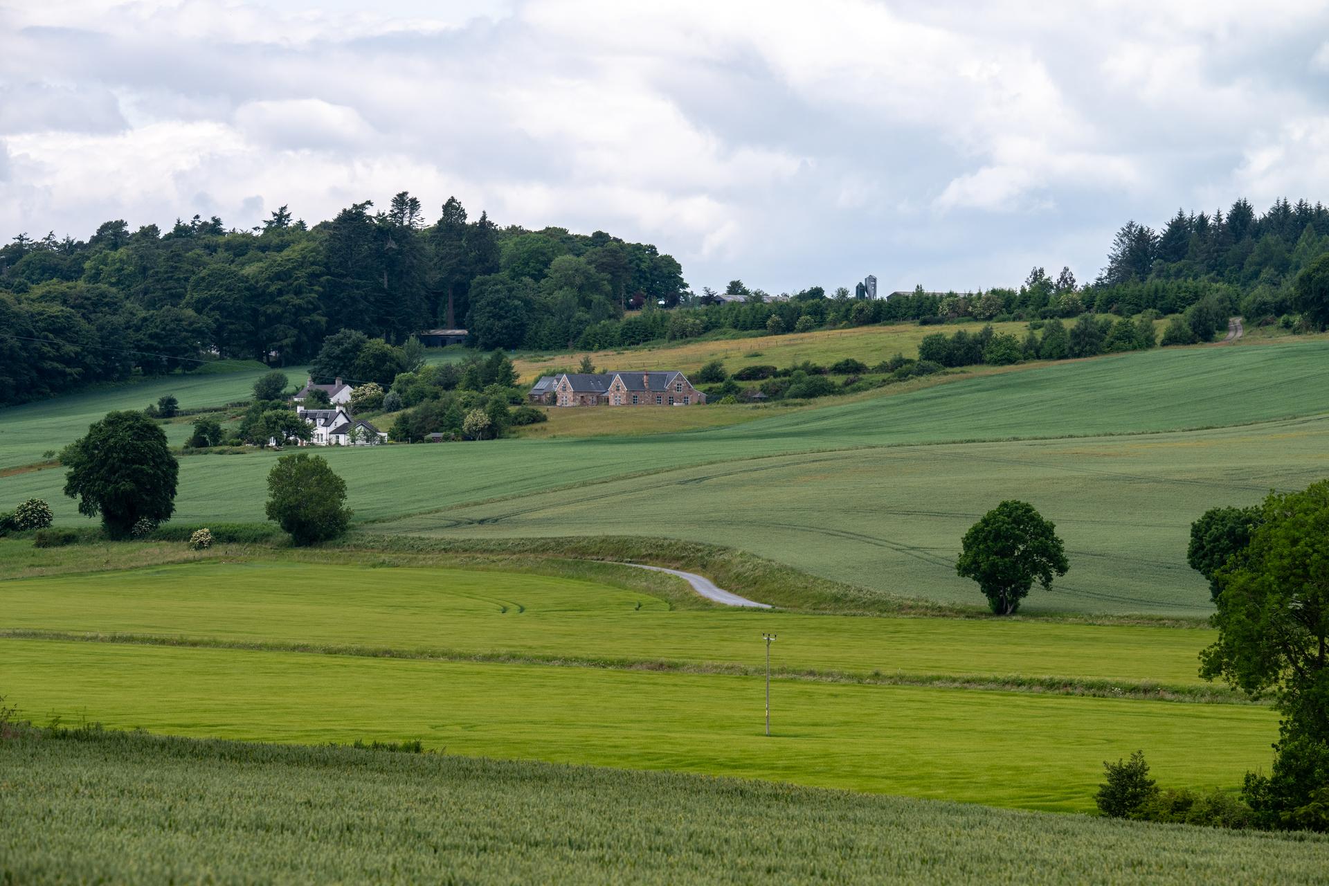
#4: View towards Quarryfield from NH 6462 5225. In this perspective, the bright-green field situated below the curve in the single-track road sits on the circa 8.2m marine terrace & is of Flandrian age. A higher terrace on which the white house centre-left sits and extending up slope to the substantial sandstone building above it, is the 29m terrace formed during the Main late-glacial event. This latter terrace is persistent, extending a further 1km back towards Munlochy village.
Andy Leggatt
June 20, 2023
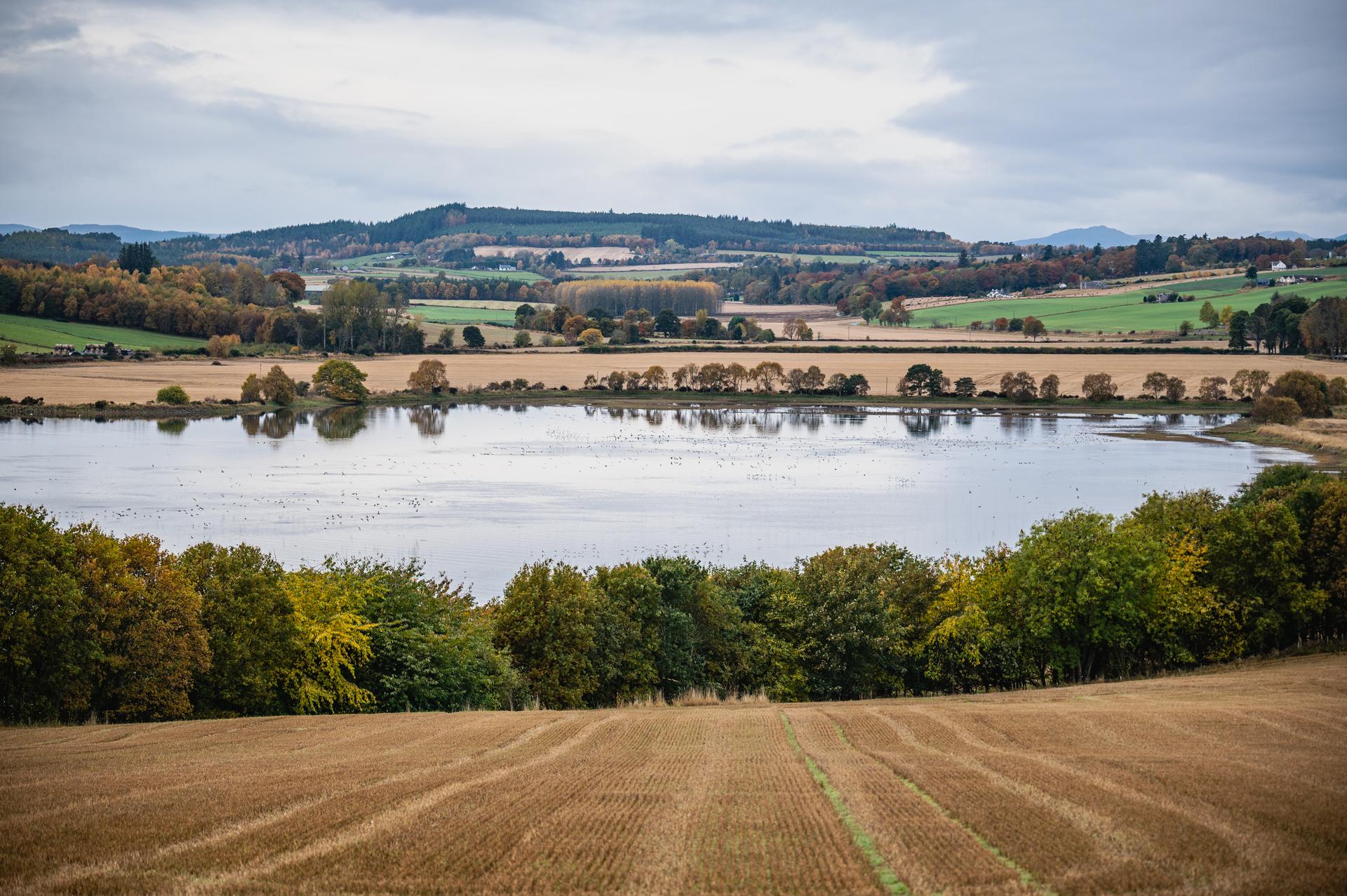
#2: Southwest up the Munlochy Valley from NH 6640 5372. View along the line of the Holocene marine retreat from circa 8m terrace occupied by the stand of trees in the middle distance, to the 2.2m terrace in the stubble field closest to the water's edge at the righthand side of the image, with intermediate terraces noted at circa 6.8m, 5.4m, 4.2m, and 3.0m.
Andy Leggatt
Oct. 28, 2020
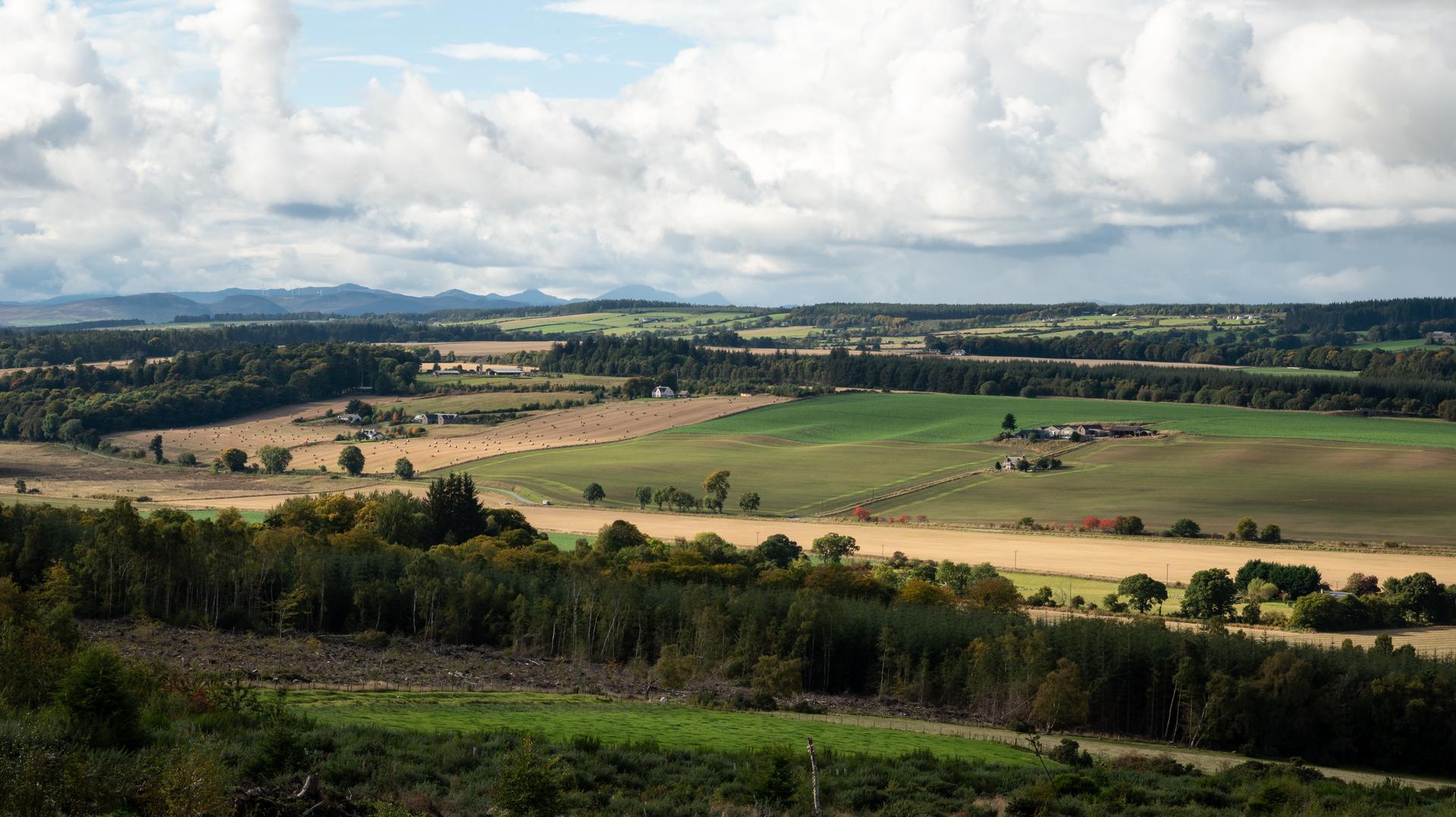
#3: View of Drumore to Quarryfield from NH 6538 5220. This view encompasses the westerly extent of the Lateglacial raised marine shoreline fragments which extend for around 2km on this northwest slope, along the 29m contour. This passes between the upper and lower buildings of the Quarryfield and Drumore building complexes.
The Holocene raised marine fragments are located in the valley bottom below the road.
Andy Leggatt
Oct. 5, 2020
#5: Information board located at car park off the A832 which includes 'the level of the sea immediately after the last ice age', suggesting an Early Holocene date. However, the long section on the information board dates the high sea level at 13,000 year before present, i.e. correlating with the Late Glacial terraces.
Andy Leggatt
Feb. 2, 2024