Barnyards
Geological Conservation Review site | GCR #1955 | Quaternary Geology | Quaternary of Scotland
Geological Conservation Review site | GCR #1955 | Quaternary Geology | Quaternary of Scotland
Scotland's geosites are chosen because of their local, national or international importance. Take only photos, leave only footprints: avoid causing any damage to this site. You can walk almost anywhere in Scotland without the need to ask permission or keep to paths, but you have a responsibility to care for your own safety, to respect people's privacy and peace of mind and to cause no damage.
The right of access does not extend to quarries, building sites or any land where public access is prohibited, or to the collection of geological samples.
Barnyards provides a detailed record of relative sea-level change in the Beauly Firth area over the last 13,000 years, caused by changes in global sea-level combined with local isostatic movement.
Barnyards is an important stratigraphic site for studies of late- glacial and Flandrian changes in relative sea-level. Buried marine deposits record the Main Late-glacial Shoreline and several Flandrian shorelines including the Main Buried Beach, the Low Buried Beach, the Main Post-glacial Shoreline and the inferred storm surge layer of eastern Scotland.
Parking and facilities are available in Beauly Square and all areas are accessible within walking distance from here.
Barnyards sits within the extensive Beauly Carse which occupies the flat-lying agricultural land from the Beauly to Muir of Ord railway line and the River Beauly (east-west axis), and from beneath the degraded cliff-line and slope at Windhill to the south of Beauly Village (north-south axis). These are considered to be marine deposits from around 6,500 BP (before present).
The highest shorelines from this episode sit along the railway line at around 9.5m OD, with intermediate shorelines formed at 7.5m, 5.9m, 4.9m, and 3.1m, as they stepped down eastwards across the carselands, as the sea retreated to its present level and position.
To the north, the GCR Site is revised and provides a discrete additional location incorporating details of the degraded cliff and slope between the Lateglacial and Holocene shorelines.
From a series of boreholes carried out along line A - B (Figure 7.20 on the map refers), the presence of a sequence of marine and terrestrial deposits was established, the oldest dating from the late Devensian some 13,000 BP, followed by several significant fluctuations in relative sea level positions as the last ice wasted from the Beauly Firth contributing to sea-level rise and as the land rose recovered from ice-loading (isostatic adjustment).
Traffic on the A862, which cuts through the site, often passes at high speed where speed restrictions allow.
Although pavements are present, great care should therefore be taken during visits.
The railway line should only be crossed using the road bridge at NH 5213 4682
There are no site highlights yet.
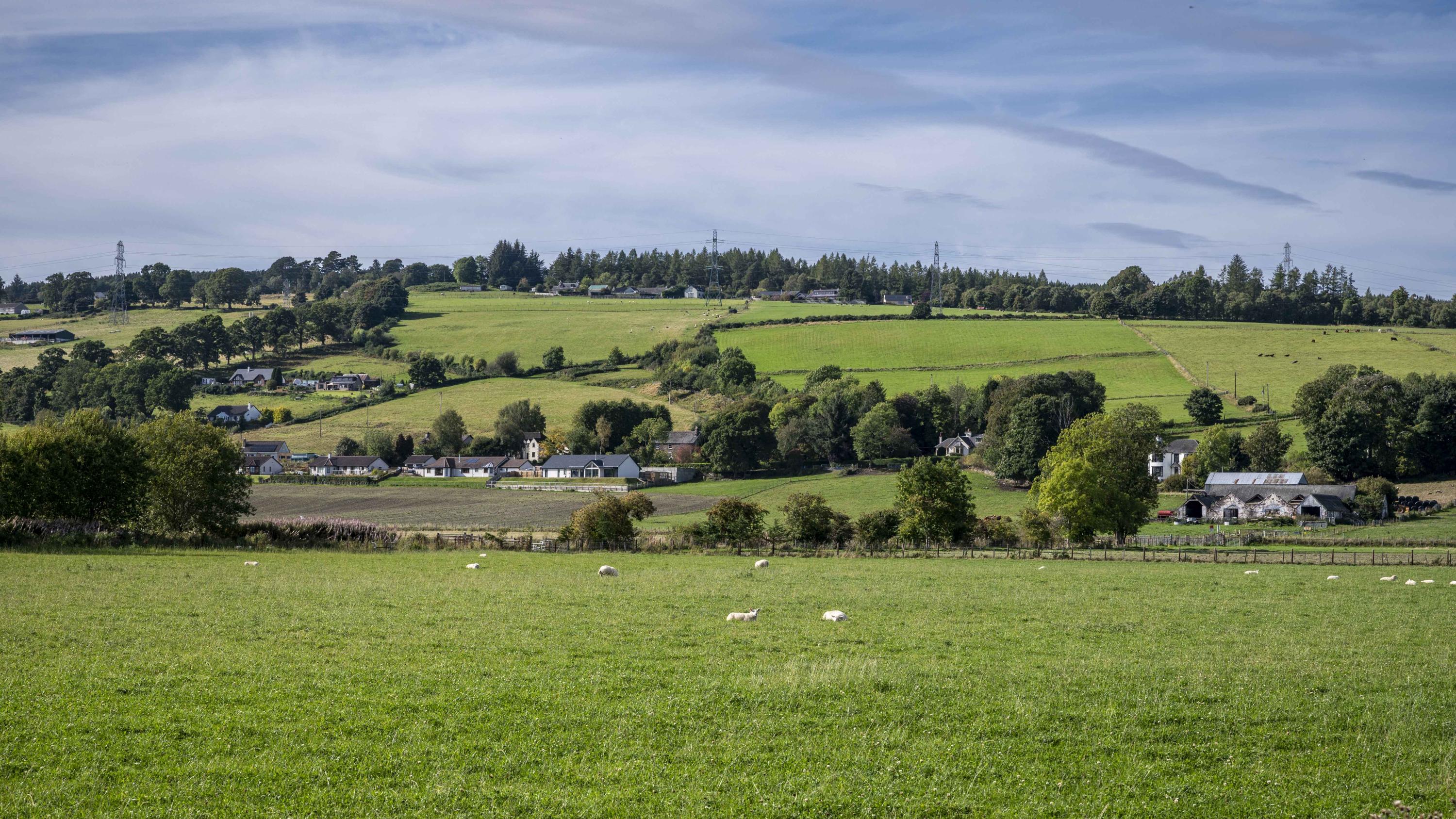
#1: panoramic view over the Beauly Carse, with Barnyards located in the centre of the image, just above the freshly ploughed fields. The original south-eastern site boundary commences a little beyond the Beauly River, here seen curving round the site from middle left and along the lower part of image behind trees, with the north-western limit at the break in slope beyond the green fields in the middle distance.
Andy Leggatt
May 5, 2024
#2: Revised GCR Site extents.
Andy Leggatt
Aug. 25, 2024
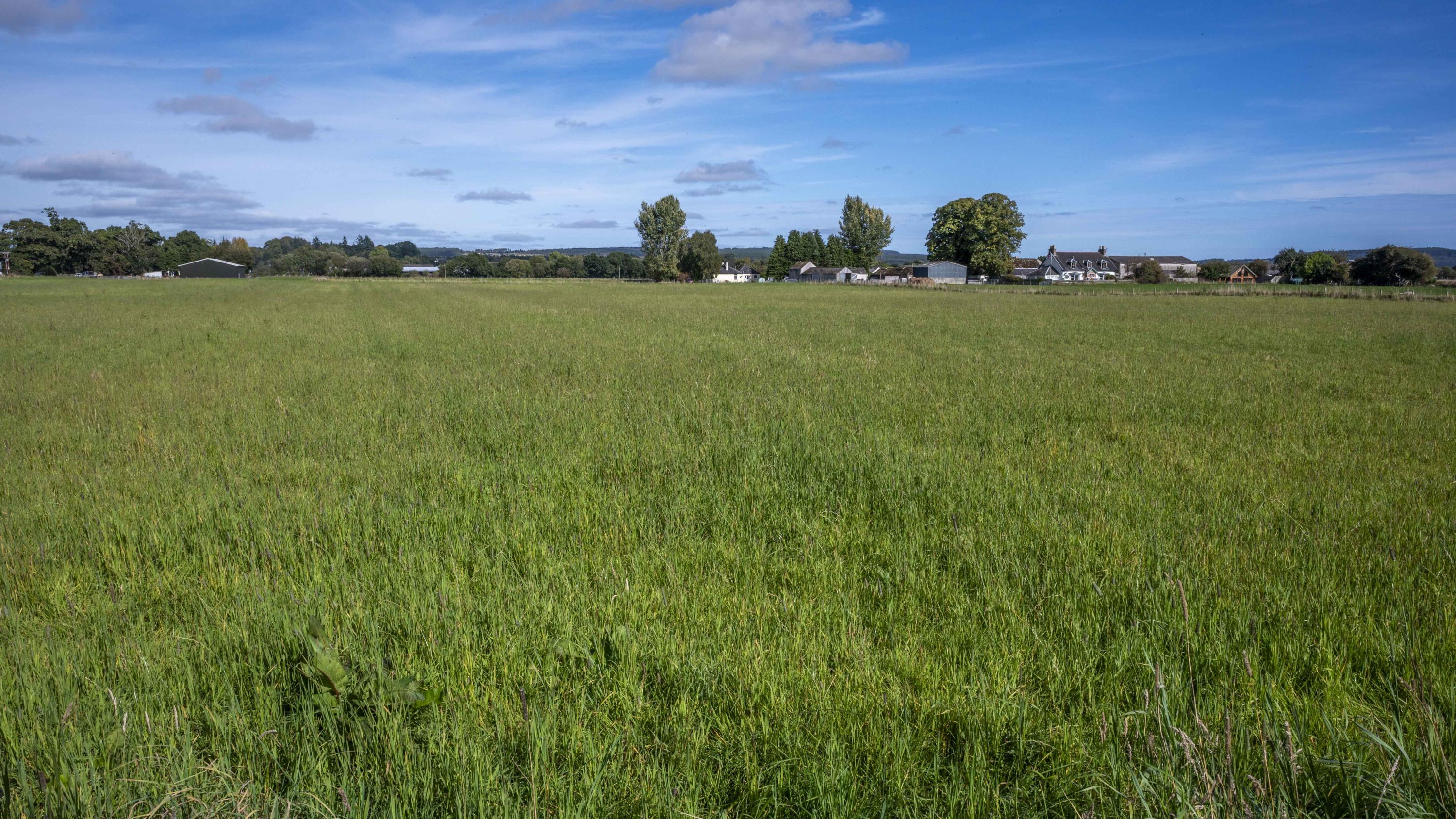
#3: view over what was once the field next to the Police Station, now defunct.
This field has likely lost all scientific potential as it has been sterilised by development including housing and swale construction as part of the associated SUDS measures.
Wellbank is the row of houses part-way up the sunlit slope in the distance, and the northwest limit of the revised GCR Site is located at their fence lines.
Andy Leggatt
Sept. 15, 2024
#4: view from Wellbank with farm of the same name on the left, with the railway crossing in the middle distance, and various developments adjacent to the tree-lined A862 between Beauly and Windhill beyond. These buildings are constructed within the new GCR Site boundary.
This panorama approximately covers the extend of the GCR site west of the A862.
Andy Leggatt
Sept. 15, 2024
#5: looking from the A862 towards Wellbank. The railway crosses near the base of the slope below the houses, and Wellbank Farm is visible on the extreme right, marking the north-easterly extent of the GCR site beyond the rail track.
Andy Leggatt
Sept. 15, 2024
#6: looking north-east from the Catholic Churchyard boundary wall, this field is now incorporated within the GCR Site following revisions and is sited on the circa 6.5m Holocene terrace.
Andy Leggatt
Sept. 15, 2024
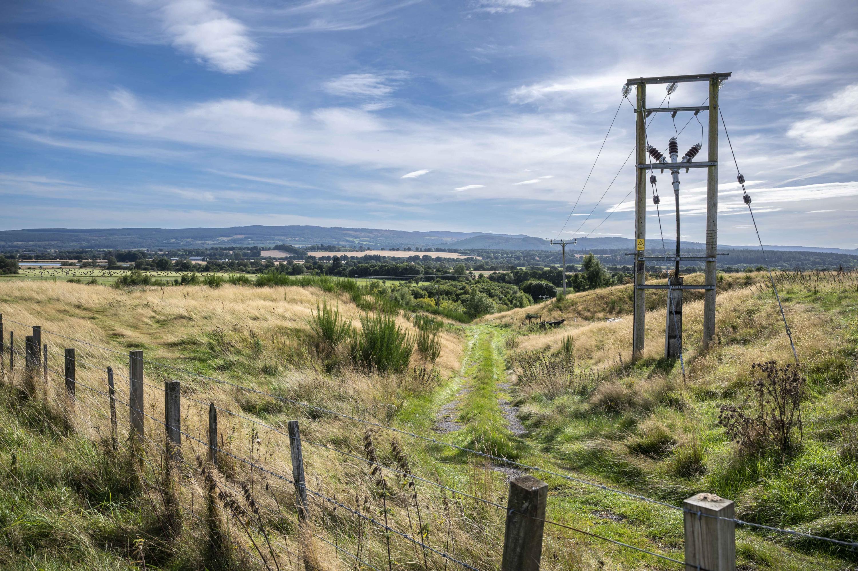
#7: channel with track descending cutting into the degraded slope between the Lateglacial shoreline circa 25m above datum and the Holocene shoreline of Barnyards and Beauly.
Andy Leggatt
Sept. 15, 2024
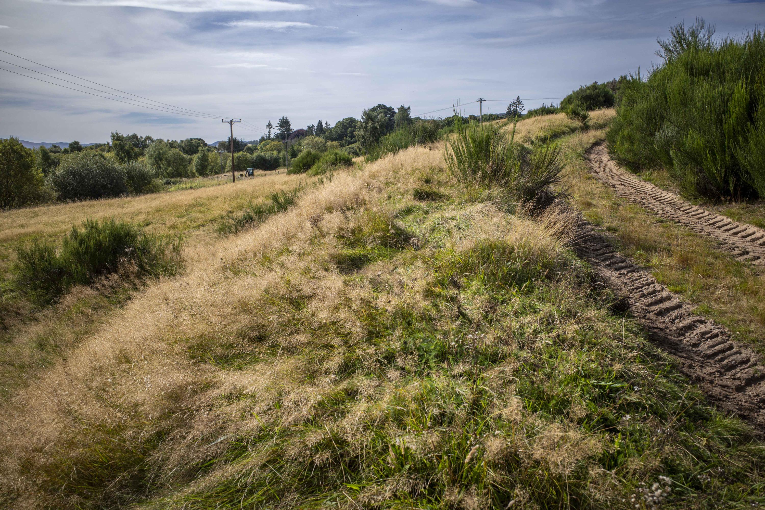
#8: here the farm track may be seen descending from the Lateglacial terrace, cutting into the associated degraded cliff to the Holocene shoreline.
Andy Leggatt
Sept. 15, 2024
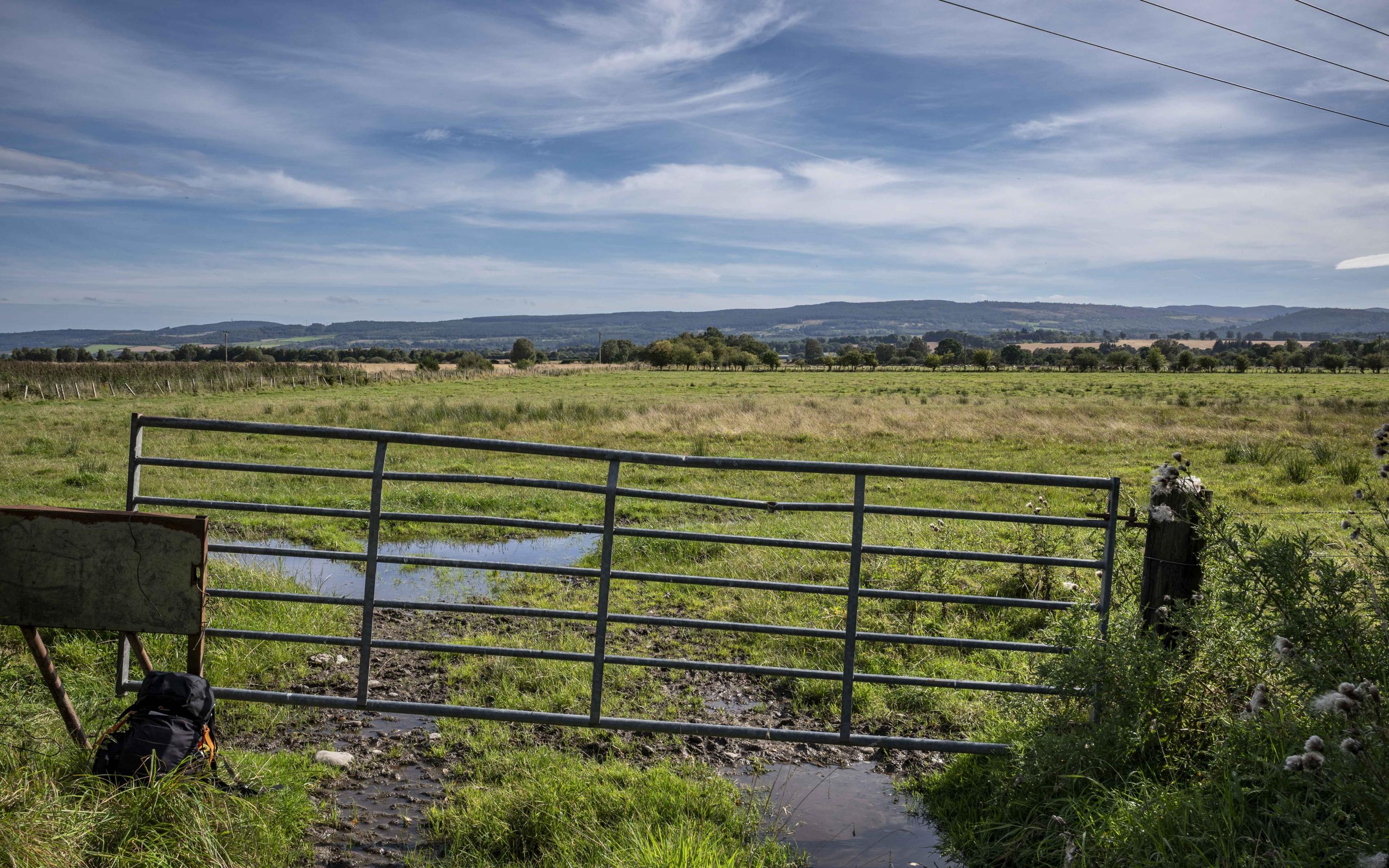
#9: This field gate is sited at the bottom of the slope between the upper surface of the higher Lateglacial shoreline (circa 25m above datum) and that of the Holocene shoreline seen here (circa 5.9m above datum).
The GCR Site's north eastern boundary runs along the fence line receding into the distance on the left, with the site terminating close to the River Beauly some 800m away. The Holocene terraces step down to 4.8m and then 3.1m over this distance.
Andy Leggatt
Sept. 15, 2024