Abernethy Forest
Geological Conservation Review site | GCR #367 | Quaternary Geology | Quaternary of Scotland
Geological Conservation Review site | GCR #367 | Quaternary Geology | Quaternary of Scotland
Scotland's geosites are chosen because of their local, national or international importance. Take only photos, leave only footprints: avoid causing any damage to this site. You can walk almost anywhere in Scotland without the need to ask permission or keep to paths, but you have a responsibility to care for your own safety, to respect people's privacy and peace of mind and to cause no damage.
This site is a Site of Special Scientific Interest (SSSI). It is an offence to intentionally or recklessly damage the protected natural features of a SSSI, and this includes unauthorised sample collection.
The right of access does not extend to quarries, building sites or any land where public access is prohibited, or to the collection of geological samples.
Abernethy Forest is an outstanding biostratigraphic locality and is particularly important in demonstrating the Lateglacial and Holocene vegetation history of the Strathspey and Cairngorm area. It is especially significant in the context of the development and history of the native Scots pine forest. It has also been studied in greater detail than most other sites in terms of combined pollen and plant-macrofossil analyses. Furthermore, it provides important contrasts with sites further west in Scotland. In a wider context, the Loch Lomond Stadial in Scotland is more pronounced and more intensively recorded biostratigraphically than anywhere else in north-west Europe, and Abernethy Forest contributes significantly to the detail of this record.
The site is easily accessible from the car park at NH97161855 on the unclassified road just N of Loch Garten; a track leads SSW from here towards Loch Mallachie.
https://www.geograph.org.uk/photo/7775139
The core site is off to the left of this photo.
https://www.geograph.org.uk/photo/560050
Loch Mallachie, with remnant Caledonian pine forest.
There are no safety notes yet.
There are no site highlights yet.
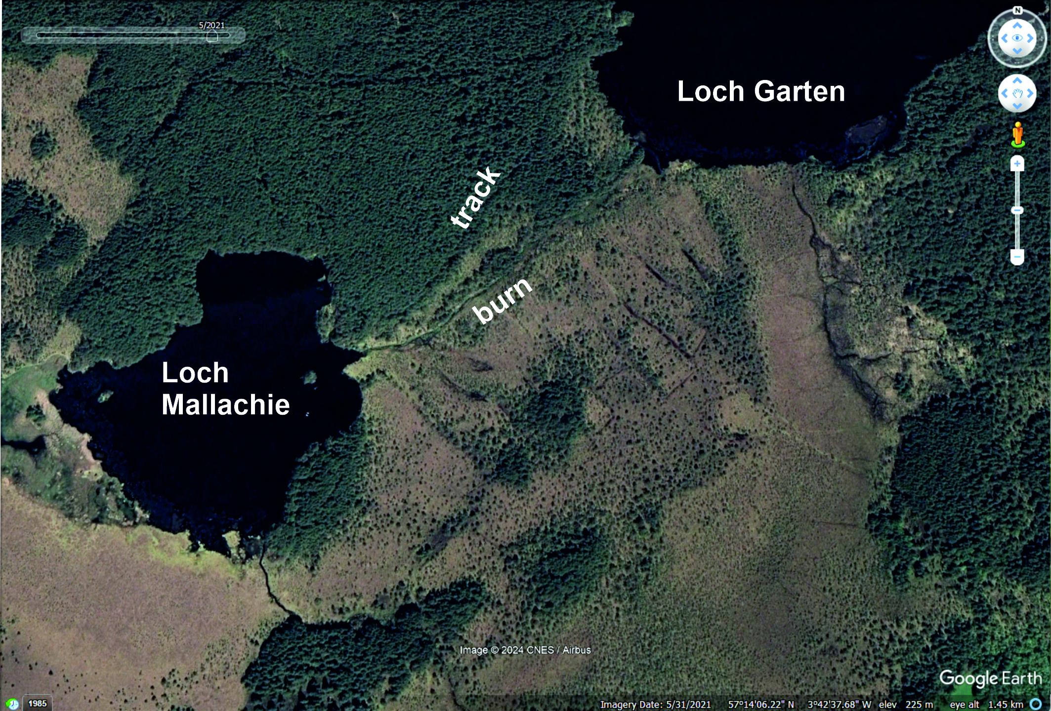
Vertical satellite image of the boggy area where the core was taken: the unforested area SE of the burn now crossed by several drainage ditches. Image © 2025 Google Earth.
Carol Pudsey
May 30, 2021