Allt Coire Gabhail
Geological Conservation Review site | GCR #2219 | Geomorphology | Fluvial Geomorphology of Scotland
Geological Conservation Review site | GCR #2219 | Geomorphology | Fluvial Geomorphology of Scotland
Scotland's geosites are chosen because of their local, national or international importance. Take only photos, leave only footprints: avoid causing any damage to this site. You can walk almost anywhere in Scotland without the need to ask permission or keep to paths, but you have a responsibility to care for your own safety, to respect people's privacy and peace of mind and to cause no damage.
This site is a Site of Special Scientific Interest (SSSI). It is an offence to intentionally or recklessly damage the protected natural features of a SSSI, and this includes unauthorised sample collection.
The right of access does not extend to quarries, building sites or any land where public access is prohibited, or to the collection of geological samples.
This integrated alluvial system provides a unique example of the impact of a catastrophic change in base level caused by a landslide possibly during the late-glacial. An alluvial basin has built up behind this barrier and over a few kilometres displays a sequence of channel types comprising a mountain torrent, a low sinuousity wandering channel and an active braided channel. The lack of flow for much of the year makes the site ideal for analysis of fluvial sediments. This site is also well-suited for measuring sedimentation rates within a small upland catchment.
The parking area at NN171569 in Glencoe is the most convenient for the Lost Valley path.
https://www.geograph.org.uk/photo/6487557
A Munroist's view of Coire Gabhail.
There are no safety notes yet.
There are no site highlights yet.
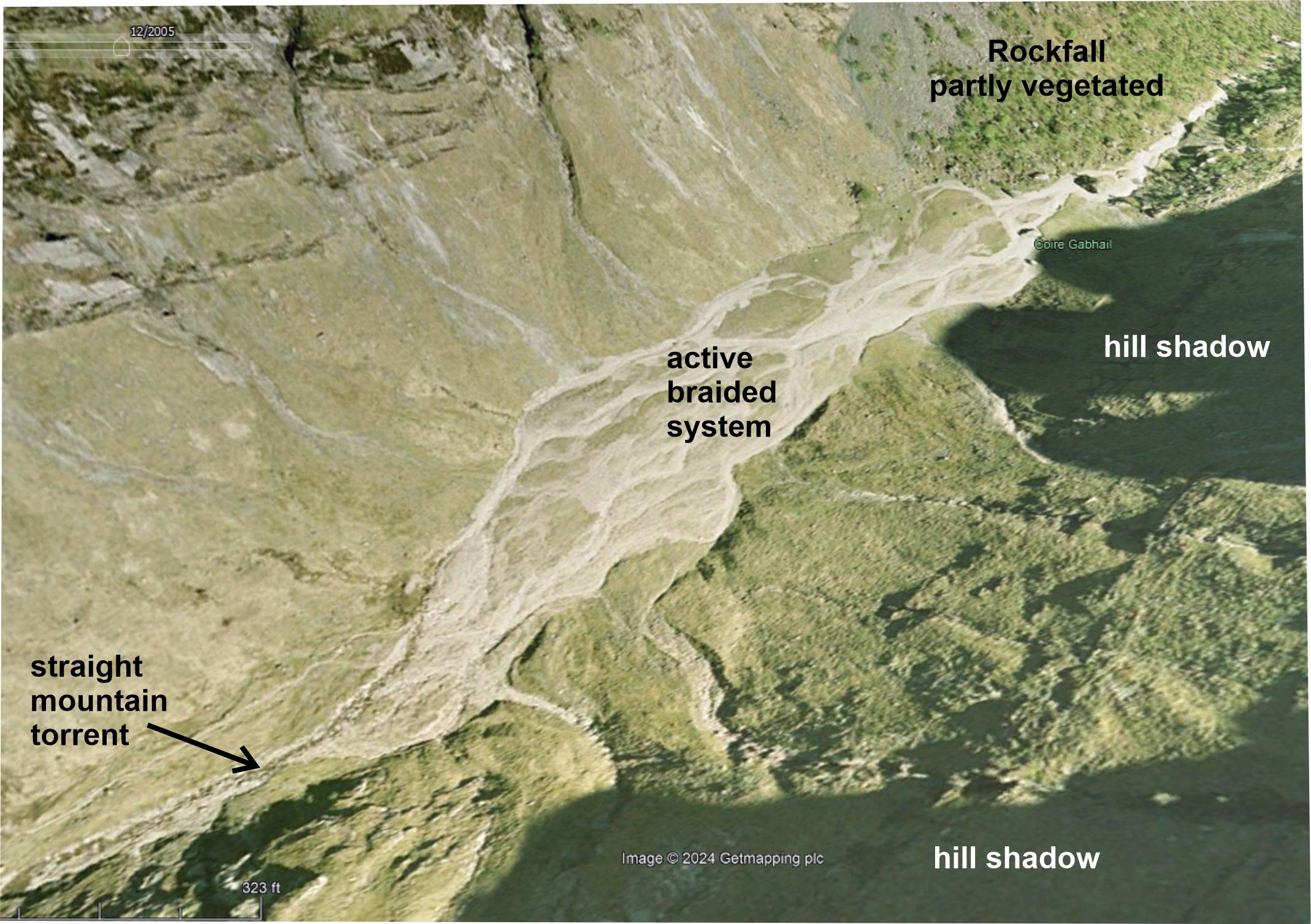
Oblique satellite image looking north, downstream. Rockfall at right. Google Earth, Imagery © 2024 Getmapping plc, Map data © 2024 Google.
Carol Pudsey
Jan. 1, 2005
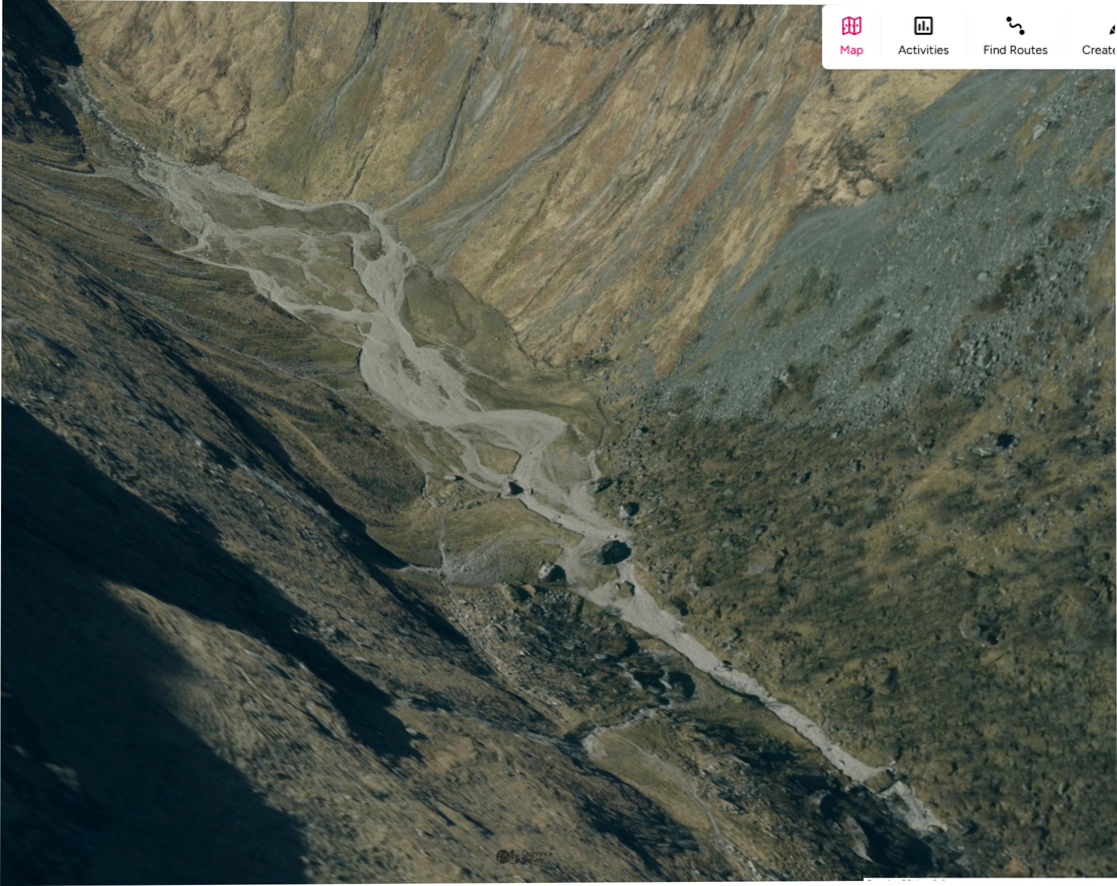
Oblique satellite image looking WSW up the Allt Coire Gabhail. The massive rockfall which dammed the valley is visible right. The braided stream disappears among the boulders. Contains OS data © Crown copyright and database rights 2024.
Carol Pudsey
Oct. 17, 2024