Abhainn an t-Strath Chuileannaich
Geological Conservation Review site | GCR #2229 | Geomorphology | Fluvial Geomorphology of Scotland
Geological Conservation Review site | GCR #2229 | Geomorphology | Fluvial Geomorphology of Scotland
Scotland's geosites are chosen because of their local, national or international importance. Take only photos, leave only footprints: avoid causing any damage to this site. You can walk almost anywhere in Scotland without the need to ask permission or keep to paths, but you have a responsibility to care for your own safety, to respect people's privacy and peace of mind and to cause no damage.
The right of access does not extend to quarries, building sites or any land where public access is prohibited, or to the collection of geological samples.
The Abhainn an t-Srath Chuileannaich provides an excellent example of an actively meandering upland river, with meanders persisting over a distance rare in Scotland. Good examples occur of irregular, regular and tortuous meandering planforms, as well as more complex features. There are also classic examples of point bars and steep banks cut within cohesive, fine-grained sediments. Some reaches are very active with a recent history of planform adjustment while others appear to have been relatively stable over much longer timespans. Areas with a history of recent activity are identifiable by meander neck cutoffs and unvegetated channel-side sedimentation. In contrast, other apparently unconfined reaches have displayed little channel adjustment over a similar time span. Occasional bedrock confinement in the lower reaches provides localised baselevels. Over all, this site is noteworthy for the range of channel types present. Since the discharge remains relatively constant, the variety of planforms must reflect major variations in local environmental controls.
The public road along the north side of Strathcarron goes as far as Croick Church where there is parking. The church is (was) well worth a visit. Beyond here a good track, which can be cycled, continues for miles up the river. On Google Streetview it is known as the Central Sutherland Crater Walk. One can walk down to the river to see the meanders in several place (beware drainage ditches - they are on the map).
https://www.croickchurch.com/index.htm
Croick Church
https://www.undiscoveredscotland.co.uk/bonarbridge/croickch…
More about Croick Church
https://www.geograph.org.uk/photo/301323
A closer view of a meander
There are no safety notes yet.
There are no site highlights yet.

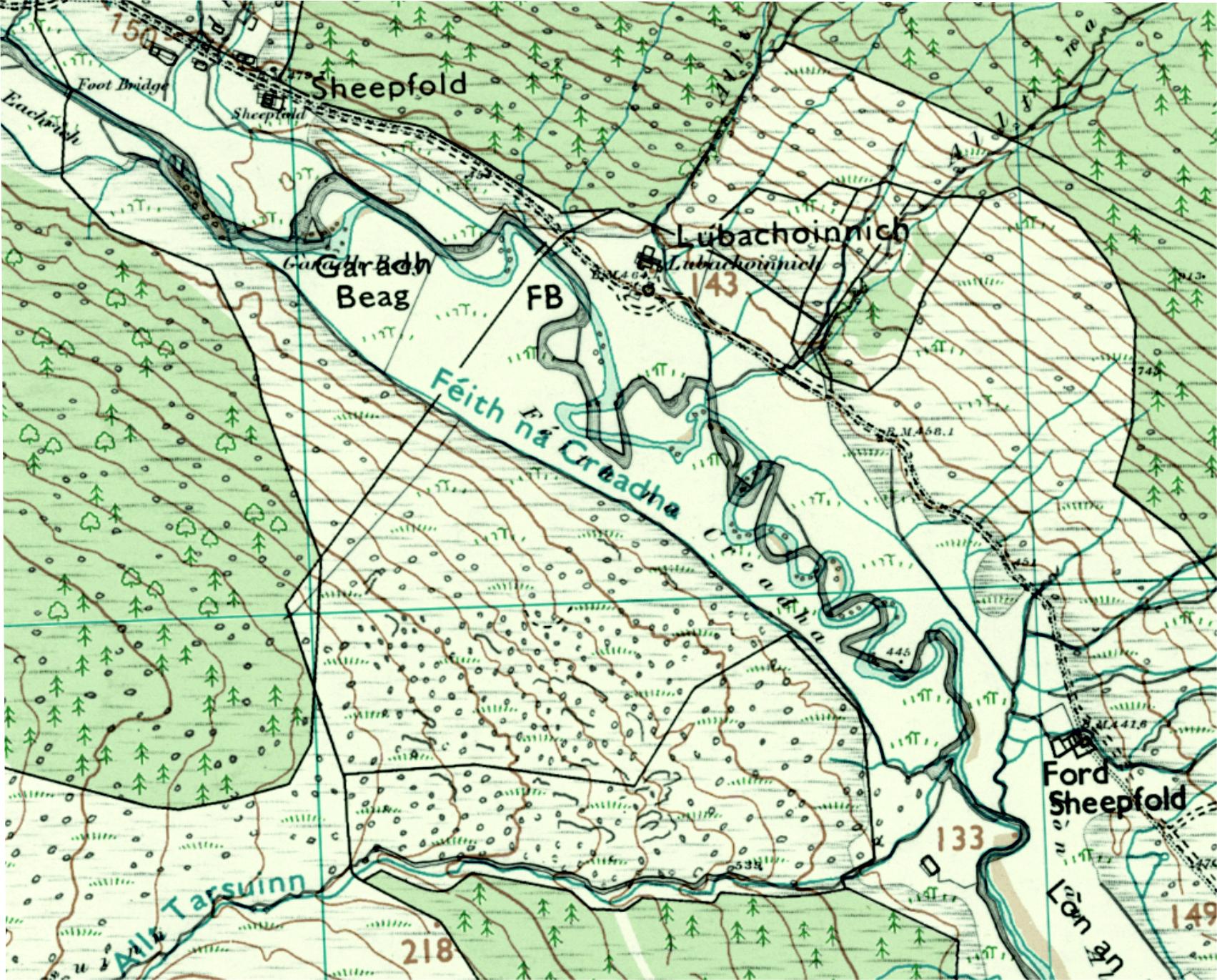
Comparison of the 1st edition Ordnance Survey Six-inch map (surveyed in 1885, greyscale) with the modern OS 1:25.000 map (coloured). The closely-spaced meanders SSE of Lubachoinnich seem to have been particularly changeable. Contains OS data © Crown copyright and database rights 2024.
Carol Pudsey
Nov. 11, 2024

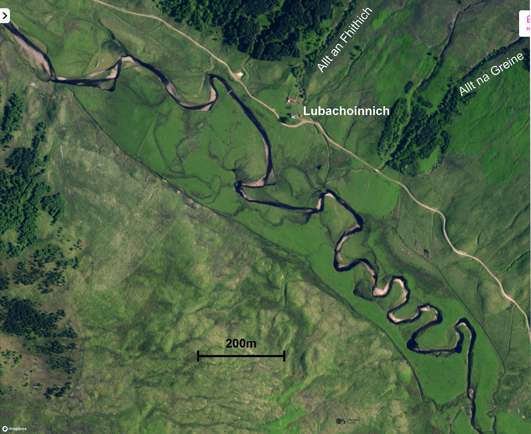
Satellite image of the northwestern part of the site. Contains OS data © Crown copyright and database rights 2024.
Carol Pudsey
Nov. 11, 2024

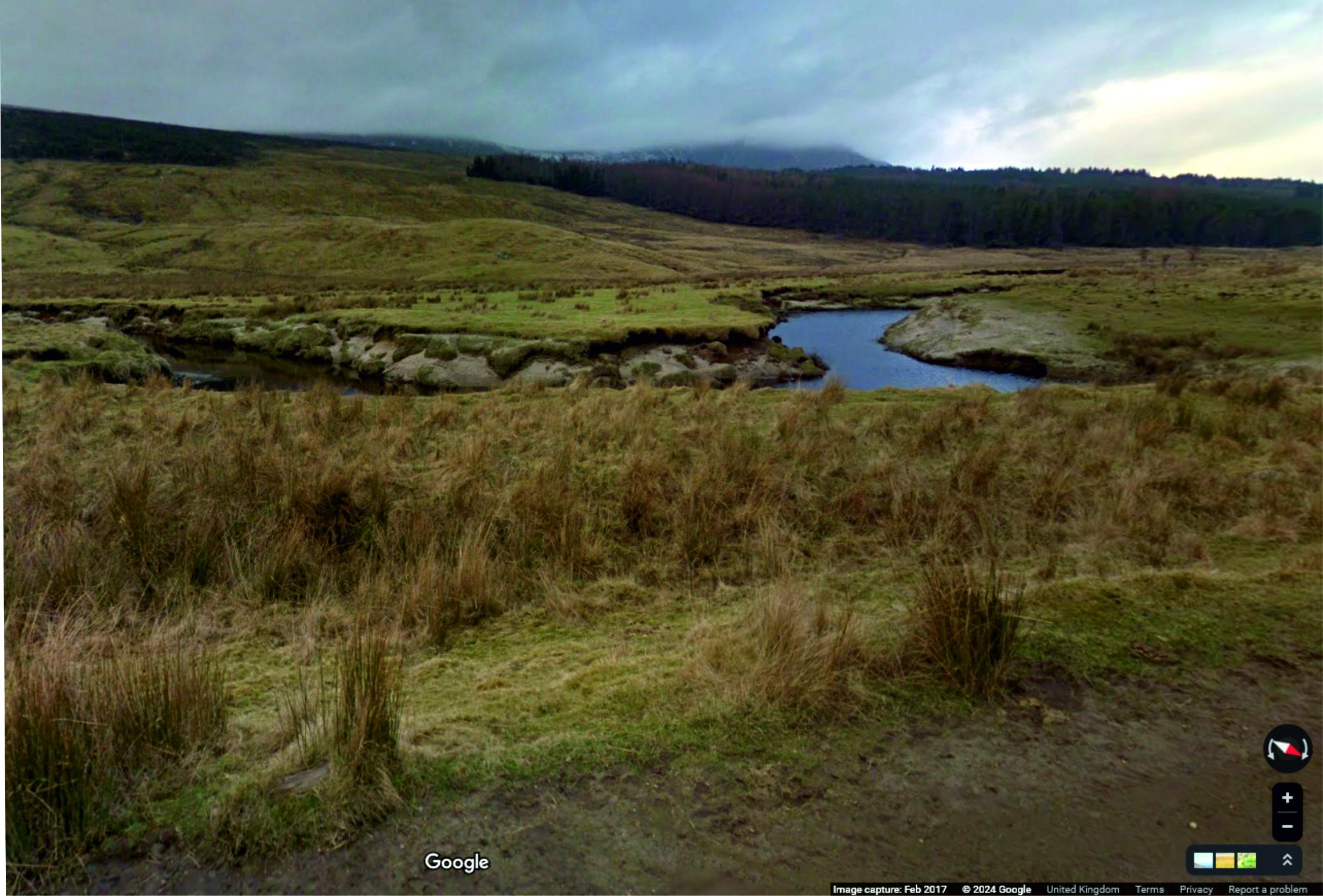
View of a meander bend from the track
Carol Pudsey
Feb. 15, 2017