Torrisdale Bay and Invernaver
Geological Conservation Review site | GCR #306 | Geomorphology | Coastal Geomorphology of Scotland
Geological Conservation Review site | GCR #306 | Geomorphology | Coastal Geomorphology of Scotland
Scotland's geosites are chosen because of their local, national or international importance. Take only photos, leave only footprints: avoid causing any damage to this site. You can walk almost anywhere in Scotland without the need to ask permission or keep to paths, but you have a responsibility to care for your own safety, to respect people's privacy and peace of mind and to cause no damage.
This site is a Site of Special Scientific Interest (SSSI). It is an offence to intentionally or recklessly damage the protected natural features of a SSSI, and this includes unauthorised sample collection.
The right of access does not extend to quarries, building sites or any land where public access is prohibited, or to the collection of geological samples.
At the head of Torrisdale Bay the interrelationship of landforms of coastal deposition with the older landscape created by glacial and fluvioglacial deposition has produced an area of great geomorphological diversity. A wide variety of dune and machair landforms are finely developed, demonstrating various stages of evolution and stability and ranging from fossil features to highly dynamic forms. Individual features of particular interest include the so-called climbing dunes which are developed to a height of over 120m OD on slopes of up to 20 degrees, the dune and machair forms found in association with outwash terraces in the Borgie and Naver valleys and the high level ridge top machair of Druim Chiubhe. It is, however, the complex juxtaposition of impressive landforms of coastal, glacial and post-glacial origin which gives the area its considerable geomorphological importance. The site possesses considerable potential for research work, further enhanced by the concentration of archaeological sites in and under the blown sand areas.
Paths lead to the peninsula from either side. SE of Torrisdale there is a small parking area at NC68076112 and a footbridge crosses the Borgie river directly below here. Invernaver does not have visitors' parking. There is a space just W of the River Naver road bridge but this is used as farm storage; otherwise the nearest spots are in Bettyhill or 1.5km to the SE at Achanlochy clearance village.
https://www.geograph.org.uk/photo/5046310
One of several hut circles on the Naver terrace. Climbing dunes in the background.
https://www.geograph.org.uk/photo/5046331
This is the gully east of the loch. Note the sand plastered up the slope on the right.
https://www.geograph.org.uk/photo/7475733
Looking across from the pier at Bettyhill.
There are no safety notes yet.
There are no site highlights yet.
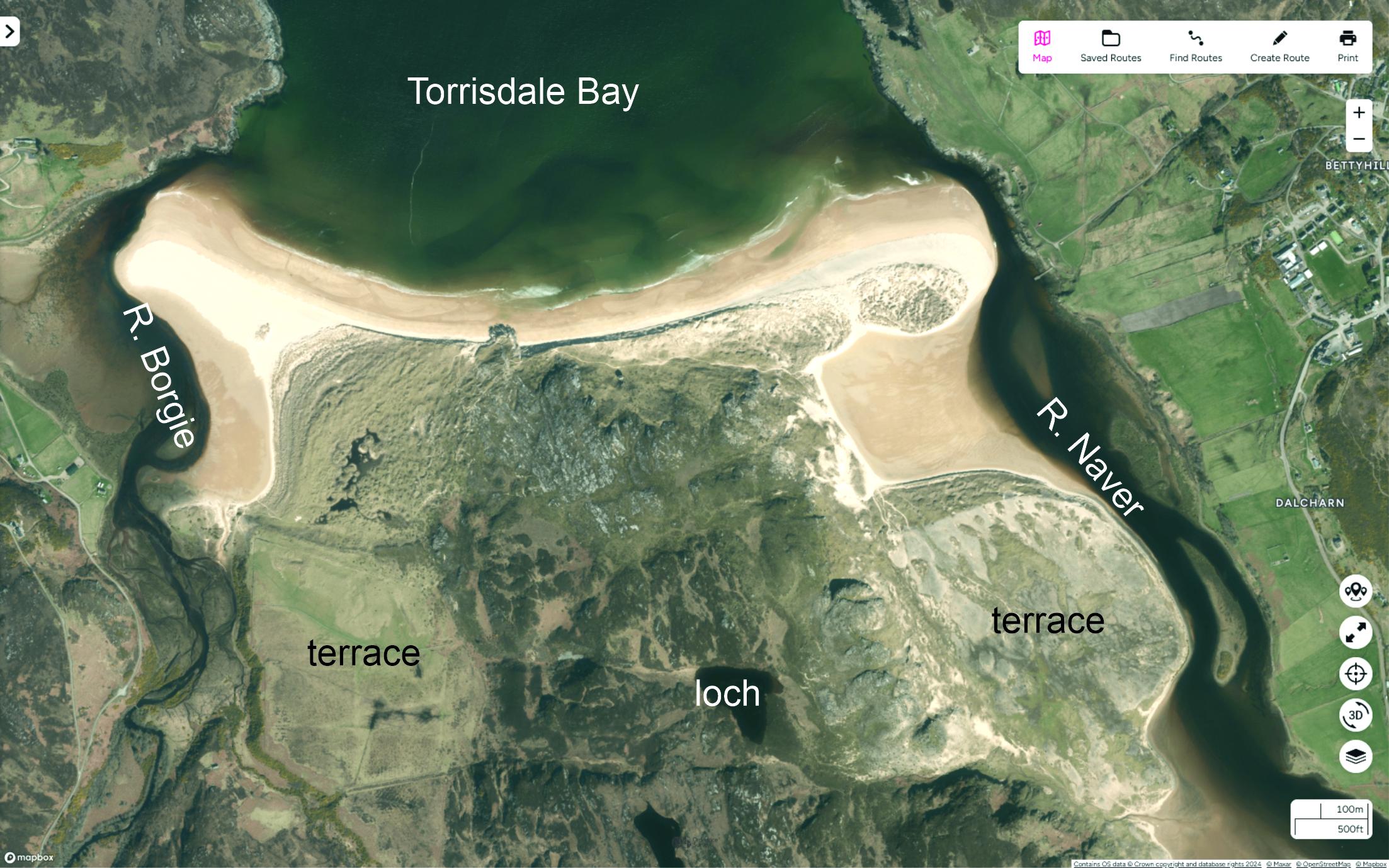
Vertical satellite image of Torrisdale Bay and Invernaver. Compare with the geomorphological map in the GCR account. Contains OS data © Crown copyright and database rights 2025.
Carol Pudsey
Jan. 23, 2025
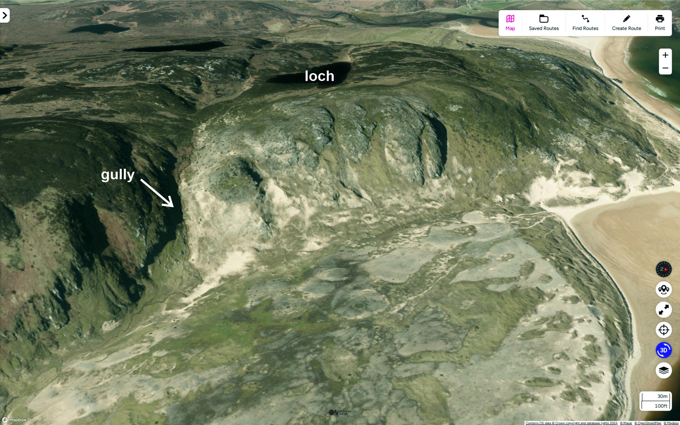
Oblique satellite image of the Naver terrace, with kettle holes. The rocky slope above is cut by gullies which act as conduits for blown sand. Contains OS data © Crown copyright and database rights 2025.
Carol Pudsey
Jan. 23, 2025
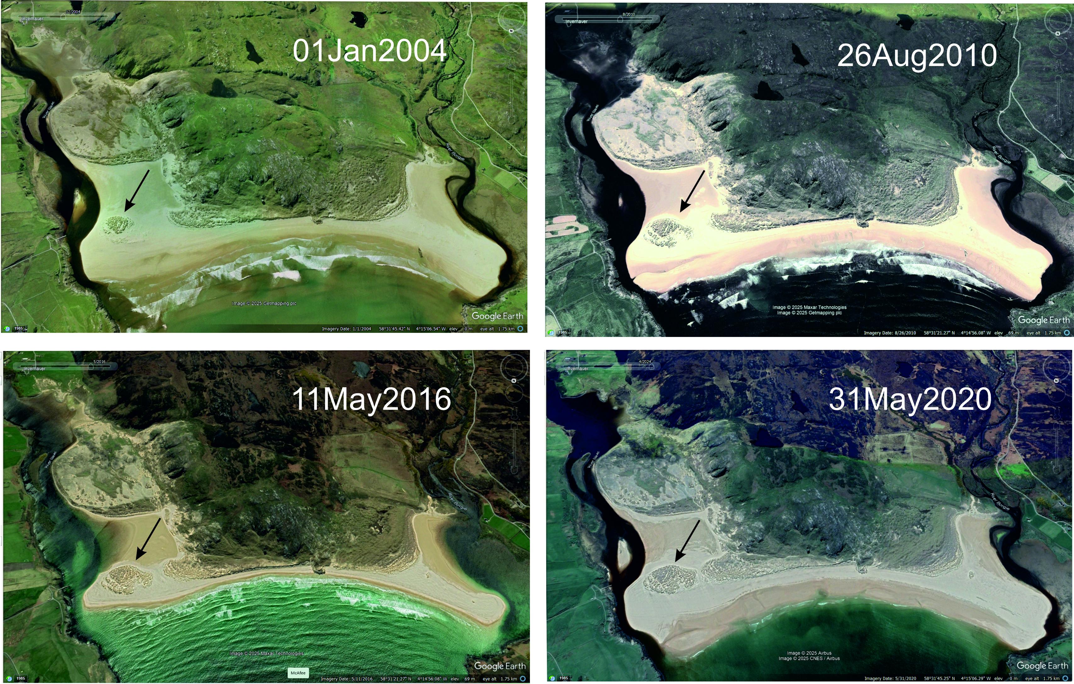
Time series of oblique satellite images, looking south into Torrisdale Bay. The patch of marram-clad sand dunes (arrowed) has grown since 2004. The high-level sand above the Naver terrace shows up particularly well on the 2010 photo. Images © 2025 Google Earth.
Carol Pudsey
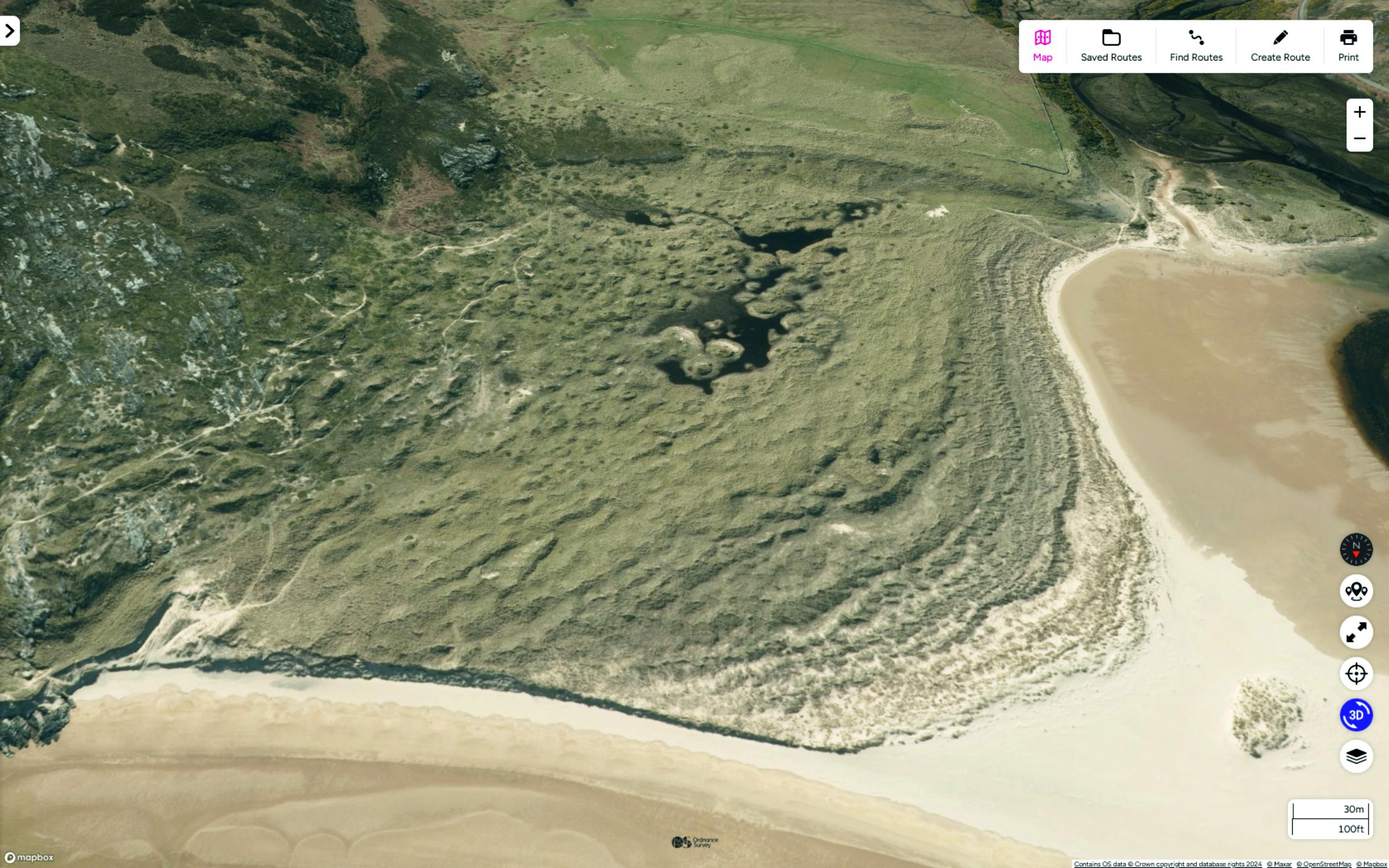
Oblique satellite image of the dunes on the west side of Torrisdale Bay. Borgie terrace in the background, central rock ridge on the left. Contains OS data © Crown copyright and database rights 2025.
Carol Pudsey
Jan. 23, 2025