North Esk and West Water Glaciofluvial Landforms
Geological Conservation Review site | GCR #3051 | Quaternary Geology | Quaternary of Scotland
Geological Conservation Review site | GCR #3051 | Quaternary Geology | Quaternary of Scotland
Scotland's geosites are chosen because of their local, national or international importance. Take only photos, leave only footprints: avoid causing any damage to this site. You can walk almost anywhere in Scotland without the need to ask permission or keep to paths, but you have a responsibility to care for your own safety, to respect people's privacy and peace of mind and to cause no damage.
This site is a Site of Special Scientific Interest (SSSI). It is an offence to intentionally or recklessly damage the protected natural features of a SSSI, and this includes unauthorised sample collection.
The right of access does not extend to quarries, building sites or any land where public access is prohibited, or to the collection of geological samples.
This site is important for understanding the geomorphological changes that occured in the landscape during and following deglaciation of the Late Devensian ice-sheet (approximately 14,000-13,000 years ago) when large volumes of meltwaters were released from the decaying ice.
It shows an excellent assemblage of landforms characteristic of the eastern Highland boundary area. These include outwash and river terraces that were formed as the ice melted and wasted back into the Highland glens. The higher terraces contain kettle holes indicating the former presence of the glacier, whereas the lower terraces are most notable for particularly good examples of fossil river channels. The latter provide valuable evidence for reconstructing the changes that occured in river characteristics and behaviour during and following the period of ice melting.
The terraces and channel patterns look much better on aerial/satellite images than they do on the ground. If visiting Edzell Castle, one may admire the meltwater channel. The minor roads and farm lanes west of Edzell are narrow, without parking opportunities; seek permission from local farmers if wishing to examine the sand and gravel in the westernmost part of the site.
There are no safety notes yet.
There are no site highlights yet.
There are no further information notes yet.
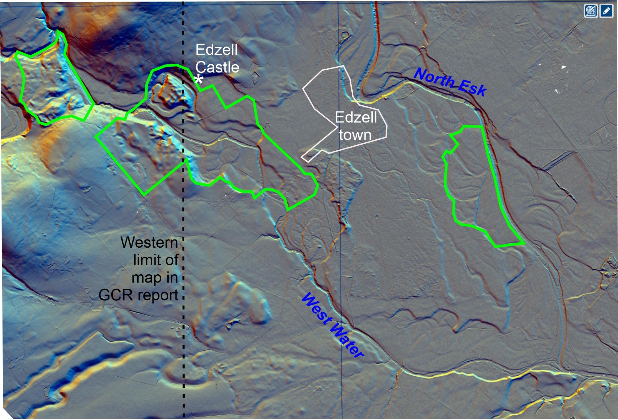
LiDAR image of the Edzell area, showing the GCR site as three geeen polygons. Image reproduced with the permission of the National Library of Scotland.
Carol Pudsey
Oct. 9, 2024
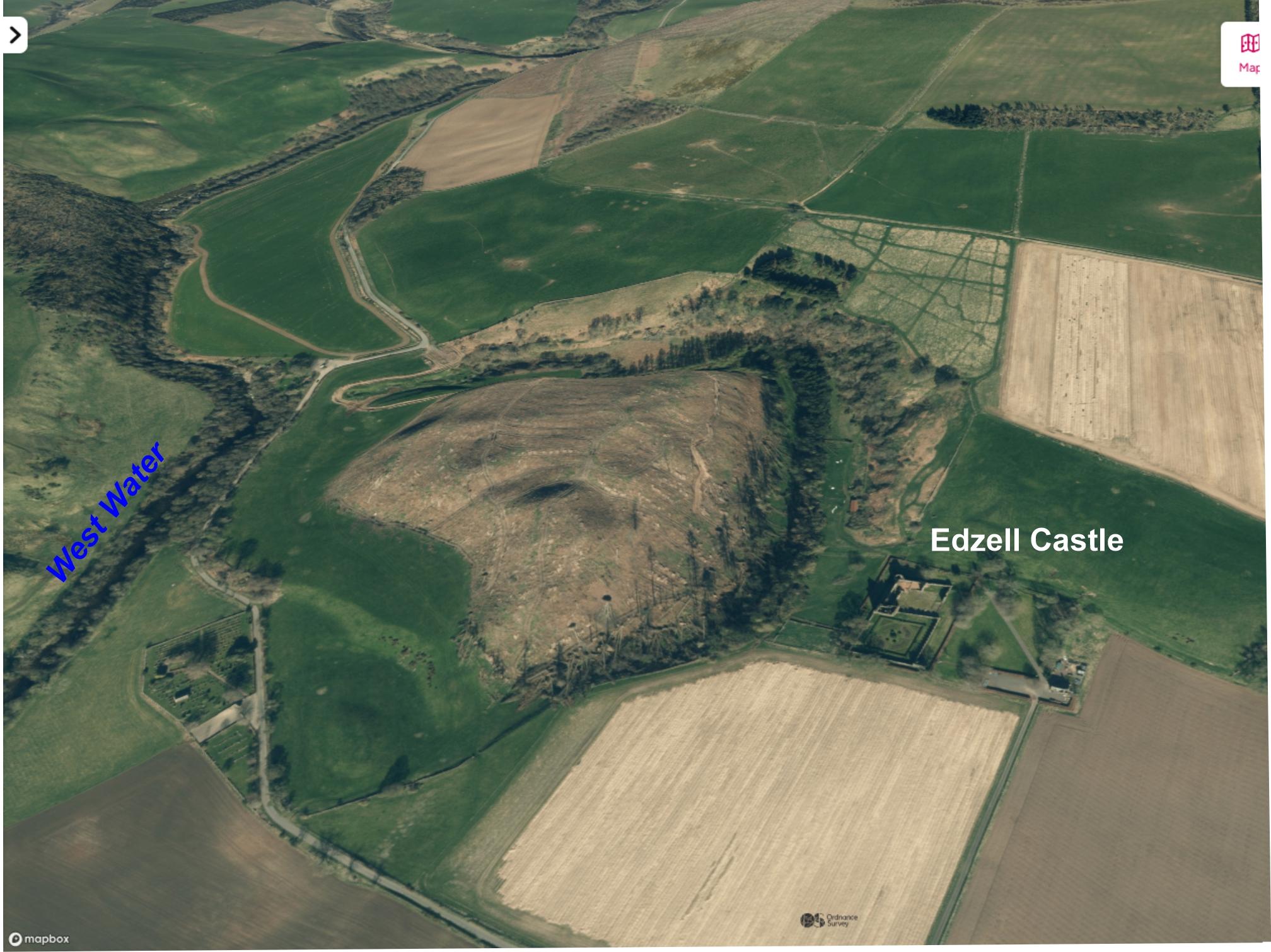
Oblique satellite image looking NW over Edzell Castle, showing the meltwater channel between the castle and the clear-felled mound to its left. Contains OS data © Crown copyright and database rights 2024.
Carol Pudsey
Oct. 9, 2024
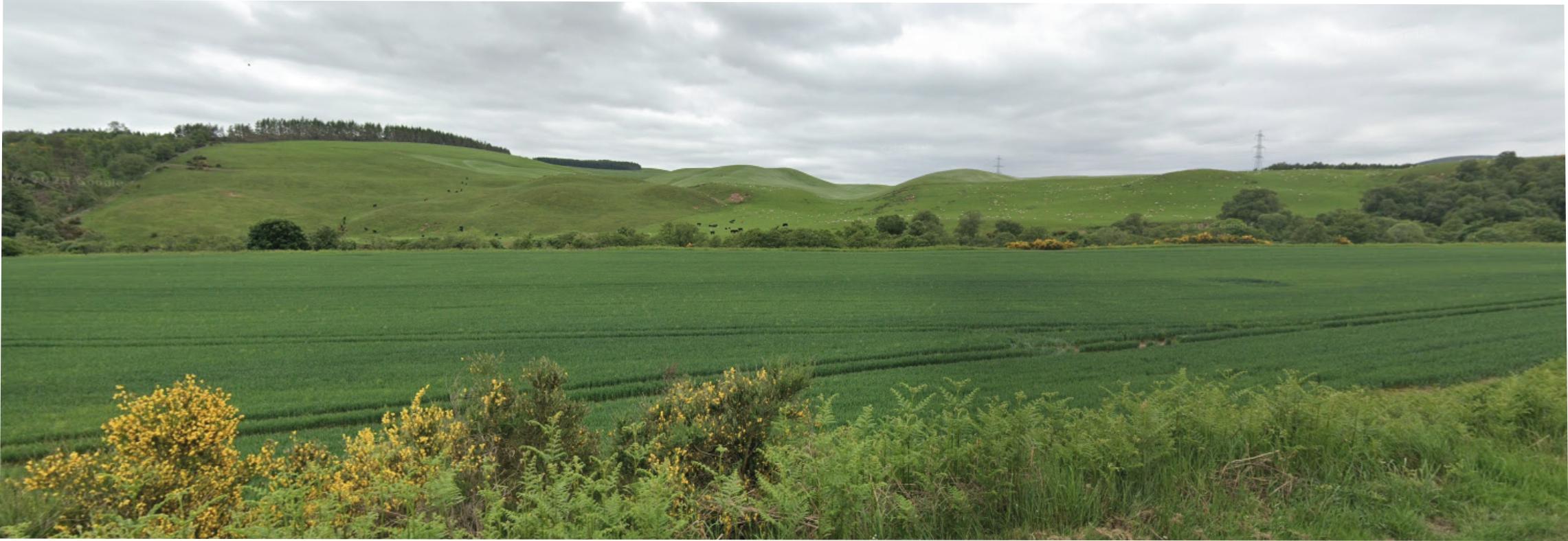
Kame and kettle topography with ice-contact slopes, West Water about 3km west of Edzell (see GCR description). Google Streetview image.
Carol Pudsey
June 14, 2023