Ben Wyvis
Geological Conservation Review site | GCR #175 | Quaternary Geology | Quaternary of Scotland
Geological Conservation Review site | GCR #175 | Quaternary Geology | Quaternary of Scotland
Scotland's geosites are chosen because of their local, national or international importance. Take only photos, leave only footprints: avoid causing any damage to this site. You can walk almost anywhere in Scotland without the need to ask permission or keep to paths, but you have a responsibility to care for your own safety, to respect people's privacy and peace of mind and to cause no damage.
This site is a Site of Special Scientific Interest (SSSI). It is an offence to intentionally or recklessly damage the protected natural features of a SSSI, and this includes unauthorised sample collection.
The right of access does not extend to quarries, building sites or any land where public access is prohibited, or to the collection of geological samples.
Ben Wyvis Provides The Most Extensive Relict Examples Of Stripes Found In Scotland As Well As Fine Examples of Active Solifluction Sheets and Lobes.
An outstanding locality for its periglacial landforms including the best examples in Scotland of turf-banked and vegetated lobes and non-sorted circles and stripes. The turf-banked lobes are fossil feature showing strong evidence of frost sorting and probably moved downslope under permafrost conditions. The vegetated lobes relate to solifluction sensu stricto and are currently active, moving downslope at a rate of a few millimetres per year. The non-sorted circles and stripes show no evidence of lateral frost sorting but owe their surface expression to hummock and ridge and furrow patterns in the vegetation. The transition from circles to stripes is particularly well-demonstrated. Additional periglacial landforms present on Ben Wyvis includes blockfields, relict vegetated boulder lobes and active turf-banked terraces. This assemblage of features, therefore, makes Ben Wyvis a key area for periglacial studies in Scotland.
The official path commences at the car park off the Inverness to Ullapool road (map reference NH4102 6712 refers) and extends to the summit via An Cabar, the most westerly peak along the massif's ridge.
https://sitelink.nature.scot/site/195
NatureScot SiteLink
Walkers accessing the summit ridge and upper slopes should equip themselves with gear appropriate for mountain walking, even in the summer. The path leading to the summit from the south west can prove challenging for inexperienced or the less fit walker. The path's condition varies from year to year, as it is susceptible to storm damage.
There are no site highlights yet.
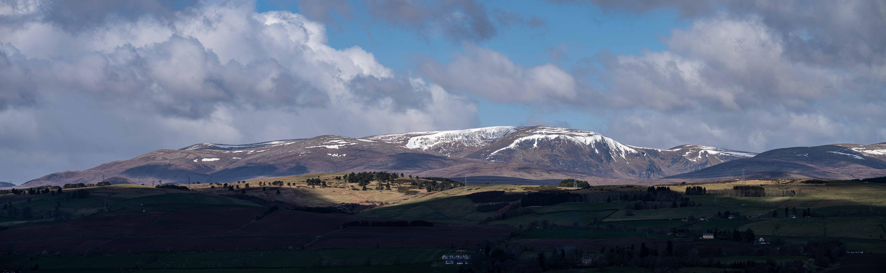
#1: view from the south east to the Ben Wyvis Massif. Glas Leathad Mor, at 1046m, is the highest point along a 2km ridge all of which sits above 950m.
'Regolith', the term used to describe the loose material blanketing the Moine-age schist and gneiss underlying the summit and upper slopes, is likely derived from the weathering of the bedrock.
The BGS Geology Viewer more specifically advises that these almost exclusively consist of pelites and semipelite, metamorphic rocks derived from sediments originally enriched with clays and silts.
The regolith contains both relict Late Glacial periglacial features which are well preserved, as well as contemporary features which continuing to evolve.
Examples of features to be found include: Soliflucation sheets and lobes; 'ploughing' boulders; nivation hollows; turf hummocks; non-sorted stripes.
Andy Leggatt
April 18, 2024
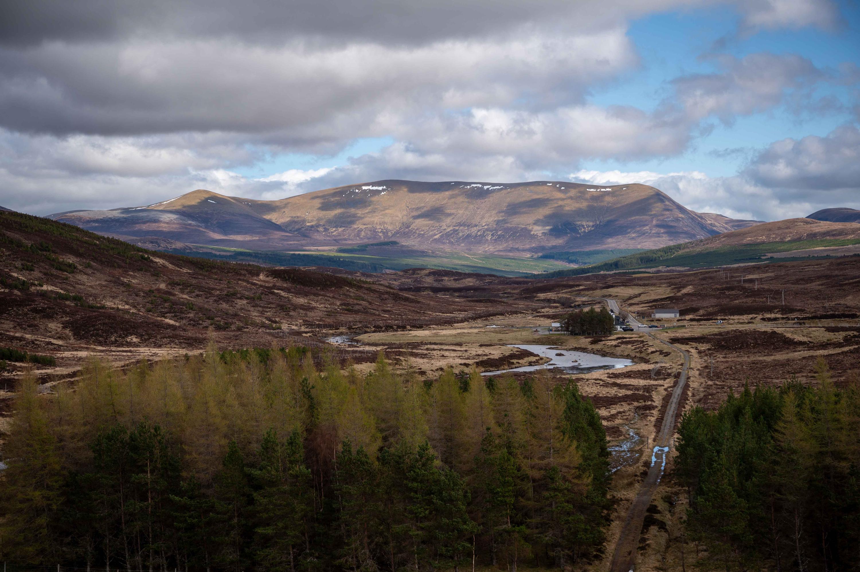
#2: Ben Wyvis Massif from the north west, viewed from Glascarnoch dam. This perspective can be corollate with information board in #3.
Andy Leggatt
April 21, 2024
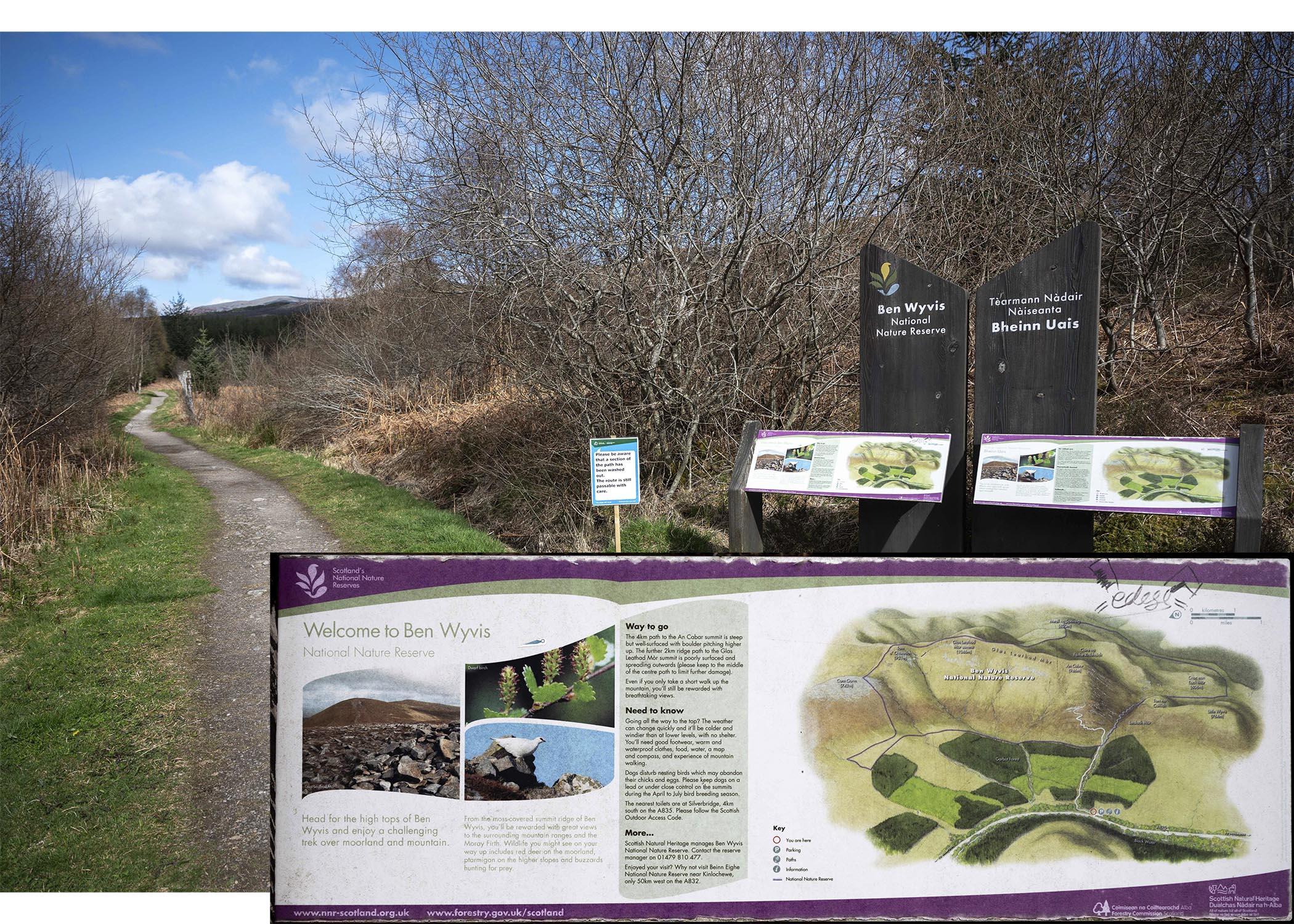
#3: the walking path extending from the Forestry and Land Scotland's carpark at the edge of the Garbat Forest. The boundary of the Ben Wyvis National Nature Reserve are shown on the inset map. However, it should be noted that the GCR/SSSI boundary extends beyond those shown for the NNR .
Andy Leggatt
April 23, 2024
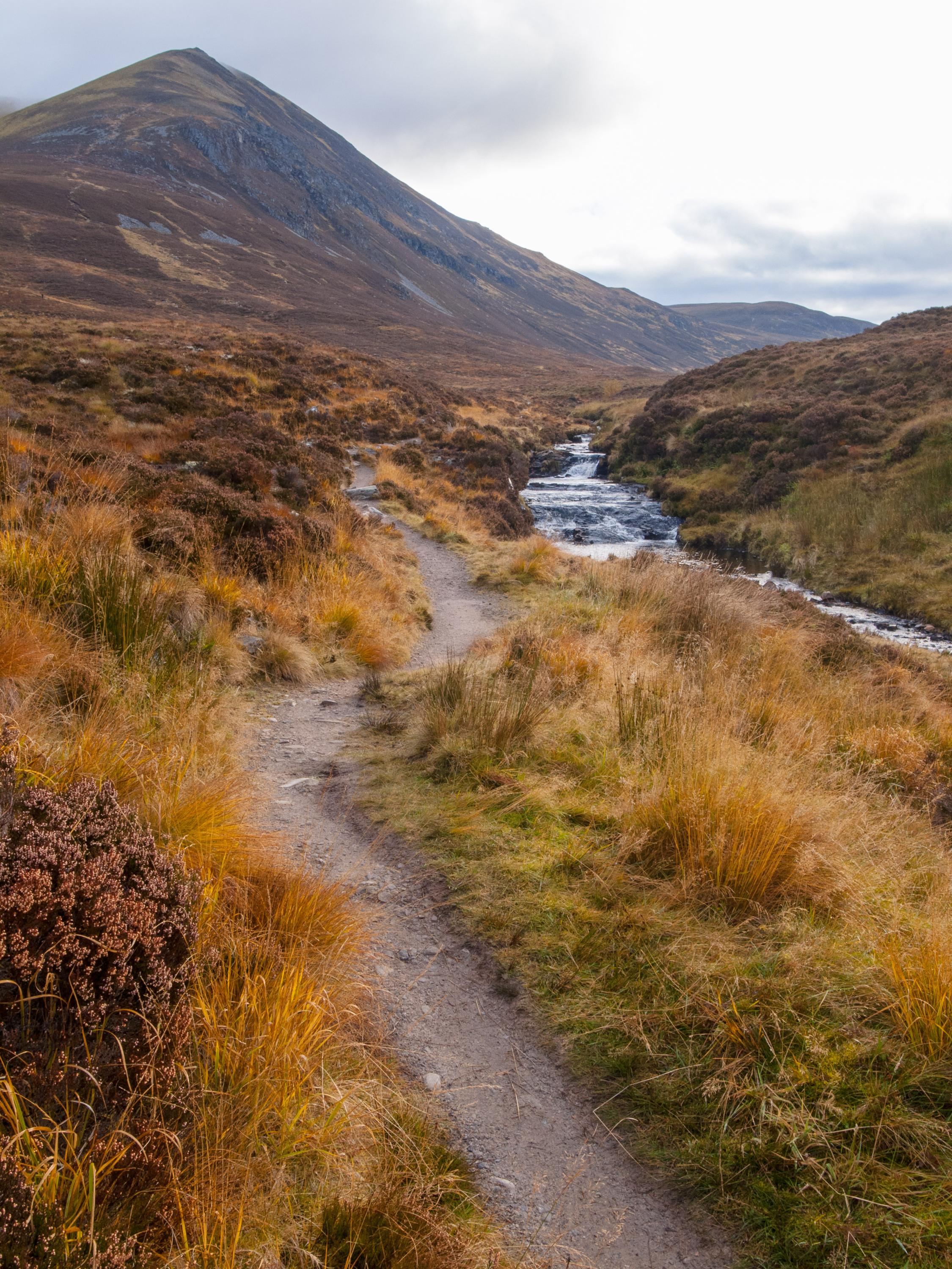
#4: the footpath beyond the eastern extend of the forest, with the steep flank of An Cabar (946m) to the upper left of the image, up which the path can be seen climbing. An Cabar is located at the south western limit of the Ben Wyvis ridge.
Andy Leggatt
Oct. 23, 2012
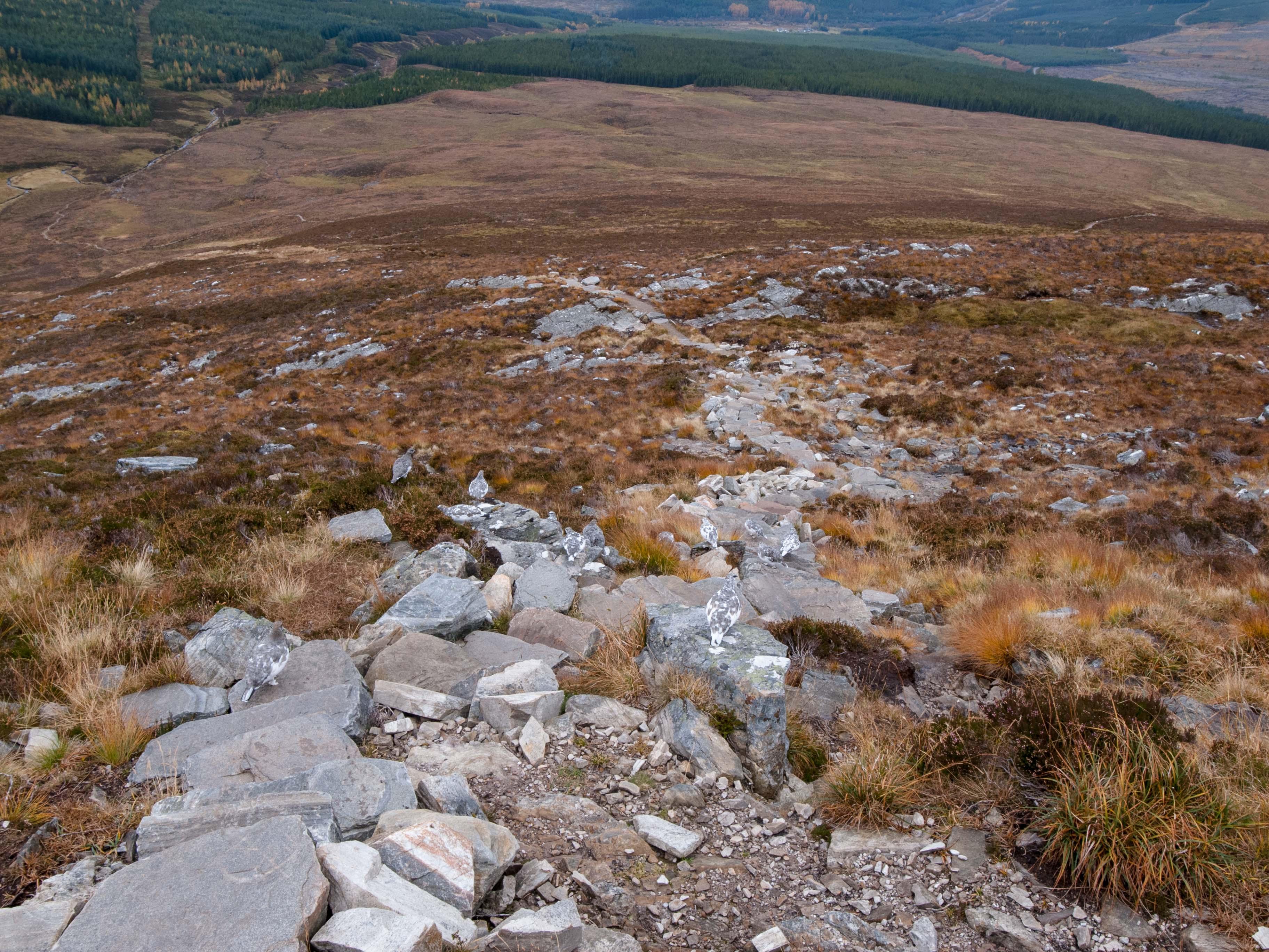
#5: the path higher up on the flank of An Cabar, well within the boundary of the GCR. Garbat Forest is visible towards the top of the photograph, beyond which lies the Ben Wyvis car park.
Andy Leggatt
Oct. 23, 2012
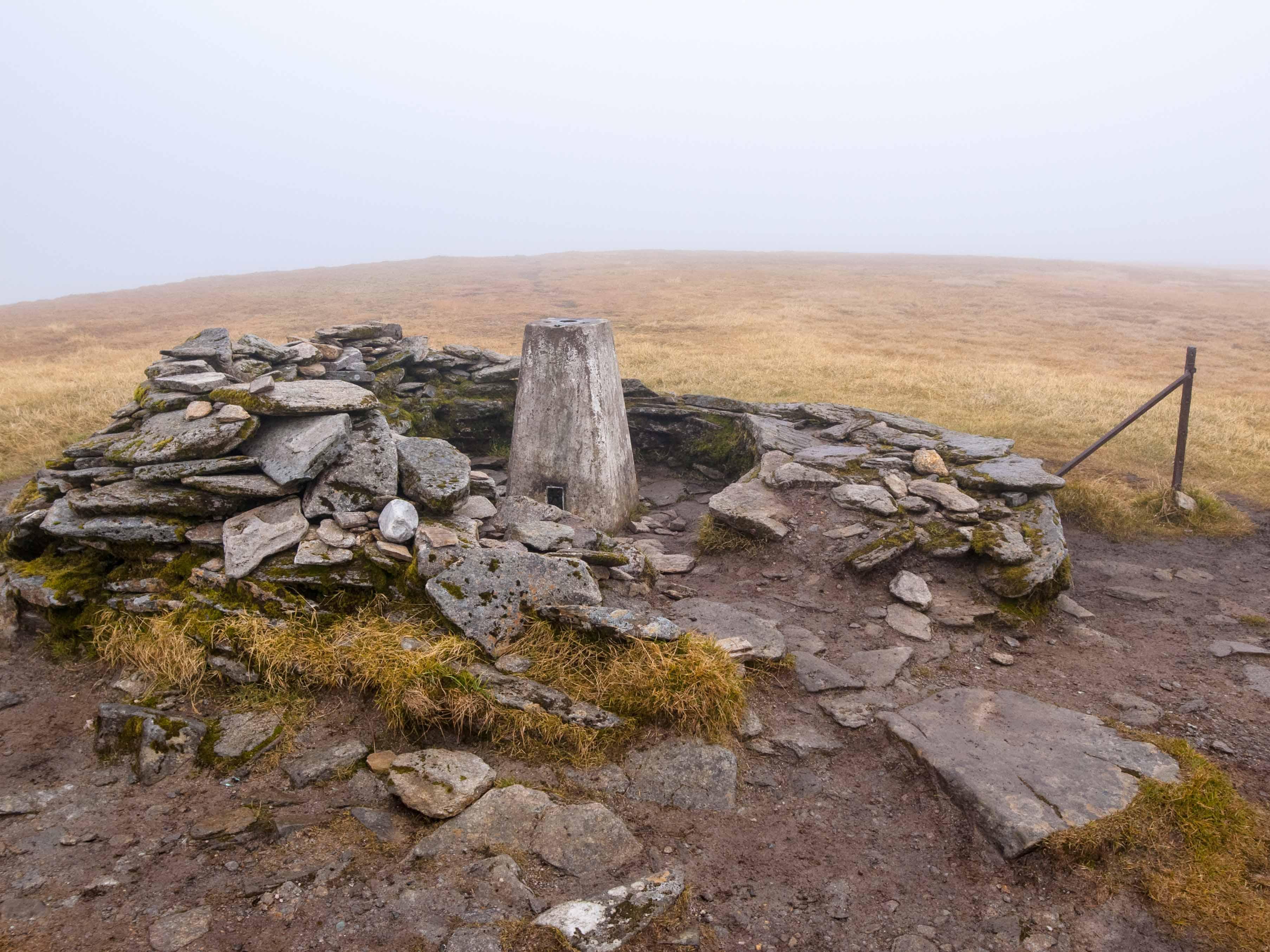
#6: it is noted that much of the largely smooth, vegetation covered regolith mantling the summit and upper slopes, predates the last glacial maximum, which would have been subjected to prolonged periods of freeze/thaw conditions as it protruded above the surrounding ice. This resulted in sever weathering of the pelites and semipelites, in which a wide variety of geomorphological features subsequently formed in the weathered product. The photograph shows the trig point on Glas Leathas Mor surrounded by soil exposed by erosion. These soils seem particularly well suited to produce a wide range of periglacial landforms. These include those formed during the the Lateglacial (and as such are often relict features, i.e. no longer actively evolving) as well as those formed and remaining active during the Holocene.
Andy Leggatt
Oct. 23, 2012
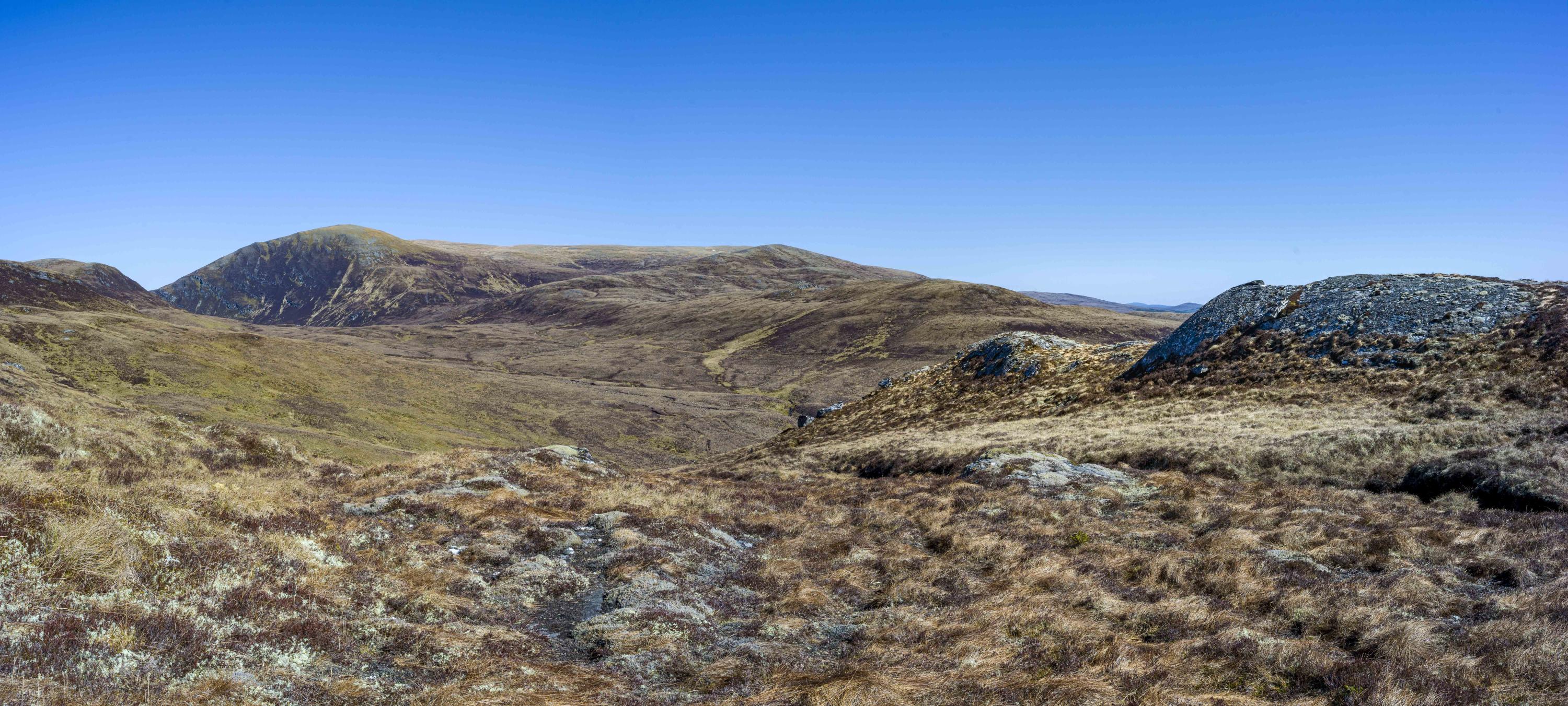
#7: towards the left side of the image, the 946m summit of An Caber and the valley of Bealach Mor beneath mark the south western extent of the site, with the Ben Wyvis plateau rising to1046m running away along the horizon to its right: see also #4 and #6.
In the foreground, the ice-smoothed exposure marks the northerly extent of the garnet-muscovite pegmatite within the Moine-age Ben Wyvis Pelite Formation and part of the Carn Gorm GCR Site. The height here is circa 540m. All heights are referenced to OS datum.
Andy Leggatt
April 6, 2025