Ardersier
Geological Conservation Review site | GCR #877 | Quaternary Geology | Quaternary of Scotland
Geological Conservation Review site | GCR #877 | Quaternary Geology | Quaternary of Scotland
Scotland's geosites are chosen because of their local, national or international importance. Take only photos, leave only footprints: avoid causing any damage to this site. You can walk almost anywhere in Scotland without the need to ask permission or keep to paths, but you have a responsibility to care for your own safety, to respect people's privacy and peace of mind and to cause no damage.
This site is a Site of Special Scientific Interest (SSSI). It is an offence to intentionally or recklessly damage the protected natural features of a SSSI, and this includes unauthorised sample collection.
The right of access does not extend to quarries, building sites or any land where public access is prohibited, or to the collection of geological samples.
Ardersier late-glacial deposits, landforms, and Holocene shorelines, are important for the studies of ice sheet history, the behaviour of the Moray Firth ice stream, relative sea-level change and glacier deposition, with an associated sequence of contorted silts, sands and clays of key interest.
Ardersier is an important Quaternary site containing a suite of glacial and marine features of late-glacial age. The core of the Ardersier peninsula consists of contorted silts, sands and clays, described last century as containing marine shells, which have been interpreted as a moraine of glaciomarine material dredged up from the floor of the Moray Firth by a readvance of the Late Devensian ice-sheet. The deposits where washed over and trimmed by the sea in late-glacial times, producing fine examples of raised beach terraces. At a lower level the moraine is flanked by extensive post-glacial beach deposits. The site provides important evidence for the history of the Late Devensian ice-sheet and associated sea- levels in the Moray Firth area, but its full significance in relation to sites elsewhere in Scotland has yet to be evaluated. Ardersier is also notable for the sedimentological interest of the glaciomarine deposits and the geomorphological interest of its raised shorelines.
As there are no accessible exposures of the contorted silts, sands and clays, the site's remaining features are best appreciated from the public roads which surround it.
Public parking is available at Ardersier Common (NH 77928 55771) and Kirkton Cemetery (NH 77991 56715) from which the post-glacial beach deposits and lateglacial raised beach deposits may be viewed. The former also offers an excellent view of the a degraded cliff line.
https://sitelink.nature.scot/site/71
Ardersier Glacial Deposits SSSI.
Care should be taken when viewing the site from public roads.
There are no site highlights yet.
#1a: view of the site from the Black Isle. Kirton Cemetery may be seen between Fort George and the pinewood close to the left of the image, and the gorse-clad relict shoreline and cliff above the current shore towards the right.
Andy Leggatt
Nov. 6, 2024
#1b: LiDAR image of the site with the walls of Kirton Cemetery forming the rather coffin-shaped feature near the top left, and the gorse-clad relict cliff featured in #2 & #5, in reddish brown.
Image reproduced with the permission of the National Library of Scotland.
Andy Leggatt
#1c: View from a location on the Holocene raised marine deposits with the degraded relict cliff-line beneath the gorse-covered slope concealing the Ardersier Silts Formation, centre-right, and a Late Devensian raise marine deposits occupying the lower slope, centre-left.
Andy Leggatt
Aug. 2, 2023
#2: View from the B9039 towards the vegetated slope concealing the Ardersier Silt Formation where a window reveals an exposure of the contorted silts section.
These silts preserve a wide range of glacial deformation which occurred during glaciation.
The Holocene raised marine deposits are to be found beneath the grassy field in the foreground, with the degraded cliff beyond.
Andy Leggatt
Aug. 2, 2023
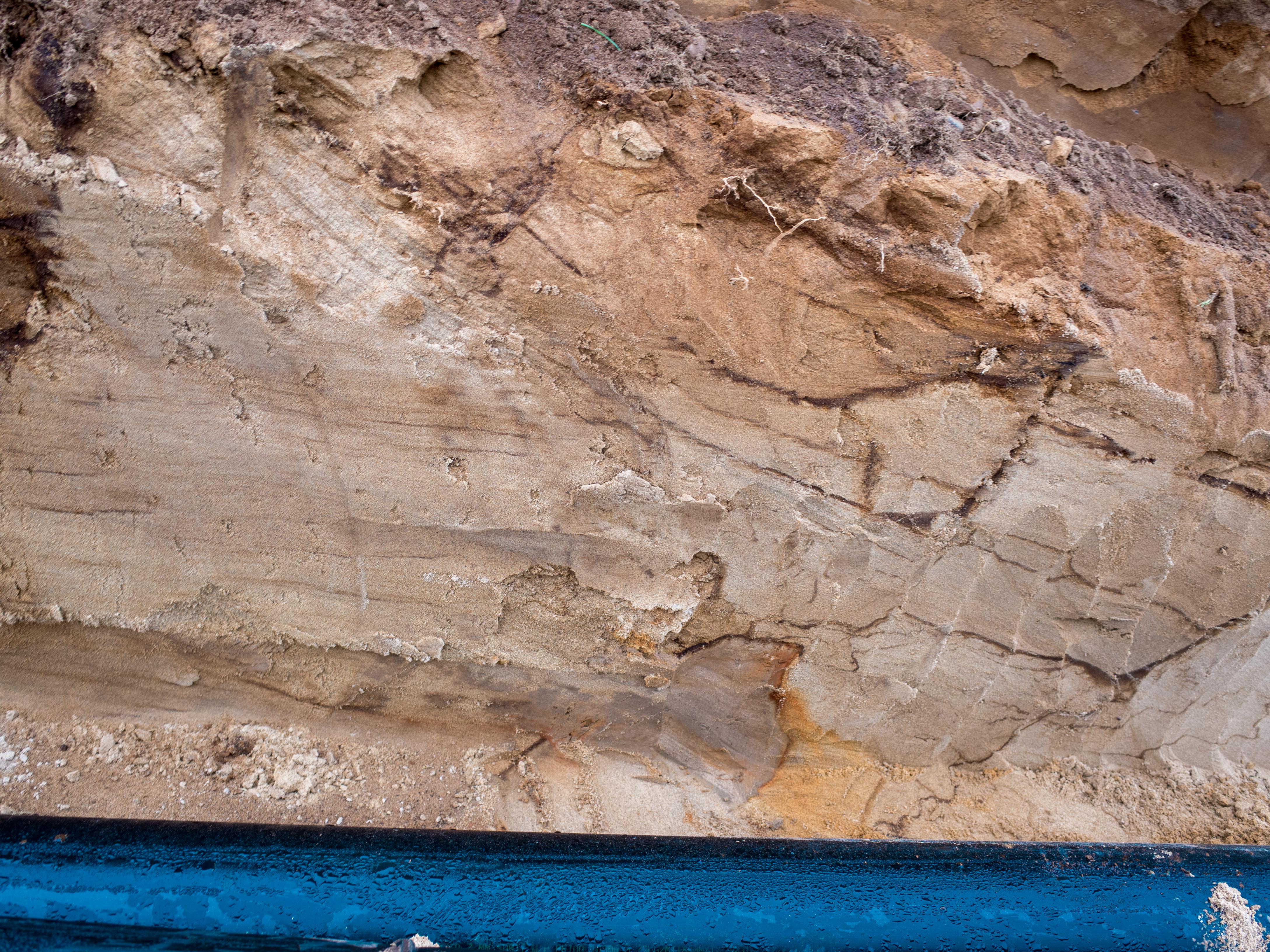
#3: Distorted silts exposed during the installation of 180mm diameter pumping main. Features of interest here include crossbedding (top left), distorted clay layers appearing to show oxidation bleeding out of them (various locations) and brecciation of the sand/clay units (bottom centre).
Andy Leggatt
Nov. 8, 2017
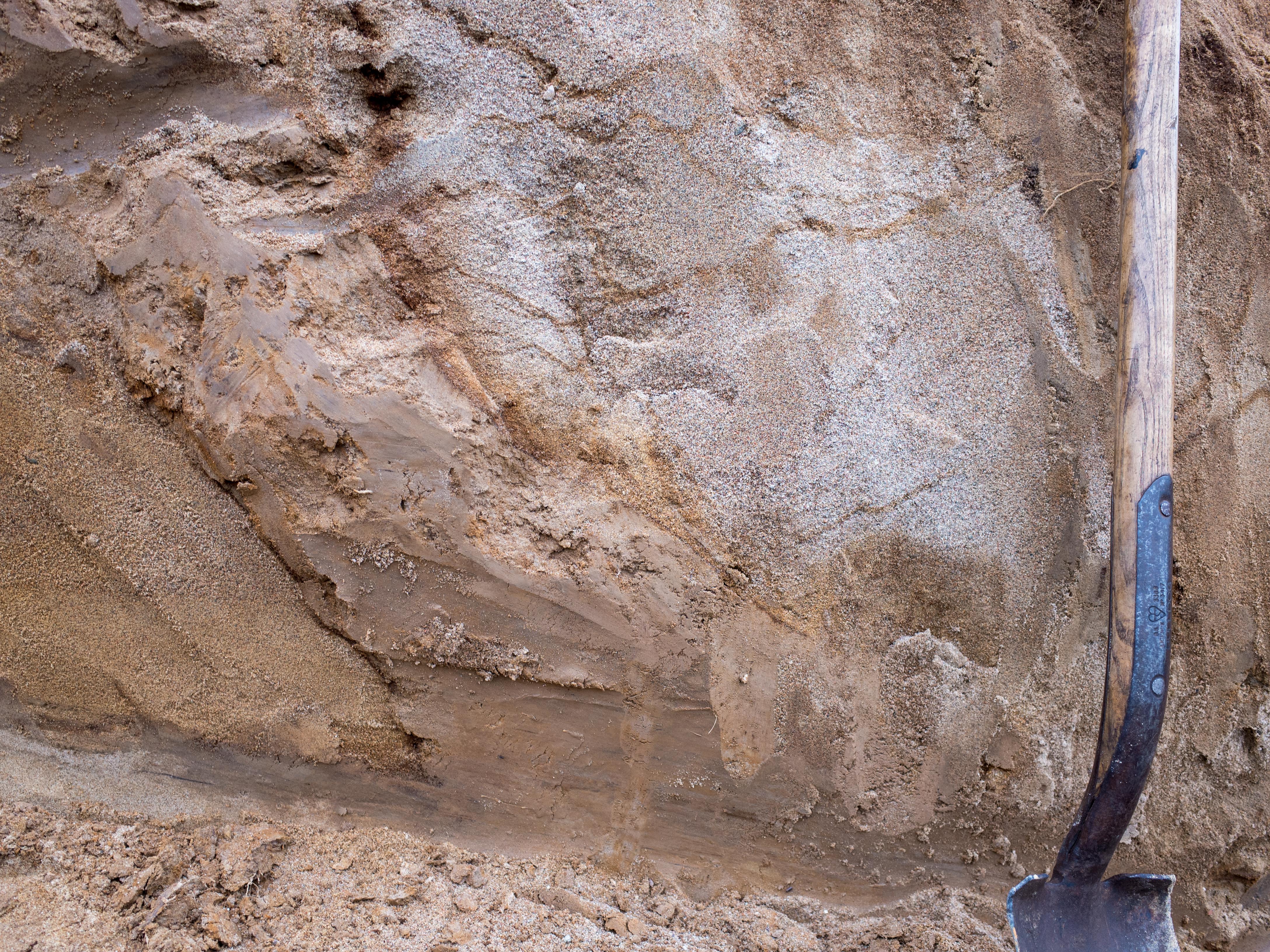
#4: Disjointed clay horizon exposed during the installation of a pumping main, with a sand wedge to the left hand side and distorted silts above and to the right.
Andy Leggatt
Nov. 8, 2017
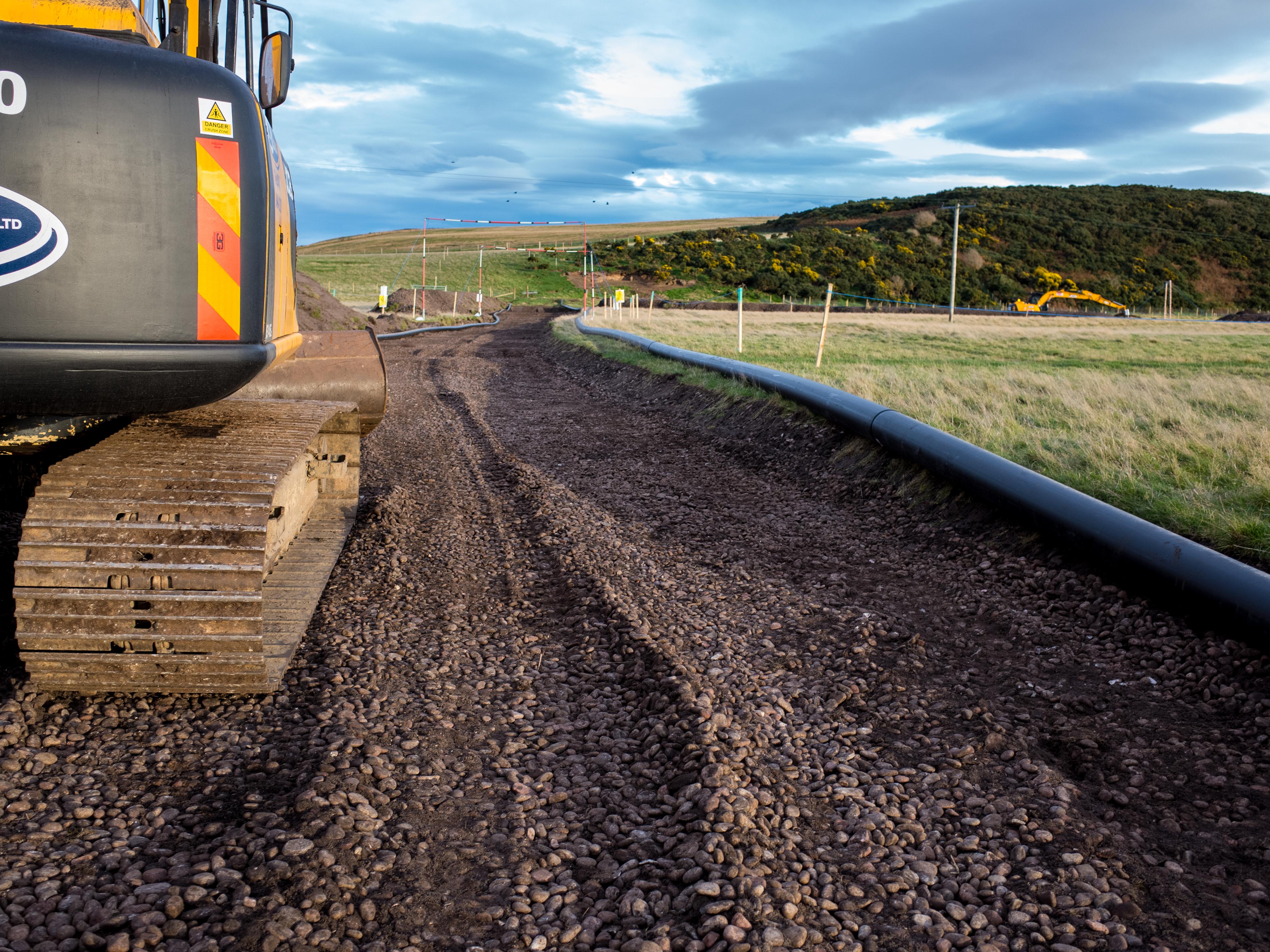
#5: Holocene raised marine deposits exposed during the installation of a pumping main (foreground) with the degraded and gorse-covered relict cliff-line tapering off to the left near the skyline. The Ardersier Silts Formation is exposed at the rabbit burrows and sheep scrapes, middle-distance.
Andy Leggatt
Nov. 6, 2017

#6: BGS compiling report on the Ardersier Silt Formation.
Andy Leggatt
Nov. 27, 2017