West Coast of Jura (Bagh Gleann Speireig - Carragh an t-Sruith)
Geological Conservation Review site | GCR #979 | Quaternary Geology | Quaternary of Scotland
Geological Conservation Review site | GCR #979 | Quaternary Geology | Quaternary of Scotland
Scotland's geosites are chosen because of their local, national or international importance. Take only photos, leave only footprints: avoid causing any damage to this site. You can walk almost anywhere in Scotland without the need to ask permission or keep to paths, but you have a responsibility to care for your own safety, to respect people's privacy and peace of mind and to cause no damage.
This site is a Site of Special Scientific Interest (SSSI). It is an offence to intentionally or recklessly damage the protected natural features of a SSSI, and this includes unauthorised sample collection.
The right of access does not extend to quarries, building sites or any land where public access is prohibited, or to the collection of geological samples.
The west coast of Jura is a locality of international importance for a magnificent assemblage of raised marine landforms, including some of the most extensive areas of raised shingle ridges and terraces in western Europe. There are additional raised beach deposits, and a series of three rock platforms. The High Rock Platform is mantled by extensive raised beach deposits and, in places, by till. At one locality a remarkable suite of up to 55 separate late-glacial shingle ridges occurs on its surface. The Main Rock Platform is exceptionally well-developed along the whole coast and in places is mantled by post-glacial beach ridges. The Low Rock Platform occurs as an intertidal feature. Typically it terminates inland against the front cliff of the Main Rock Platform, but sometimes passes under post-glacial raised beaches, then till. Post- glacial raised beaches are extensive, including at one locality a superb staircase of 31 ridges. These are probably the finest set of post-glacial beach ridges in Britain and reflect the pattern of relative sea-level change from the maximum of the post-glacial transgression to the present day. The site also includes a particularly fine example of a Late Devensian medial moraine.
Jura is a wild and beautiful island but is not the easiest place to get around. It is reached by a small ferry from Islay which arrives at Feolin Ferry on the SW coast. The only public road from here goes round the south and east coasts to Ardlussa (infrequent bus service and limited car parking). The landforms on the SW coast may be reached by following tracks north from Feolin below the Paps of Jura; additional walks are linked below under "Further Information". Note that away from tracks the ground can be very rough and boggy.
https://www.walkhighlands.co.uk/islay-jura/evans-walk.shtml
A longer walk across the island.
https://www.walkhighlands.co.uk/islay-jura/whitefarland-bay…
A short walk north from Feolin Ferry
https://www.geograph.org.uk/photo/3555632
View of the moraine at ground level
There are no safety notes yet.
There are no site highlights yet.
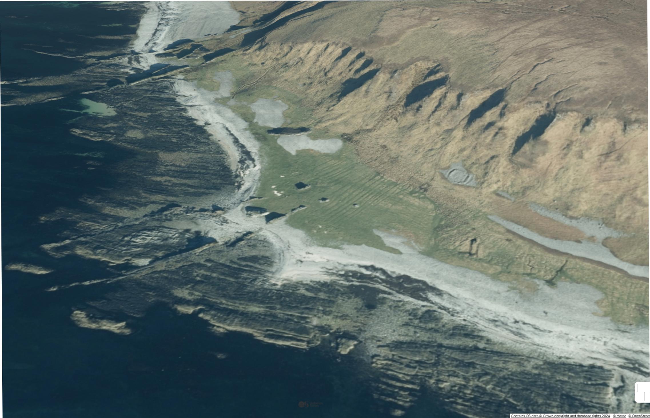
Oblique satellite image ((c) Ordnance Survey) of the Low Rock Platform at Rubha Aird na Sgitheich. The Jura Quartzite strikes NNE and the cross-cutting ridges are Tertiary dolerite dykes.
Carol Pudsey
Oct. 24, 2024
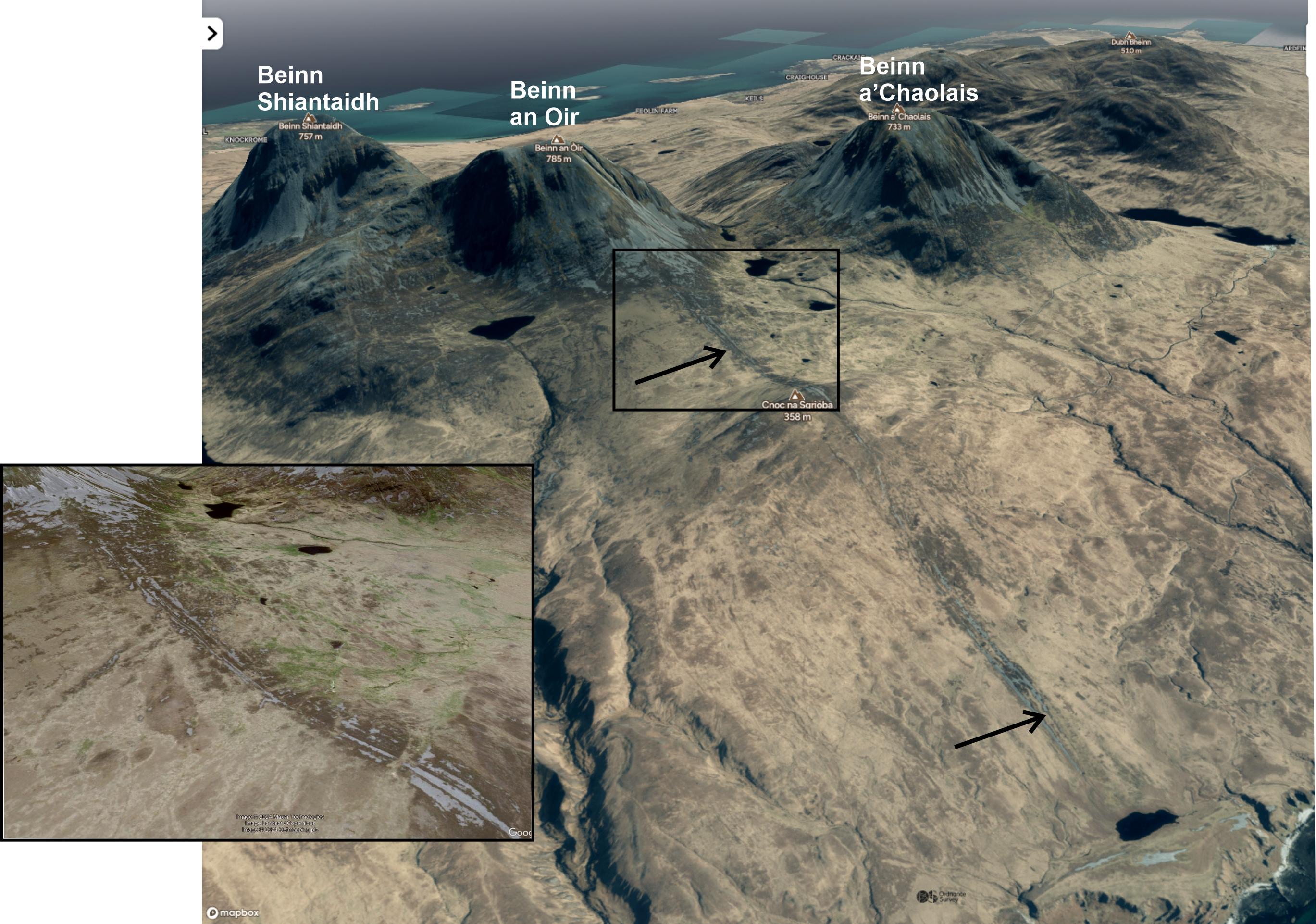
Oblique satellite image of the medial moraine (arrowed) below Beinn an Oir. Contains OS data © Crown copyright and database rights 2024.
Inset is a closer view: Google Earth image from 9 June 2013, showing several parallel ridges of boulders. Image © 2024 Maxar Technologies.
Carol Pudsey
Oct. 24, 2024
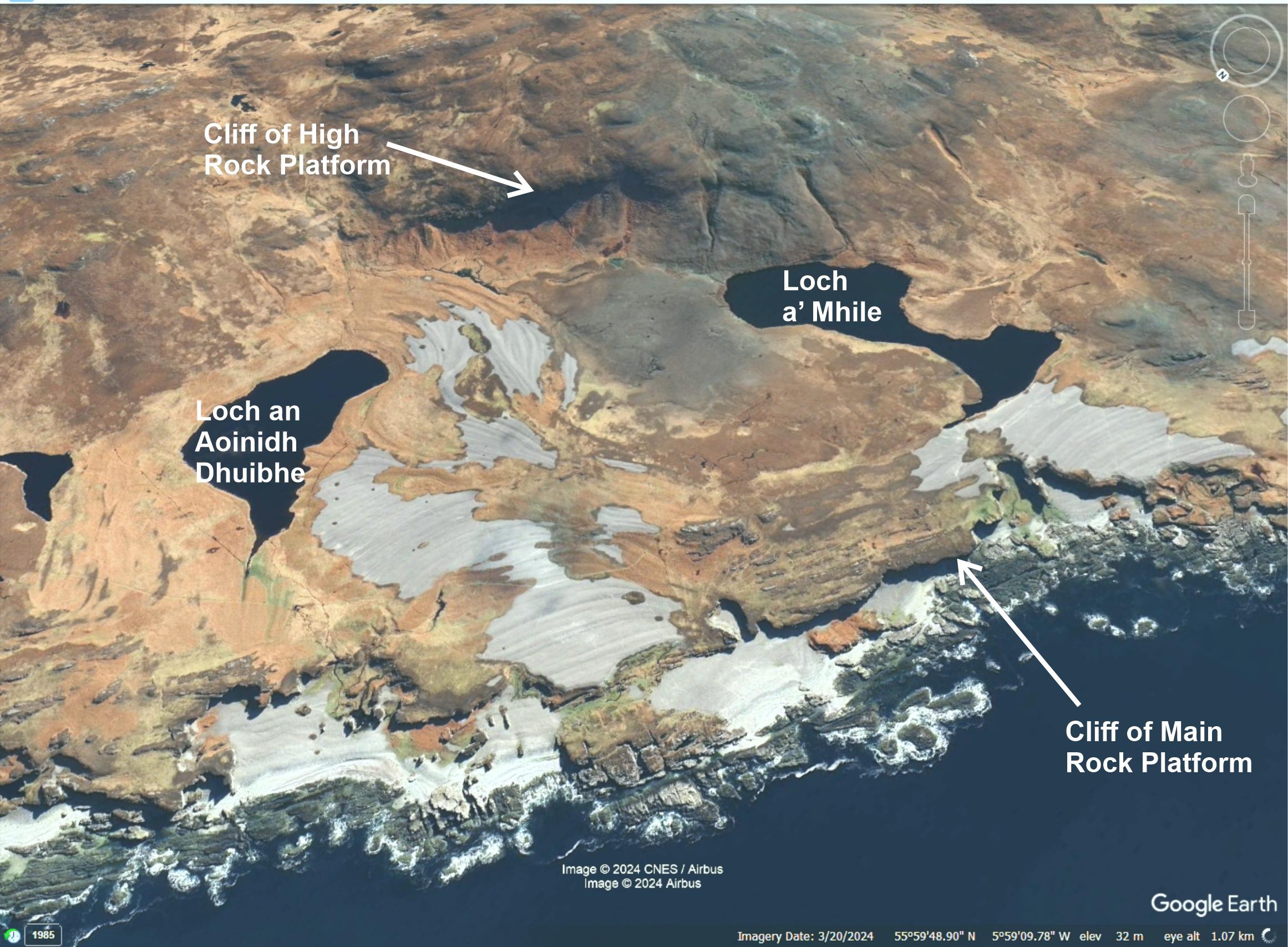
Oblique satellite image of Late Devensian raised beaches, south of Shian Bay. These extend up to about 35m above sea level. The cliffs of the Main and High Rock Platforms are clearly visible. Google Earth, Image © 2024 CNES/Airbus, Image © 2024 Airbus.
Carol Pudsey
March 20, 2024
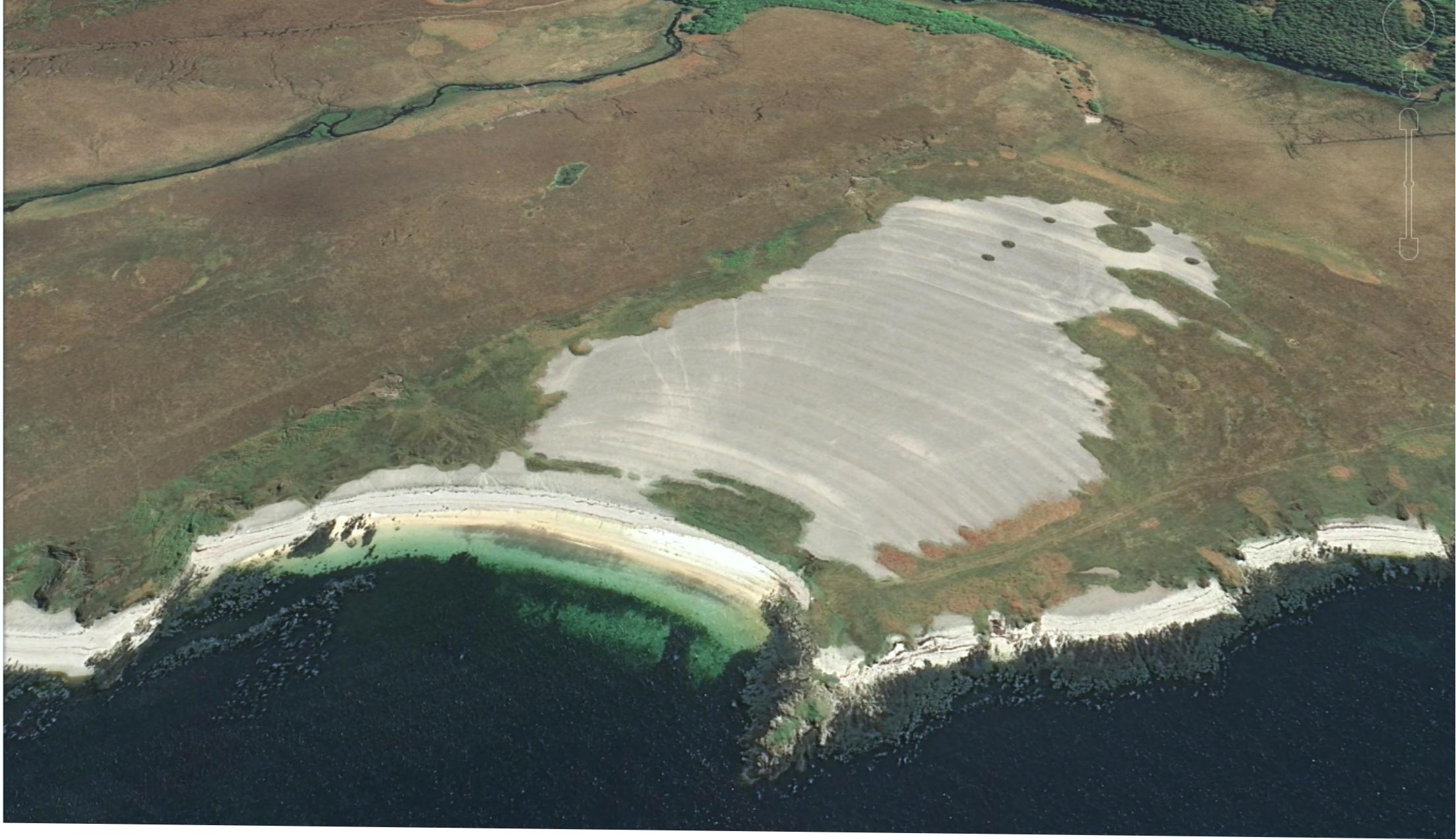
Oblique satellite image of Holocene beach ridges at Traigh nam Feannag, SW Jura; these extend up to about 12m above sea level. Contains OS data © Crown copyright and database rights 2024.
Carol Pudsey
Oct. 24, 2024