Clashach - Covesea
Geological Conservation Review site | GCR #1500 | Stratigraphy | Permian - Triassic
Geological Conservation Review site | GCR #1500 | Stratigraphy | Permian - Triassic
Scotland's geosites are chosen because of their local, national or international importance. Take only photos, leave only footprints: avoid causing any damage to this site. You can walk almost anywhere in Scotland without the need to ask permission or keep to paths, but you have a responsibility to care for your own safety, to respect people's privacy and peace of mind and to cause no damage.
This site is a Site of Special Scientific Interest (SSSI). It is an offence to intentionally or recklessly damage the protected natural features of a SSSI, and this includes unauthorised sample collection.
The right of access does not extend to quarries, building sites or any land where public access is prohibited, or to the collection of geological samples.
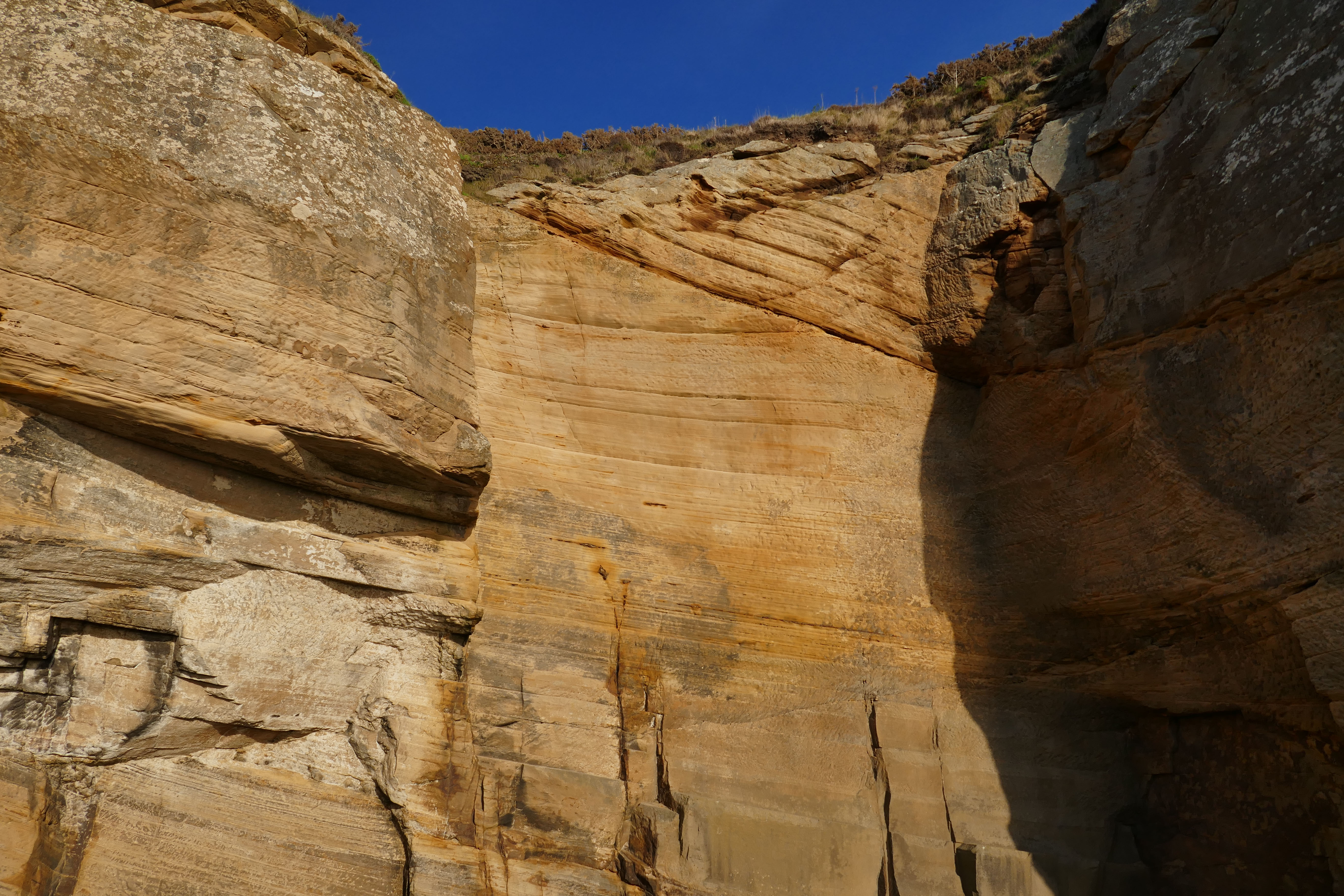
The coastal section between the disused New Red Sandstone quarries of Clashbach and Covesea provides an excellent section in the Hopeman Sandstone Formation. This formation is dated as Lower Triassic on the basis of its contained vertebrate fossil material. The sandstones show a variety of sedimentary lamination types within large-scale dune bedding. Cross strata, often affected by spectacular post- depositional deformation structures, dip generally to the west indicating palaeowinds blowing from the east during that time.
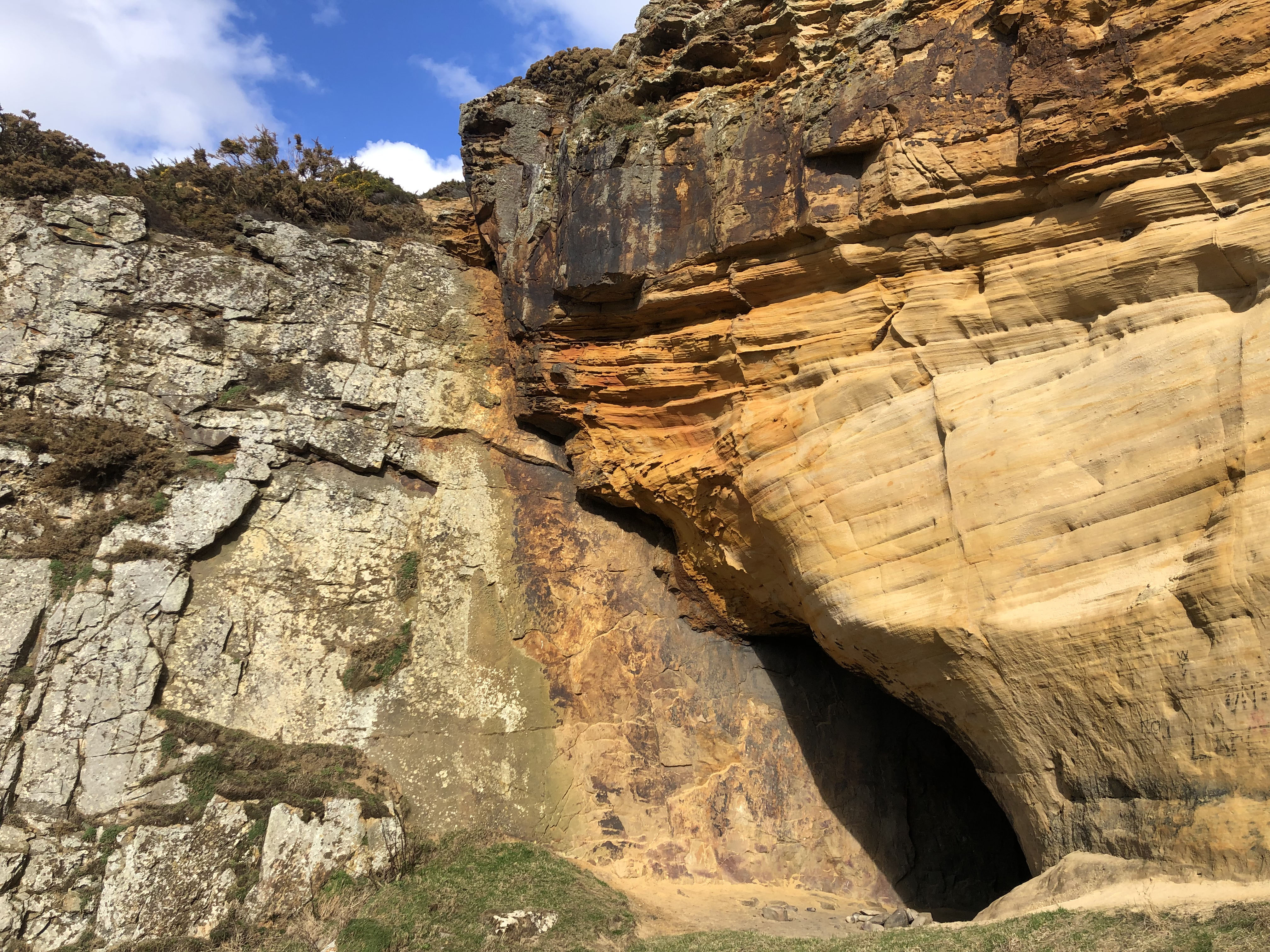
This very interesting stretch of coastline is difficult to access. A dropping spring tide is preferred, even a neap low tide only allows brief access. From Clashach Quarry a rough track leads down to this stretch and, similarily, a rough path from Covesea Village allows access. A famous ladder 'The Lummy', a rope and sometimes wooden ladder, situated in a narrow hidden gully near the clifftop path near Sculptor's Cave is not reccommened. The central portion of this part of the coast is covered in fridge sized, very slimy, rounded boulders and is quite unpleasant.
Detailed reconstruction of local desert paleo-environment in Permian times. Lars Clemmenson, 1987. Complex star dunes and associated aeolian bedforms, Hopeman Sandstone (Permian), Moray Firth, Scotland.
There are no safety notes yet.
There are no site highlights yet.
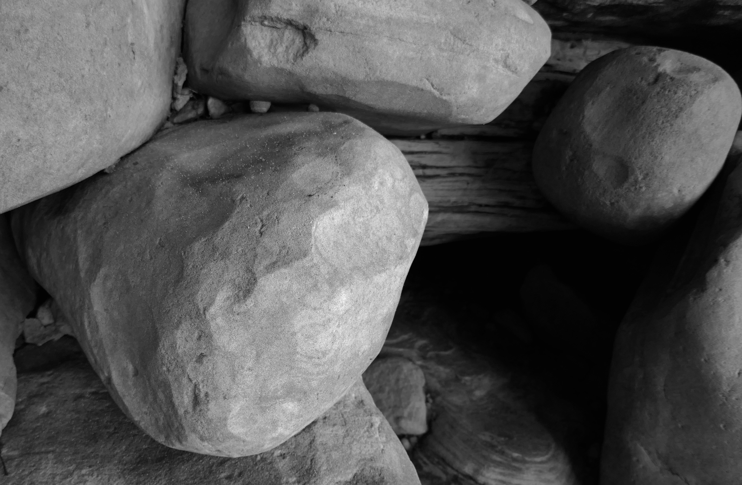
Detail of facetted boulders from the 'sea cave deposit'
Dave Longstaff
Oct. 24, 2022
A very remote, and difficult to reach, location showing a deposit of facetted boulders, a very rare occurrence. Note the finely layered deposit at the top of the boulders and a shell midden middle top amonst the topmost boulders...neolithic? It is thought this is a deposit from a back of a long lost sea cave, facetted boulders shaped by the waves then standing water in the uppermost section. A most interesting deposit known to very few geologists because of it's location. Storms with easterly winds remove boulders at times and this deposit is in danger of collapse at some point.
Dave Longstaff
March 28, 2023
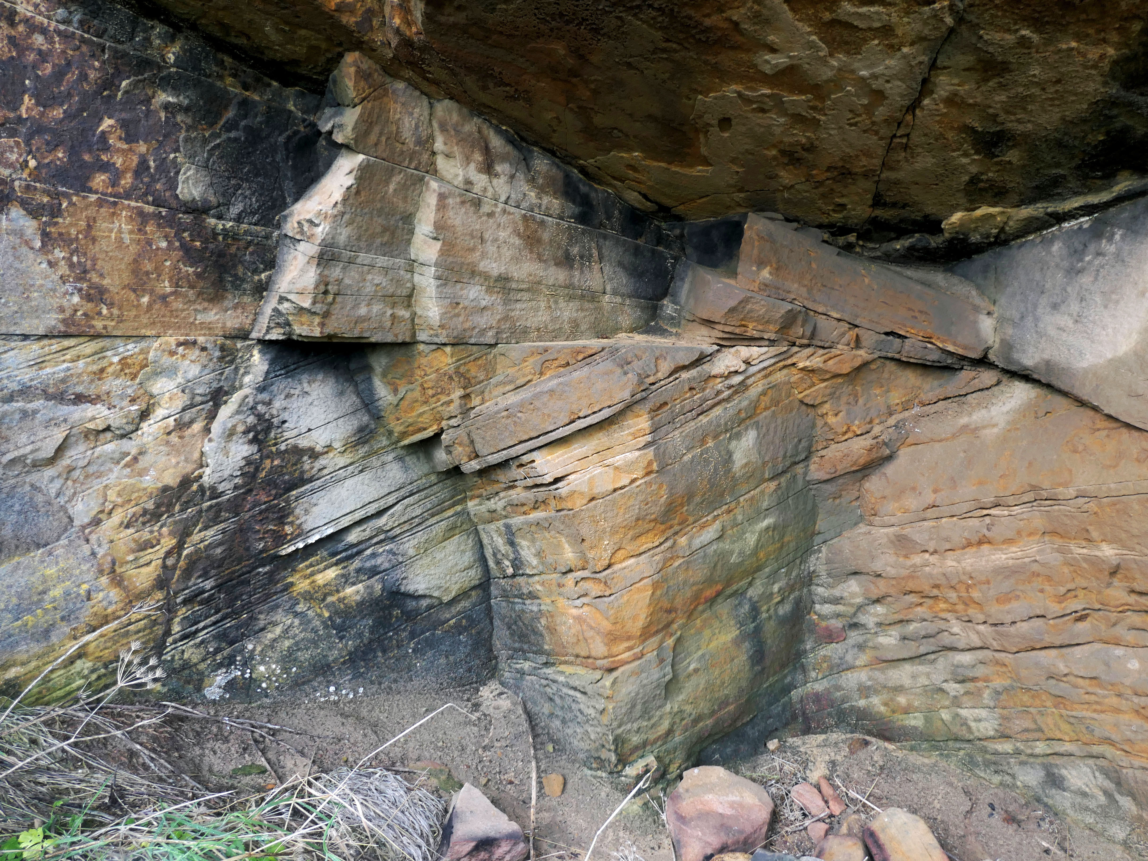
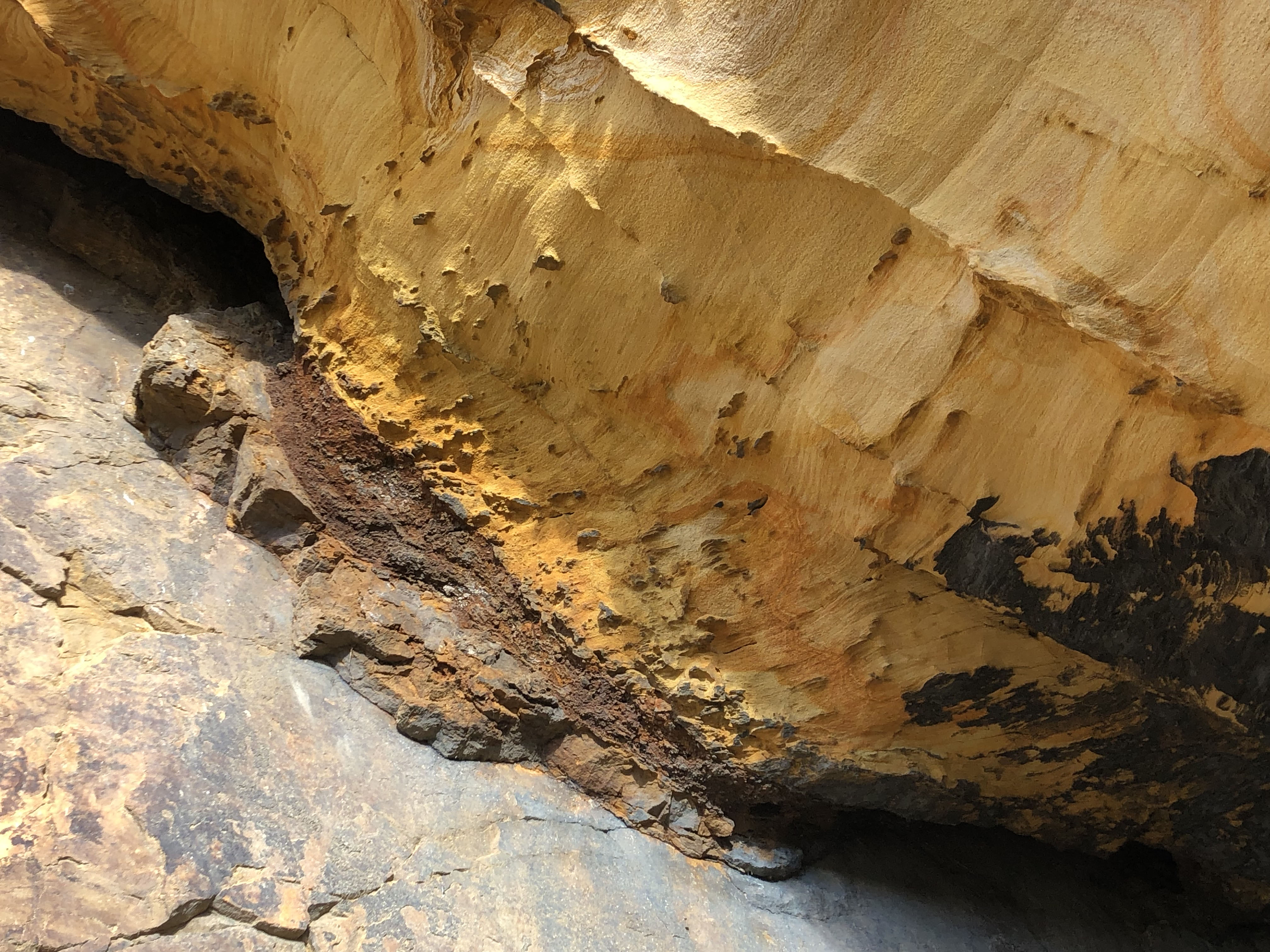
One of the few (of 4-5) in-situ Permian trackways visible on this coast. This is a view looking upwards to the ceiling of the entrance to an almost hidden quarried cave. Chisels marks abound on this surface and it's interesting to speculate where the counterpart to this chiselled surface ended up.
Dave Longstaff
April 30, 2022
'The Bow' cove between Clashach and Covesea Quarry. Cross bedded and variably cemented sandstones. The Bow only accessible at very low tides.
Dave Longstaff
April 26, 2022
Drone photo (Will Hall) of detail of soft sediment deformation in Hopeman Sandstone Formation, dune collapse/earthquake features?. Height of features about 30m from sea level..
Dave Longstaff
March 28, 2023
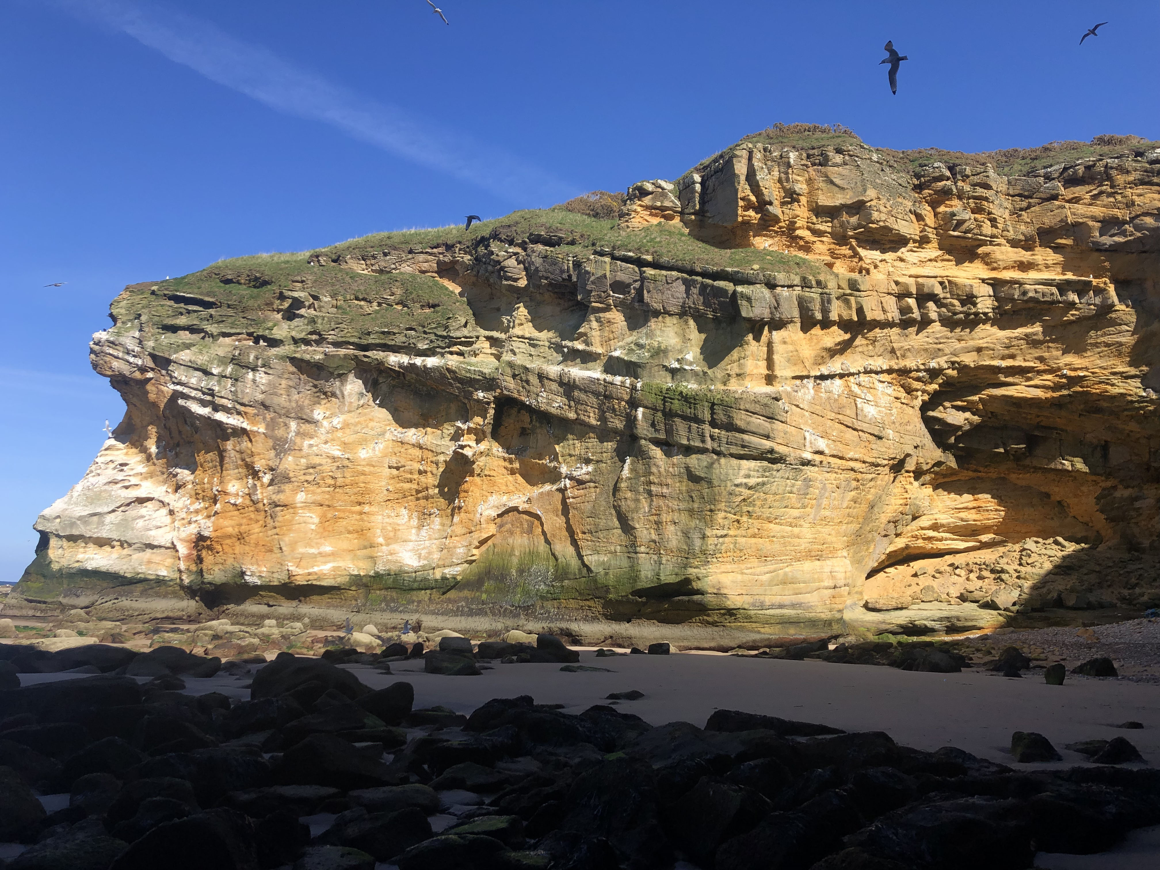
Drone photograph (Will Hall) of large sandstone cliff known locally as 'Aberdeen Wall'. Soft sediment deformation features visible top left. Cliff about 30m high.
Dave Longstaff
March 28, 2023
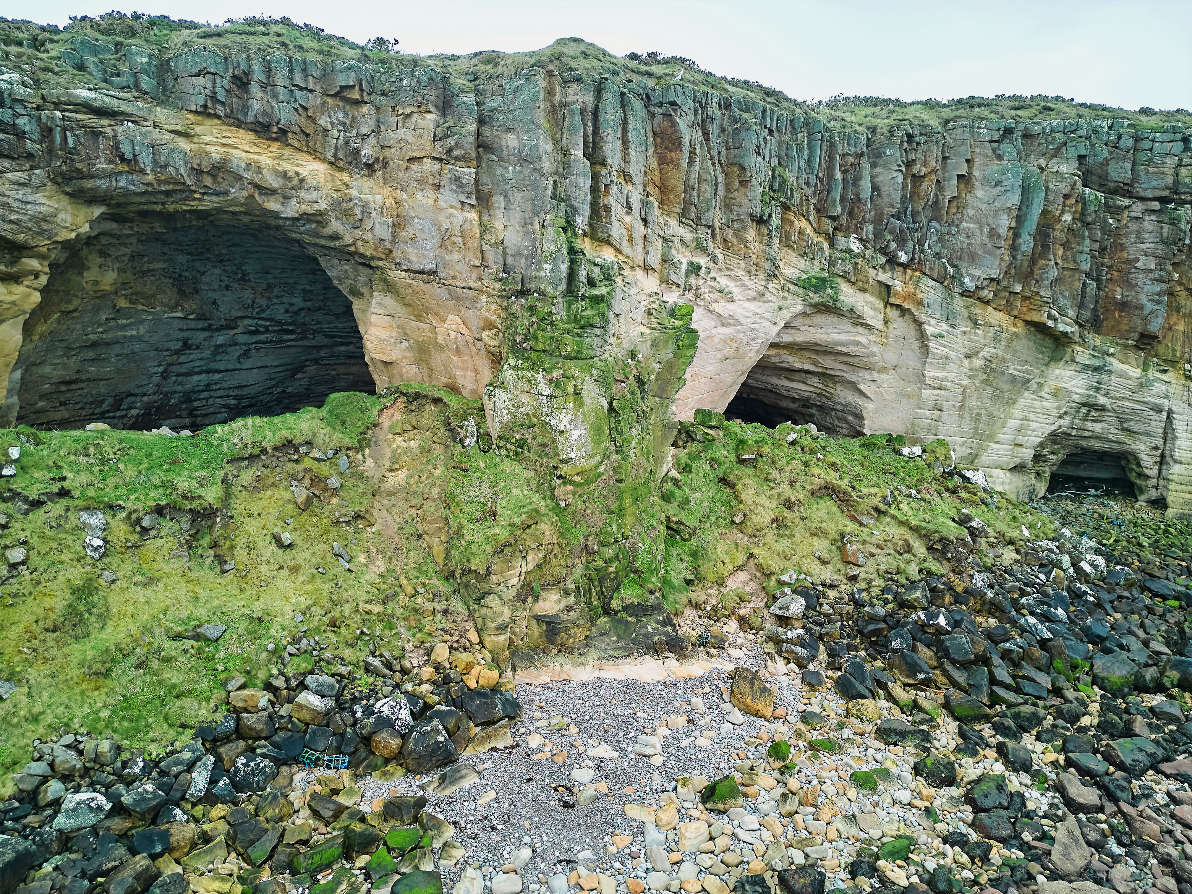
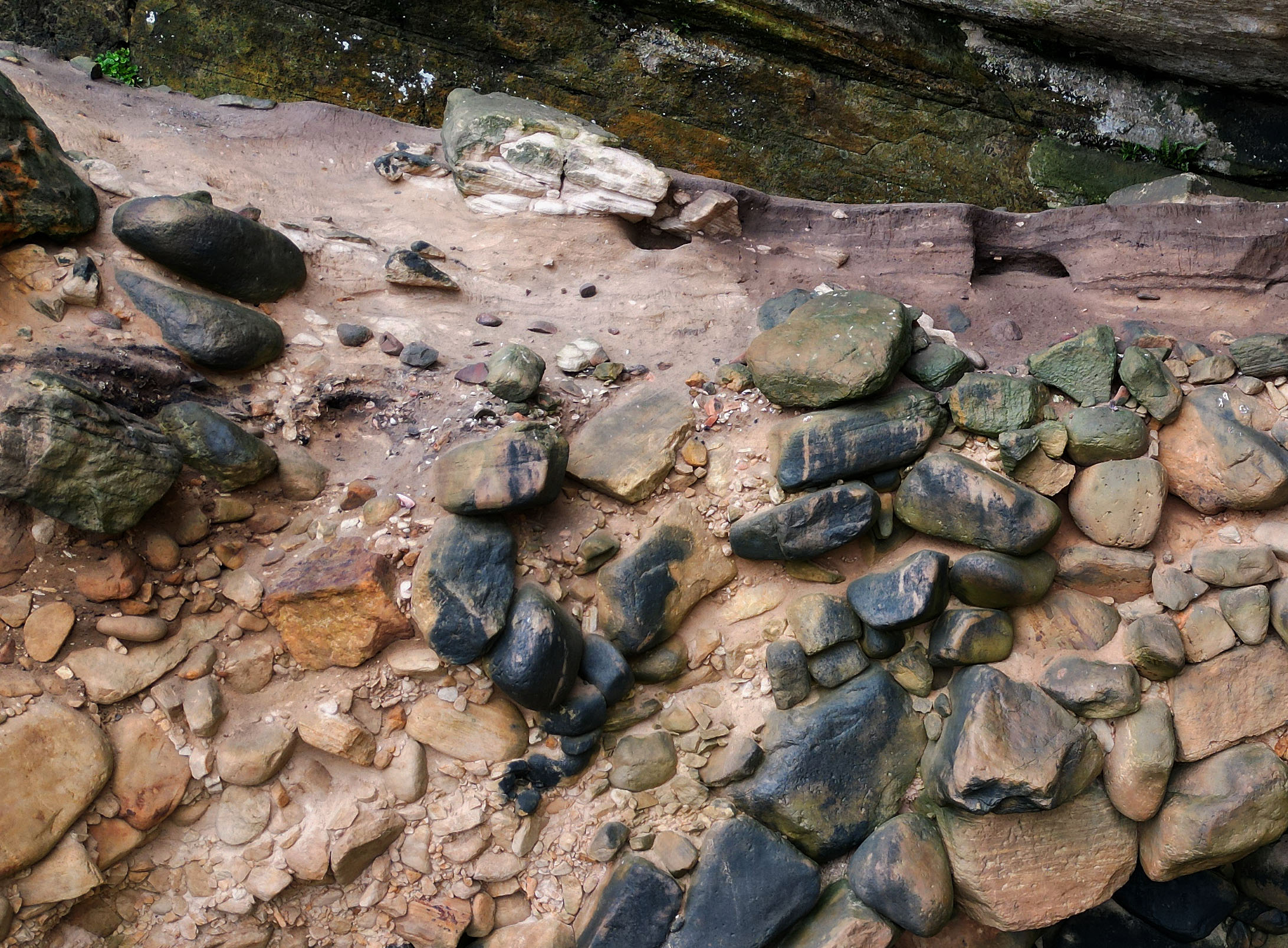
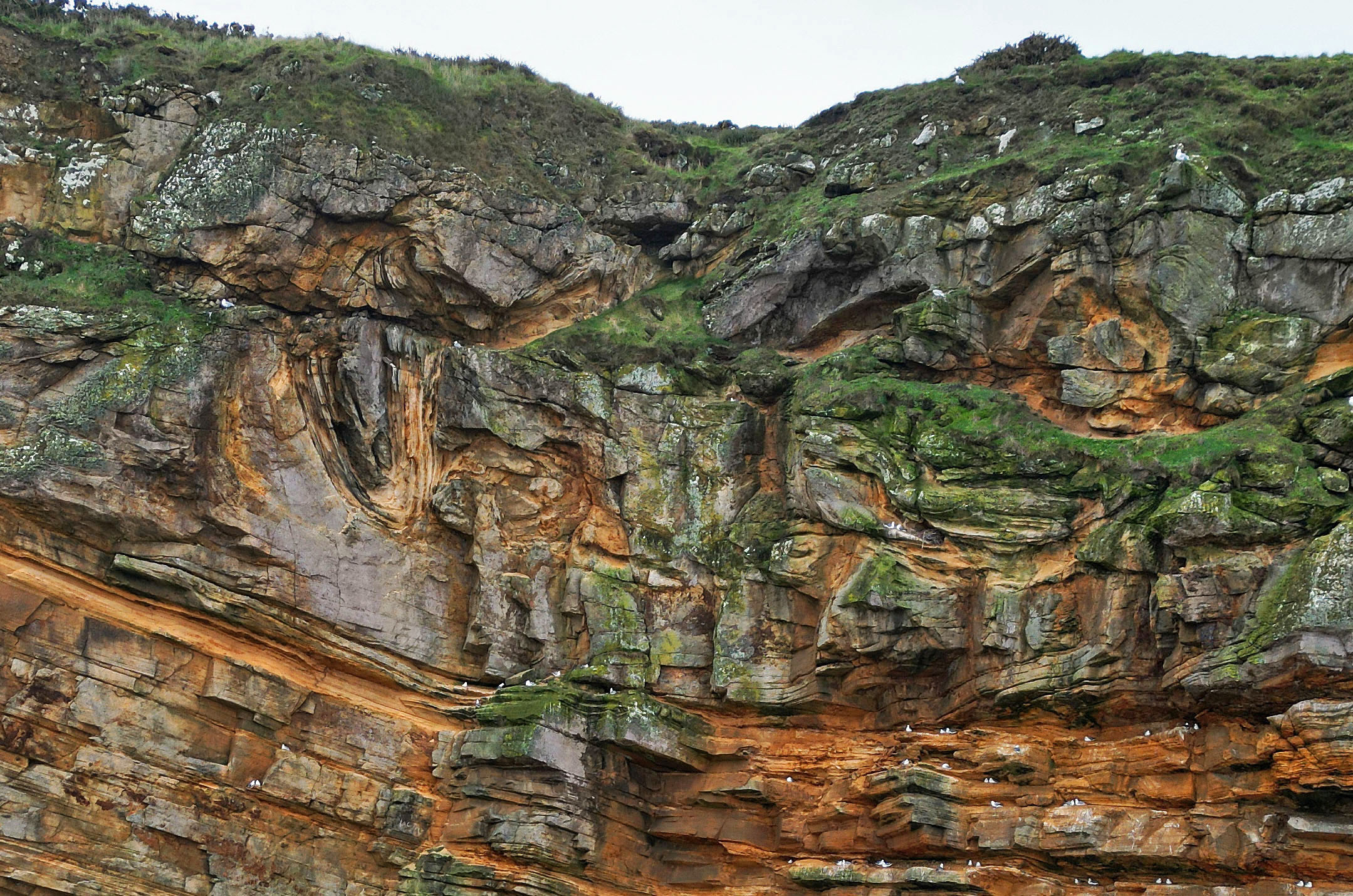
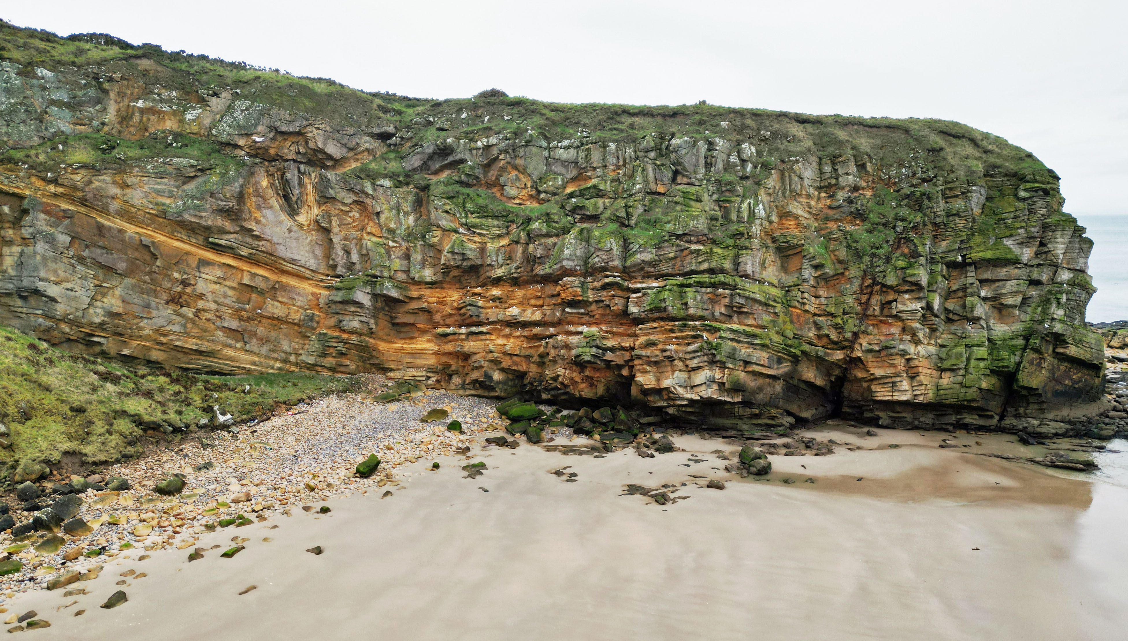
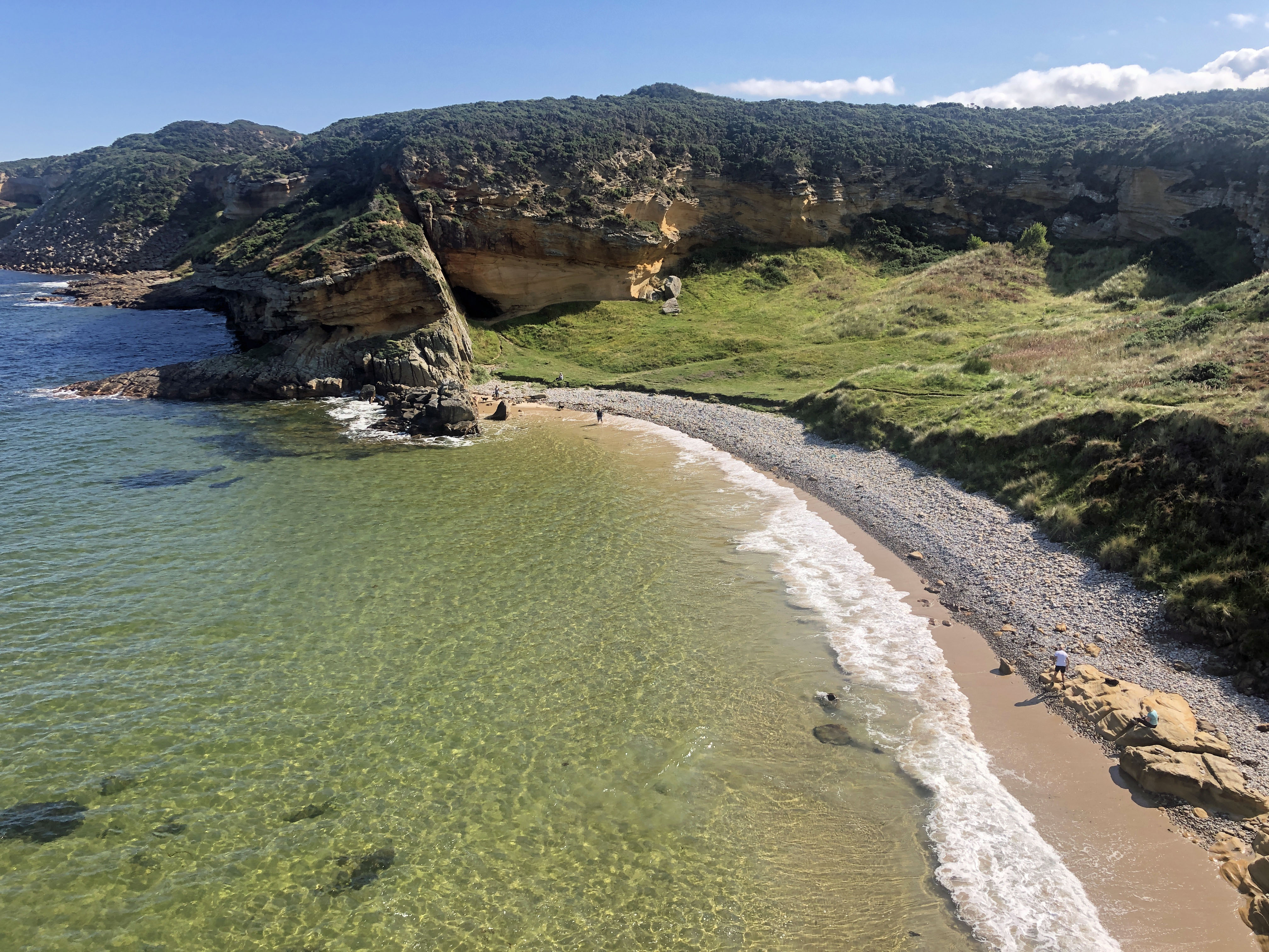
Drone photo (Will Hall) showing the 3 Covesea Caves. The magnificent Covesea Cave 1 on the left in the largest and has archeology from Neolithic period. Note the caves being picked out by wave acting on the softer iron cemented sandstone with the harder silicified sandstone standing prominent. The larger caves are interesting because they contain room shaped internal collapse caves' accessible only by crawling under ledges. These 'box' caves are where the ancients were living and are the subject of Bradford and Leeds University research projects.
Dave Longstaff
March 28, 2023
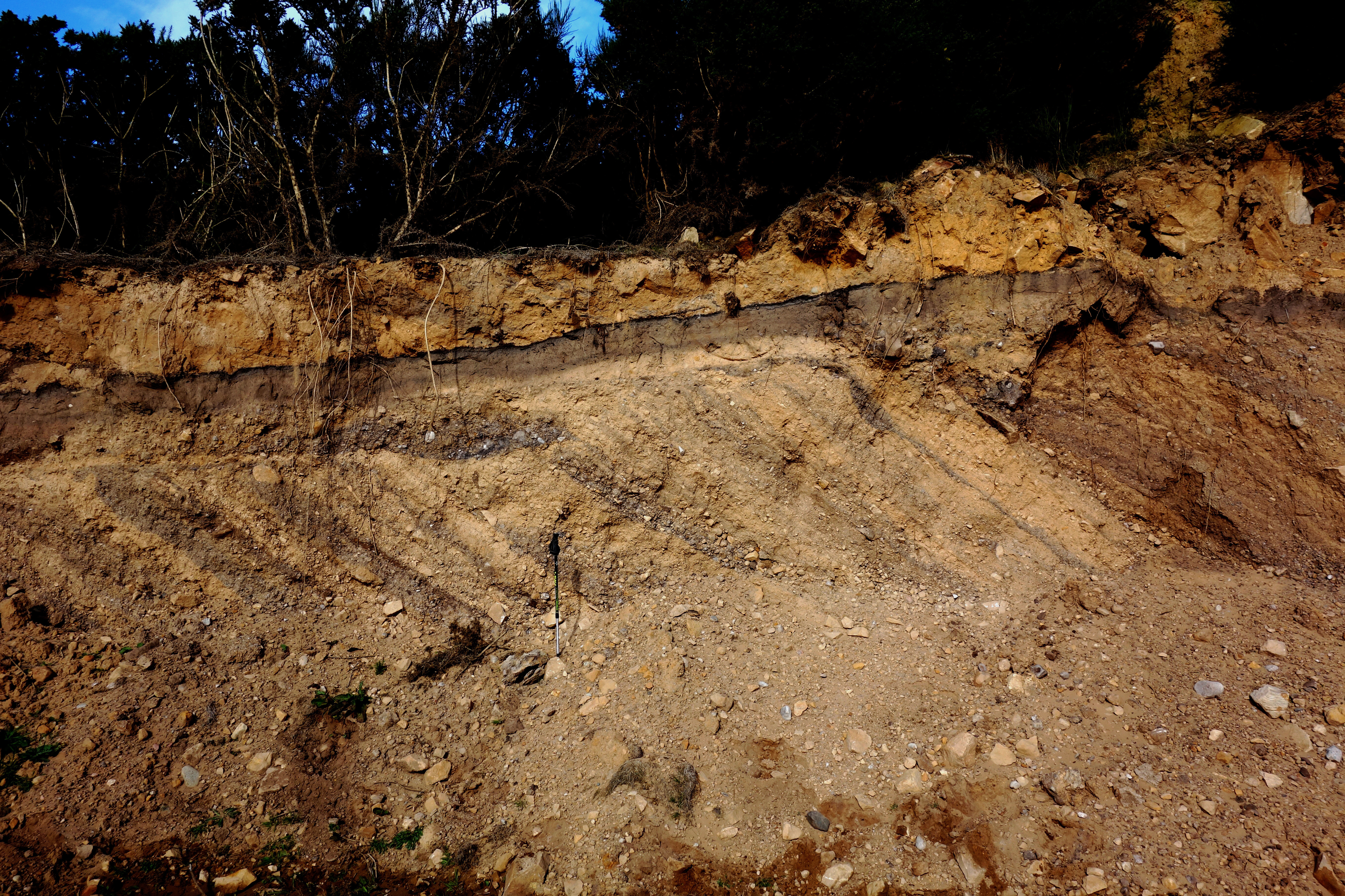
Cross section through a Da Geer moraine in topmost level of Clashach Quarry only recently revealed by quarrying 'tidying up' operations.. These moraines are normally seen in plan view and this exposure is a rare cross section. Moraine formed in sub-aqueous environment beneath glacier snout with sediment being deposited from left (west) to right. View looking north.
Dave Longstaff
Oct. 11, 2019
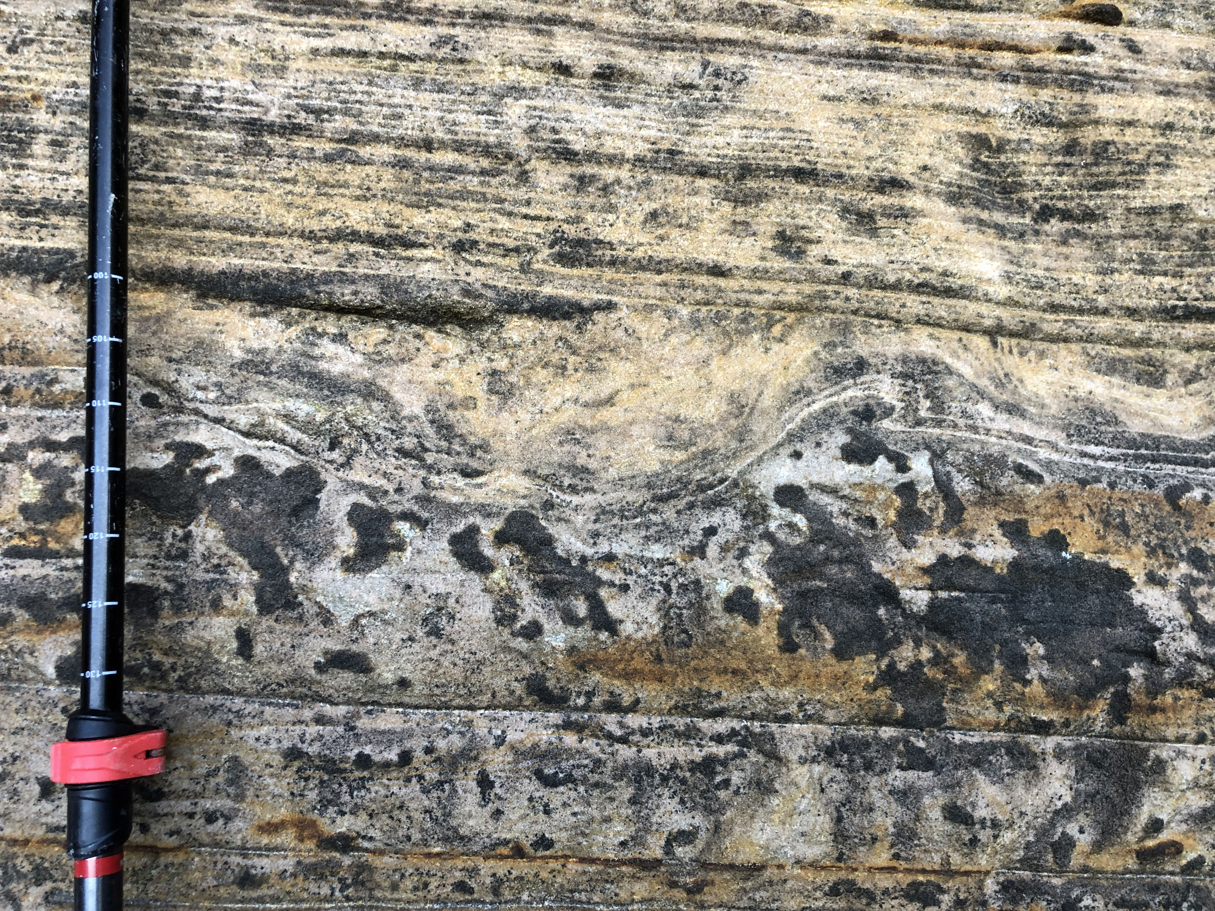
Detail of intersection of 3 dunes available to study in 3d. See Lars Clemmenson paper, 1987, Complex star dunes, Scotland. Fig 13 for full analysis.
Dave Longstaff
Detail of possible cross section through a Permian footprint. Note minor thrust faulting to right of 'footprint' showing animal was moving right to left? Unfortunately this bedding plane doesn't display any more deformation features which might have helped confirm the hypothesis.
Dave Longstaff
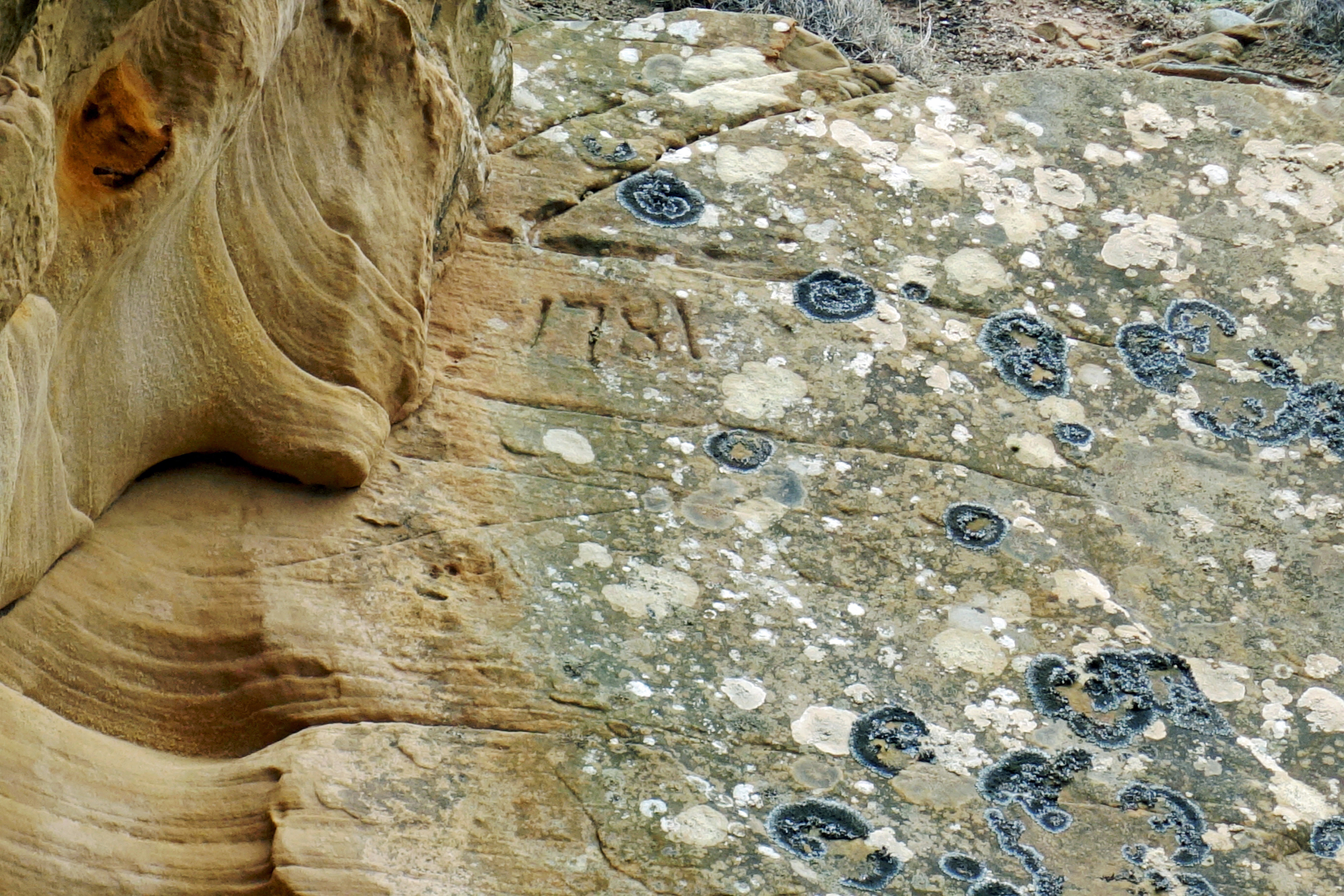
Detail of late medieval graffiti showing date of 1781 in old quarry to north of Clashach Quarry. Carving in harder silicified sandstone with softer iron cemented sandstone to the left. Impossible to know what the date signifies but it must have been made while the quarry was operational.
Dave Longstaff
Detail of late medieval quarrying pick marks. Date of quarry 1781 see photo.
Dave Longstaff
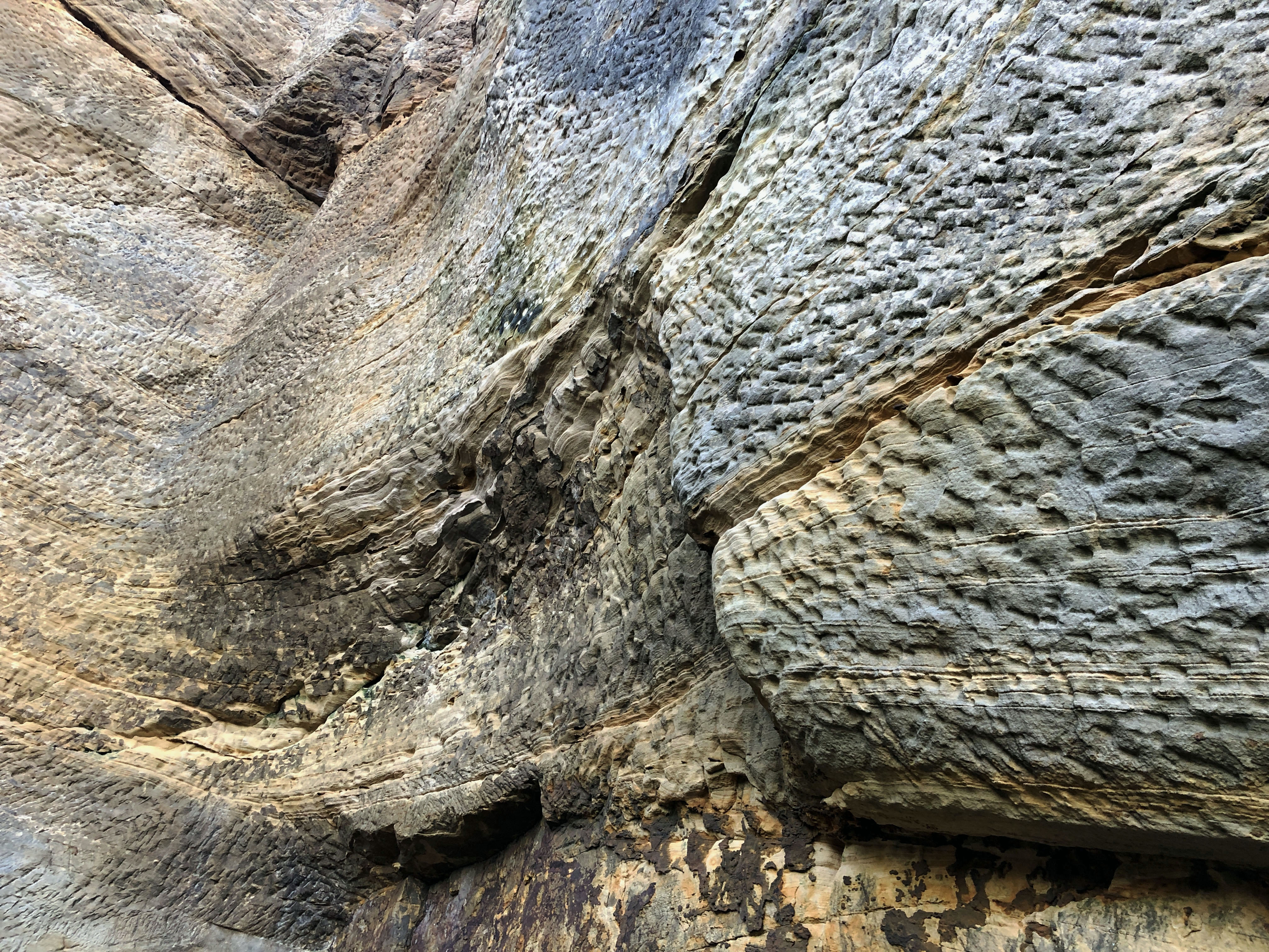
Section of cross-bedded Hopeman sandstone in old quarry to the north of Clashach Quarry looking southwards. Erosion surface and subsequent dune deposition well shown at top of photograph.
Dave Longstaff
Detail of fault gouge and deformation bands at Cove Bay fault.
Dave Longstaff
View of Cove Bay, Hopeman, from the west. Gypsies Cave and the Hopeman Sandstone Formation visible on east side of bay, downthrow to the south, displacement of order of 10m.
Dave Longstaff
Detail of fault in Cove Bay looking northeastwards, downthrow to south. Slickensides and deformation bands well displayed in the cross bedded Hopeman Formation Sandstone.
Dave Longstaff