Dubh Loch, Colonsay
Geological Conservation Review site | GCR #2937 | Igneous Petrology | Carboniferous - Permian Igneous
Geological Conservation Review site | GCR #2937 | Igneous Petrology | Carboniferous - Permian Igneous
Scotland's geosites are chosen because of their local, national or international importance. Take only photos, leave only footprints: avoid causing any damage to this site. You can walk almost anywhere in Scotland without the need to ask permission or keep to paths, but you have a responsibility to care for your own safety, to respect people's privacy and peace of mind and to cause no damage.
The right of access does not extend to quarries, building sites or any land where public access is prohibited, or to the collection of geological samples.
This locality exposes the Kilchattan monchiquite, a dyke of Permo-Carboniferous age, which is noteworthy for the diverse range of phenocrysts and xenoliths found within it.
Many of the xenoliths are coarse-grained and it is clear that they are disaggregated fragments of rocks of lower crustal and mantle derivation, including pegmatitic glimmerite, pyroxenite and peridotite. Megacrystic minerals of note are biotite, kaersutite, clinopyroxene and apatite. These xenolith assemblages provide a critical insight into the character of the deep crust and mantle below Scotland during Permo-Carboniferous times, and the site is of high scientific research interest. The dyke is also significant historically in being one of the earliest rocks to be dated radiometrically in 1941.
https://presscentre.nature.scot/resources/colonsay-cover-fo…
Note on Kilchattan place name:
Cille Chatain ‘Cattan’s chapel’ – the birthplace of the esteemed Gaelic scholar Prof. Donald MacKinnon – is now a settlement, but the ruins of the original church can still be seen at the top of the current graveyard. From: Gaelic in the Landscape – Place-names of Colonsay and Oronsay, Dr Jacob King with Eilidh Scammell. ISBN 978-1-78391-484-5. Scottish Natural Heritage (now NatureScot), www.snh.gov.uk (free to download; excellent photographs).
https://webapps.bgs.ac.uk/data/MapsPortal/map.html?id=11014…
Link to BGS 1:50 000 scale geological map of Colonsay, Sheet 35, 1966 (preview).
https://pubs.bgs.ac.uk/publications.html?pubID=B01889
Link to BGS Memoir, 1911:
Cunningham-Craig, et al. The geology of Colonsay and Oronsay, with part of the Ross of Mull (Explanation of sheet 35 with part of 27). 124 pages. 1911.
Webster, D. 2025. A Guide to the Geology of Colonsay, 75 pages. Ringwood Publishing, Glasgow. This guide has an excursion to the Dubh Loch dyke.
https://www.cambridge.org/core/journals/geological-magazine…
This dyke was one of the first places where Arthur Holmes conducted age dating work, in 1941.
Urry, W. D., Holmes, Arthur (1941). Age Determination of Carboniferous Basic Rocks of Shropshire and Colonsay. Geological Magazine, volume 78 (part 1), pages 45–61.
doi:10.1017/s0016756800071715
https://www.lyellcollection.org/doi/abs/10.1144/gsjgs.140.1…
UPTON, B G J, ASPEN, P, and CHAPMAN, N A. 1983. The upper mantle and deep crust beneath the British Isles: evidence from inclusions in volcanic rocks. Journal of the Geological Society of London, volume 149, pages 195–122.
Extract: North of the Highland Boundary fault, notable localities for spinel lherzolite (harzburgite) inclusions are Streap Comlaidh; Kilchatten and Riasg Buidhe on Colonsay (Urry & Holmes 1941); Duncansby Ness (Chapman 1974); and Coire na Ba near Kinlochleven.
https://www.alexstrekeisen.it/english/vulc/lamprophyres.php
Link to Alex Strekeisen's igneous rocks website page, with definitions of lamprophyre and ouachitite. This is a great resource, with plenty of hand specimen and thin section photographs of rocks and minerals.
https://www.mindat.org/min-54552.html
Link to MinDat.org page with definition of ouachitite. This is another outstanding resource for minerals (over 6600), rocks and ore deposits around the world; excellent photographs, rotatable crystal structure 3D models, locality maps, and extensive reference lists.
There are no access notes yet.
There are no safety notes yet.
There are no site highlights yet.
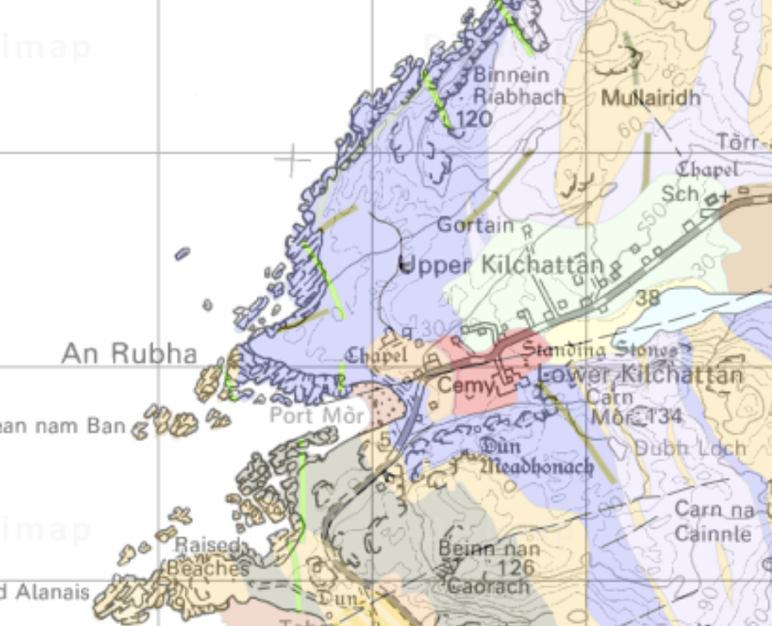
BGS 1:50k map extract (Digimap) showing location of Dubh Loch, south of Lower Kilchattan, with topography included.
Note: in the GCR account and Brian Upton's paper, the place name is spelled as Kilchatten, but OS maps show Kilchattan.
Con Gillen
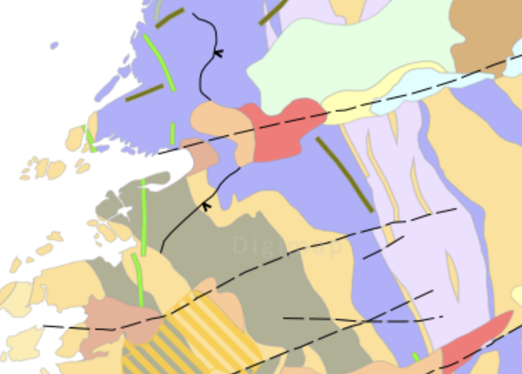
BGS map (Digimap) , with 100% colour overlay; the Dubh Loch dyke is shown in dark green between the two faults.
Con Gillen
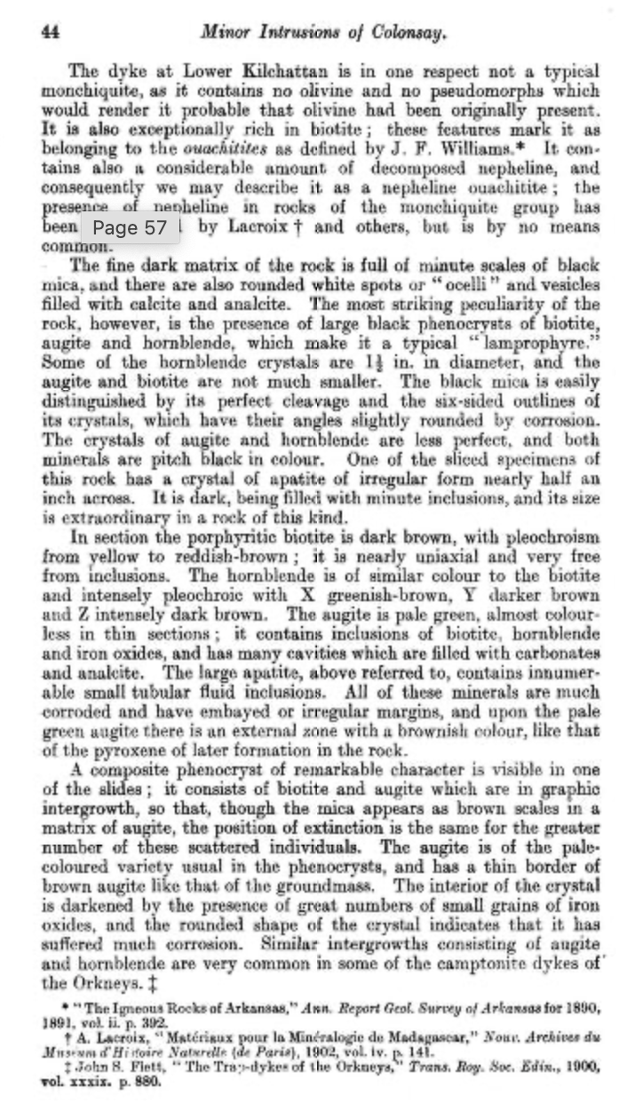
Page 44 from BGS Memoir (1911), with a description of the Dubh Loch dyke.
Con Gillen
Page 45 from BGS Memoir (1911), with a description of the Dubh Loch dyke. The term used then was 'ouachitite', which is now little used. (MinDat.org has this definition: A dark-colored aphanitic porphyry composed of a glassy groundmass with large phenocrysts of biotite and very subordinate augite and magnetite). And this is from Alex Strekeisen's website: Ouachitite: From Ouachita Mountains., Arkansas, USA. A rare variety of ultramafic lamprophyre consisting of combinations of forsteritic olivine, diopsidic pyroxenes, various amphiboles and phlogopite in a matrix of similar minerals with abundant primary carbonates and feldspathoids, often with minor perovskite, but little or no melilite.
Con Gillen
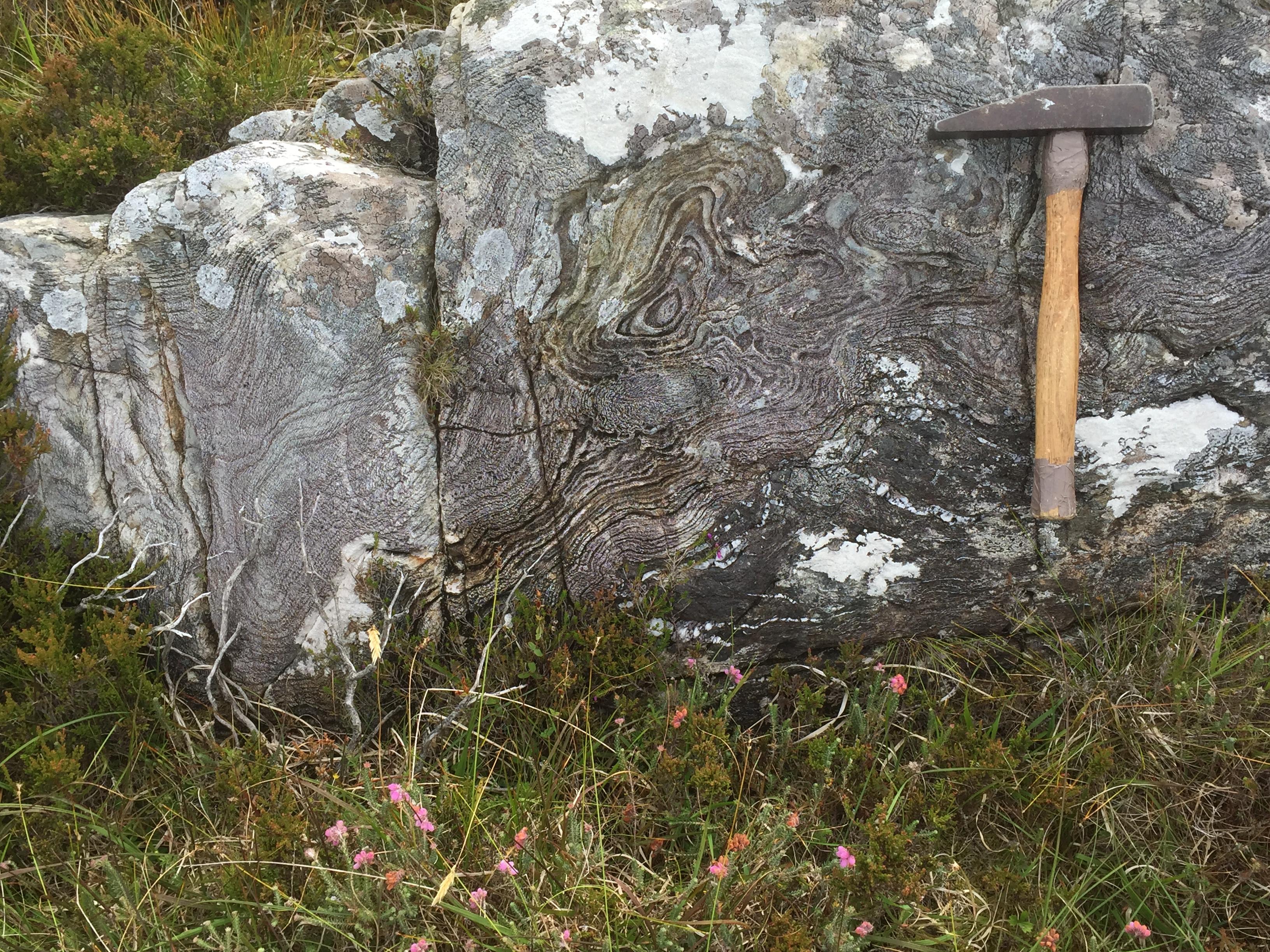
Fold interference structures (eye folds and sheath folds, i.e. refolded) in Colonsay Group rocks near Dubh Loch, above the lamprophyre dyke exposure (i.e. the bedrock into which the dyke was intruded).
Con Gillen
Aug. 2, 2019
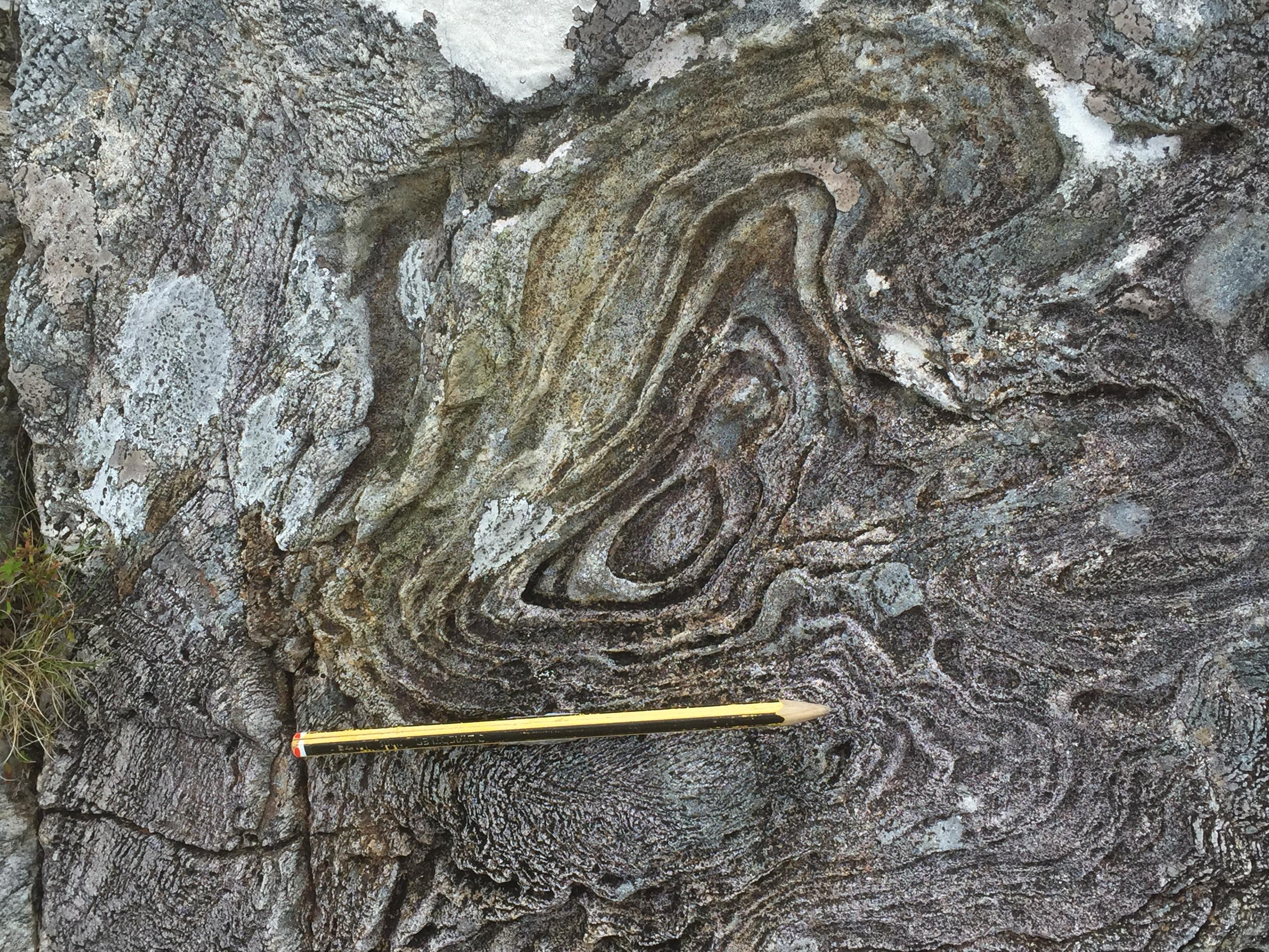
Detail of the above fold.
Con Gillen
Aug. 2, 2019
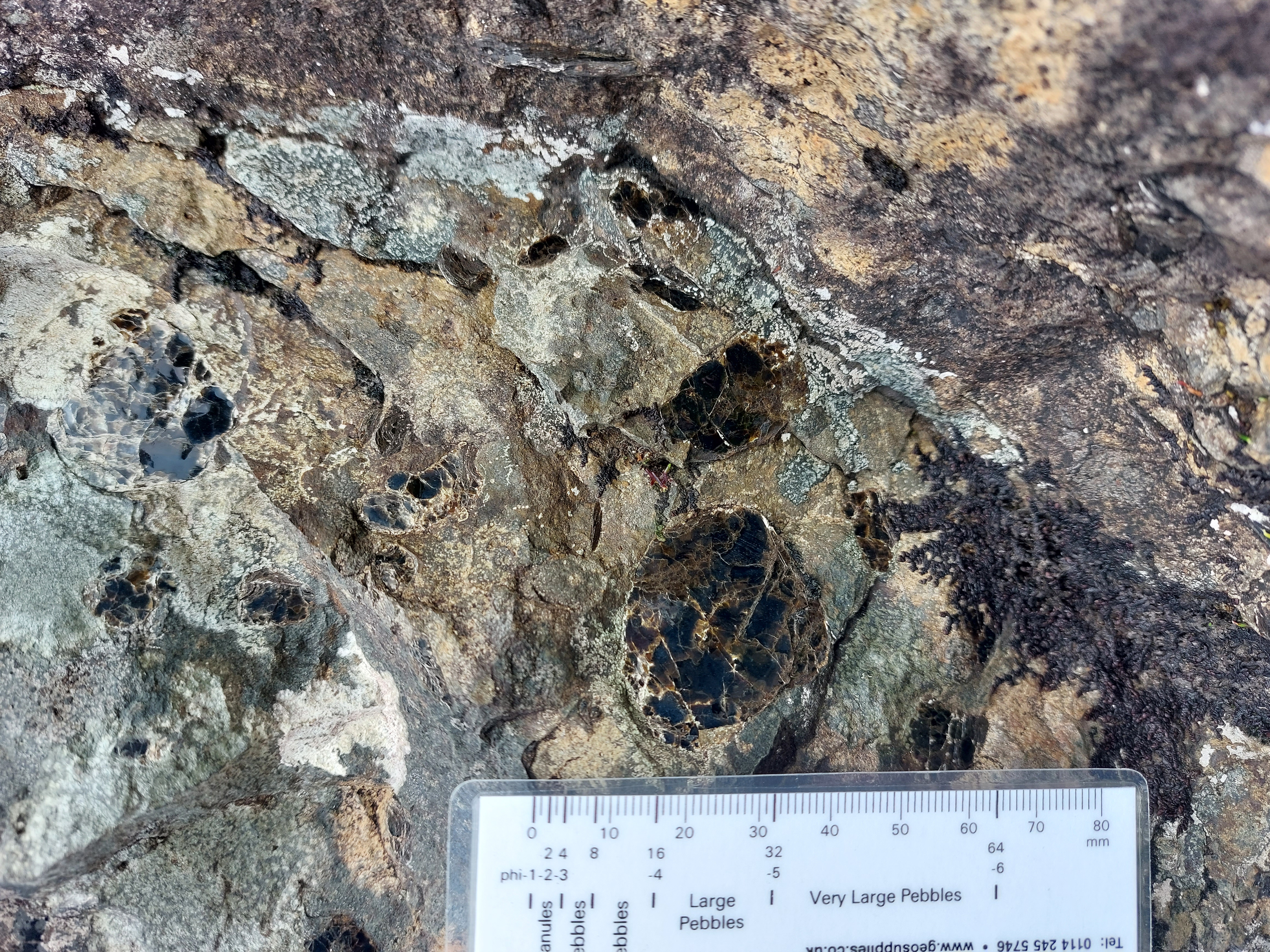
biotite megacryst
David Webster
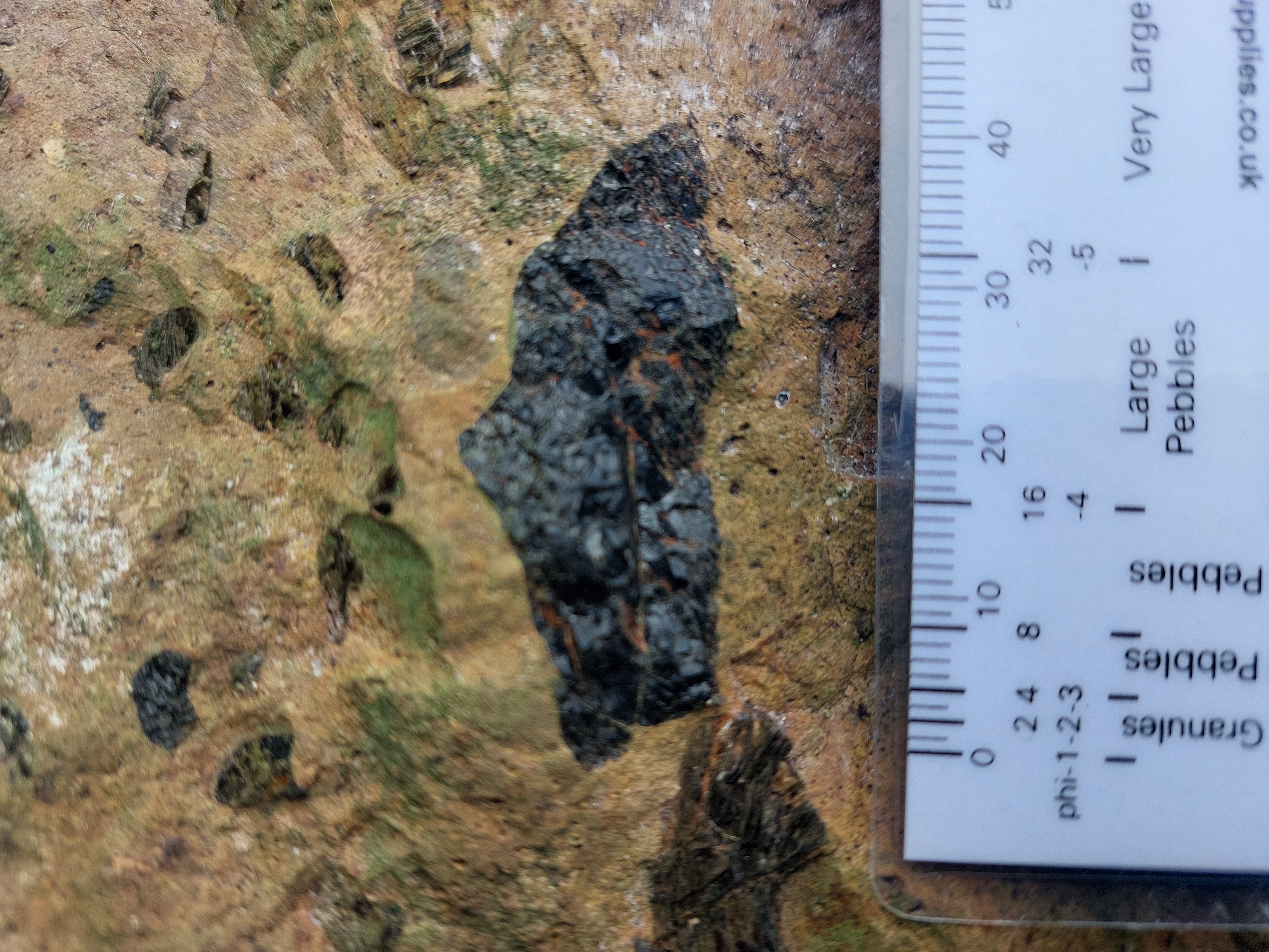
augite megacryst
David Webster
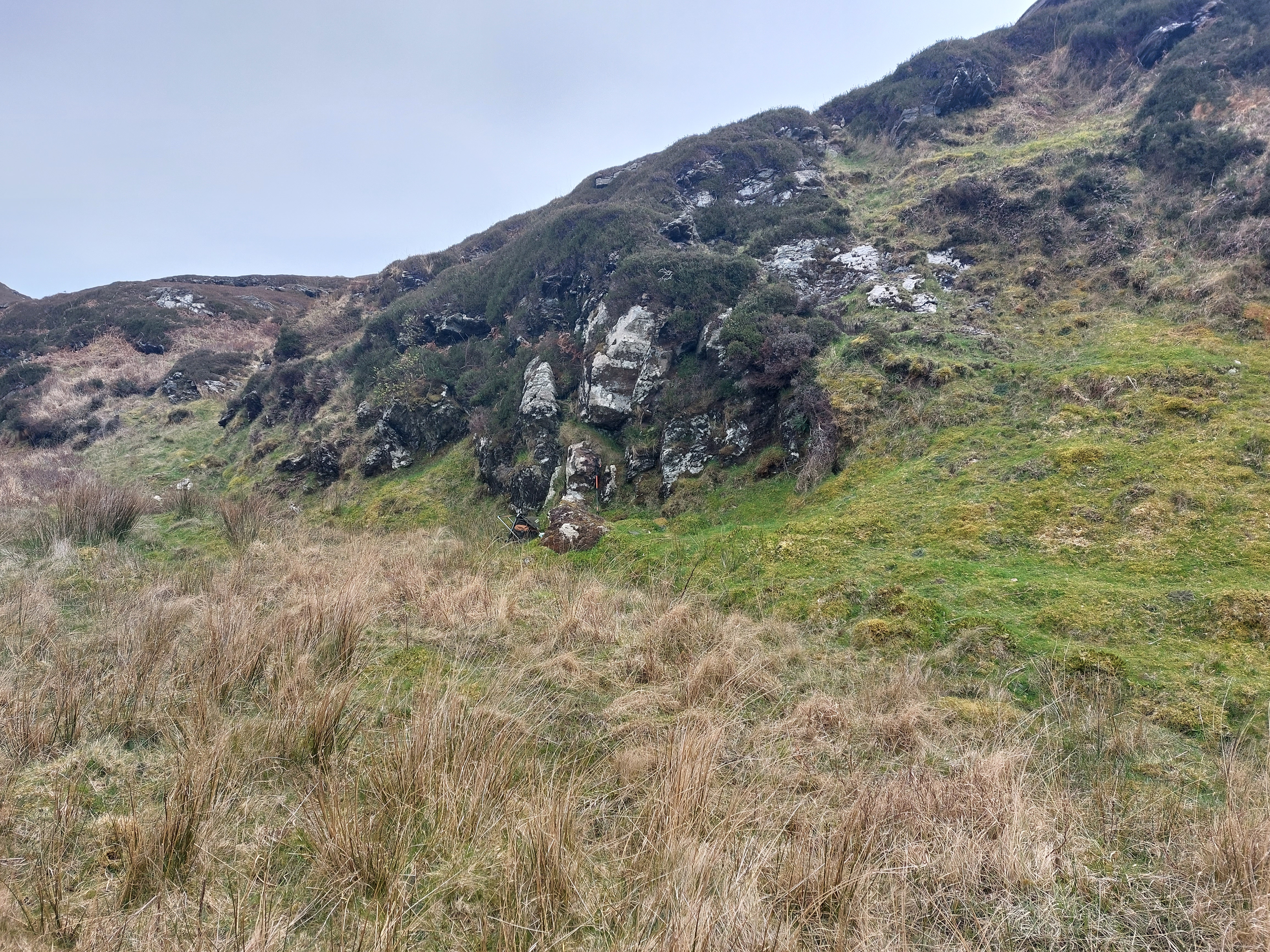
Exposure of the dyke
David Webster