Abernethy Group (proposed)
Local Geodiversity site | Perth and Kinross
Local Geodiversity site | Perth and Kinross
Scotland's geosites are chosen because of their local, national or international importance. Take only photos, leave only footprints: avoid causing any damage to this site. You can walk almost anywhere in Scotland without the need to ask permission or keep to paths, but you have a responsibility to care for your own safety, to respect people's privacy and peace of mind and to cause no damage.
The right of access does not extend to quarries, building sites or any land where public access is prohibited, or to the collection of geological samples.
Small accessible sites around Abernethy with representative local Devonian and Carboniferous rock types: andesite lavas, conglomerate, sandstone and microgranite
Abernethy village lies just north of the South Tay Fault, which forms the southern side of the Tay rift valley. The high ground to the south (Braes of Abernethy) is underlain by resistant andesite lavas and volcanic conglomerates of the Lower Devonian Ochil Volcanic Formation; softer sandstones of the Upper Devonian Glenvale Formation form most of the lower ground to the north, with a fault slice of Devonian/Carboniferous sandstone on the SE side of the village.
Loanhead quarry is in a single lava flow at least 30m thick with an uneven, brecciated top. Fallen blocks are mainly aphyric andesite with some amygdaloidal and vesicular blocks. Most of the face is weathered with vertical joints but at the east end a fresh rockfall reveals curved joints.
The summit and the south side of Castle Law are composed of a hypersthene-andesite lava flow up to 90 m thick. On the north side there is about 40 m of volcanic conglomerate, with mostly mafic clasts. The conglomerate is best seen in two very large blocks forming the gateway to Bogle’s Quarry (private). A small disused quarry at NO 18431564 shows a few m of sandstone underlying the conglomerate. On the main track up to the summit hillfort there is a viewpoint with interpretation board, a spot to appreciate the scale of the Tay rift valley. The forest roads farther west provide sporadic exposures of lavas.
Ayton quarry exposes pinkish-orange porphyritic microgranite which extends up the hill to a forest road cutting but is seen nowhere else in the area. Its contact with the grey andesite lava to the east is gradational and almost vertical, i.e. the intrusion has the form of a stock or dyke.
In Rough Den, the rocks exposed in the bed of the Ballo Burn are the only exposure of the Kinnesswood Formation (base of the Inverclyde Group, Devonian/Carboniferous boundary) in the area. Reddish-brown cross-bedded micaceous sandstones have a few beds and nodules of concretionary limestone (calcrete).
Free parking in Abernethy village. Well-signposted core paths and forest roads lead to all the outcrops. Loanhead Quarry (disused) is densely overgrown with trees and nettles, best visited in winter. Ayton Quarry is also disused but the space is used for storage (e.g. timber).
There are no safety notes yet.
There are no site highlights yet.
There are no further information notes yet.
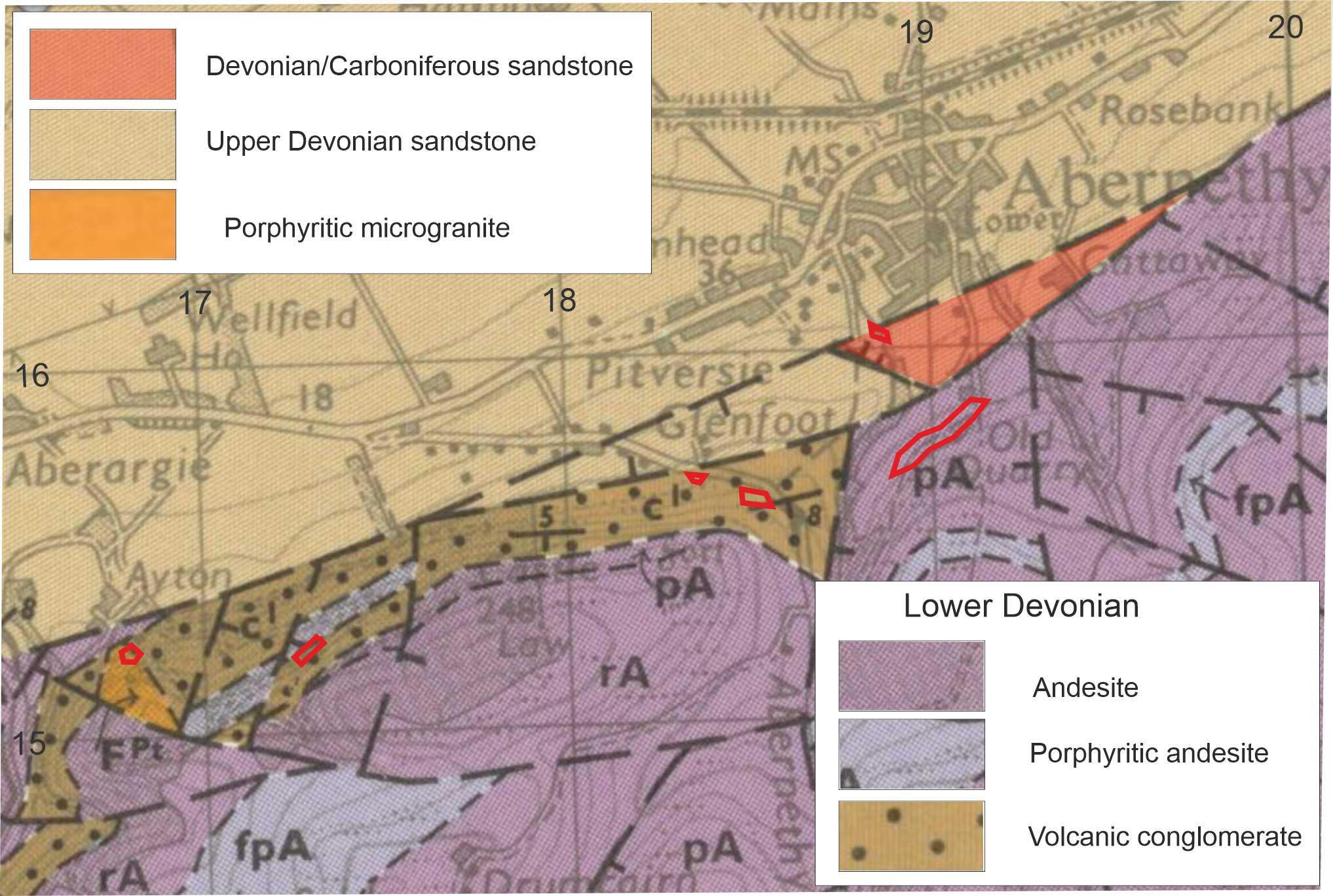
Geological map of the Abernethy area: BGS sheet 48 (1983) with correction from BGS Digimap. Map © British Geological Survey.
Carol Pudsey
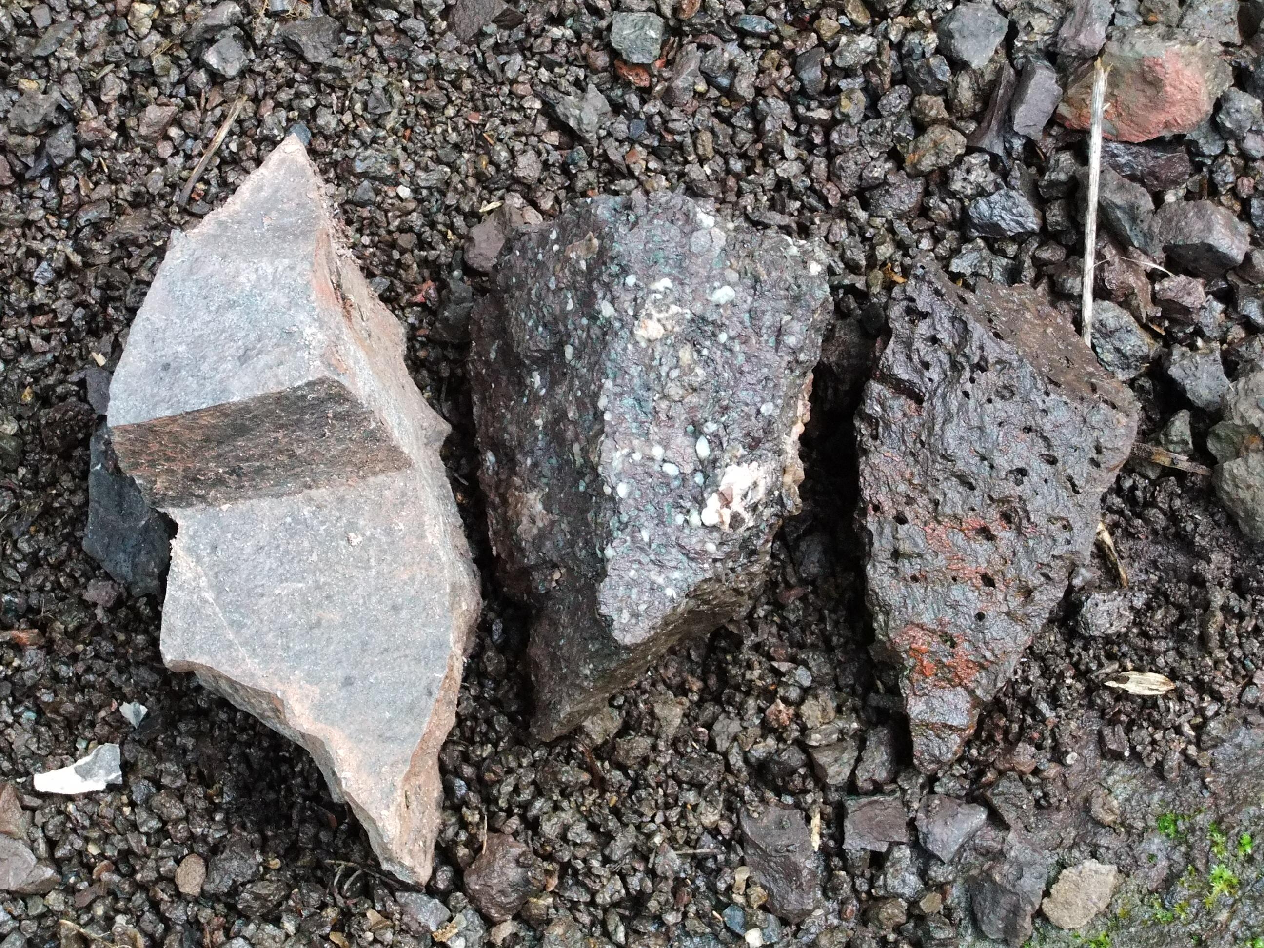
Aphyric, amygdaloidal and vesicular lavas from Loanhead quarry. The largest is 15cm long.
Carol Pudsey
Aug. 17, 2012
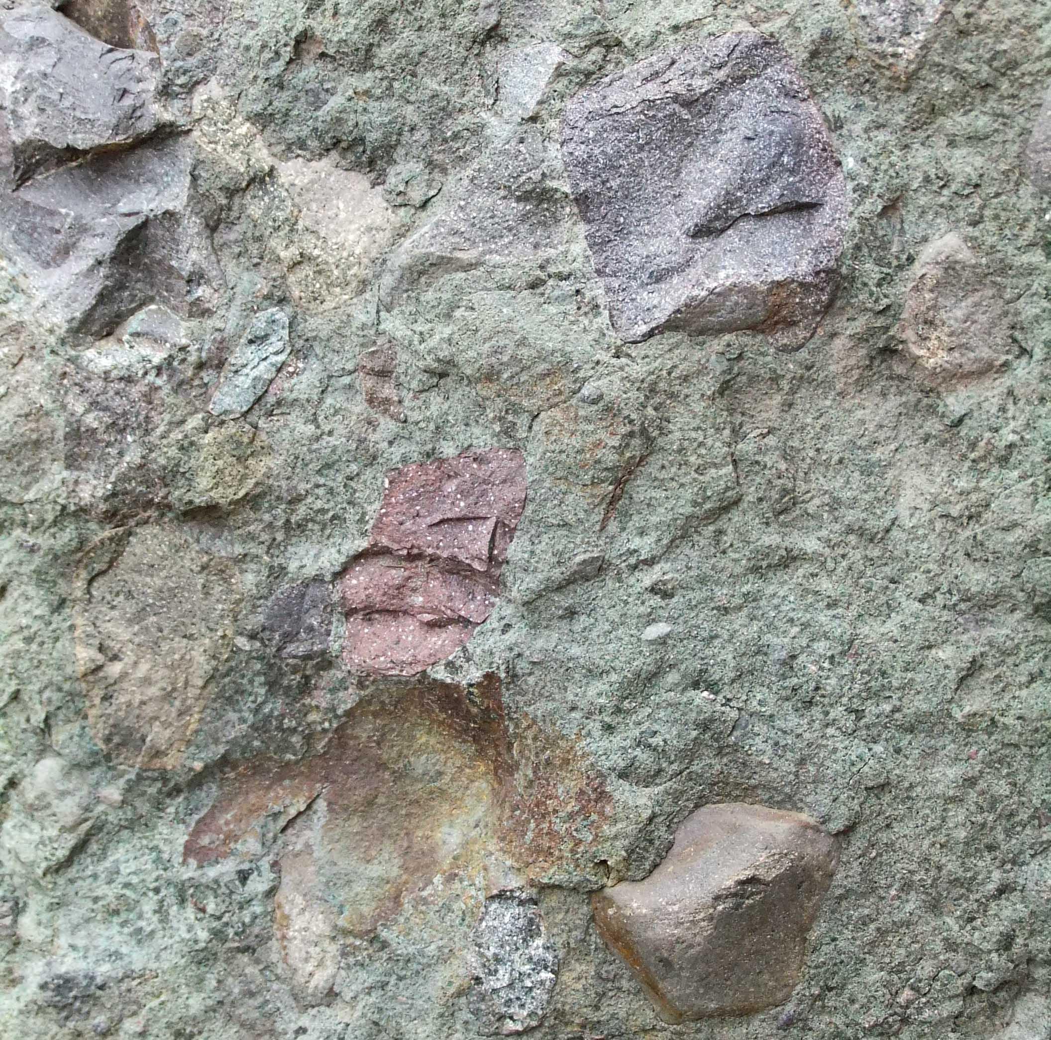
Conglomerate boulder, gateway to Bogle's quarry. The clasts are mafic and acidic lavas. Red clast in centre of photo is 5cm long.
Carol Pudsey
March 20, 2020
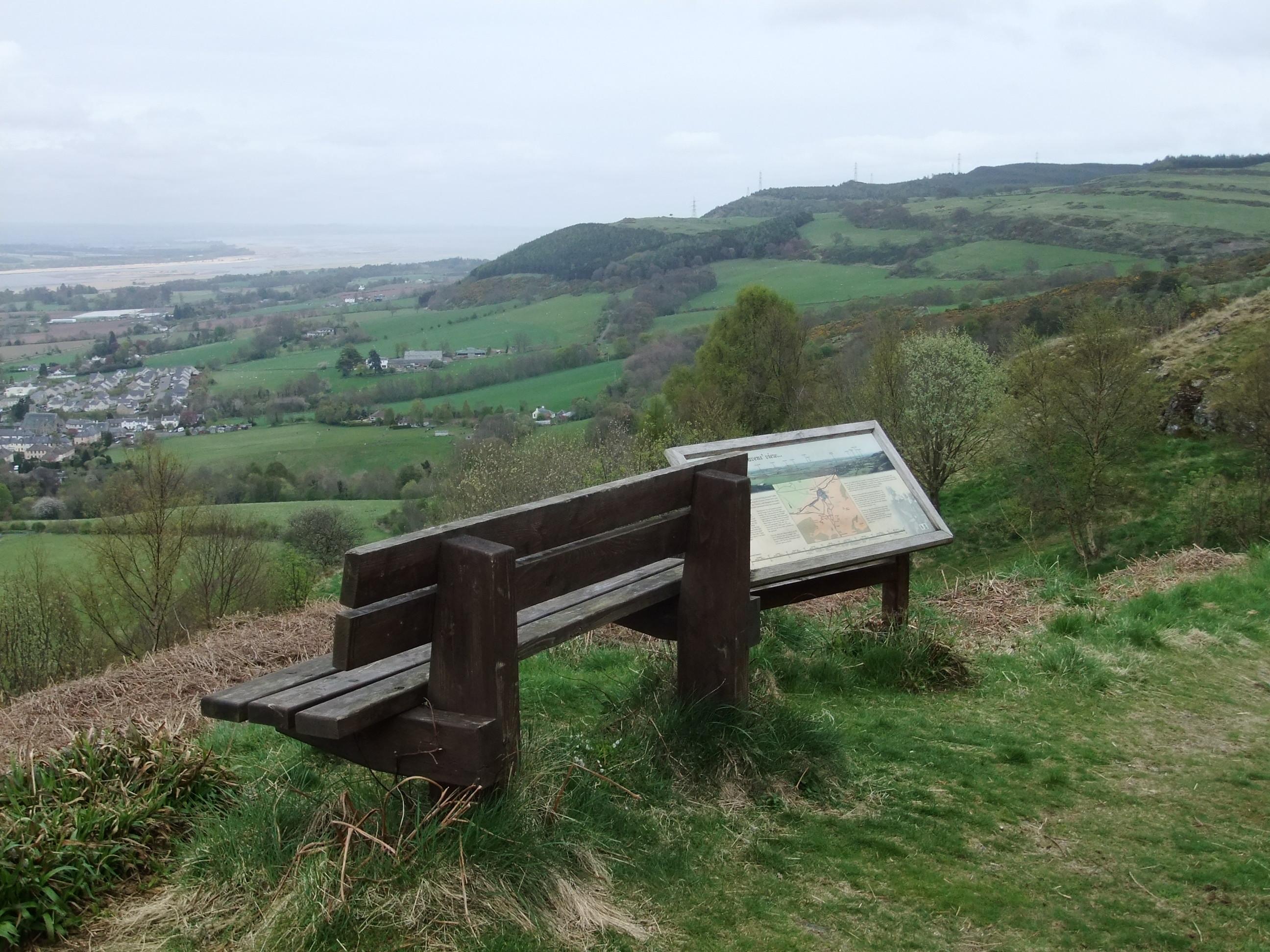
The viewpoint on Castle Hill, with interpretation board. Firth of Tay in the distance.
Carol Pudsey
May 11, 2013
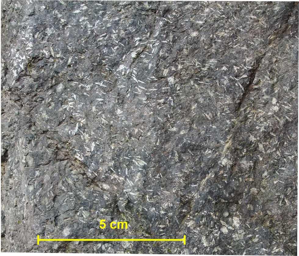
Feldspar-phyric andesite lava, forest road cutting
Carol Pudsey
Aug. 17, 2012
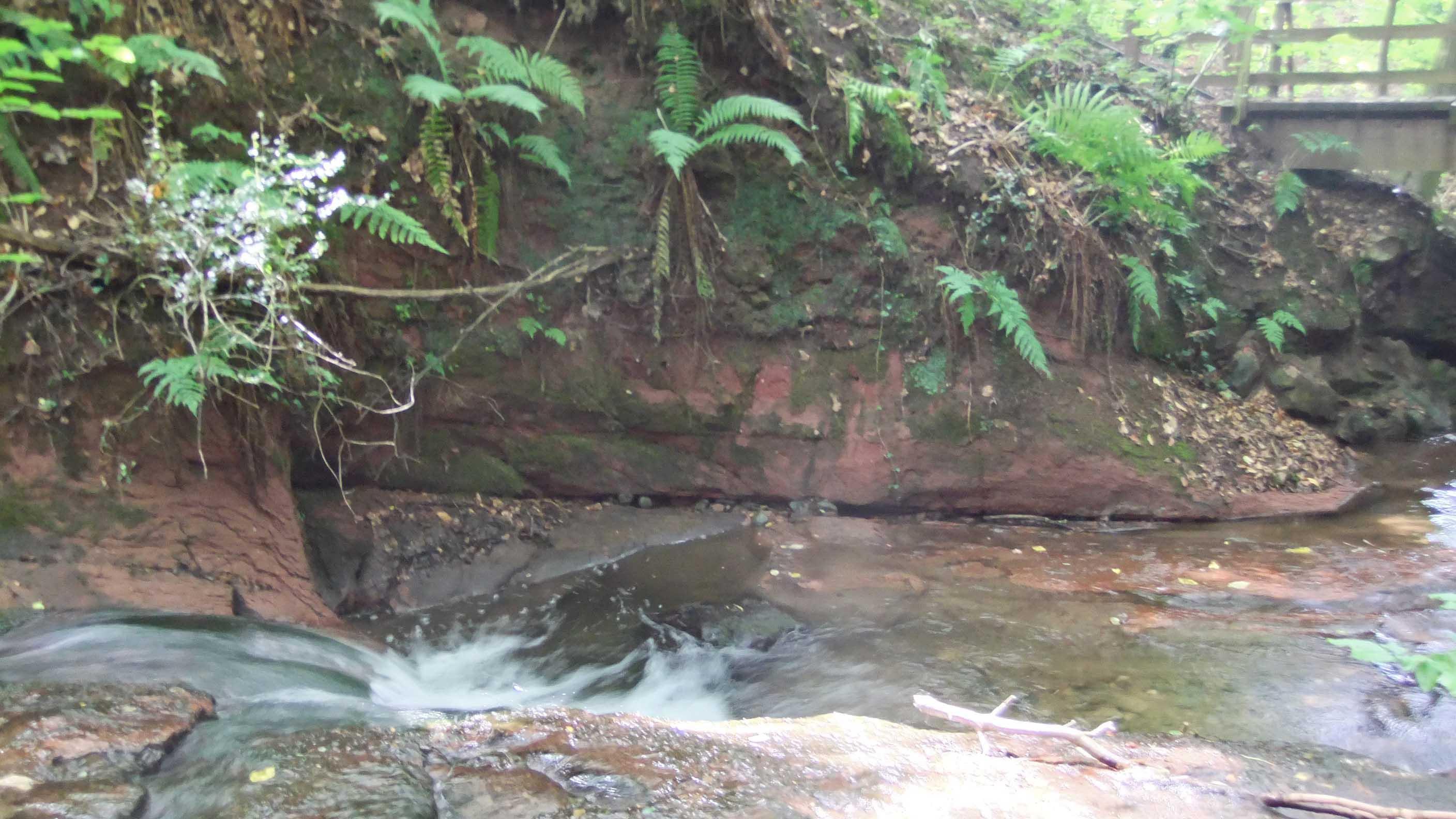
Red sandstone of the Kinneswood Formation, by the upper footbridge in Rough Den.
Carol Pudsey
March 1, 2020
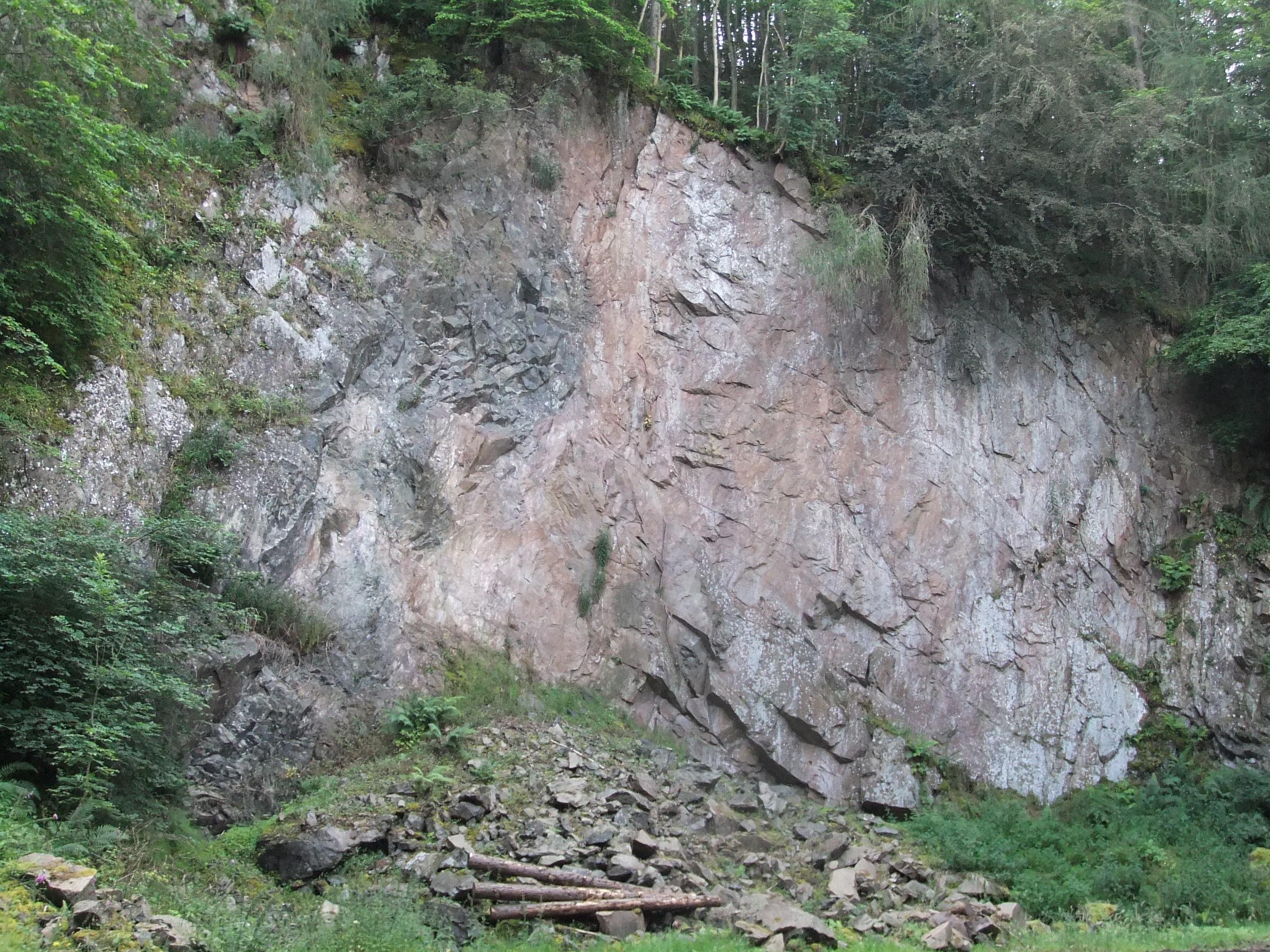
Ayton Quarry showing pink microgranite on the right, grey andesite on the left. Scale: logs are 4.2m long.
Carol Pudsey
July 25, 2019