Birnam Hill Quarry (proposed)
Local Geodiversity site | Perth and Kinross
Local Geodiversity site | Perth and Kinross
Scotland's geosites are chosen because of their local, national or international importance. Take only photos, leave only footprints: avoid causing any damage to this site. You can walk almost anywhere in Scotland without the need to ask permission or keep to paths, but you have a responsibility to care for your own safety, to respect people's privacy and peace of mind and to cause no damage.
The right of access does not extend to quarries, building sites or any land where public access is prohibited, or to the collection of geological samples.
Birnam Slate and Grit formations of the Southern Highland Group of the Dalradian. Impressively large overturned fold in Birnam Slate, part of the Steep Belt related to the Highland Border Downbend.
Birnam Hill Quarry is located within the Steep Belt of the Tay Nappe. Metamorphic grade is low and the bedding, clearly visible from a distance, defines a large-scale antiform with axial planar cleavage dipping northwest. Regional mapping shows the succession is inverted. The main rock types are purple and greenish-grey pelites, generally quite massive, with some laminae and thin beds of silt, a few of which show grading. There is attractive quartz, pink feldspar and chlorite mineralisation associated with small faults.
This is one of the most accessible of a series of quarries in the Birnam Slates just north of the Highland Boundary Fault. The stone, worked from the end of the 18th century to the early 20th century, yielded generally small roofing-quality slates and was also used for walling (many examples in Birnam and Dunkeld). Waste material from some of the other local slate quarries is currently being reprocessed for road metal for the dualling of the A9.
At the foot of Birnam Hill: parking beside the B867 at NO041404. Access by gravel road, under the railway bridge, bear right, turn off core path to left and follow zigzags up hill to quarry.
Rose, P. 2015. Excursion 18 Dunkeld and Little Glen Shee. In: Browne, M.A.E. and Gillen, C. A Geological Excursion Guide to the Stirling and Perth Area. Edinburgh Geological Society, 232pp.
Shackleton (1958) used evidence from this area to develop the concept of downward-facing folds.
Shackleton, R.M. 1958. Downward-facing structures of the Highland Border. Quarterly Journal of the Geological Society of London 113, 361-392.
The quarry face is dangerous with recent rockfall. Tectonic structures can be viewed from a distance; sedimentary features can be seen in loose blocks.
There are no site highlights yet.
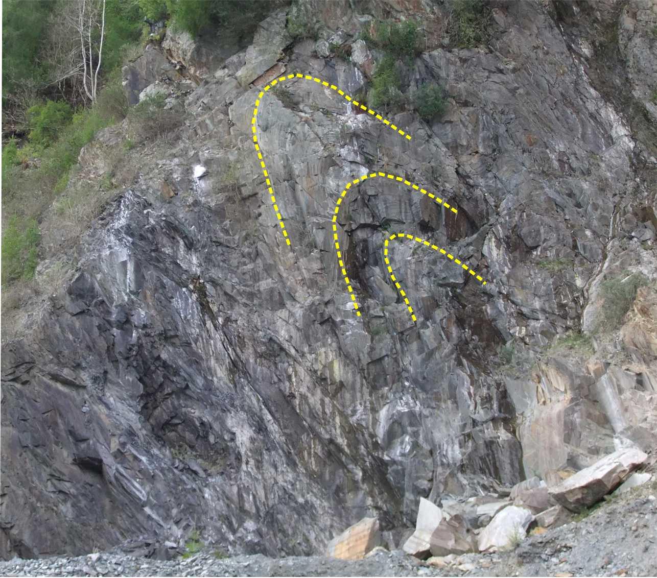
The main quarry face, looking west. Folded bedding outlined in yellow. Scale: the blocks at the base of the cliff are 2-3m across.
Carol Pudsey
May 10, 2020
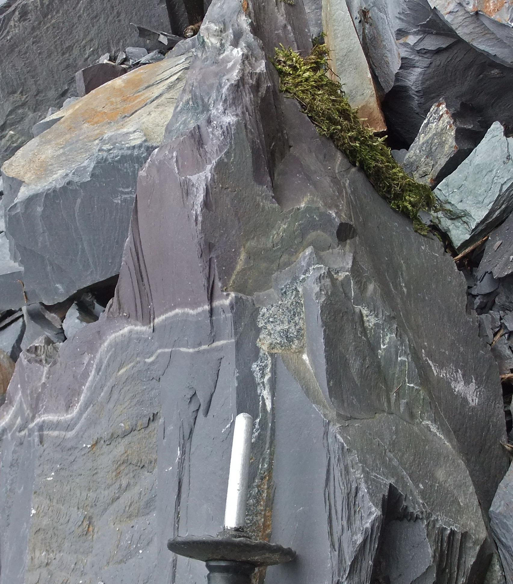
Small-scale folding in a loose block. Grey slate at the base, two thin white silt laminae, purplish slate at the top.
Carol Pudsey
July 21, 2019
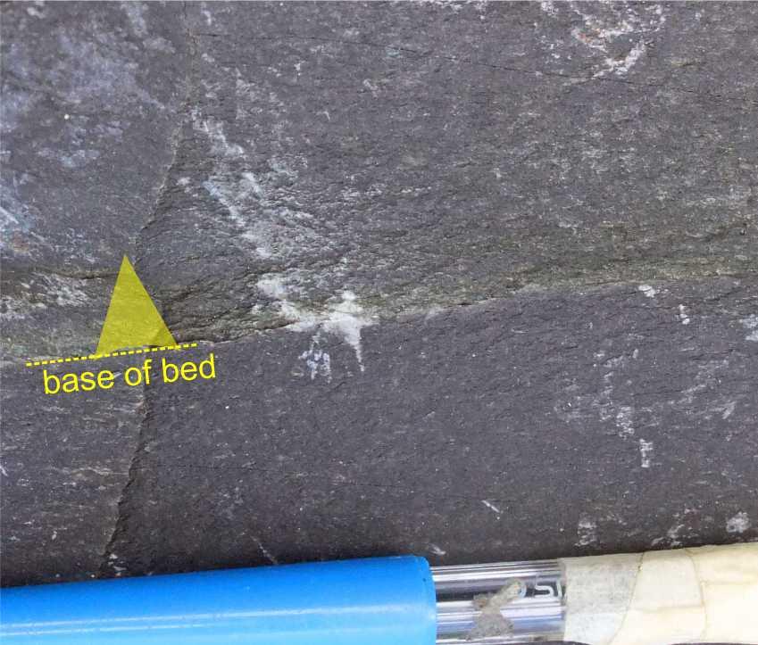
Graded silt bed (greenish, about 12mm thick) in a loose block of purple slate.
Carol Pudsey
May 10, 2020
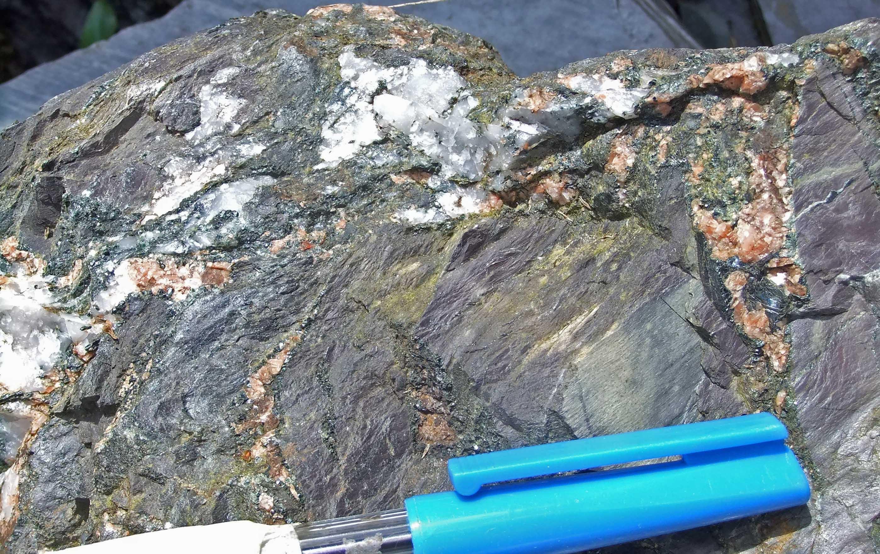
Quartz, feldspar and chlorite mineralisation in a loose block
Carol Pudsey
May 11, 2020