Achanarras Quarry [Non-marine Devonian]
Geological Conservation Review site | GCR #3323 | Stratigraphy | Non-Marine Devonian
Geological Conservation Review site | GCR #3323 | Stratigraphy | Non-Marine Devonian
Scotland's geosites are chosen because of their local, national or international importance. Take only photos, leave only footprints: avoid causing any damage to this site. You can walk almost anywhere in Scotland without the need to ask permission or keep to paths, but you have a responsibility to care for your own safety, to respect people's privacy and peace of mind and to cause no damage.
The right of access does not extend to quarries, building sites or any land where public access is prohibited, or to the collection of geological samples.
A Rare Complete Section Through The Achanarras Fish-Bearing Limestone Member Which Providing A Stratigraphical Marker Bed Throughout Much Of The Orcadian Basin
The GCR site at Achanarras Quarry provides a rare section through the Achanarras Limestone Member and its contacts with the overlying and underlying strata of the Upper and Lower Caithness Flagstone groups. The limestone member is a valuable stratigraphical marker bed for correlation within the Orcadian Basin, and contains a remarkable fossil fish fauna of international importance. The lithofacies record the transgression and regression of a lacustrine environment, possibly recording the maximum transgression by the Orcadian Basin lake. Lacustrine deposition of the fine laminites
was controlled by seasonal increased algal productivity and the resulting changes in lake water chemistry. The organic laminae are the product of decay of seasonal algal blooms, the carbonate laminae were deposited during periods when increased photosynthesis raised the pH of the lake waters. The fine-grained clastic laminae were deposited from suspension of material introduced to the lake, probably mainly during periods of seasonal rainfall and increased run-off.
(From ORS volume September 2004)
Directions to the Achanarras carpark are provided between the A9 turnoff onto the B870 at Mybster. It should be noted that distances shown on the signage are to the carpark and not the quarry, which is reached by a ~ 1Km walk up Achanarras Hill: Photos #1 & #2 refer.
During the summer months, midges can make visiting the site rather unpleasant, particularly in clam evenings, so bringing the appropriate protection (e.g. repellent or midge nets) might be wise.
The quarry is flooded with the surrounding area strewn with broken flagstones. As such, visitors should come prepared for such conditions.
However, life preservers are on site for emergencies: see photo #3.
There are no site highlights yet.
#1: 'Achanarras Quarry ½' (mile) sign at the right-turn off from the B870 running between between Mybster (on the A9) and Westerdale.
Andy Leggatt
June 1, 2026
#2: 'Milestones' describe changes in Caithness's climate through geological time as one walks up the rough track to the quarry.
Andy Leggatt
June 1, 2026
#3: View into the old workings from where the track enters the quarry area, with flooded faces on the right and foreground, and with spoil heaps and shelter / information point on the far side. The workings were drained by syphon in 1980 'for a study of the sedimentology and fish distribution within the bed': Trewin, 1986 refers.
Andy Leggatt
June 1, 2026
#4: View towards more accessible sections of the quarry face towards the north end of the east side, and to the boundary of the GCR across the heathland at its northerly end.
Andy Leggatt
June 1, 2026
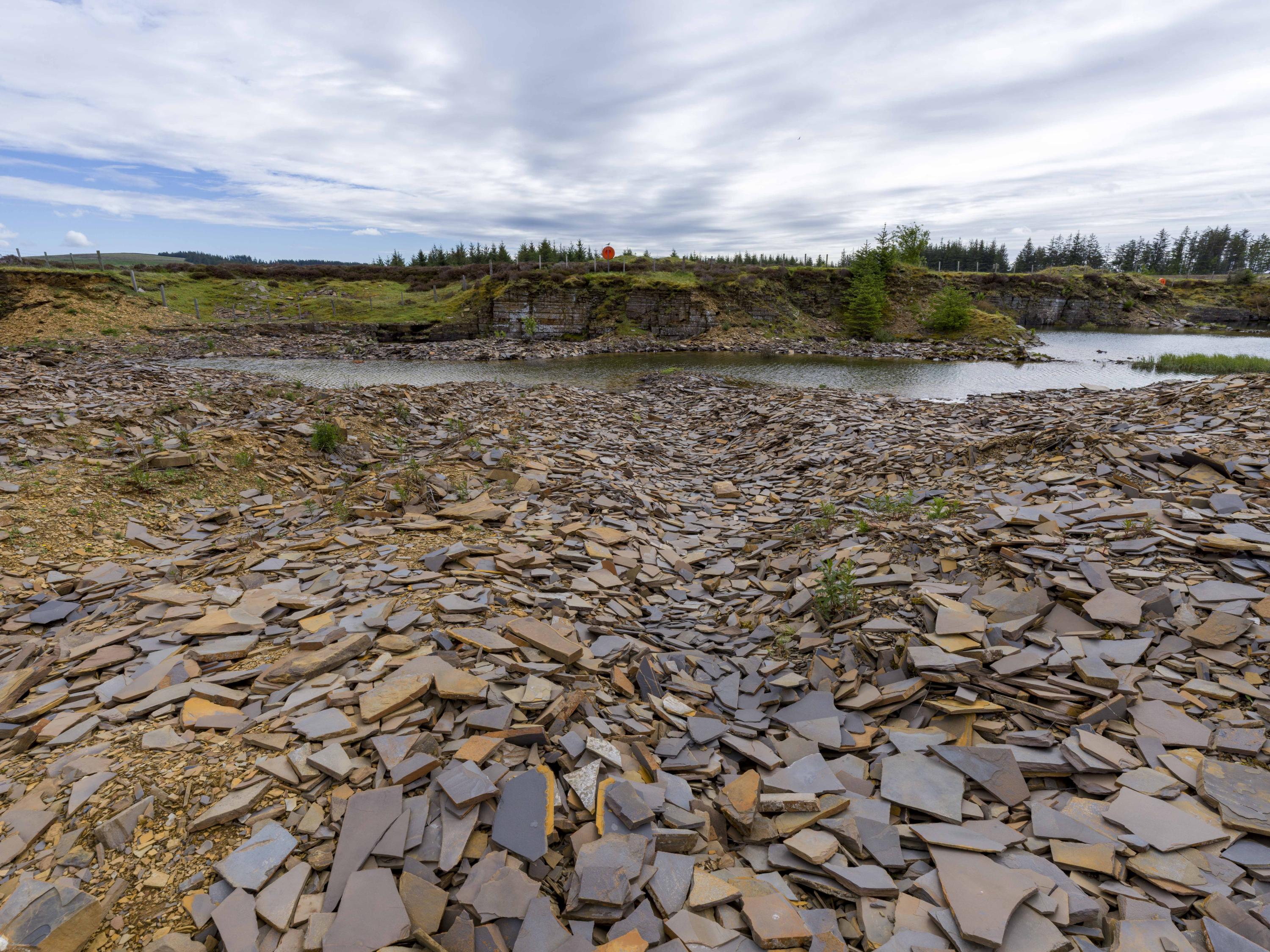
#5: a closer view of the weathered face seen in #4, with a myriad of flagstone fragments of the recently re-excavated spoil in the foreground.
Andy Leggatt
June 1, 2026