Habbie's Howe
Local Geodiversity site | Scottish Borders
Local Geodiversity site | Scottish Borders
Scotland's geosites are chosen because of their local, national or international importance. Take only photos, leave only footprints: avoid causing any damage to this site. You can walk almost anywhere in Scotland without the need to ask permission or keep to paths, but you have a responsibility to care for your own safety, to respect people's privacy and peace of mind and to cause no damage.
The right of access does not extend to quarries, building sites or any land where public access is prohibited, or to the collection of geological samples.
A steep-sided wooded glacial meltwater gorge with a small waterfall has unusual landforms such as river-eroded crags. The Carboniferous Lower Limestone Formation and the Limestone Coal Formation are exposed in the valley sides, displaying a variety of rock types and sedimentary features.
The River North Esk flows through a narrow valley about a kilometre long between Mill Bridge near Amazondean and Craigy Bield. The waterfall is a knick point, produced by headward erosion of the river. The remarkable formations caused by erosion and under-cutting of the relatively unresistant sandstones in the bottom of the valley reflects varying levels of water in the channel during glacial or post-glacial times. The site is part of the Carlops Melt-water Channels SSSI.
The sedimentary rocks consist of limestones, sandstones and mudstones of two formations of the Carboniferous Clackmannan Group (Visean), the Lower Limestone Formation and the Limestone Coal Formation. Exposures are found in the sides of the valley but rarely in the river bed. The succession is cut by several faults, indicated by frequent changes of dip angle and direction.
Ask for permission to park at Amazondean Farm or Newhall Estate, or walk from the public car park in Carlops.
https://webapps.bgs.ac.uk/memoirs/docs/B01977.html
Tulloch, W. and Walton, H.S. 1958 The Geology of the Midlothian Coalfield. Memoir of the Geological Survey of Scotland. p. 24
https://geosites.scottishgeologytrust.org/geosite/4041
See the duplicate Midlothian site for more information.
There are no safety notes yet.
There are no site highlights yet.
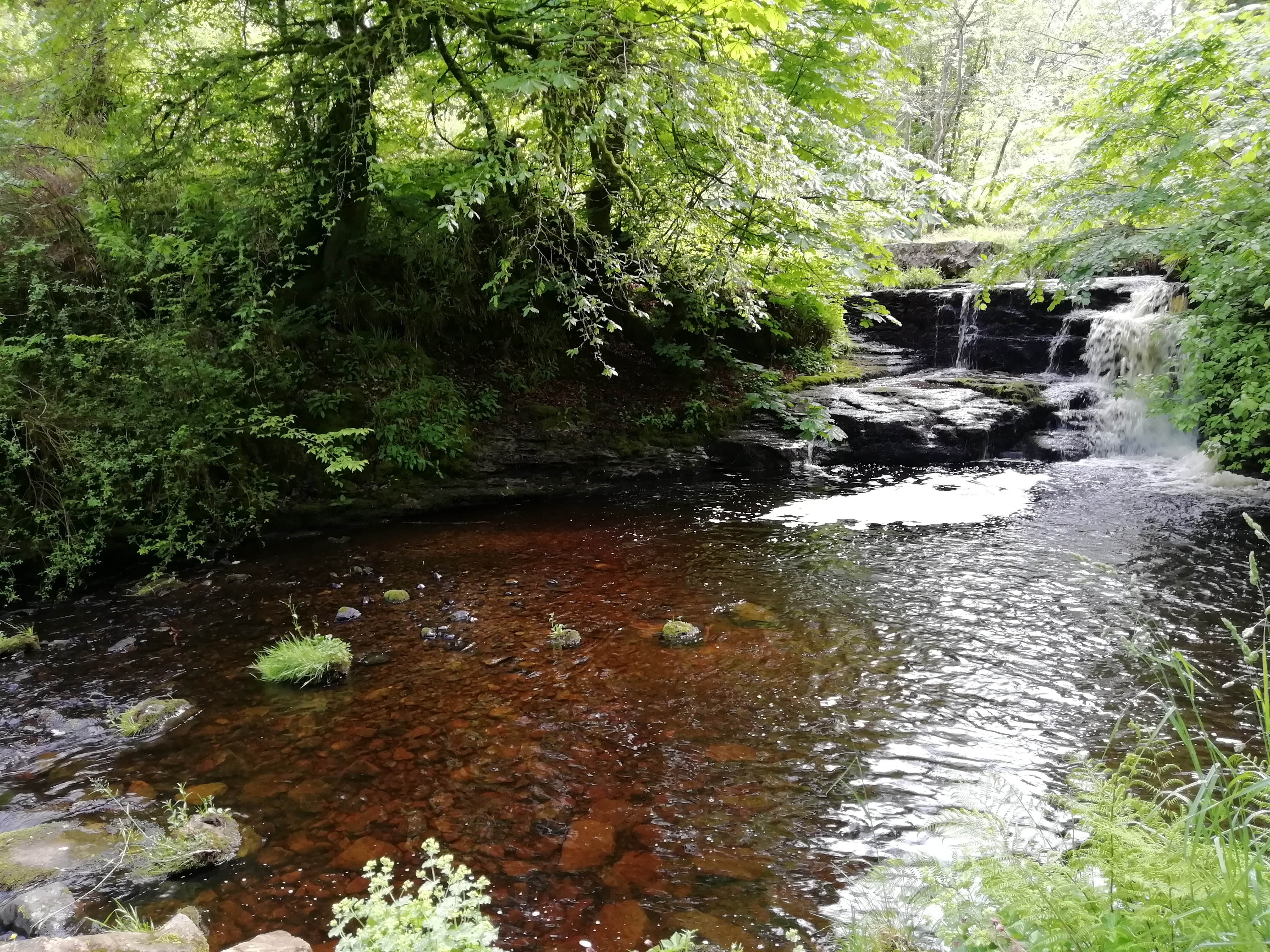
A waterfall falls over 2 m of crinoidal Blackhall Limestone underlain by dark grey mudstone, which gives rise to the plunge pool below (Peggy’s Pool). From the top of the waterfall there is a good view south-west along the river showing the upper section of the glacial meltwater valley.
Alison Tymon
Aug. 15, 2019
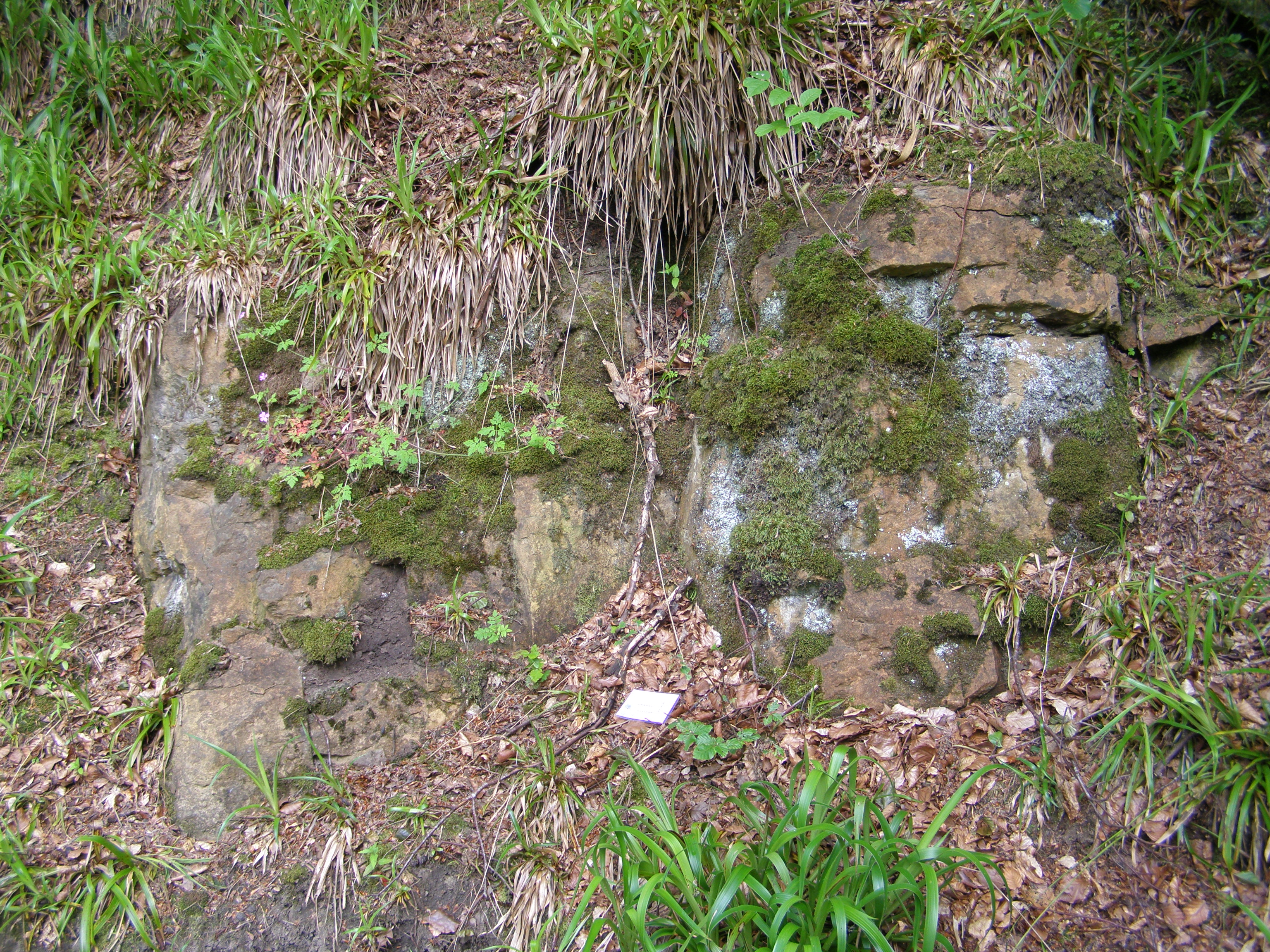
An exposure on the steep path down to the river from the top of the valley on the south side shows 1 m of grey Blackhall Limestone which weathered to an ochre colour. Vugs and small shells were seen, with crystals of calcite within the rock. This limestone was also seen on the river bank downstream and dipped at 35° south-east.
Alison Tymon
June 16, 2019
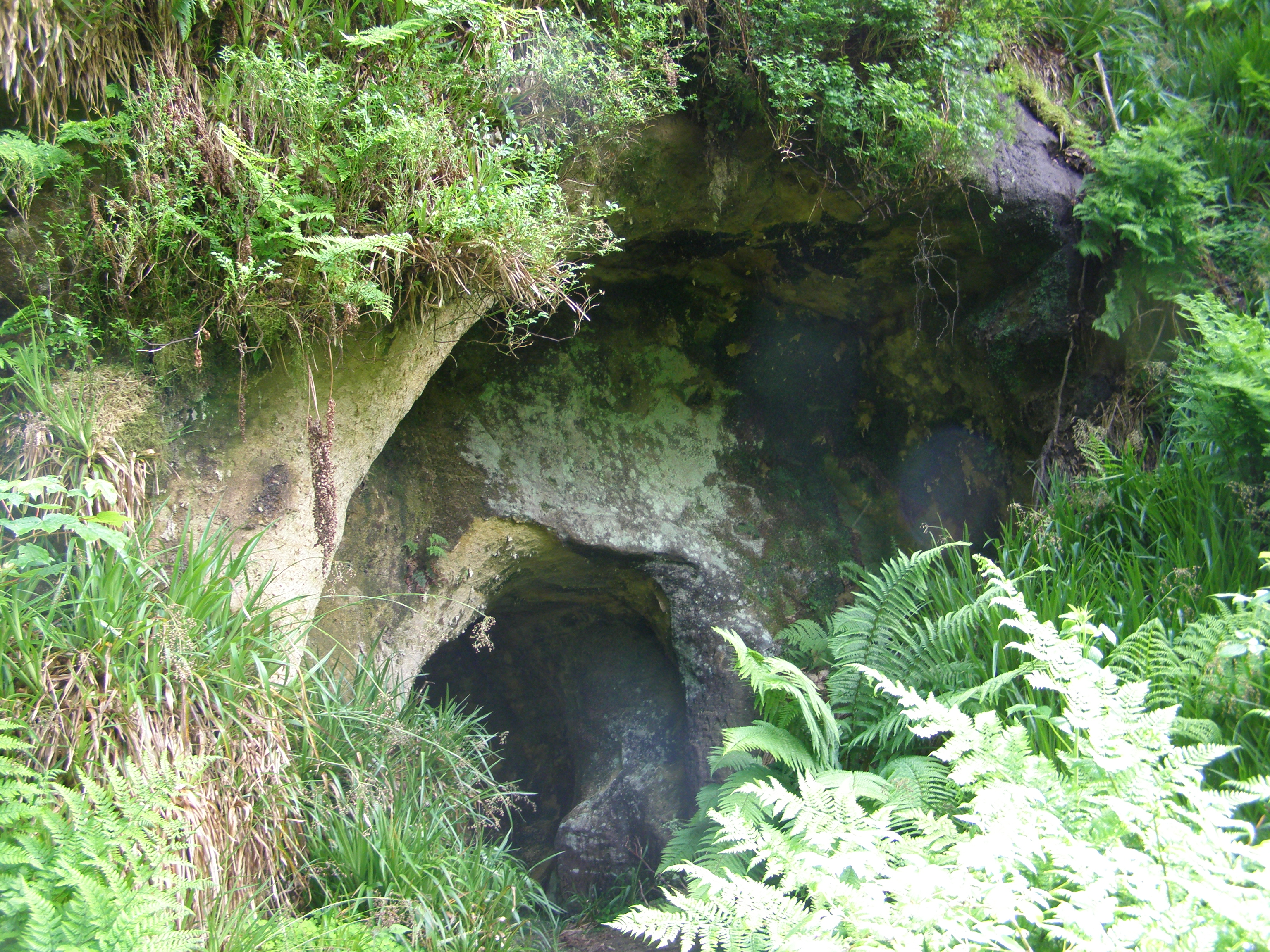
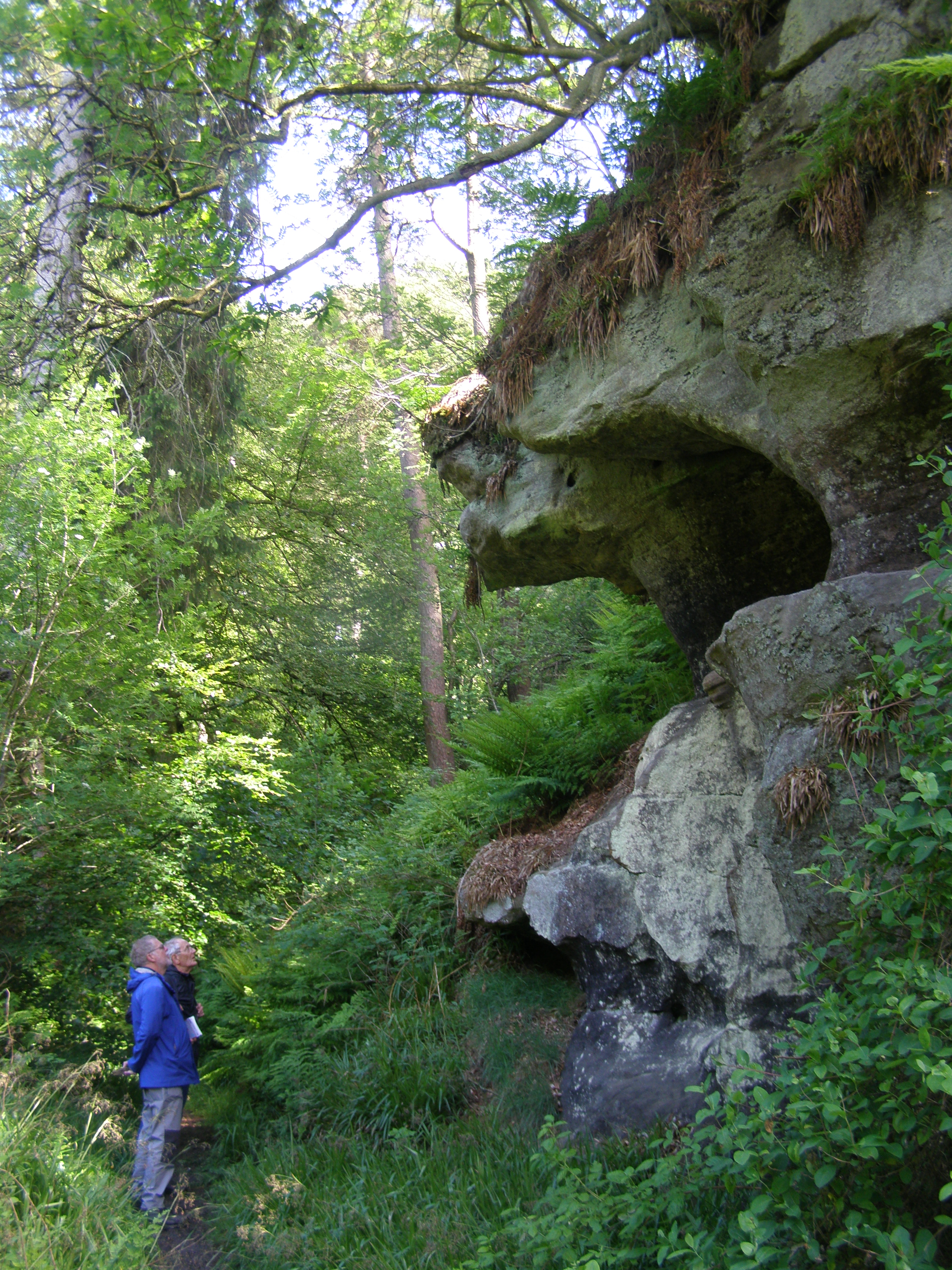
A river cave/arch (Sandy’s Cave) is seen opposite a footbridge. The feature appears to have been a natural arch in yellow sandstone of the Limestone Coal Formation. The sandstone is medium to fine-grained with massive bedding dipping at 12° to the west.
Alison Tymon
June 16, 2019
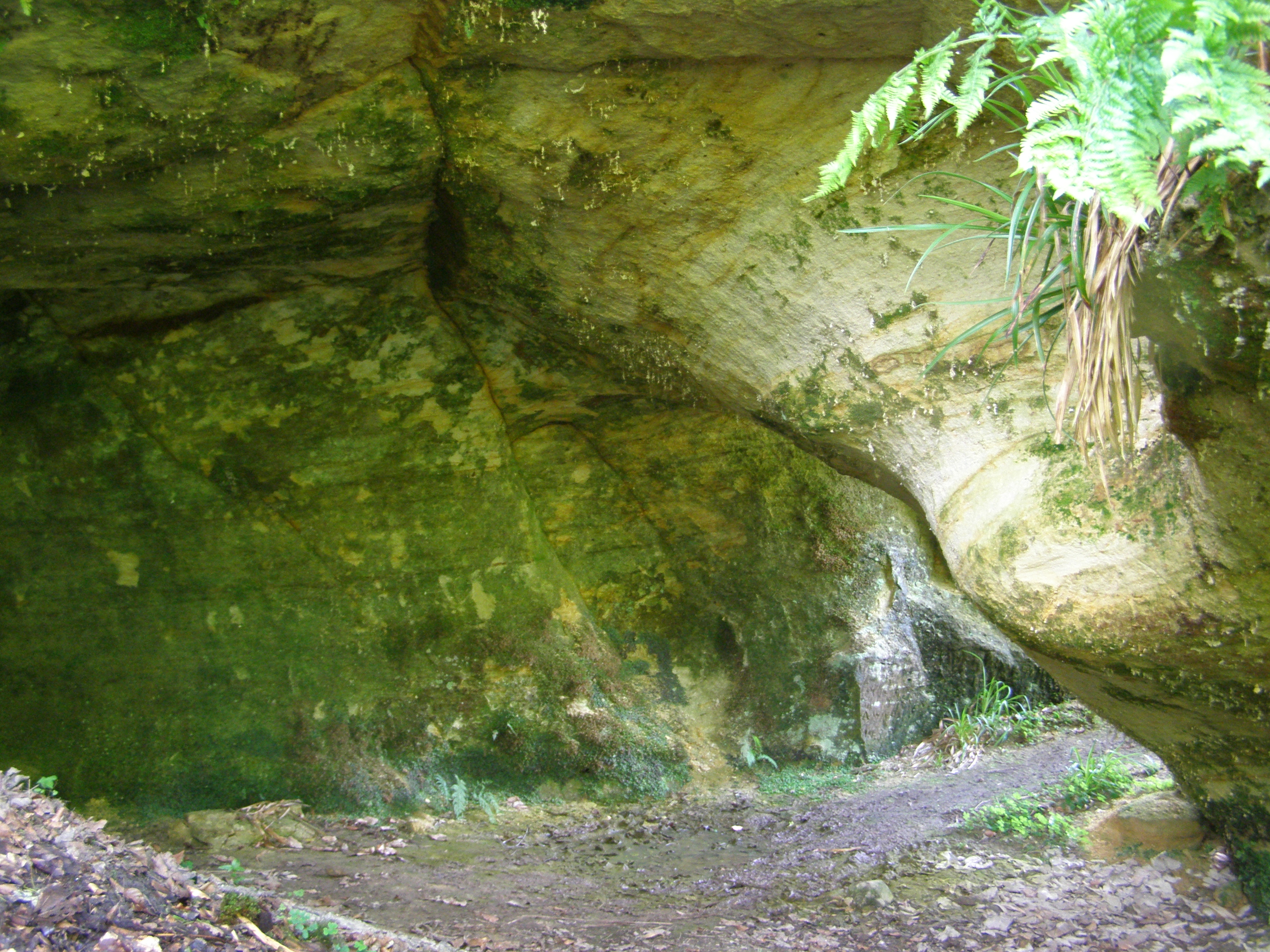
The arch widens out into a low cave. There are some indistinct pick marks on one side of the inner arch, which suggests that some of the excavation has been man-made, perhaps as part of the early 19th century landscaping of Habbie’s Howe. Major joints in the poorly-cemented sandstone are marked by iron and there are Liesegang rings in places.
Alison Tymon
June 16, 2019
There are several cliffs downstream, for at least 200 m on the south river bank, of massively bedded sandstone, one of which is about 6 m high and has been undercut, probably by glacial or post-glacial high water flows down the valley.
Alison Tymon
June 16, 2019