Kitleyknowe Sand Quarry, Carlops
Local Geodiversity site | Scottish Borders
Local Geodiversity site | Scottish Borders
Scotland's geosites are chosen because of their local, national or international importance. Take only photos, leave only footprints: avoid causing any damage to this site. You can walk almost anywhere in Scotland without the need to ask permission or keep to paths, but you have a responsibility to care for your own safety, to respect people's privacy and peace of mind and to cause no damage.
The right of access does not extend to quarries, building sites or any land where public access is prohibited, or to the collection of geological samples.
The Kitleyknowe Sand Quarry has been excavated in a relatively unconsolidated sandstone of the Upper Carboniferous Limestone Coal Formation (Clackmannan Group) (Pendleian). The rock surfaces weather quickly to form sand debris slopes at the foot of the quarry faces, which are now largely vegetated.
At the west end of the quarry, an 8 m high cliff of thickly-bedded poorly-consolidated white sandstone is easily accessible. The horizontal sandstone, which dips at about 10 towards the south, contains muscovite mica flakes and occasional clear quartz grains. The coarse-grained sand layers, only a few centimetres thick, are interbedded with thin beds of fine sands. The lower 4 m of the face is massively cross-bedded, showing flow towards the SSW (190). A coal bed approximately 10 cm thick, about 4 m from base of the face, demarcates the lower sandstone beds from upper beds of similar sandstones.
The upper beds are accessible in the middle part of the quarry and can be inspected at NT 17377 56020. They are coarse to fine-grained, with some angular quartz grains up to 5 mm, with several directions of cross-bedding and scouring at the base of each. Some cross-beds are outlined with iron precipitates and some with black disseminated carbon.
The east end of the quarry has a 10 m high cliff of similar white sands, at the base is which is 2.5 m of consolidated sandstone which forms a vertical face.
From A702, take minor road just south of Carlops, sign-posted Kitleyknowe. After the hamlet of Kitleyknowe the track continues eastwards and the quarry is reached after about 400 m. Parking is available for several cars at the entrance to the quarry. The quarry faces can be reached after climbing over loose sand and debris slopes.
https://webapps.bgs.ac.uk/memoirs/docs/B01977.html
Tulloch, W. and Walton, H.S. 1958 The Geology of the Midlothian Coalfield. Memoir of the Geological Survey of Scotland, p.139
There are no safety notes yet.
There are no site highlights yet.
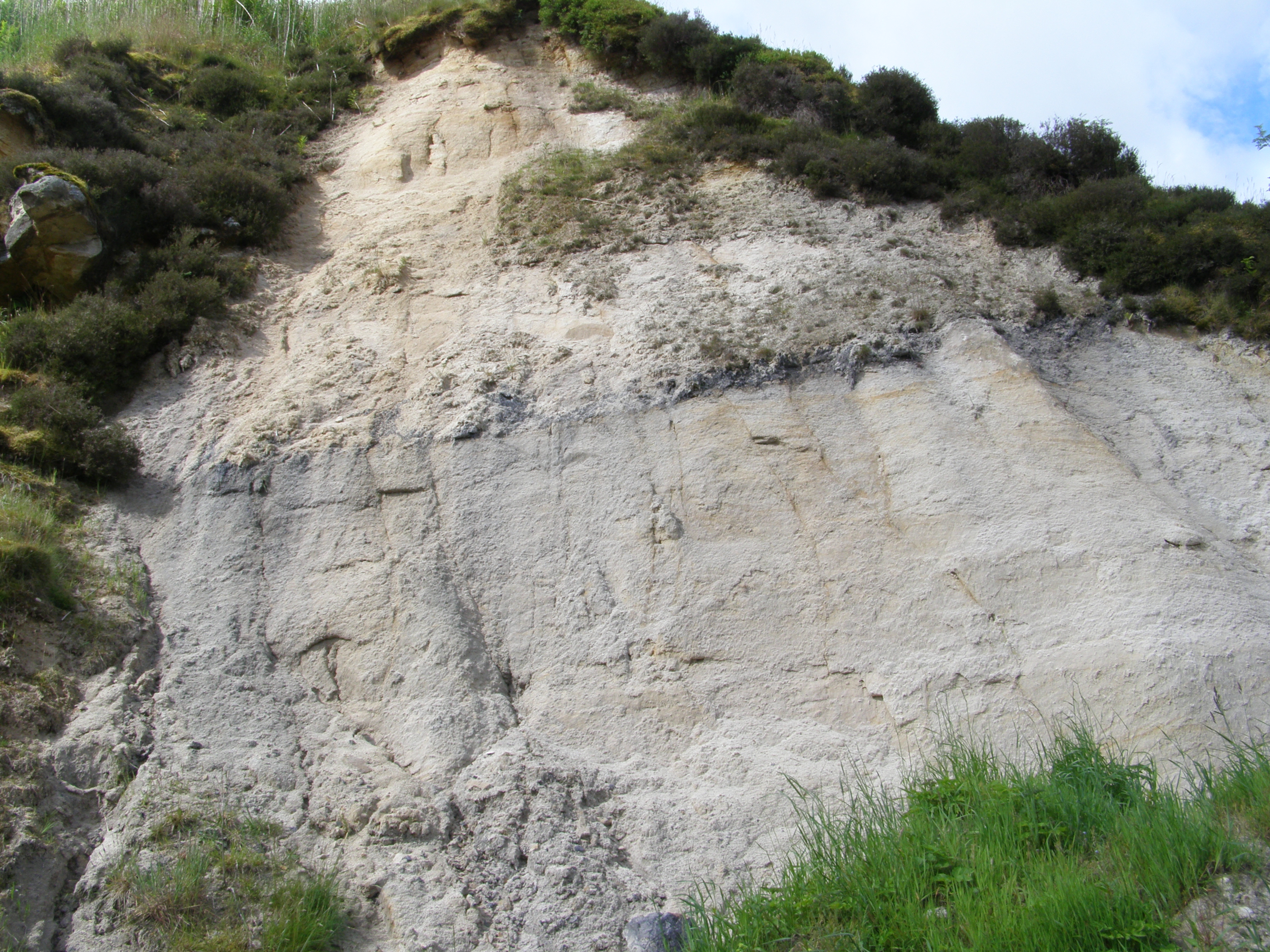
The exposure at the west end of the quarry showing thickly-bedded cross-bedded sandstones separated by a thin coal seam
Alison Tymon
June 19, 2019
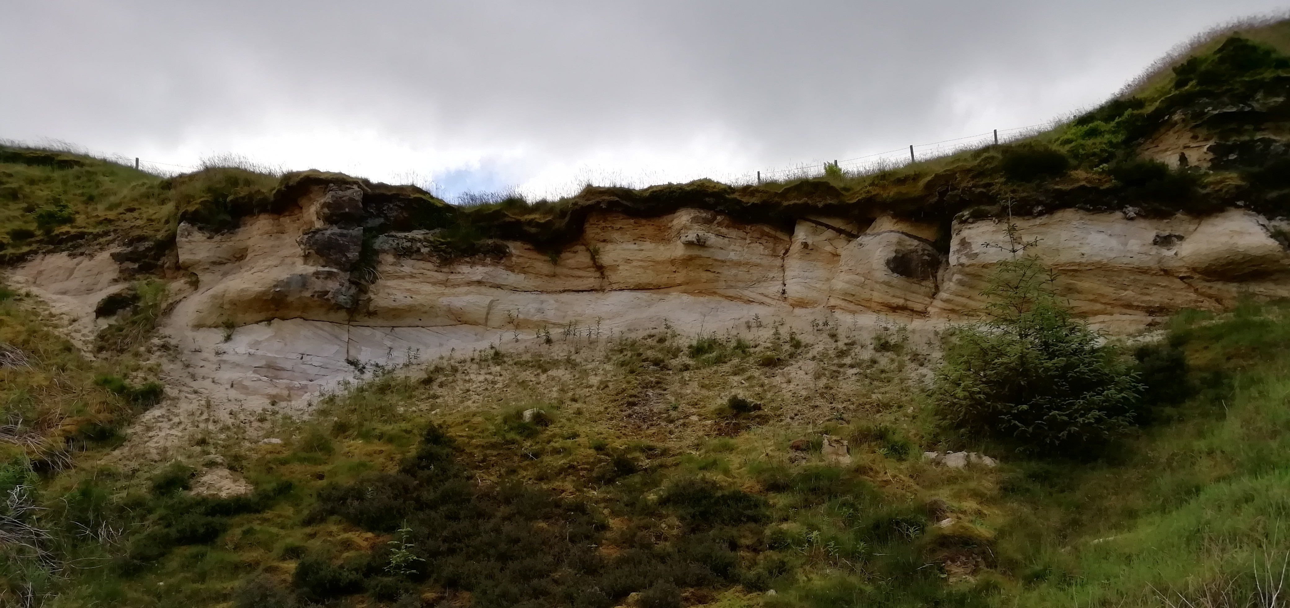
View looking south-east at the upper sandstones of the middle section of the quarry, showing cross-bedding with iron and carbon along bedding and scoured surfaces.
Alison Tymon
June 19, 2019
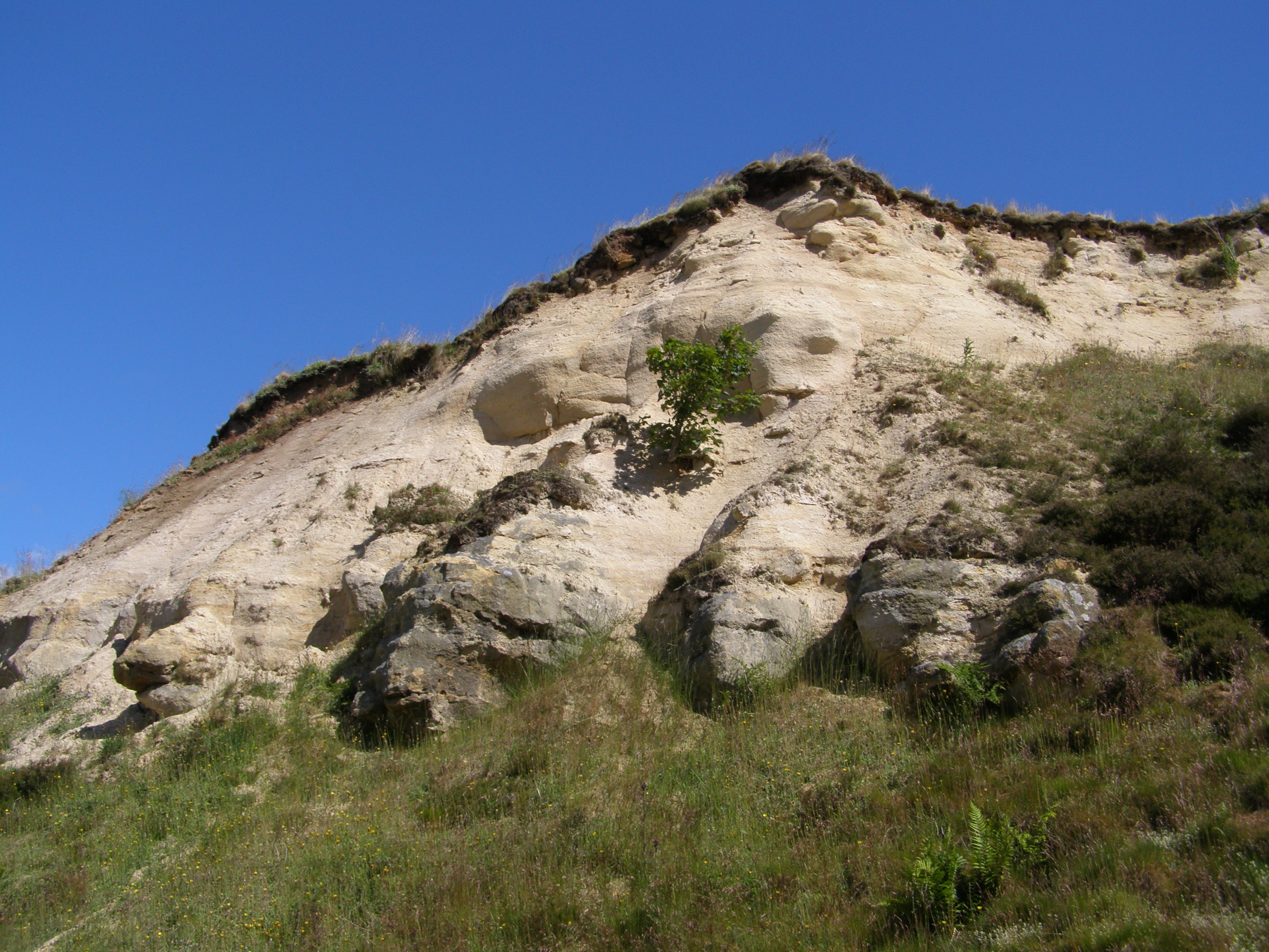
View looking north-east towards the east end of the quarry, which shows consolidated beds of sandstone at the base of the exposure, with less consolidated sandstones above.
Alison Tymon
June 19, 2019