Elie - Anstruther
Geological Conservation Review site | GCR #1569 | Stratigraphy | Dinantian of Scotland
Geological Conservation Review site | GCR #1569 | Stratigraphy | Dinantian of Scotland
Scotland's geosites are chosen because of their local, national or international importance. Take only photos, leave only footprints: avoid causing any damage to this site. You can walk almost anywhere in Scotland without the need to ask permission or keep to paths, but you have a responsibility to care for your own safety, to respect people's privacy and peace of mind and to cause no damage.
This site is a Site of Special Scientific Interest (SSSI). It is an offence to intentionally or recklessly damage the protected natural features of a SSSI, and this includes unauthorised sample collection.
The right of access does not extend to quarries, building sites or any land where public access is prohibited, or to the collection of geological samples.
A key site for stratigraphic studies of Dinantian (Lower Carboniferous) rocks in Scotland showing an almost complete Calciferous Sandstone to basal Limestone Coal Group succession. The section includes the upper Anstruther Beds, Pittenweem Beds, Sandy Craig Beds, Pathhead Beds, Lower Limestone Group and Limestone Coal Measures, in which a succession of faunas may be studied. The site shows a range of facies variations and sedimentary structures, including penecontemporaneous limestone weathering, and trace fossils. It also shows a thicker succession than more northerly localities in Fife, with more marine bands present. This is also a key locality for palynological (spore) studies in the Scottish Dinantian.
There are no access notes yet.
There are no safety notes yet.
There are no site highlights yet.
There are no further information notes yet.
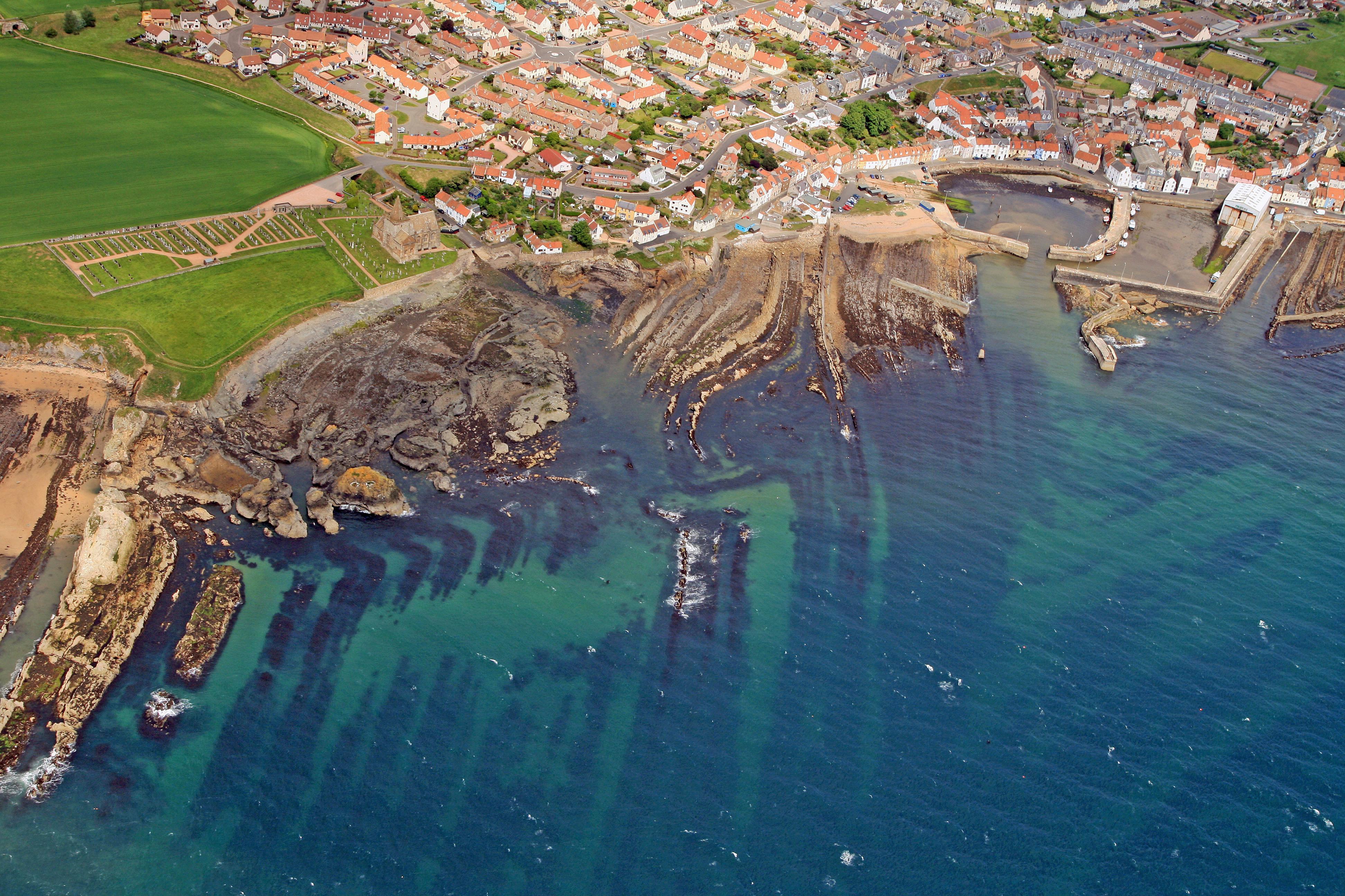
Aerial photograph of Anstruther looking northwest. Folded non-marine sediments of the Carboniferous Strathclyde Group.
Dave Longstaff
June 9, 2008
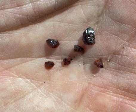
Elie Rubies, Pyrope garnet brought to the surface to the west of Lady's Tower.
The garnets are xenocrysts in the vent agglomerate at Elie and may have travelled from the mantle from depths of greater than 75km.
Dave Longstaff
April 18, 2024
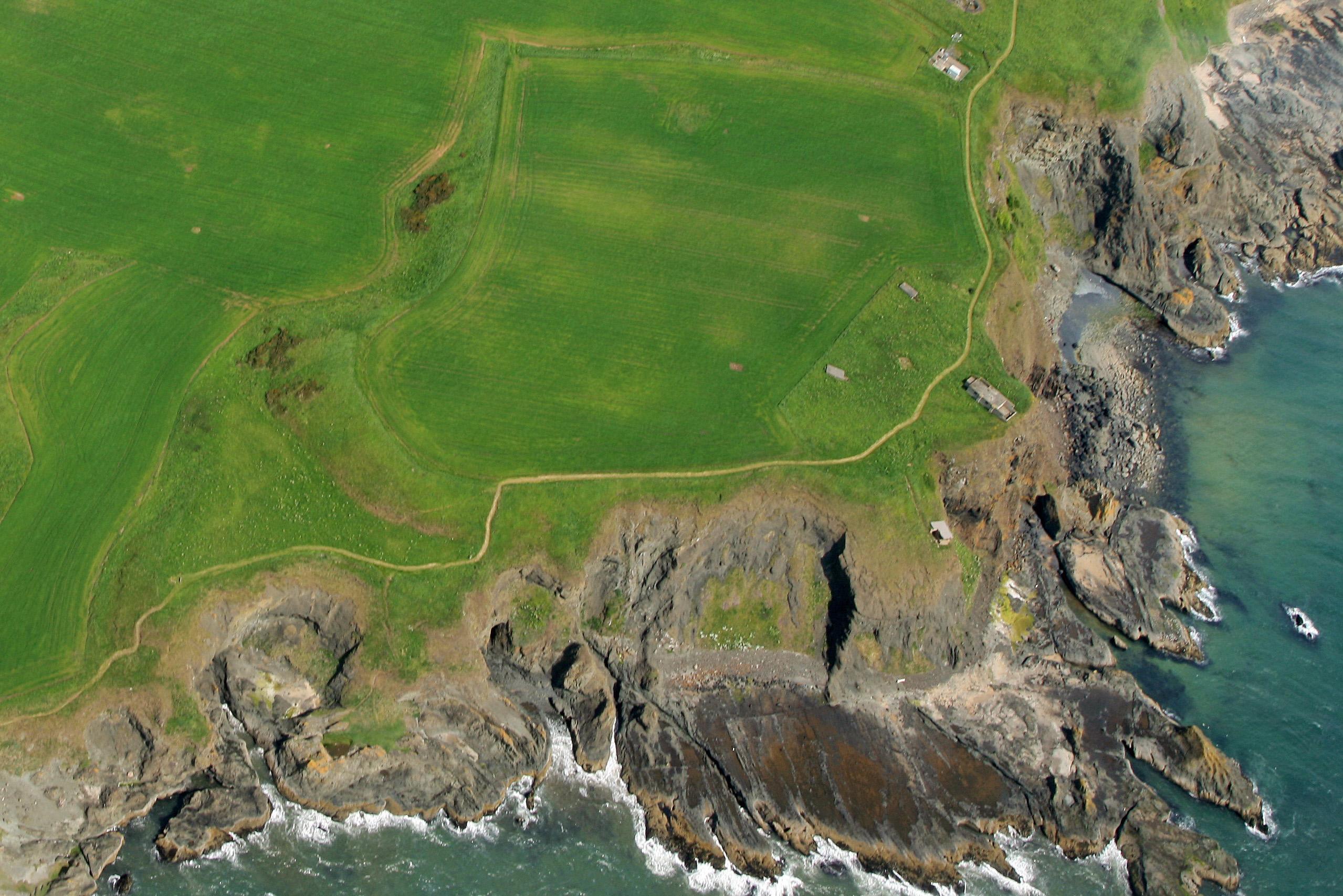
Lady's Tower, Elie, visible lower left of photograph looking northeast.
St Monans White limestone syncline.and volcanics nearer tower.
Dave Longstaff
June 9, 2008
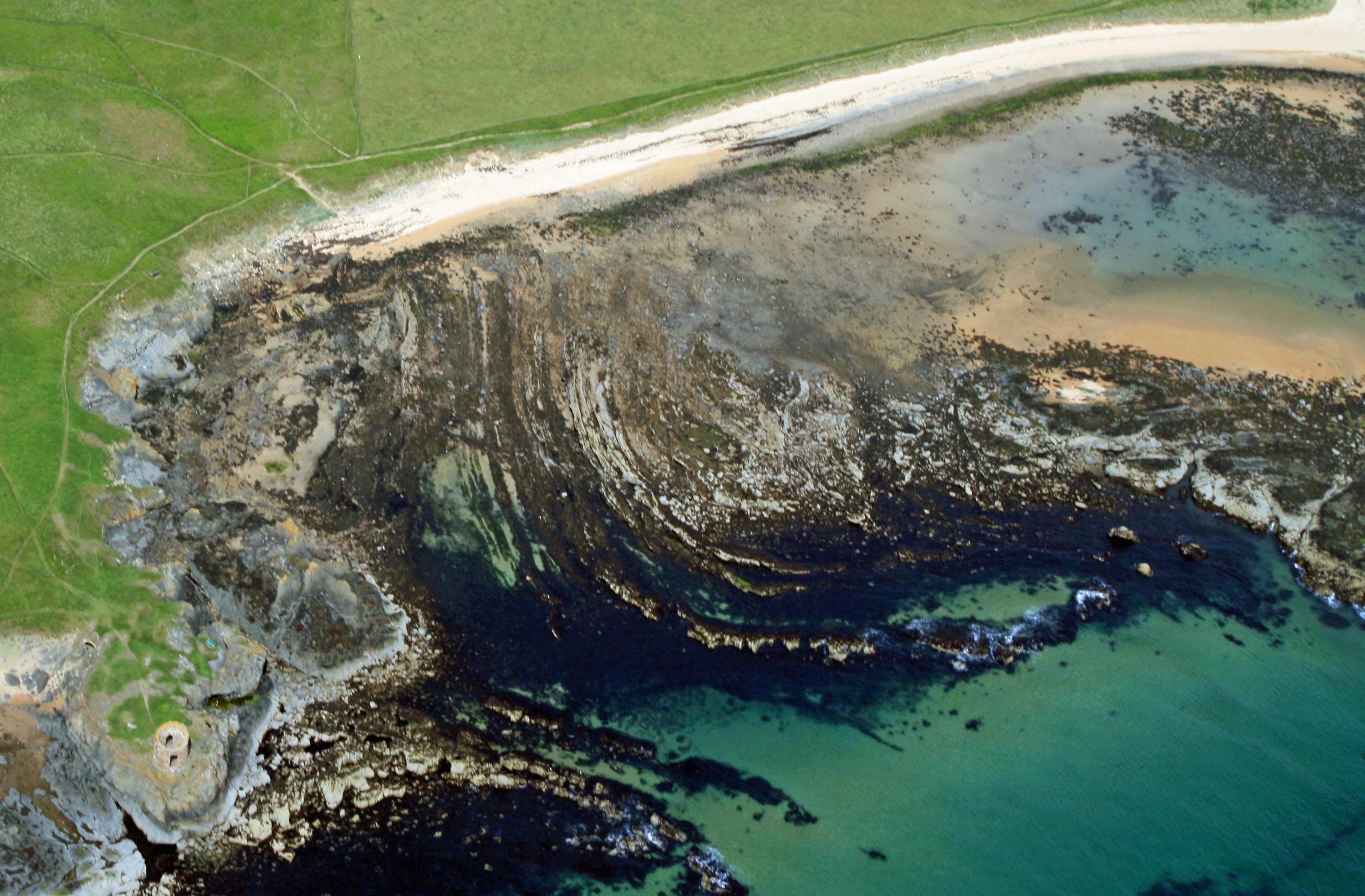
Kincraig Hill and Kincraig Point from the air looking north. Bedded tuffs visible on wave-cut platform. This photo shows the situation of the Elie Chain Walk
Dave Longstaff
June 9, 2008
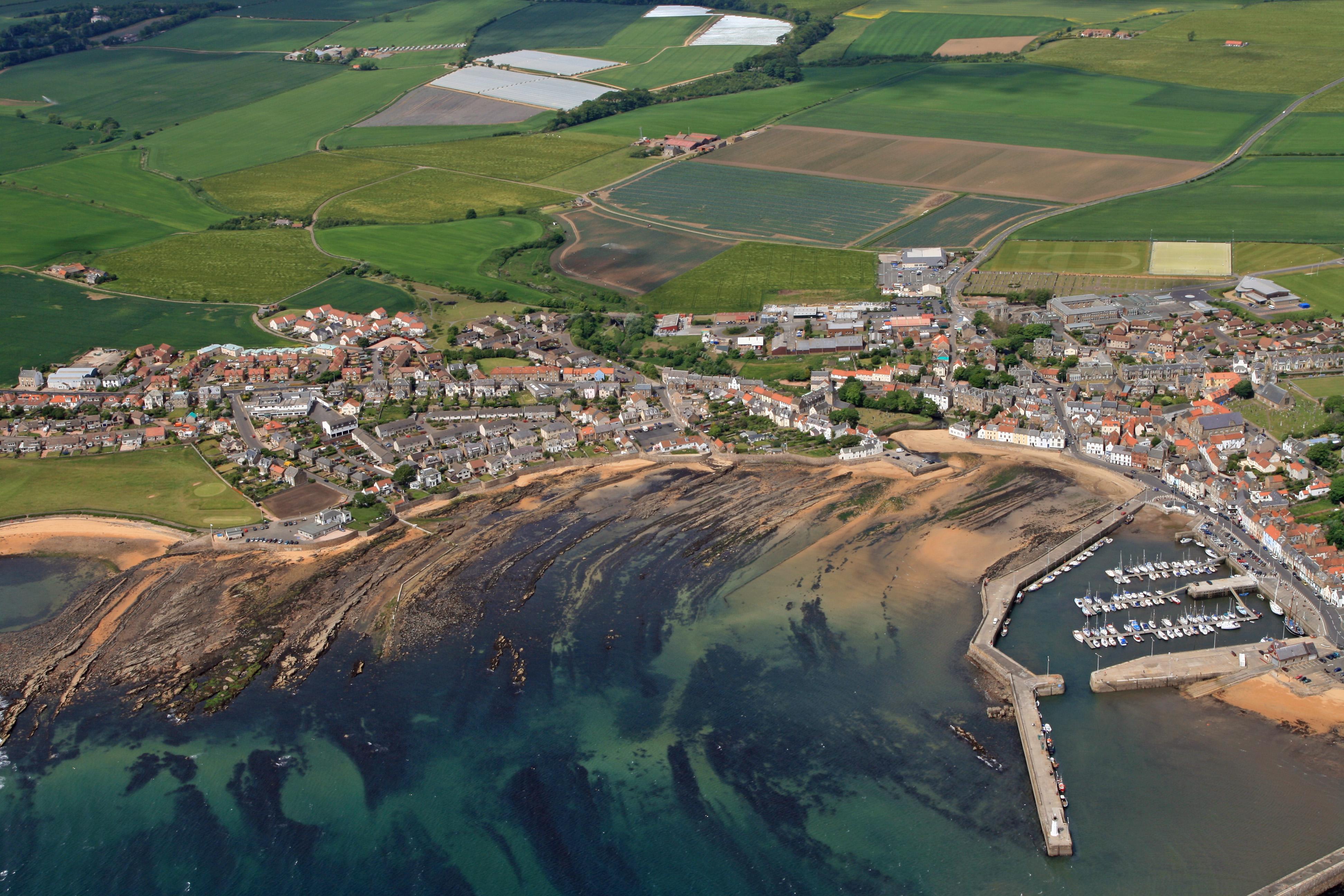
St Monans fron the air looking northeast. Faulting in lower Carboniferous sediments.
Dave Longstaff
June 9, 2008
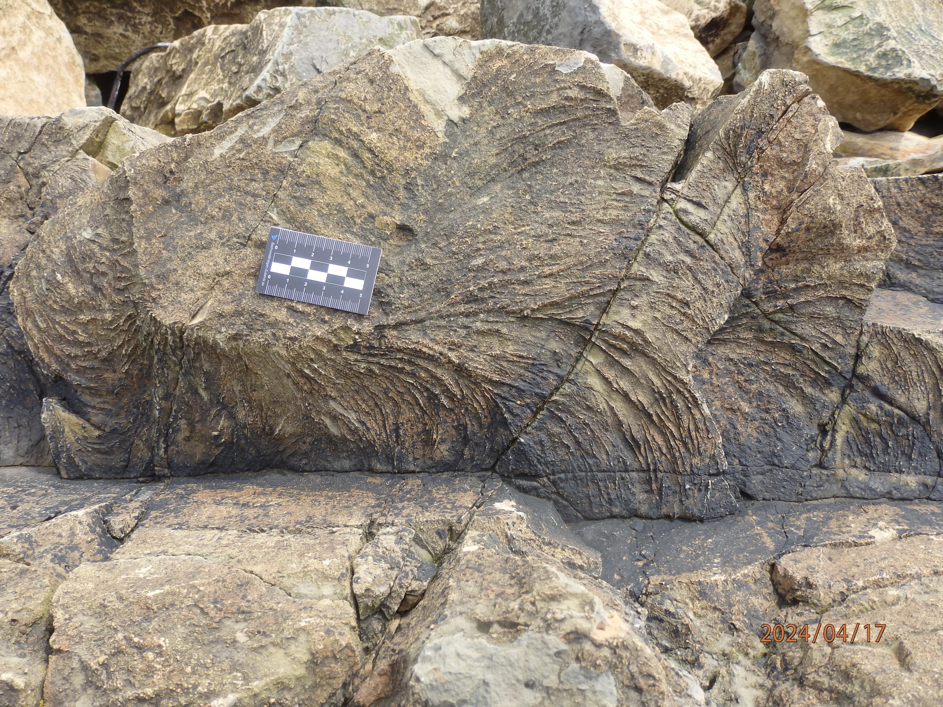
Zoophycus markings
David Rae
April 16, 2024
Skolithos burrows
David Rae
April 16, 2024
U shaped worm burrows.
Diplocraterion
David Rae
April 16, 2024
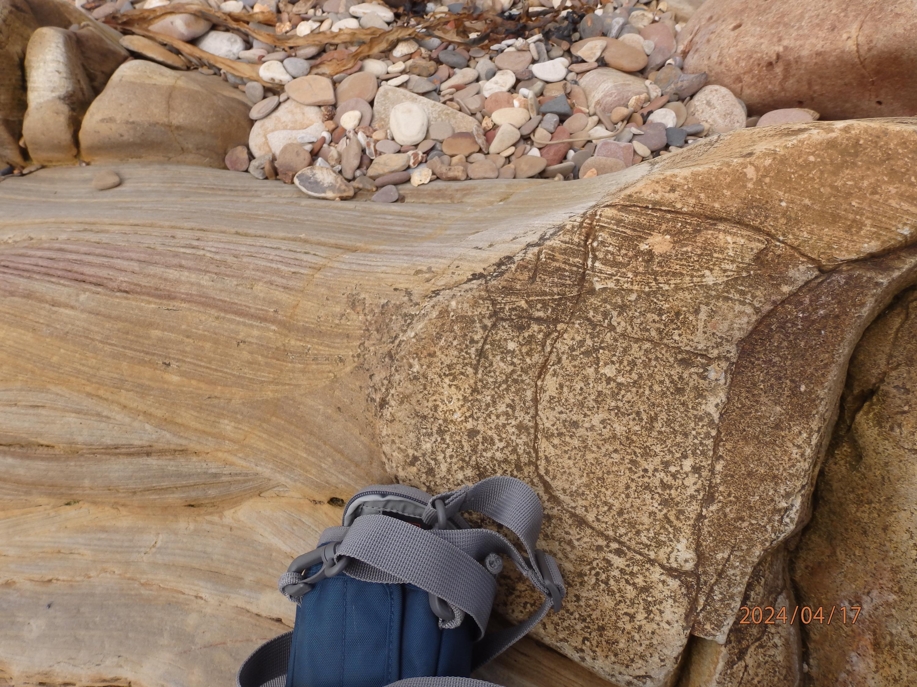
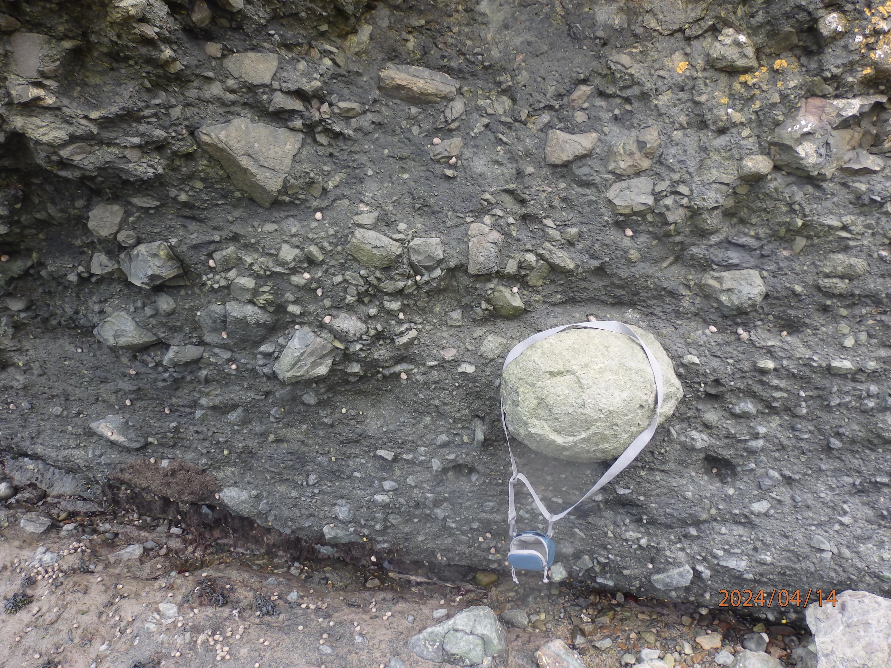
Sandstone with concretions. Cross bedding can be traced into concretion
David Rae
April 16, 2024
Yellow efflorescence in coal seam
David Rae
April 16, 2024
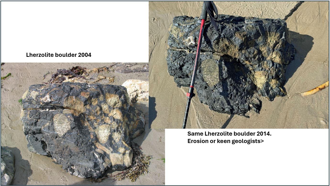
Lherzolite boulder just to west of larger outcrop which has suffered damage over the last 20 years. .
Dave Longstaff
April 13, 2024
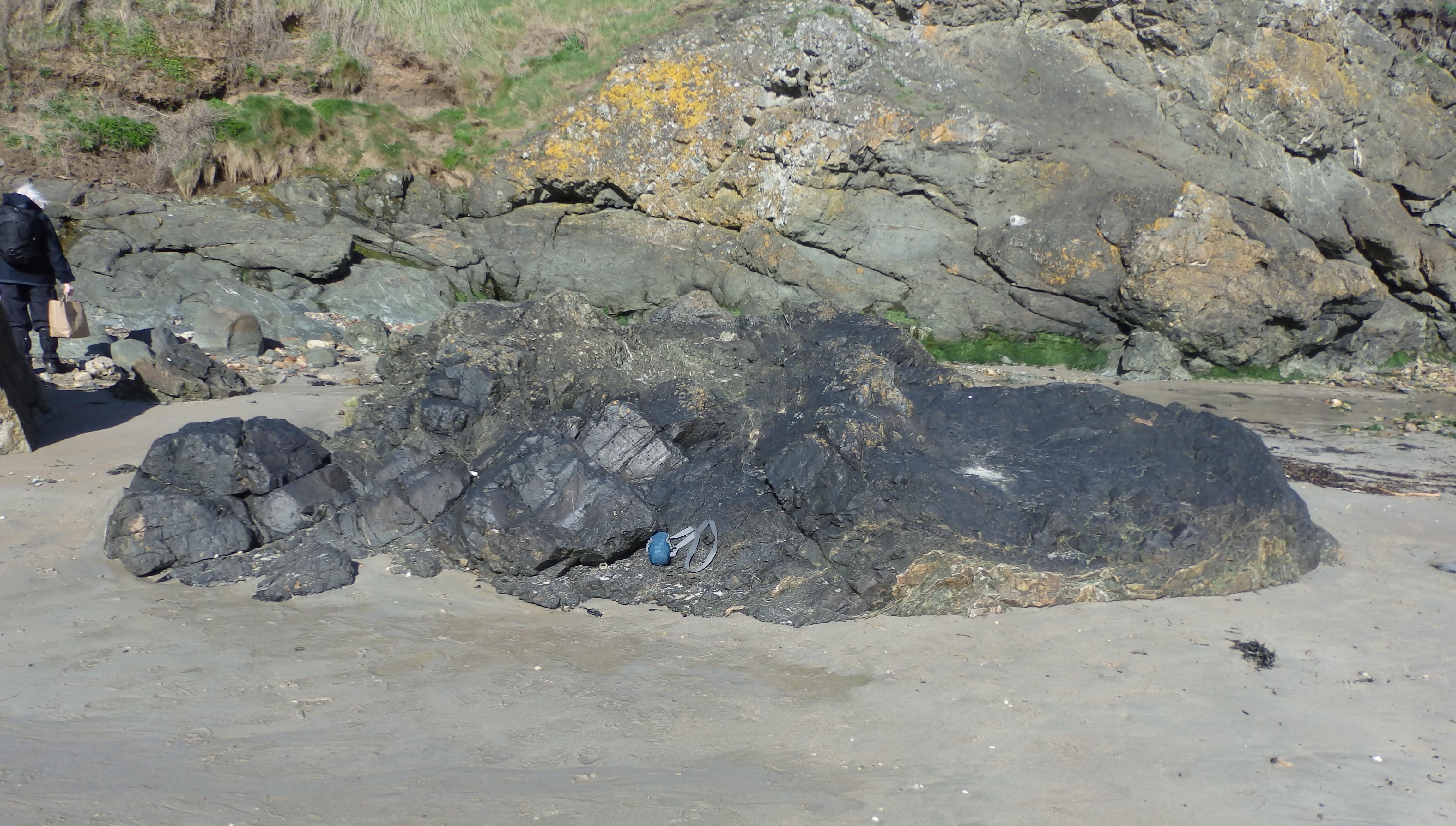
Basalt plug with peridotite (Lherzoloite) xenoliths
David Rae
April 13, 2024
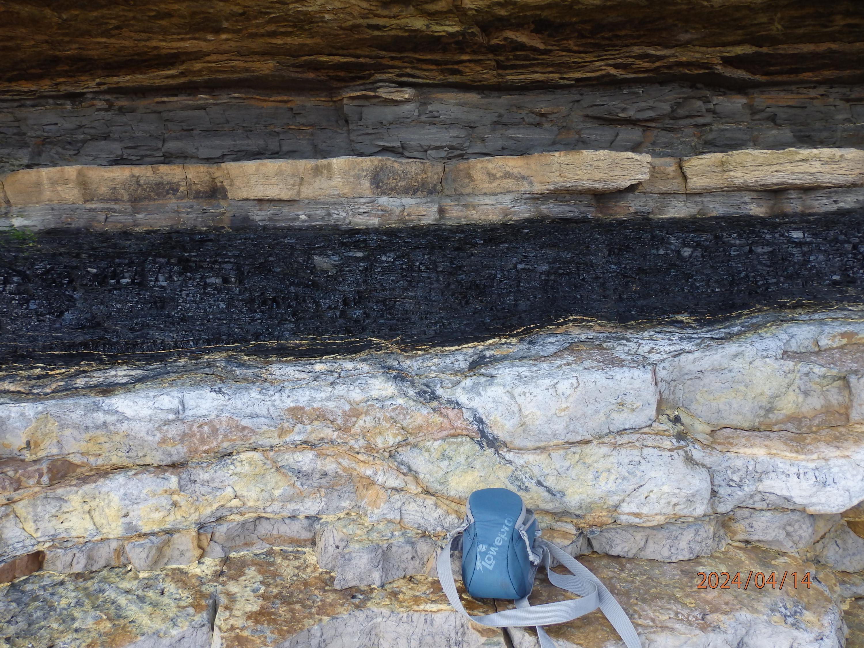
Coal with root? and seat earth below
David Rae
April 13, 2024
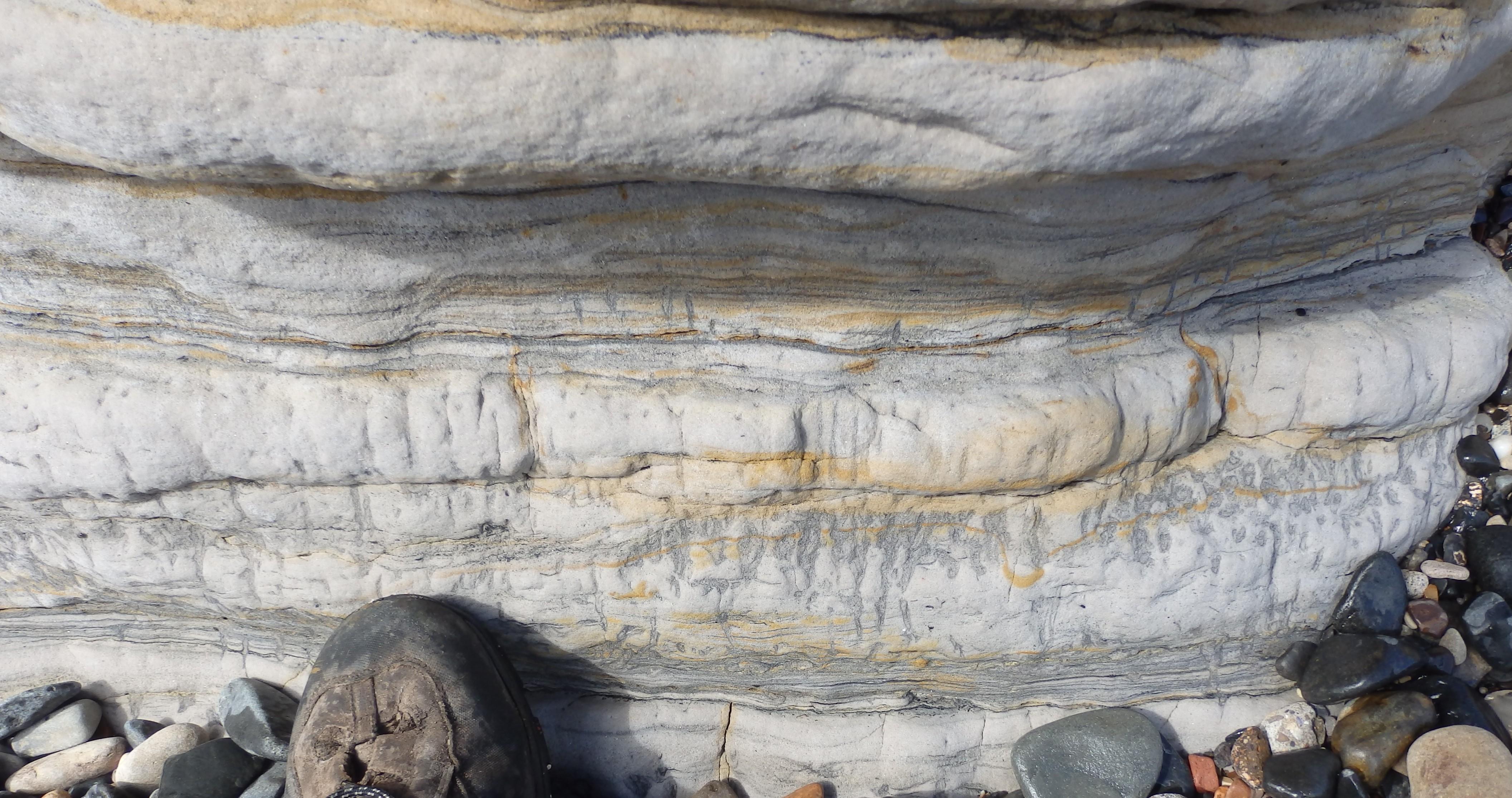
Climbing ripples
David Rae
April 13, 2024
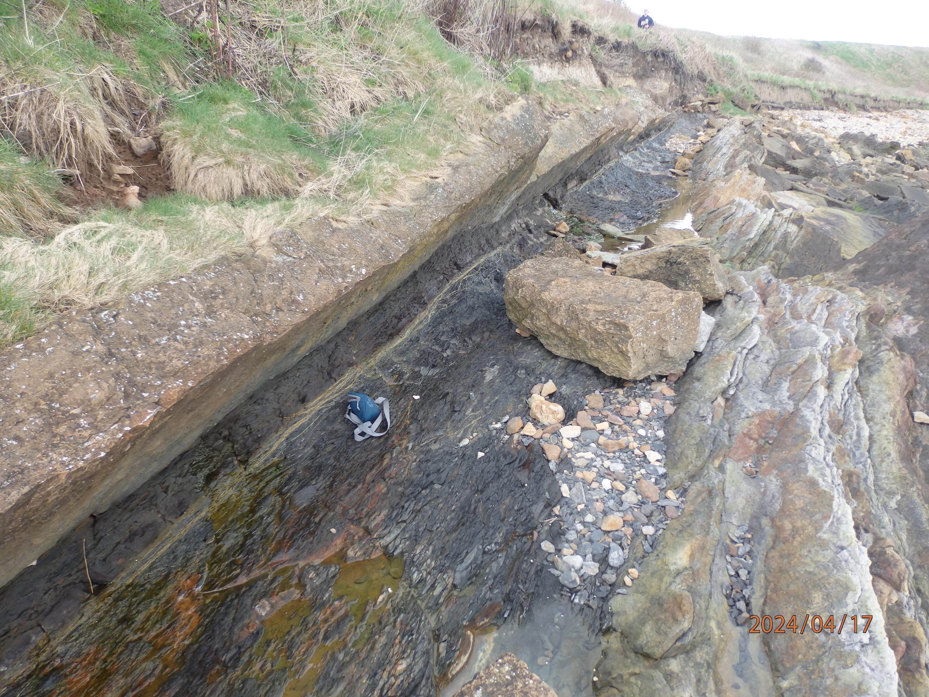
Line of Ardross fault
David Rae
April 13, 2024
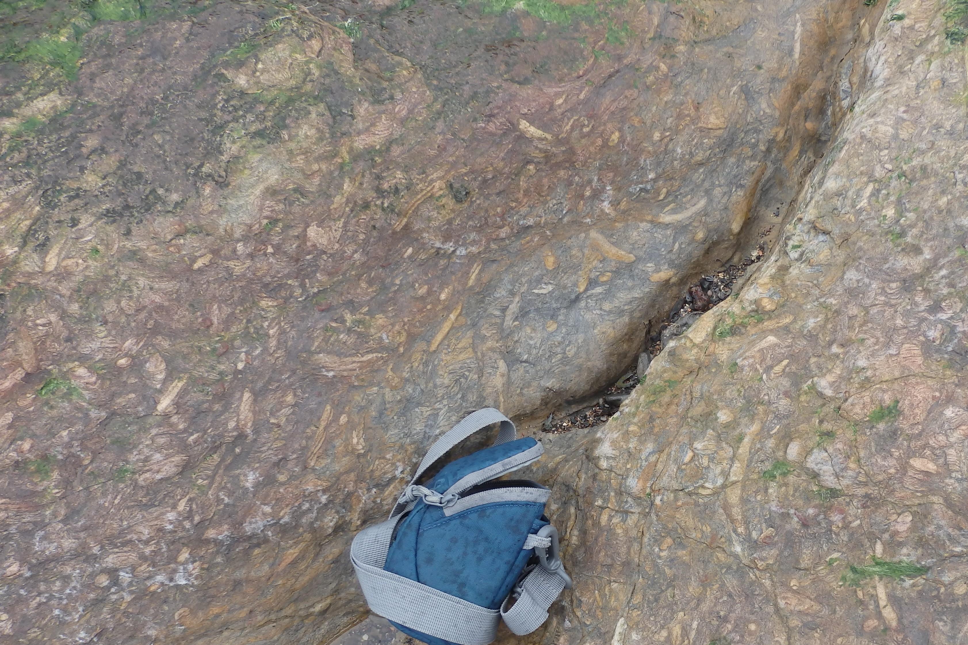
Coalyard Hill Neck agglomerate
David Rae
April 13, 2024
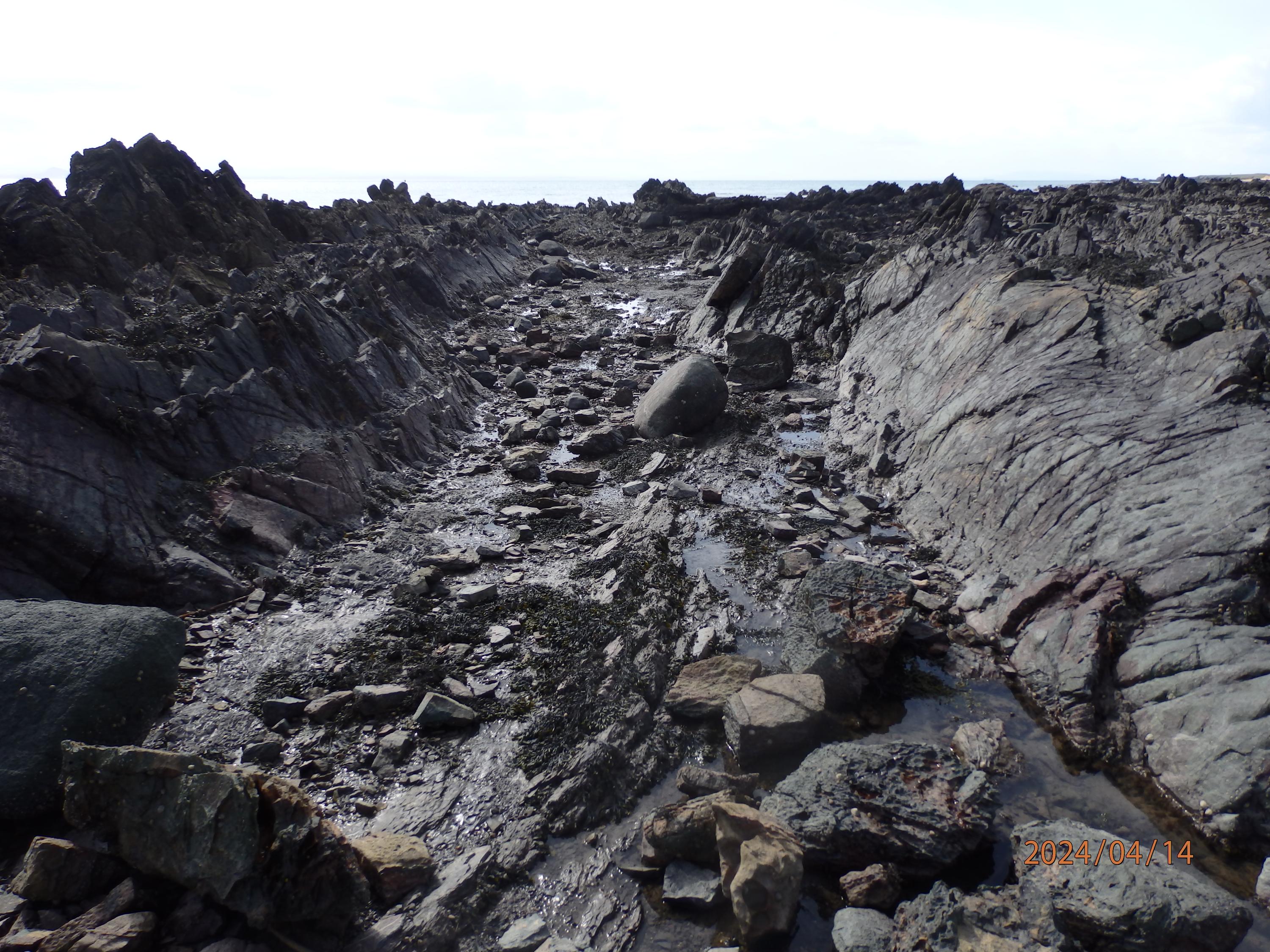
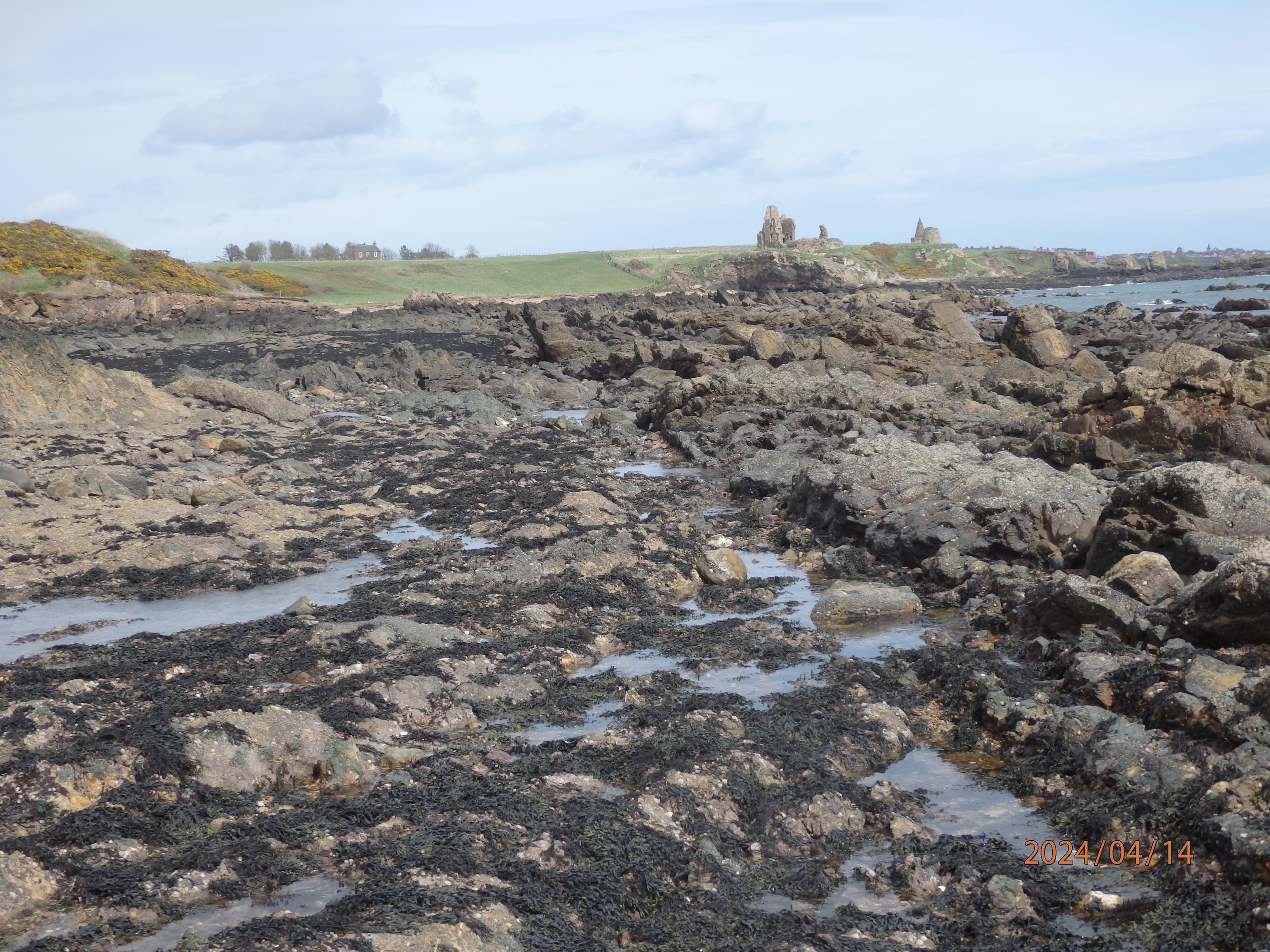
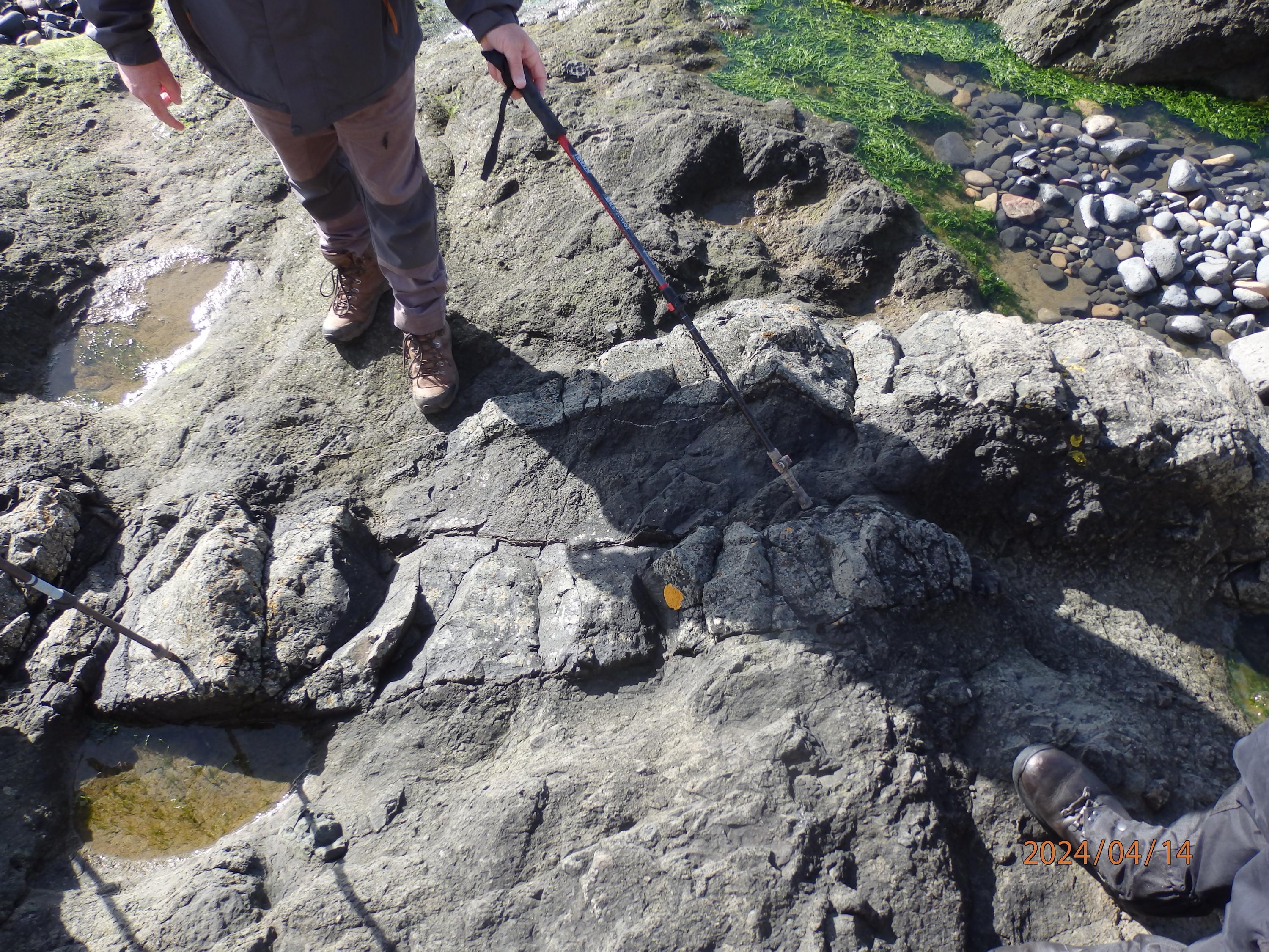
Syncline on foreshore
David Rae
April 13, 2024
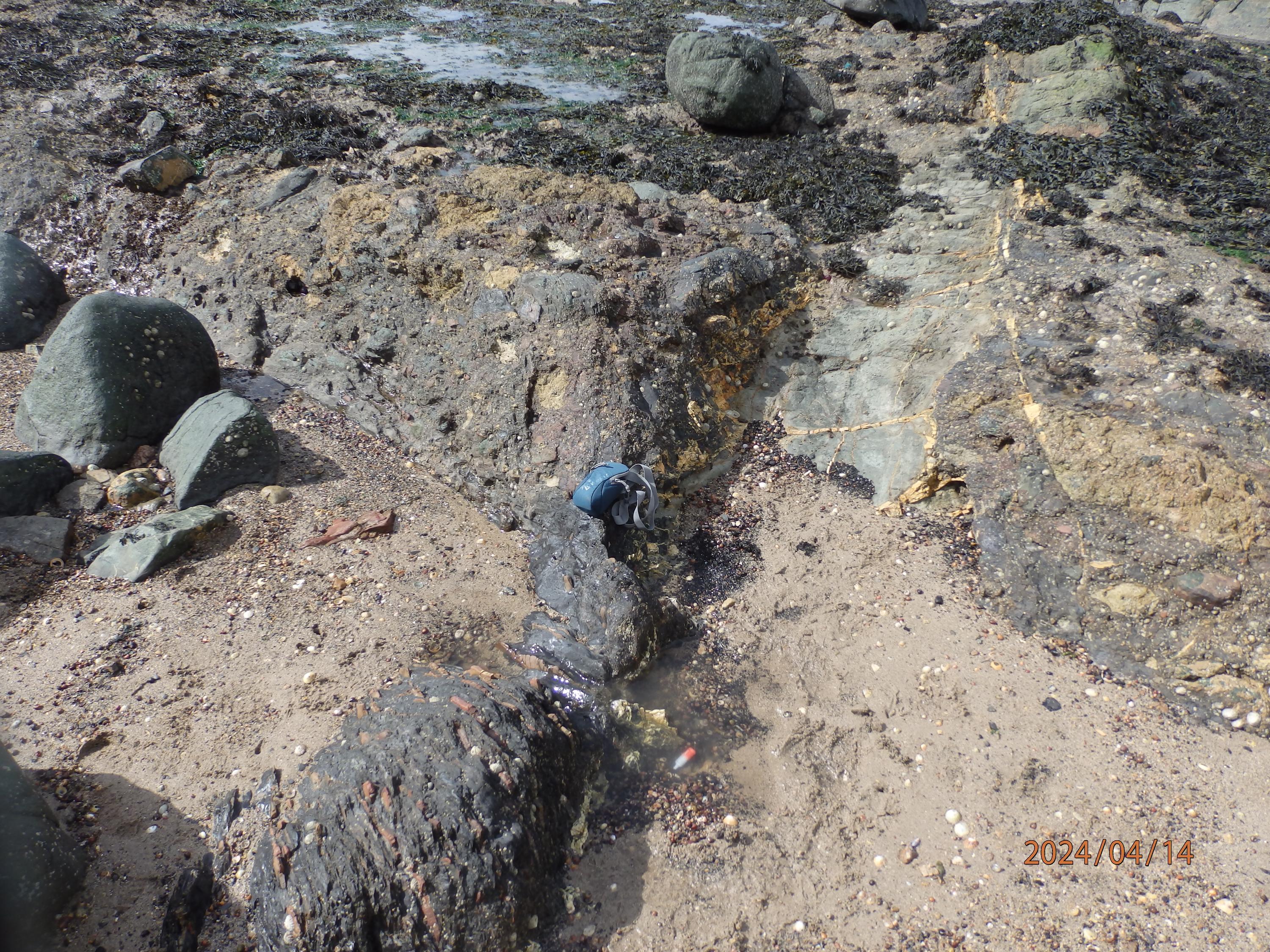
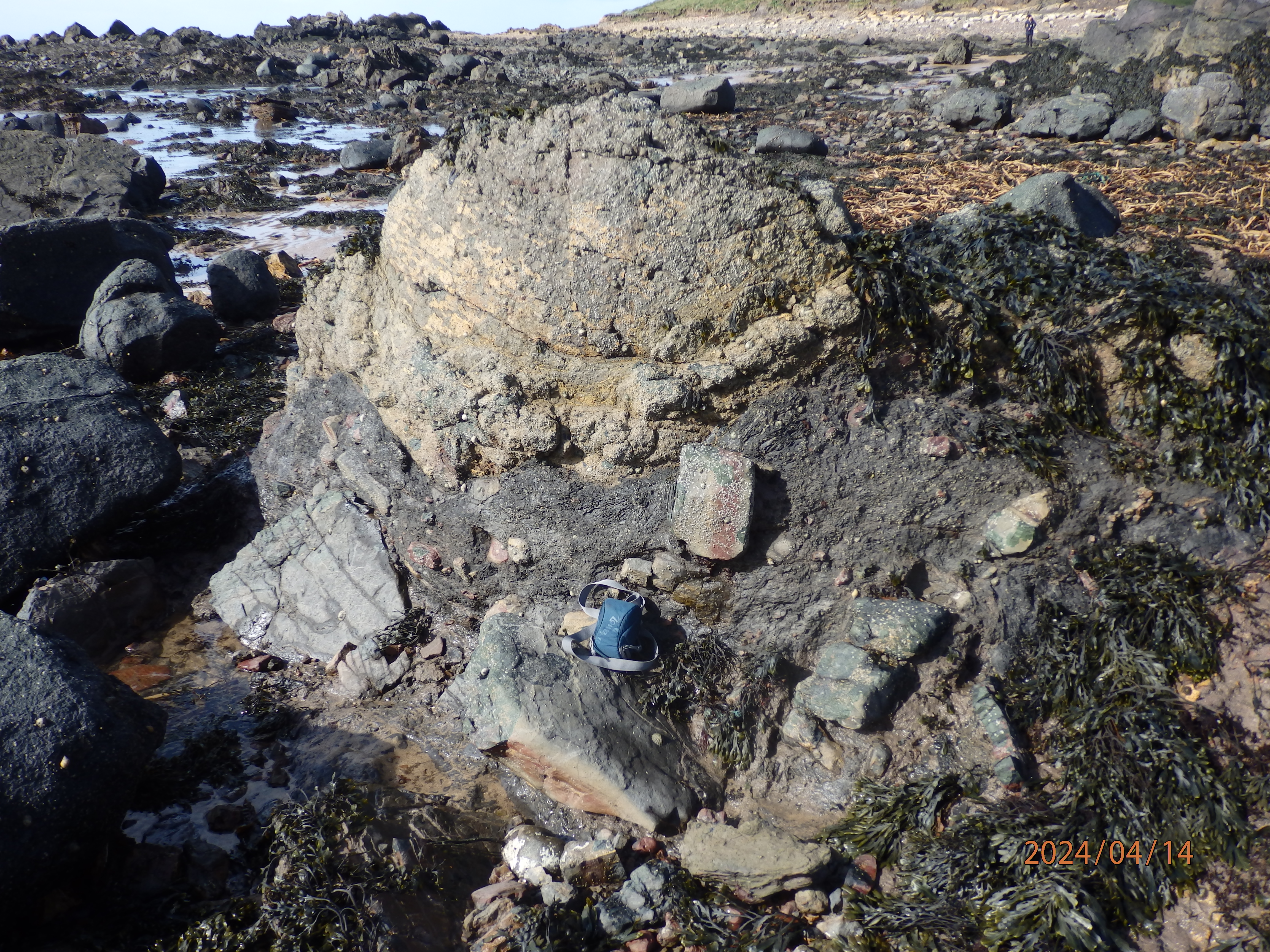
Carboniferous sediments with ironstone (lower left) in contact with tuff and both cut by white trap dyke.
(camera case at contact)
David Rae
April 13, 2024
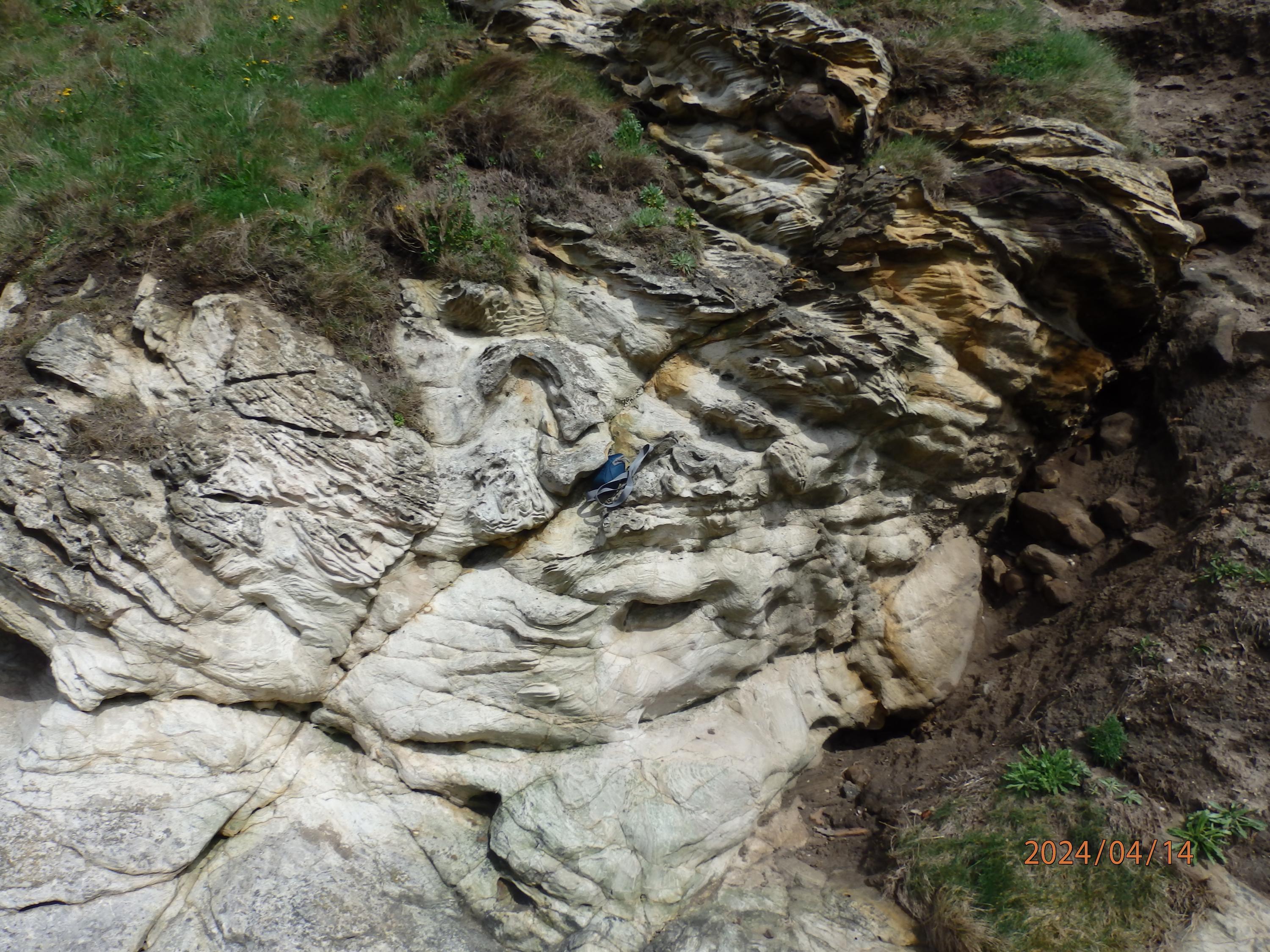
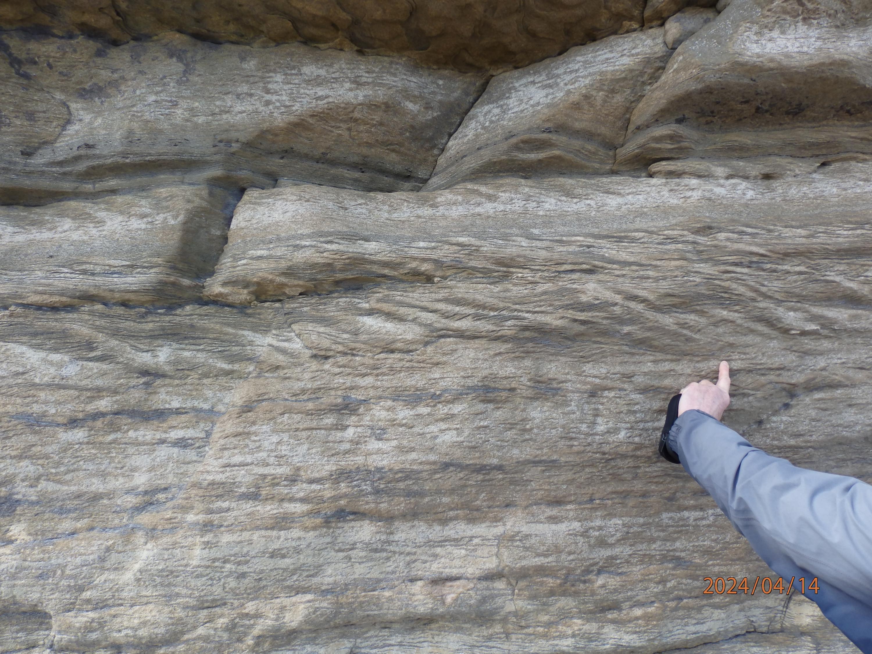
Convoluted bedding
David Rae
April 13, 2024
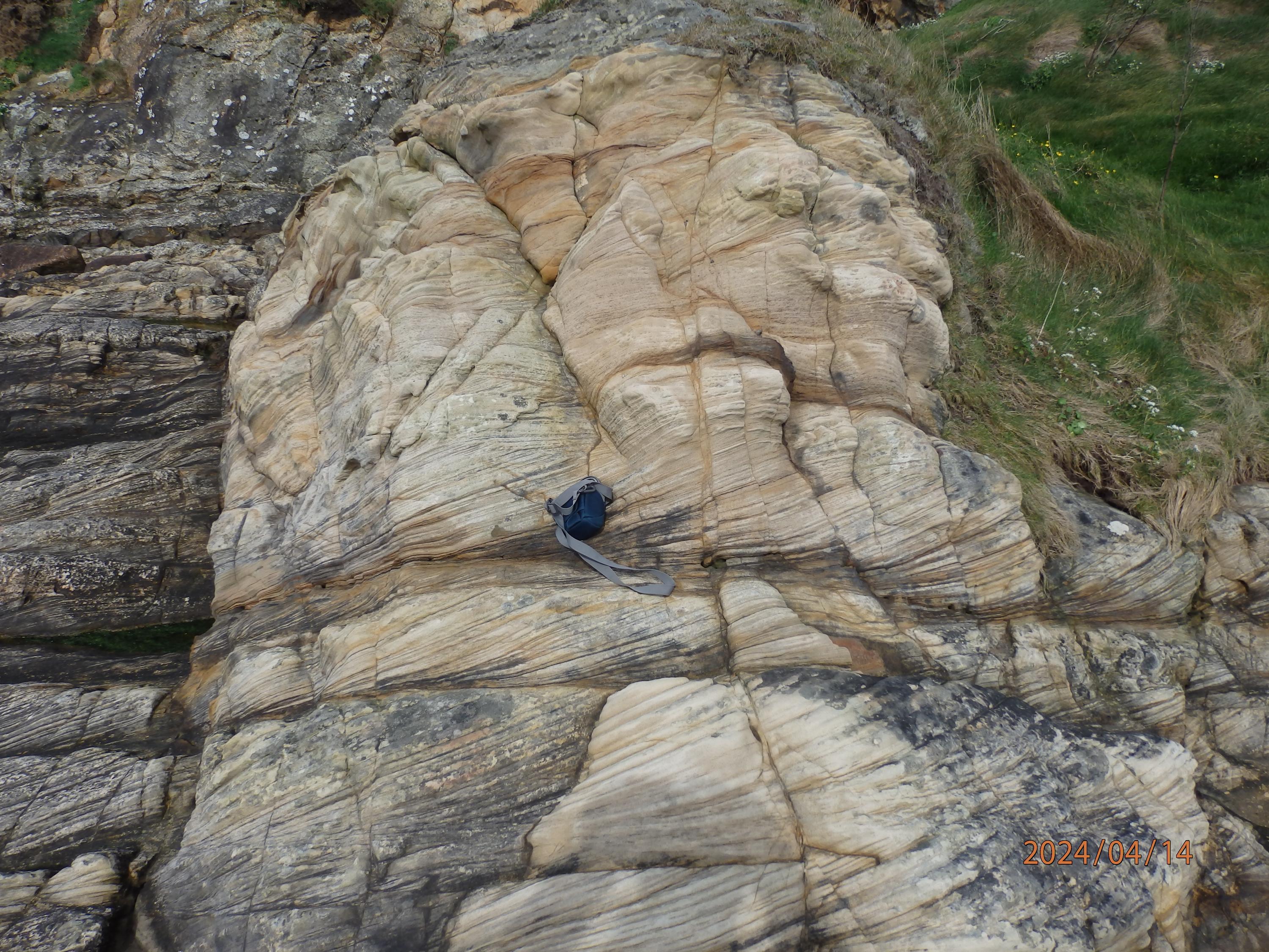
Current Bedding
David Rae
April 13, 2024
St Monans Neck. Agglomerate
David Rae
April 13, 2024
St. Monans Neck. Dyke en echelon in tuff.
David Rae
April 13, 2024