North Berwick Coast
Geological Conservation Review site | GCR #1375 | Igneous Petrology | Carboniferous - Permian Igneous
Geological Conservation Review site | GCR #1375 | Igneous Petrology | Carboniferous - Permian Igneous
Scotland's geosites are chosen because of their local, national or international importance. Take only photos, leave only footprints: avoid causing any damage to this site. You can walk almost anywhere in Scotland without the need to ask permission or keep to paths, but you have a responsibility to care for your own safety, to respect people's privacy and peace of mind and to cause no damage.
This site is a Site of Special Scientific Interest (SSSI). It is an offence to intentionally or recklessly damage the protected natural features of a SSSI, and this includes unauthorised sample collection.
The right of access does not extend to quarries, building sites or any land where public access is prohibited, or to the collection of geological samples.
The attractive coastline to the east and west of North Berwick exposes early Carboniferous basalts and tuffs with various compositions and features. They can be linked with volcanic vents as well as intrusions inland and on the offshore islands.
The coast in the neighbourhood of North Berwick provides extensive exposures of a wide range of early Carboniferous lavas, agglomerates and tuffs of the Garleton Hills Volcanic Formation. Most of the lavas exposed on the coast are thinner than those which form the Garleton Hills inland. Basaltic and basanitic dykes and sills were intruded into the lavas at a later stage. There are a number of tuff and agglomerate-filled volcanic vents. The chemical composition of the volcanic rocks gives clues to the sequence of complex changes which occurred as volcanic activity took place across southern and central Scotland during early Carboniferous times. A number of volcanic vents include fragments of the volcanic rocks and of local sediments but also xenoliths of unusual iron and magnesium-rich rocks thought to have been derived from the lower boundary of the Earth's crust. The regional dip to the west is a result of post-Carboniferous folding.
Car parks for the Yellow Craig and Longskelly Point sections of the coast are available at the Yellow Craig Plantation [NT 516855] from where a track runs to Broad Sands to join the coastal footpath west of North Berwick. Public toilets are available in the car park.
https://geoguide.scottishgeologytrust.org/p/bgs_el/bgs_el_e…
Whitbread, K., Ellen, R., Callaghan, E., Gordon, J. E. and Arkley, S. 2015. East Lothian Geodiversity Audit. British Geological Survey Open Report, OR/14/063. 192pp.
https://ougs.org/eastscotland/event-reports/214/yellowcraig…
Open University Geological Society field excursion led by Prof. Euan Clarkson on April 11th 2010
https://earthwise.bgs.ac.uk/index.php/North_Berwick,_Yellow…
A.D. McAdam and E.N.K. Clarkson Lothian geology: an excursion guide. Edinburgh Geological Society, 1996. Yellow Craig to Cheese Bay p.103
The rocks on this coastline are only visible at times of low tide.
There are no site highlights yet.
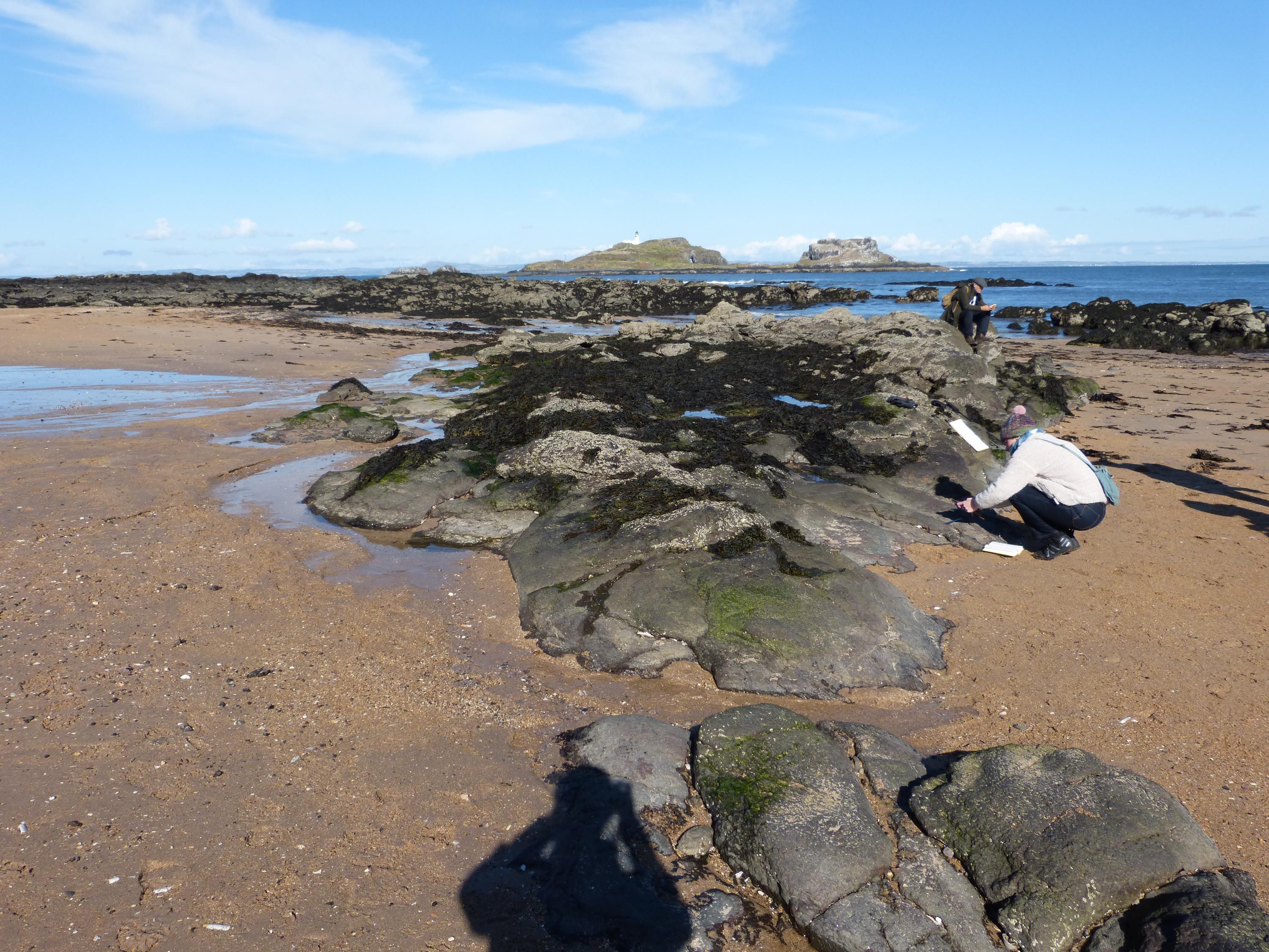
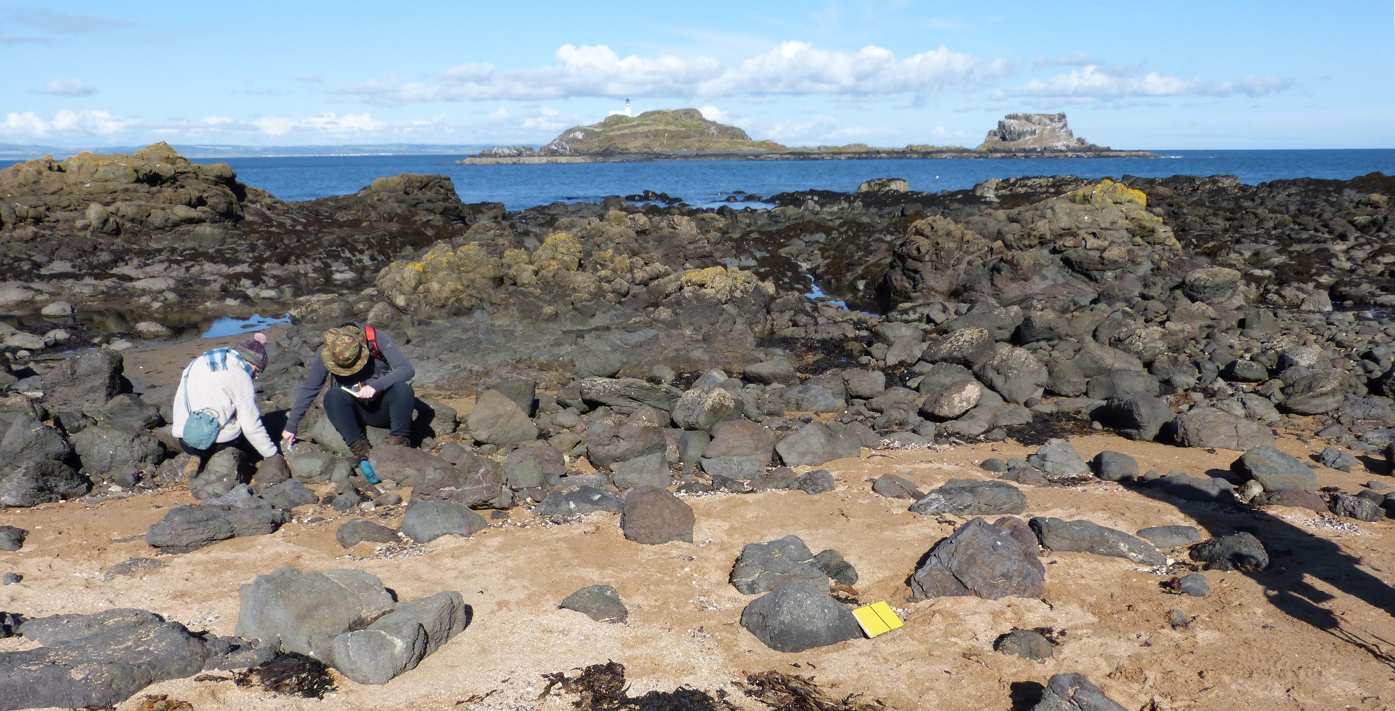
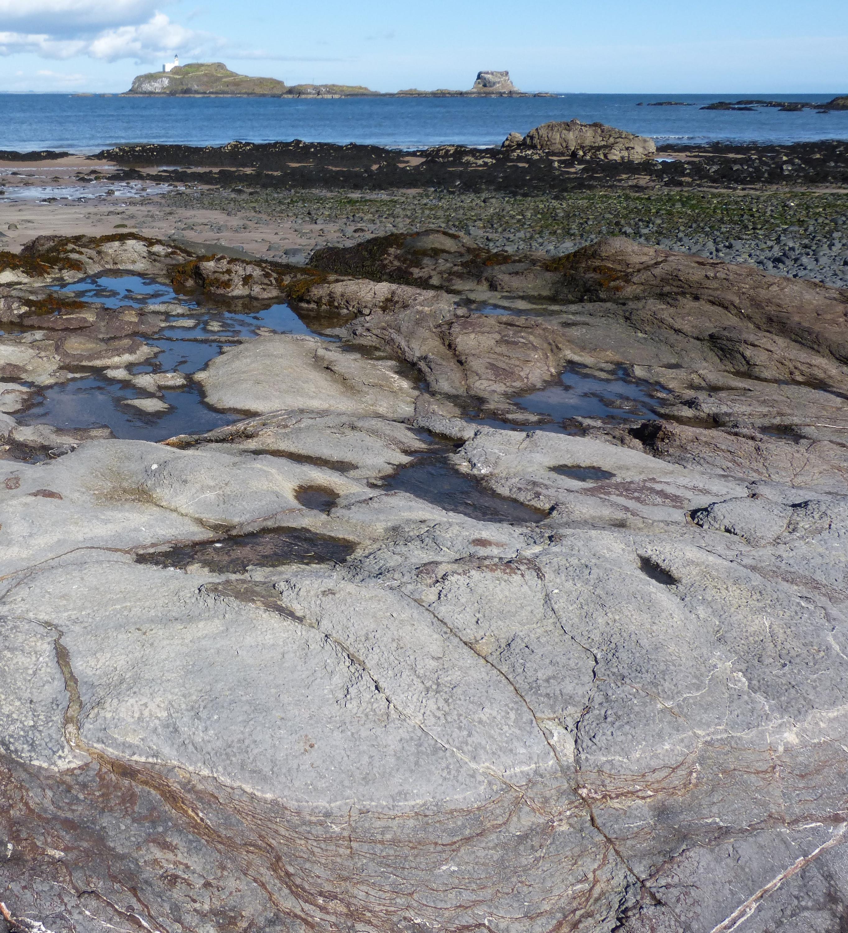
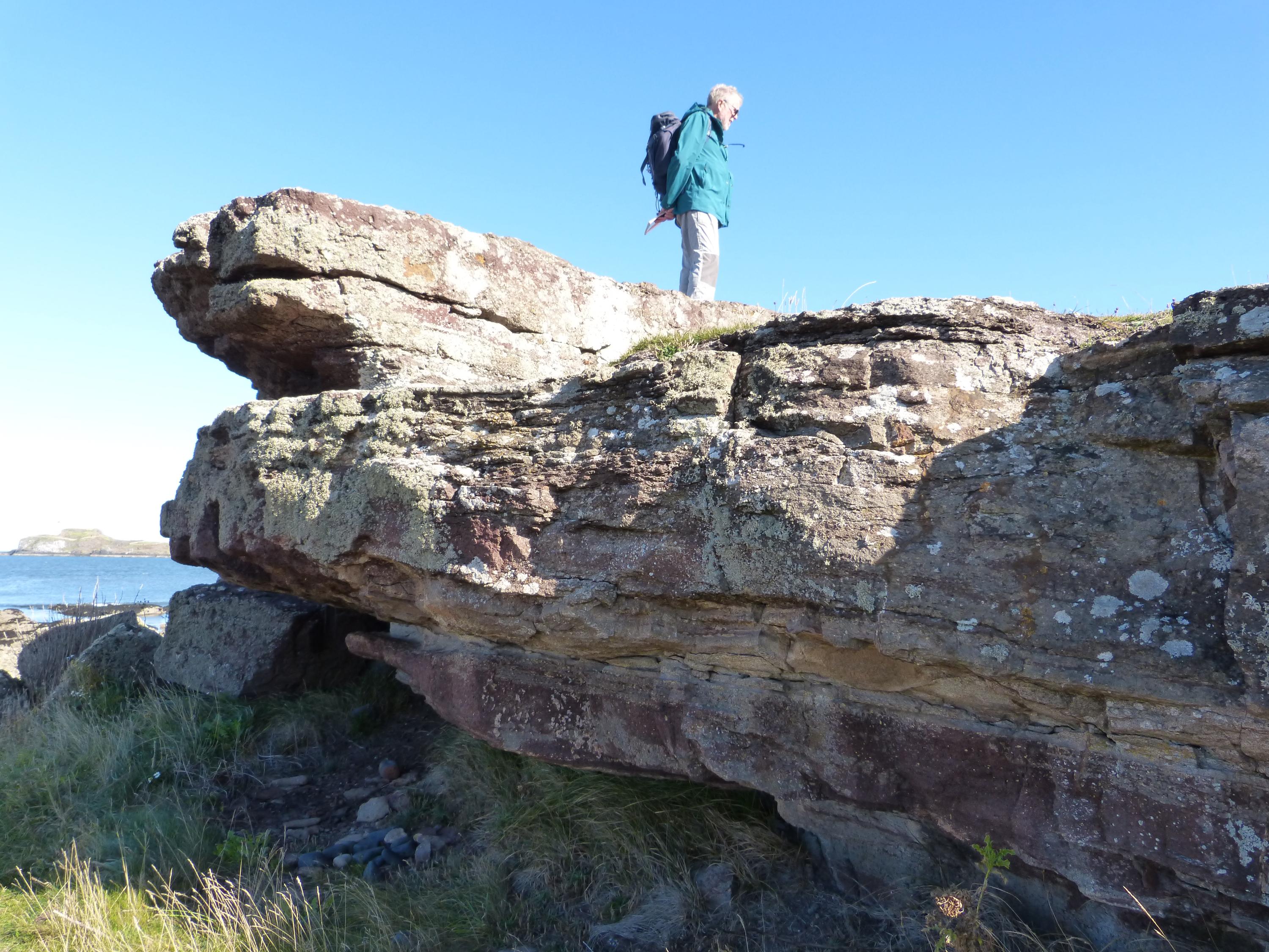
Markle basalt, named after the particular composition of a basalt found in a local quarry, forms the shore platform of the Longskelly Rocks and is well-exposed at low tide, with the island of Fidra in the background. The basalt contains small crystals of plagioclase feldspar within a fine-grained grey/green matrix. A close look showed the reddish crystals of altered olivines.
Alison Tymon
Sept. 28, 2025
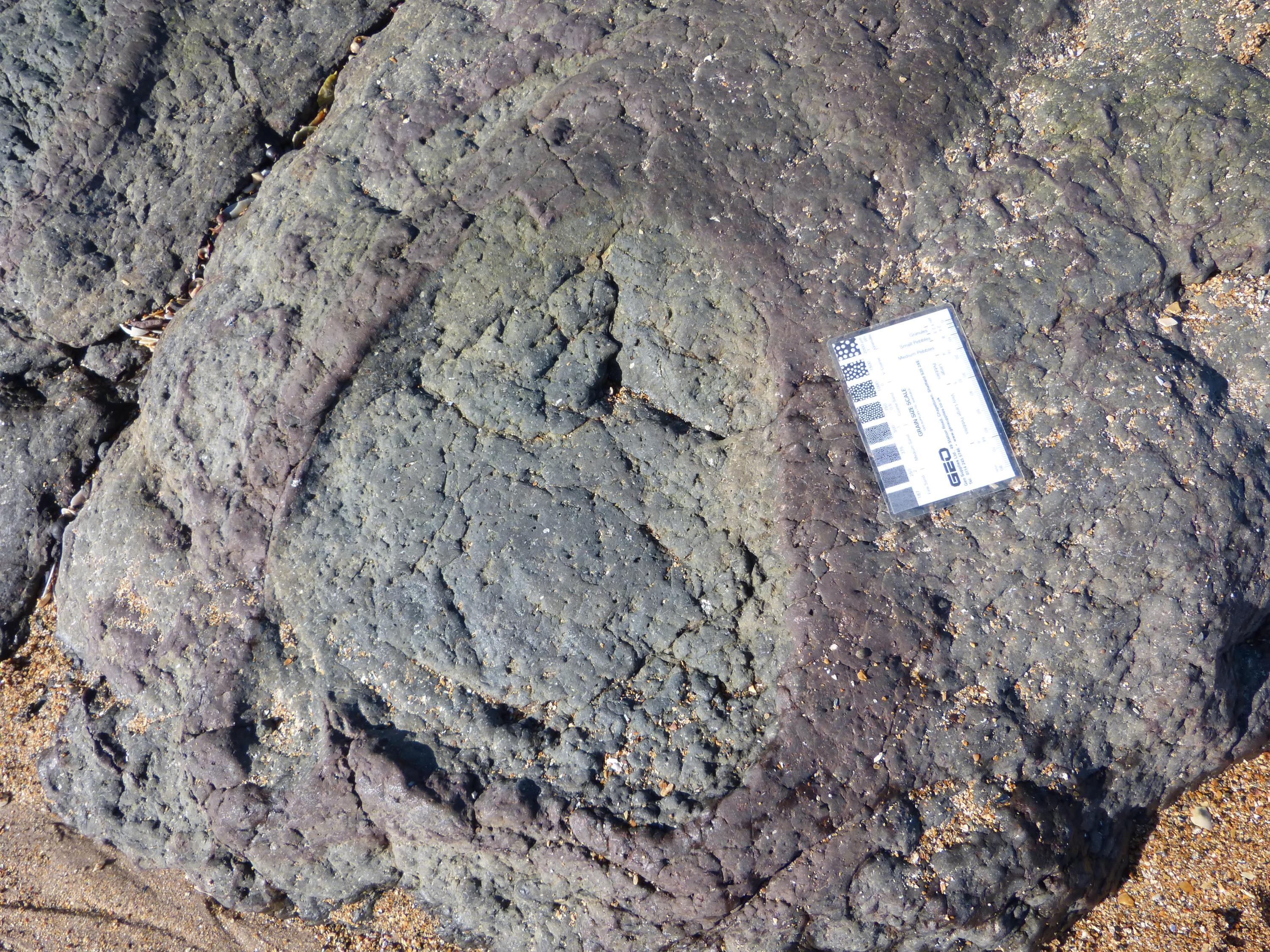
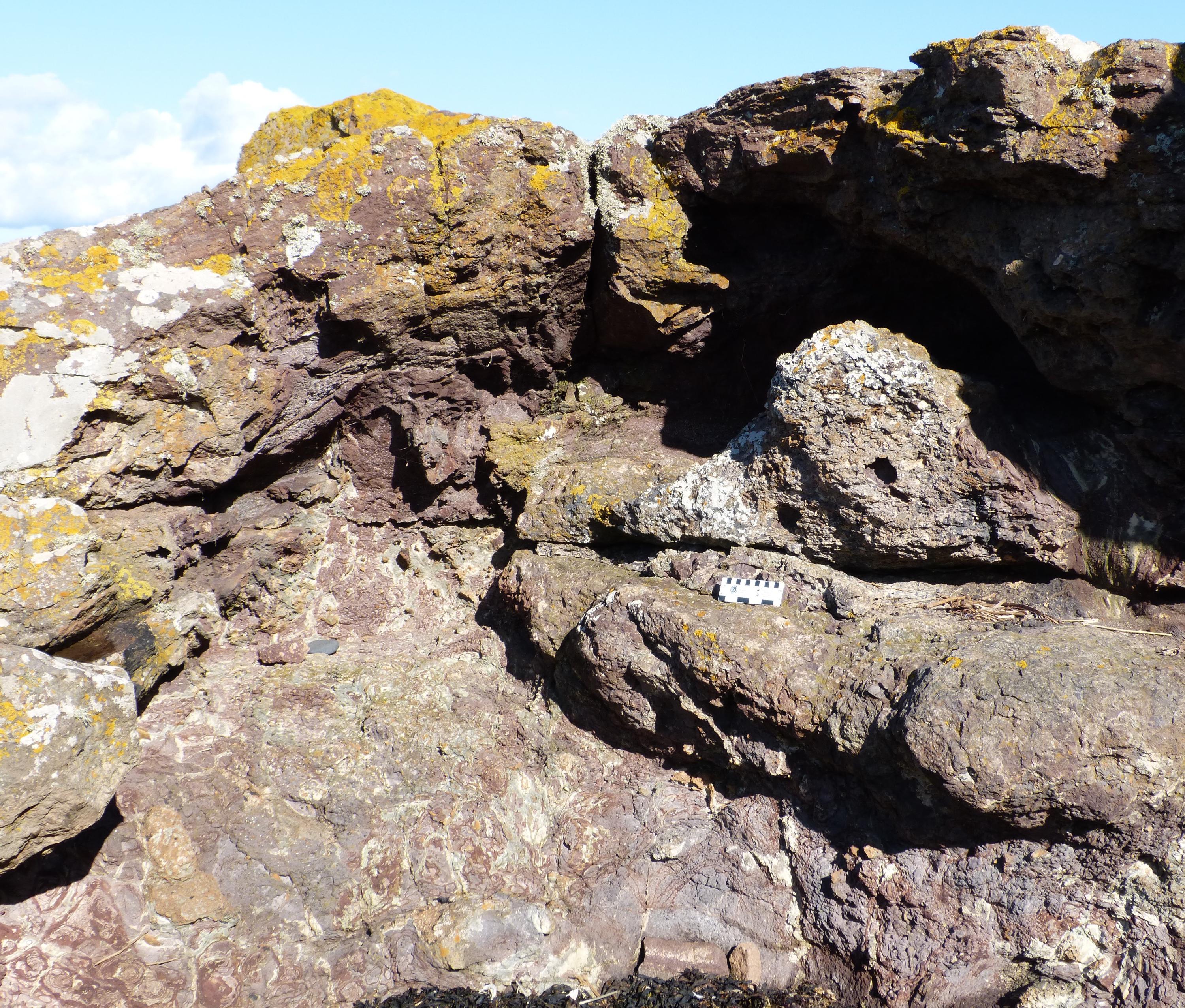
Within the basalts are sizeable rounded inclusions of the same basalt, surrounded by red reaction rims. These may be blocks of lava overrun by new lava flows, causing chemical changes in the minerals on the outside of the boulder. Scale card is 9 cm long.
Alison Tymon
Sept. 28, 2025
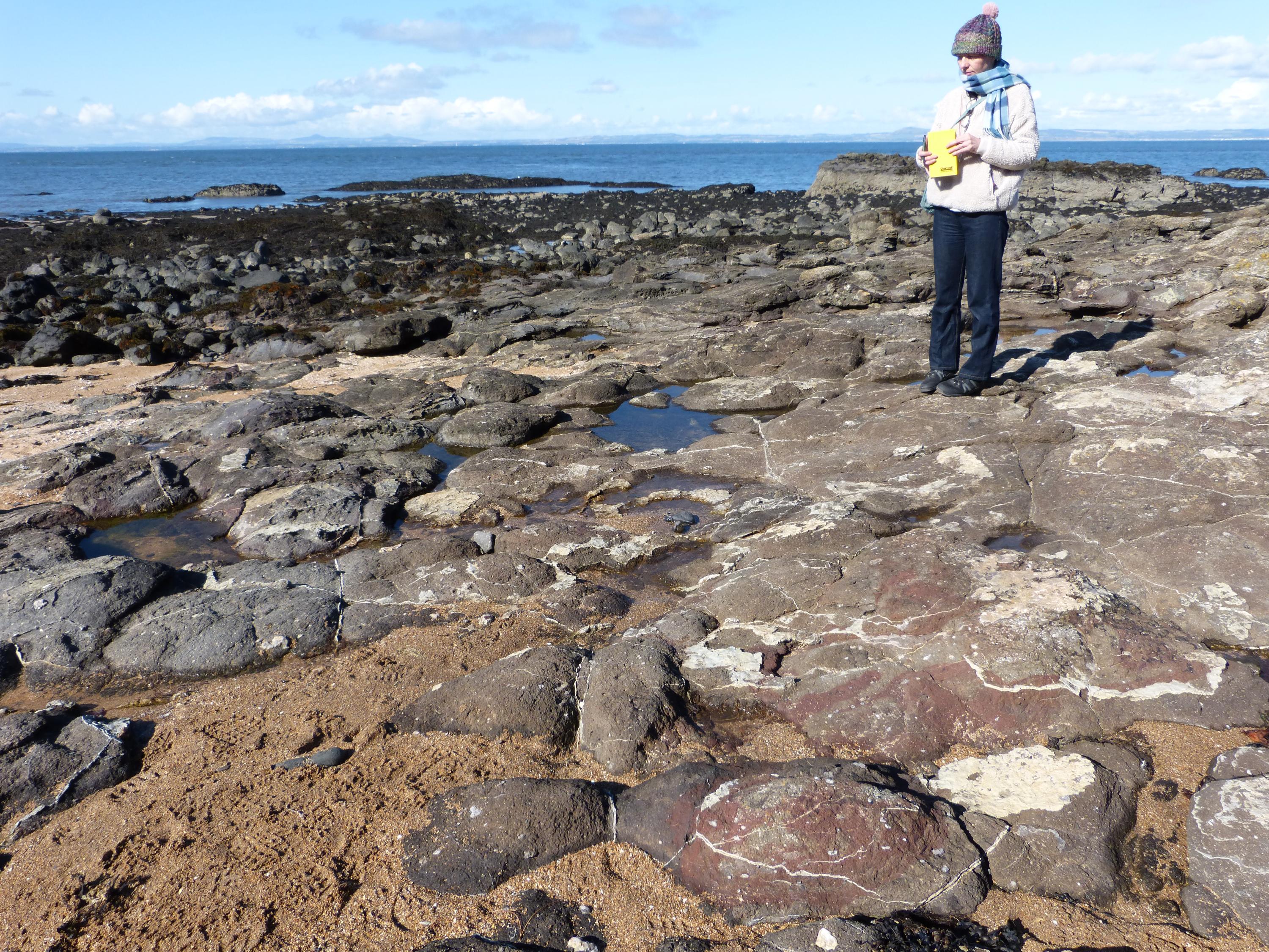
Markle basalt with thin quartz veins forms the bedrock, but boulders of basalt with large phenocrysts of plagioclase feldspar, such as the rock beside the yellow field notebook, are common.
Alison Tymon
Sept. 28, 2025
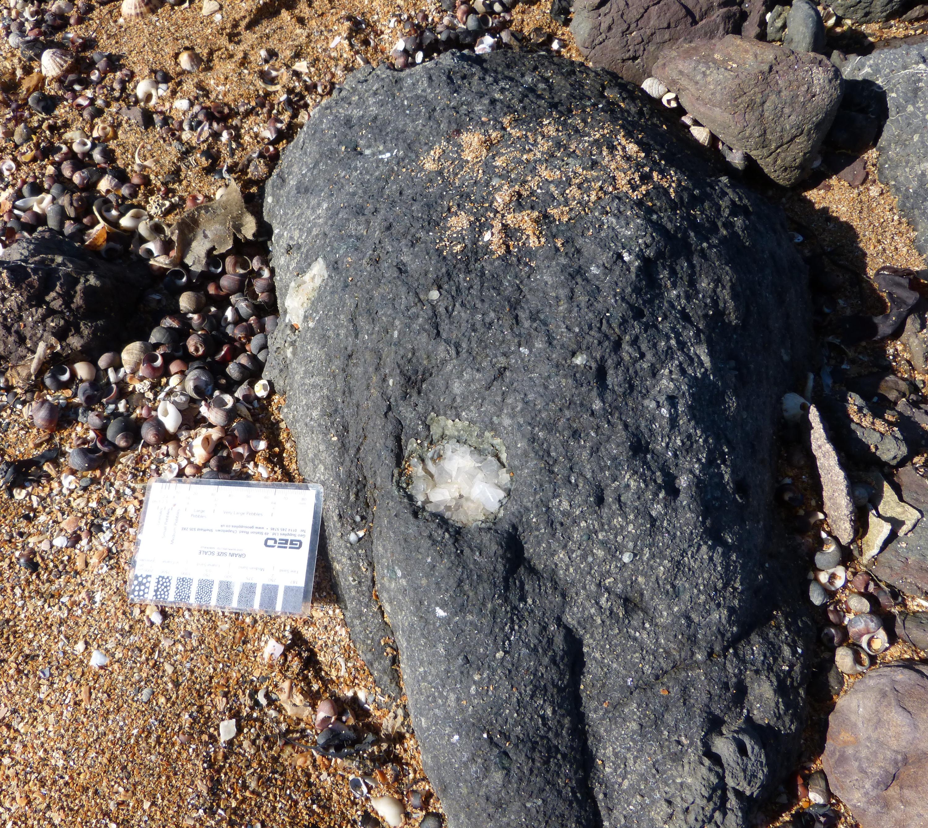
Vugs up to 5 cm across with calcite crystals can be seen in a boulder of dark basalt with phenocrysts of plagioclase feldspar. Scale card is 9 cm long.
Alison Tymon
Sept. 28, 2025
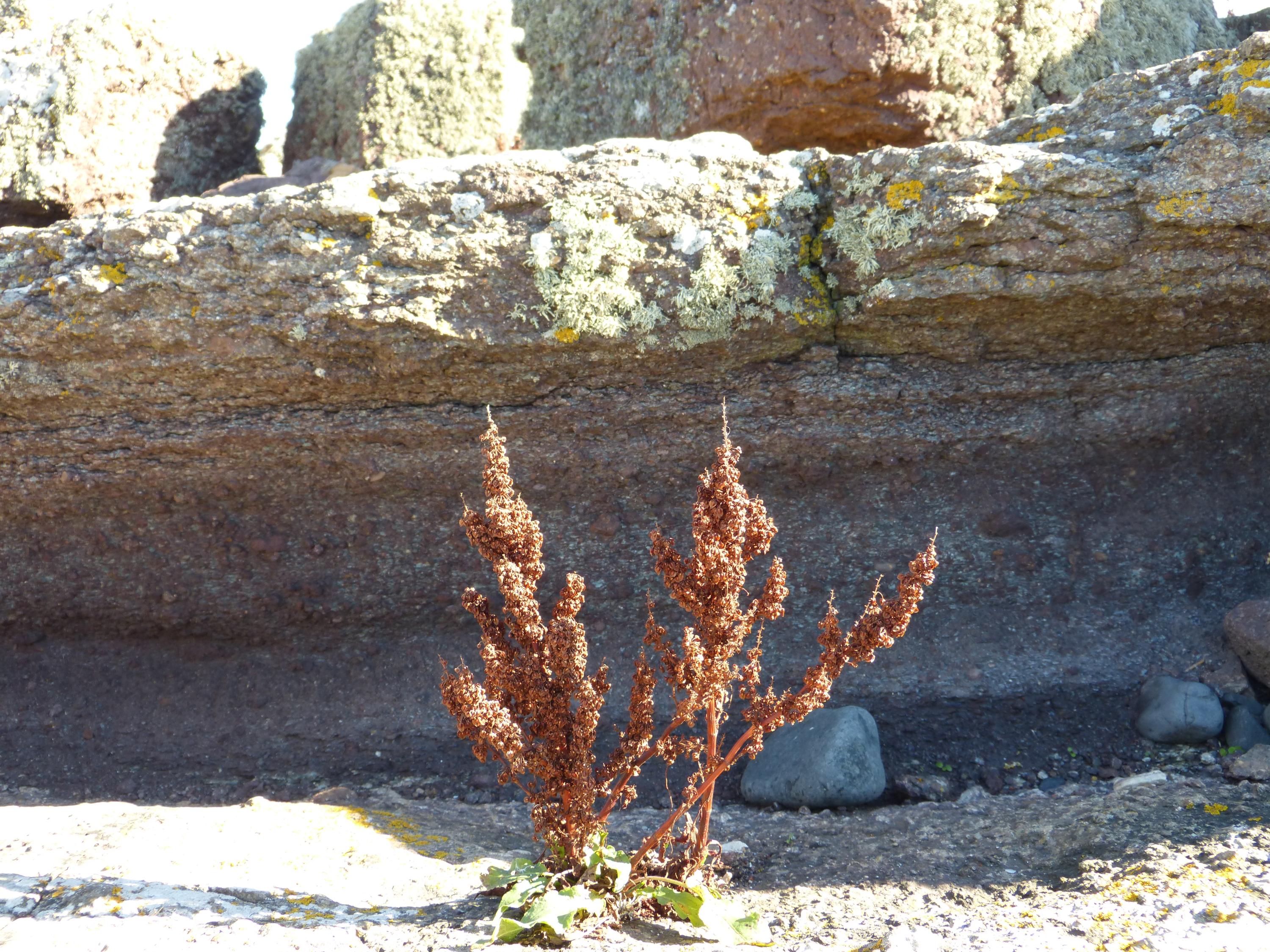
The Markle basalts at this exposure have thin irregular calcite-filled joints with many large calcite-filled vugs.
Alison Tymon
Sept. 28, 2025
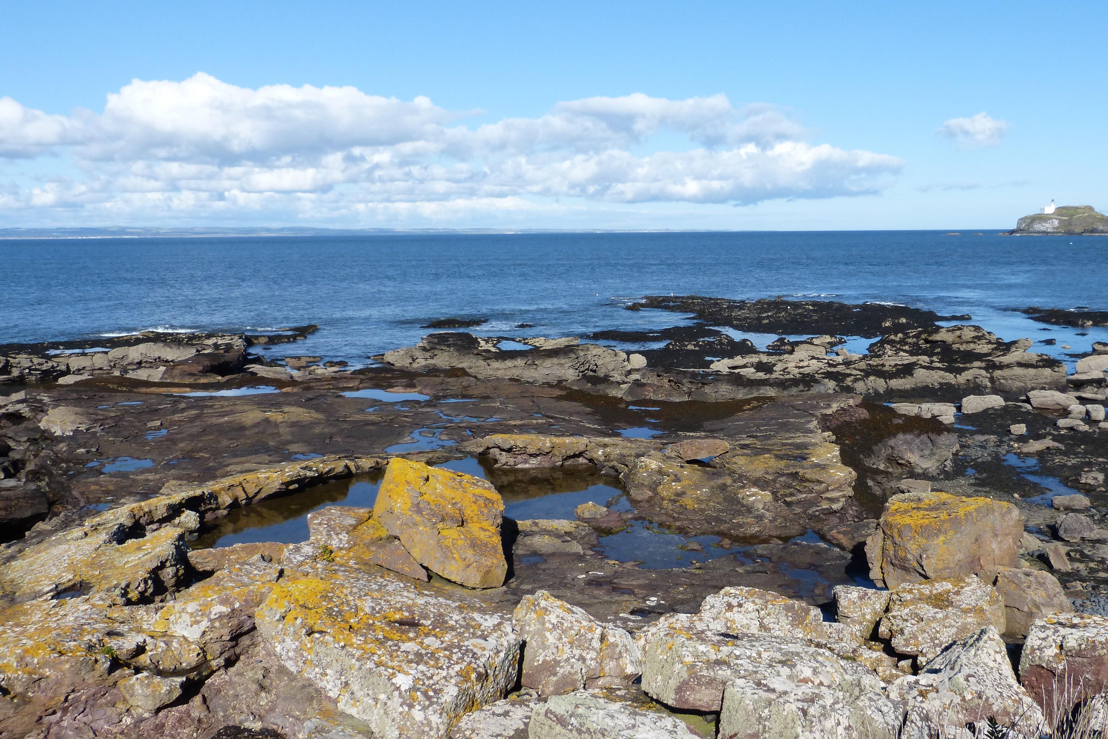
Mugearite, technically a basaltic trachyandesite named after a locality on the Isle of Skye, is a pale grey-purple fine-grained lava with fewer phenocrysts than the Markle basalts that form the shore platform in the distance. There are iron-rich calcite veins in places.
Alison Tymon
Sept. 28, 2025

This extraordinary exposure of mugearite lava is thought to show bleaching of the lavas, resulting in pale patches surrounded by networks of iron-rich calcite. It is thought to be the weathered top of a lava flow within the sequence. Field notebook is 20 cm long.
Alison Tymon
Sept. 28, 2025
At this well-studied exposure near Marine Villa, the curving planar surfaces beyond the yellow-lichened boulders in the foreground are thin layers of volcanic tuff overlying the irregular upper surface of a mugearite lava flow.
Alison Tymon
Sept. 28, 2025
The volcanic tuff lies above the highly irregular upper surface of the mugearite lava flow, above the scale card. Below the scale card, it appears that the mugearite has been highly altered and bleached in places, probably by movement of hot volatiles through the lava flow. Scale card is 13 cm long.
Alison Tymon
Sept. 28, 2025
Above the mugearite lava flow is a good exposure of volcanic tuff, of trachyte composition. The beds are regular which suggests that the volcanic ash had cooled in the atmosphere before it fell onto the lava flow.
Alison Tymon
Sept. 28, 2025
A close-up of the lowest section of the volcanic ash lying directly above the mugearite lava shows the variation in sizes of the material, which includes coarse sand-sized particles as well as small pebbles.
Alison Tymon
Sept. 28, 2025