Cullen to Whitehills
Local Geodiversity site | Aberdeenshire
Local Geodiversity site | Aberdeenshire
Scotland's geosites are chosen because of their local, national or international importance. Take only photos, leave only footprints: avoid causing any damage to this site. You can walk almost anywhere in Scotland without the need to ask permission or keep to paths, but you have a responsibility to care for your own safety, to respect people's privacy and peace of mind and to cause no damage.
The right of access does not extend to quarries, building sites or any land where public access is prohibited, or to the collection of geological samples.
Coastline with maritime grassland, steep cliffs and rocky intertidal shores. Important for diversity of plants and invertebrates. Old Red Sandstone cliffs. Boyne Quarry has exposures of glacial and interglacial features.
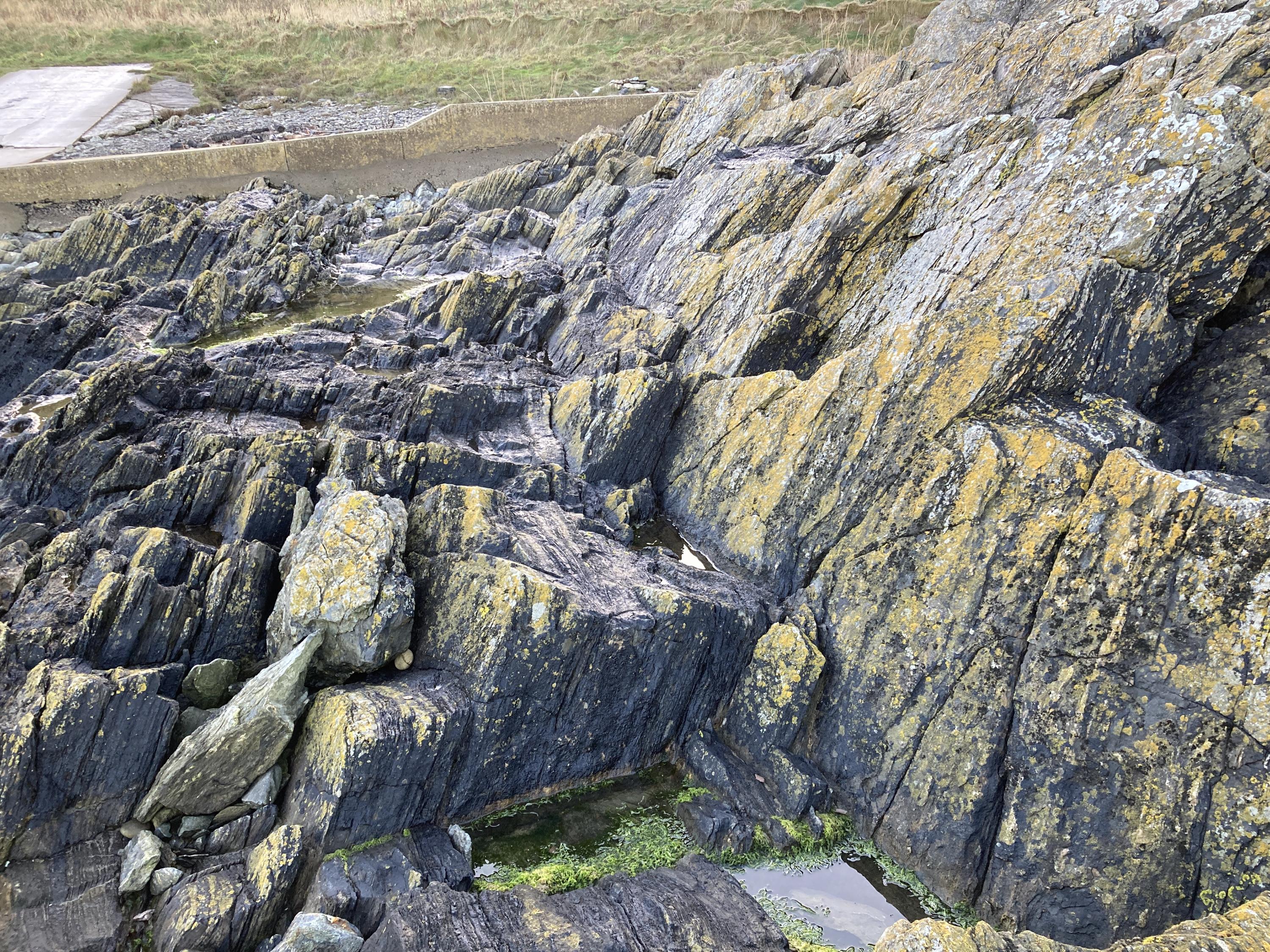
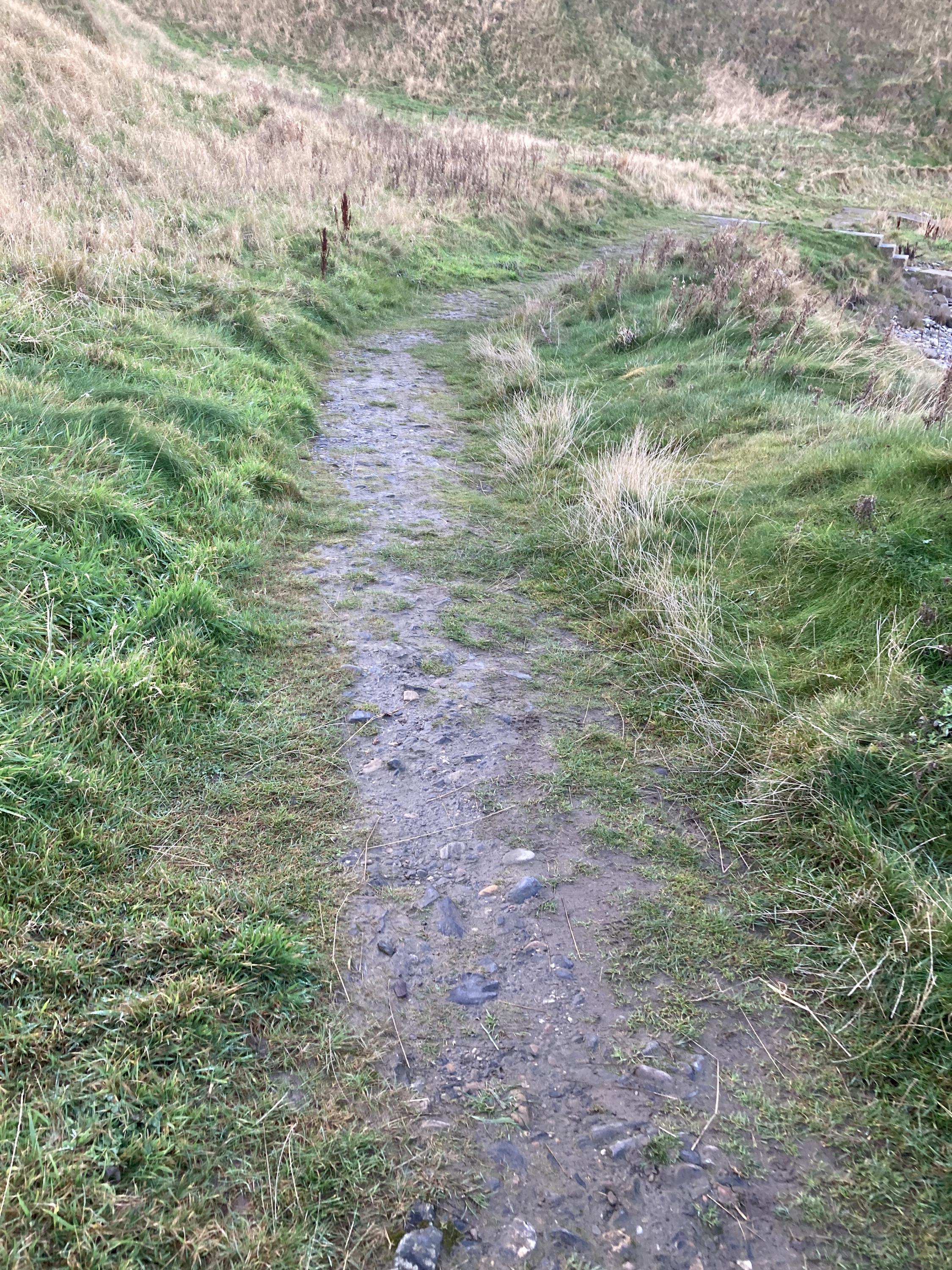
Old Hythe Bay and most of Boyne Bay are only accessible at low tide. Park at the end of the road to the quarry where the signposts say "no unauthorised persons": there is a footpath track right alongside the quarry road which is well maintained and mown, with gates, and takes you all the way to a set of rocks that act like stairs down to the bay, though they are slippery.
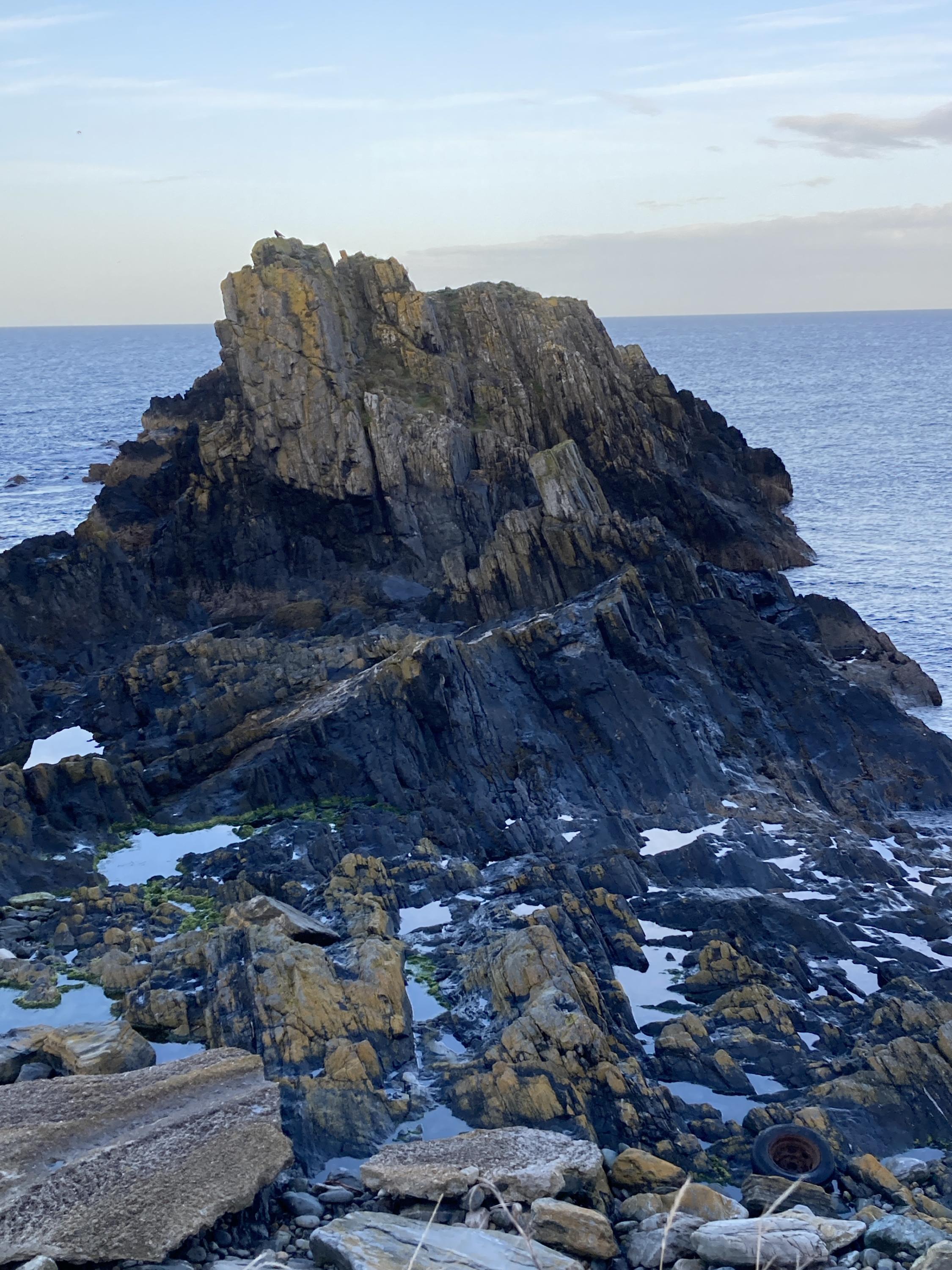
Old Hythe Bay is accessed by following path past Boyne Quarry to Boyne Bay. From the beach a short scramble westwards over a grassy knoll allows access to Old Hythe Bay, not suitable for anyone with disabilities.
The disused Lido to the West of Portsoy is readily accessible from a well-maintained road and spacious car park from which there is a great view of the sheer.
There is a very descriptive itinerary for a visit to this area from Aberdeen Geological Society: THE DALRADIAN OF THE PORTSOY AREA by J. P. CARTY & T. E. JOHNSON https://www.aberdeengeolsoc.org.uk/wp-content/uploads/2018/10/03-Portsoy.pdf
https://www.scottishgeologytrust.org/geology/51-best-places…
The impressive Portsoy Sheer is documented on the Scottish Geology Trust website.
There are many amenities in the nearby Whitehills, including a fish and chip shop.
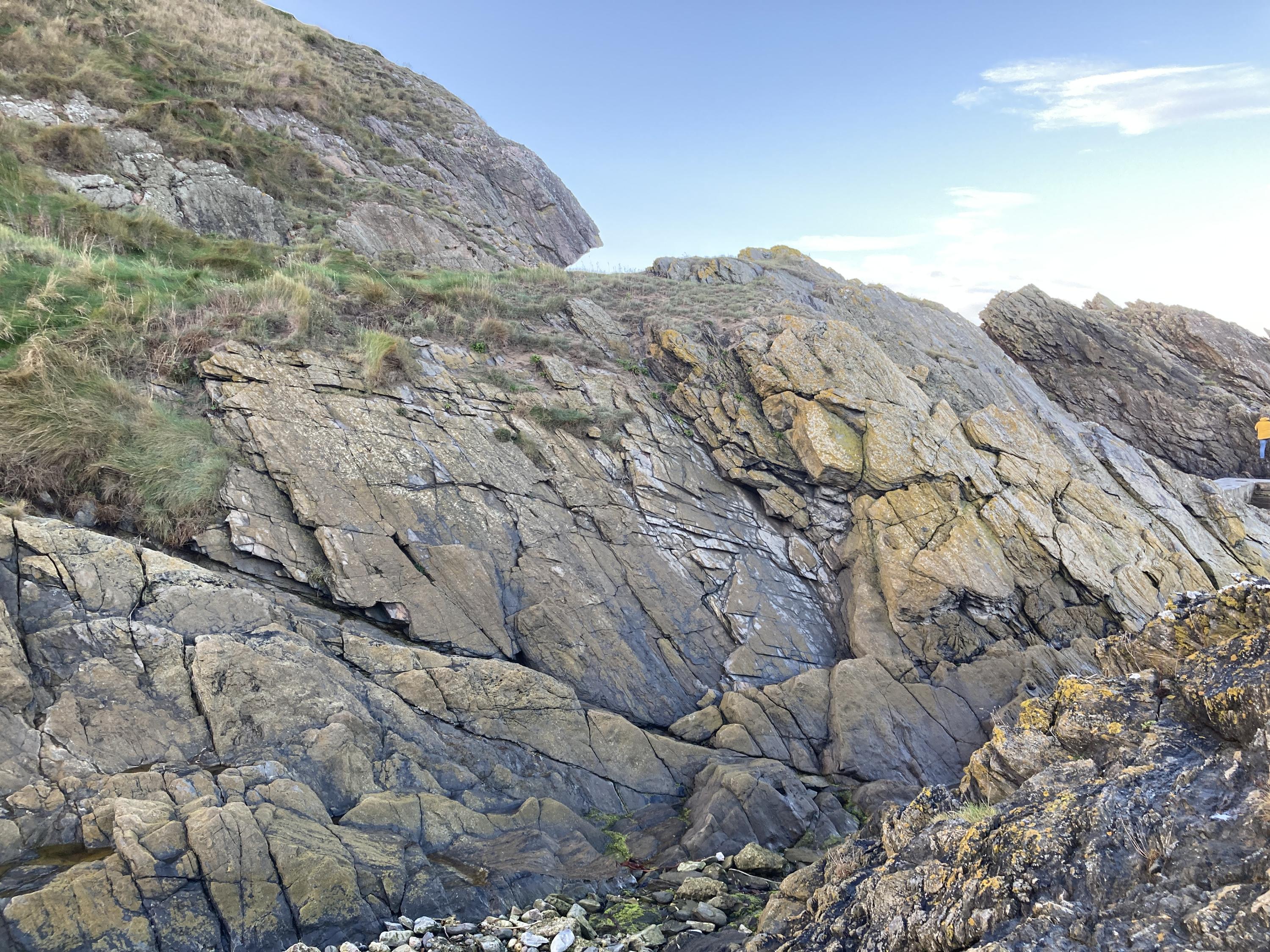
There are many tussocks and slippery rocks when you climb the grassy headland from Boyne Bay to Old Hythe Bay, and it is very steep and the track is barely visible. Giant Hogweed was also seen on the path next to the quarry road.
There are many tussocks and slippery rocks when you climb the grassy headland from Boyne Bay to Old Hythe Bay, and it is very steep. Giant Hogweed was also seen on the path next to the quarry road.
Use caution around the disused lido to the West of Portsoy - many of the rocks are very slick, and rotting seaweed can create a sulphuric scent, towards the northern end of the lido.
There are no site highlights yet.
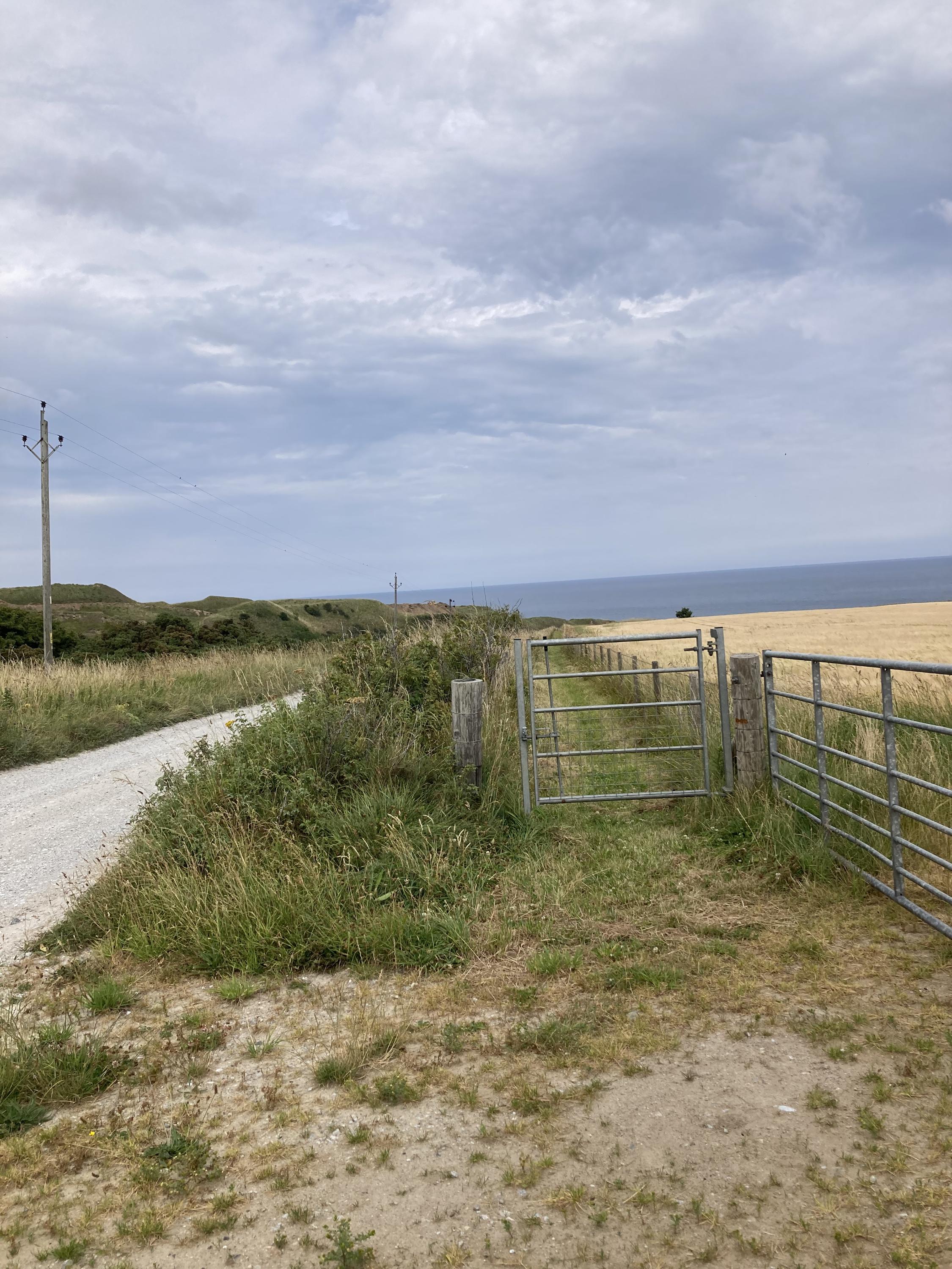
The gated path adjacent to the quarry road, about half way from the car to the bay. Quarry road is out of bounds to unauthorised people but the pathway was well maintained and continues all the way to give access to the bay. The distance from parking to bay is about 800m and is fairly level, though with a sleep, slippery, rock "staircase" at the end.
Rowan Barnes
July 19, 2025
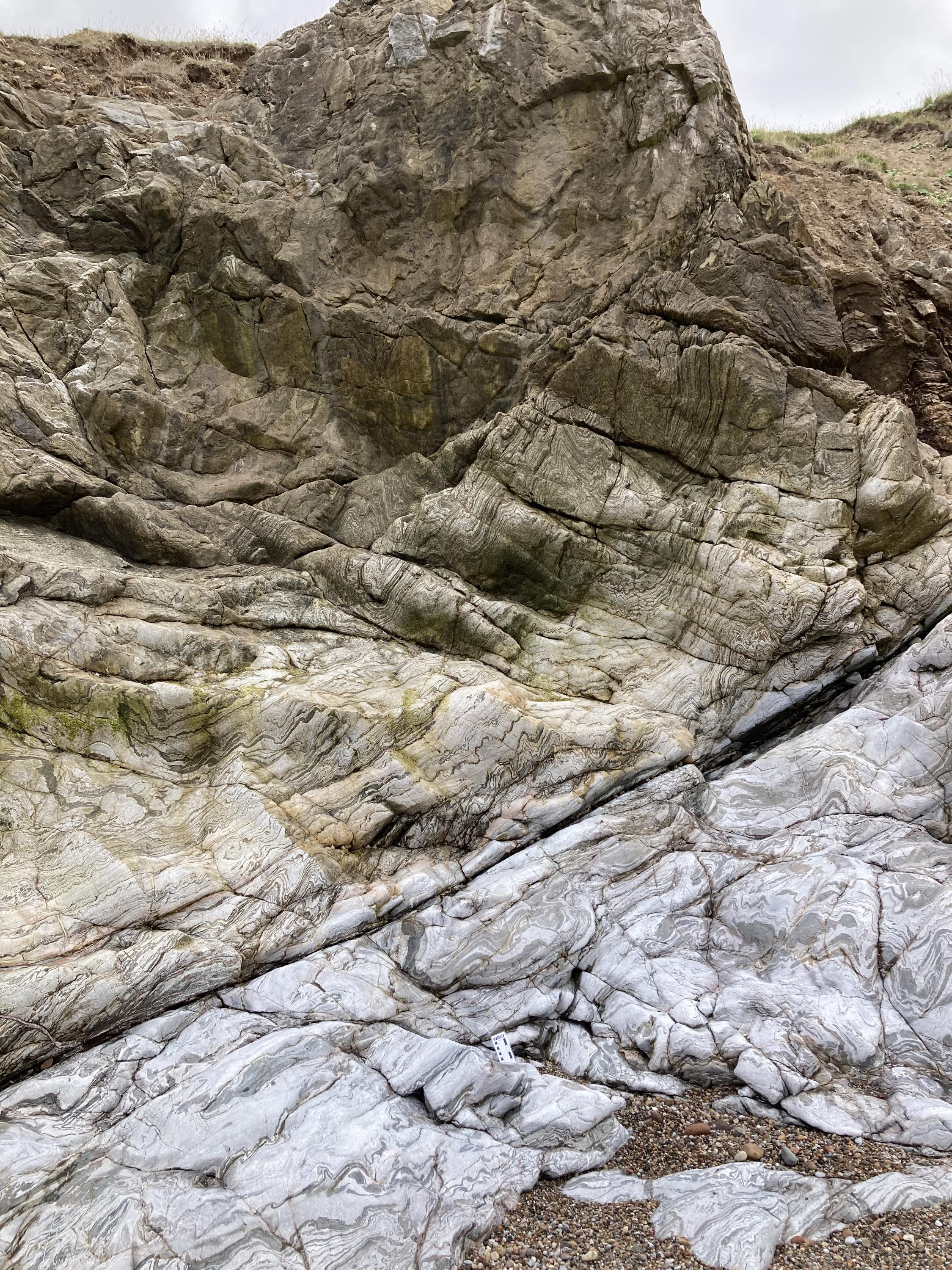
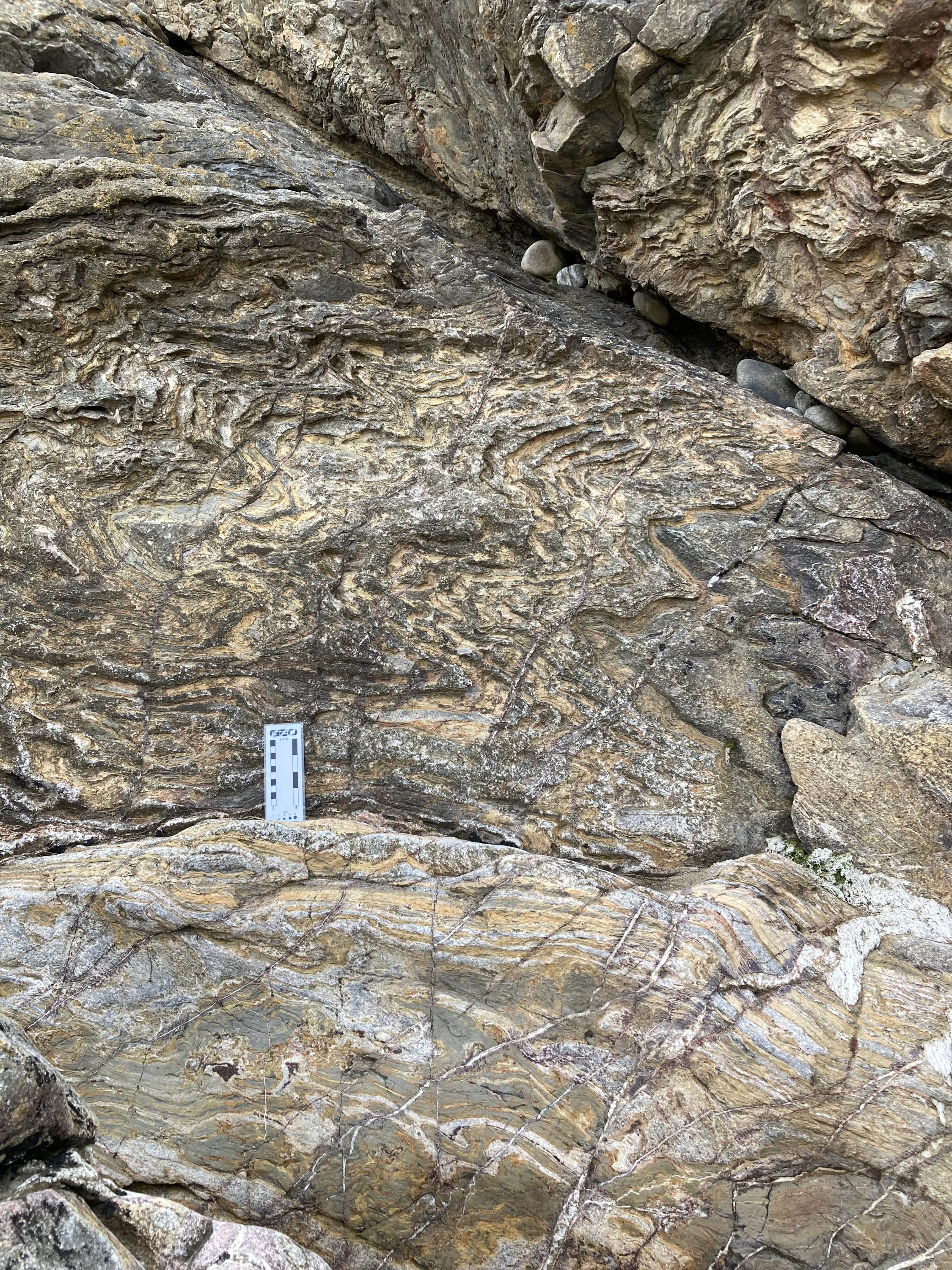
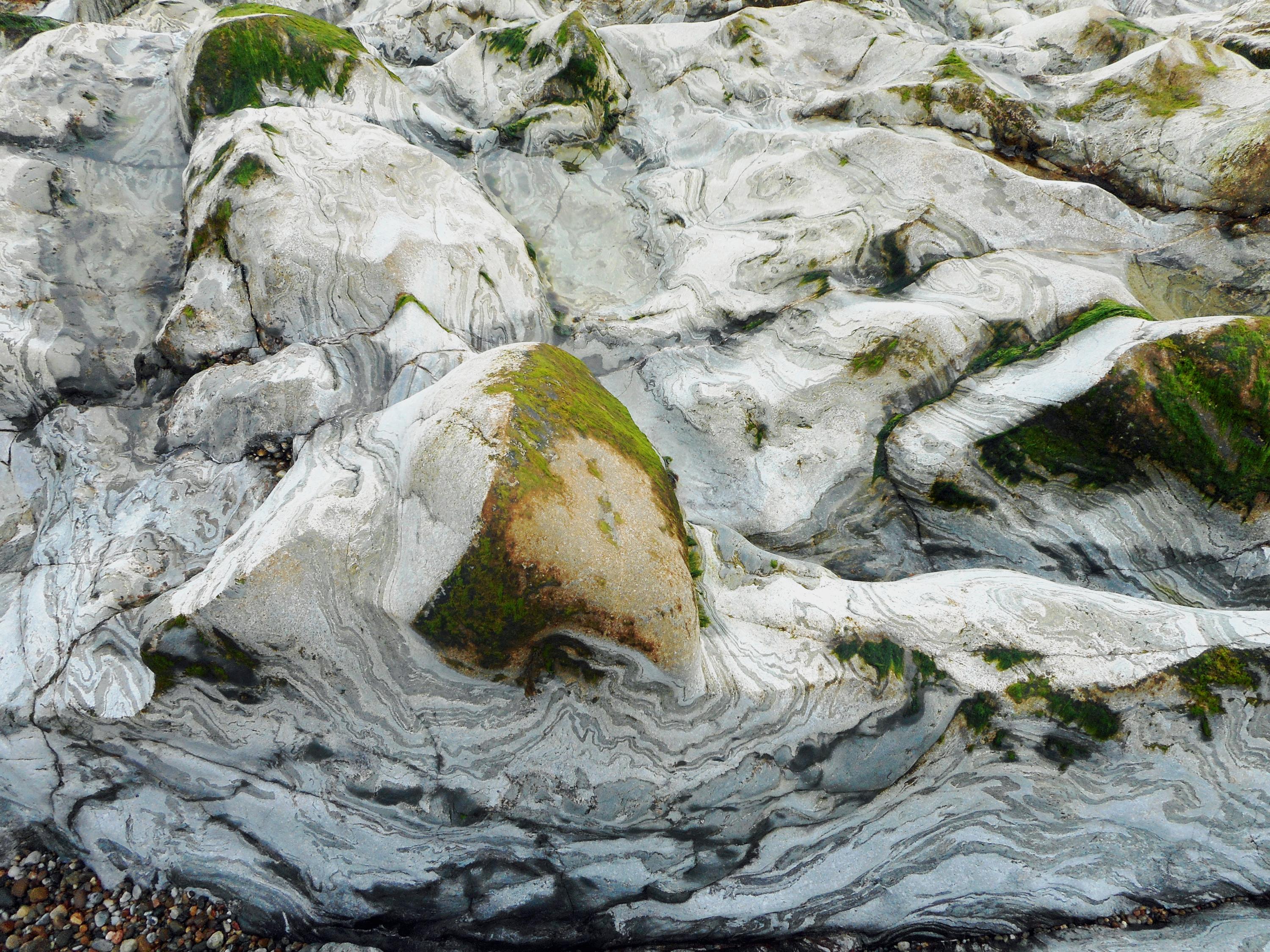
Wide shot of weathered folded limestone, card for scale at foot of photo, Old Hythe Bay east of Portsoy.
Rowan Barnes
July 19, 2025
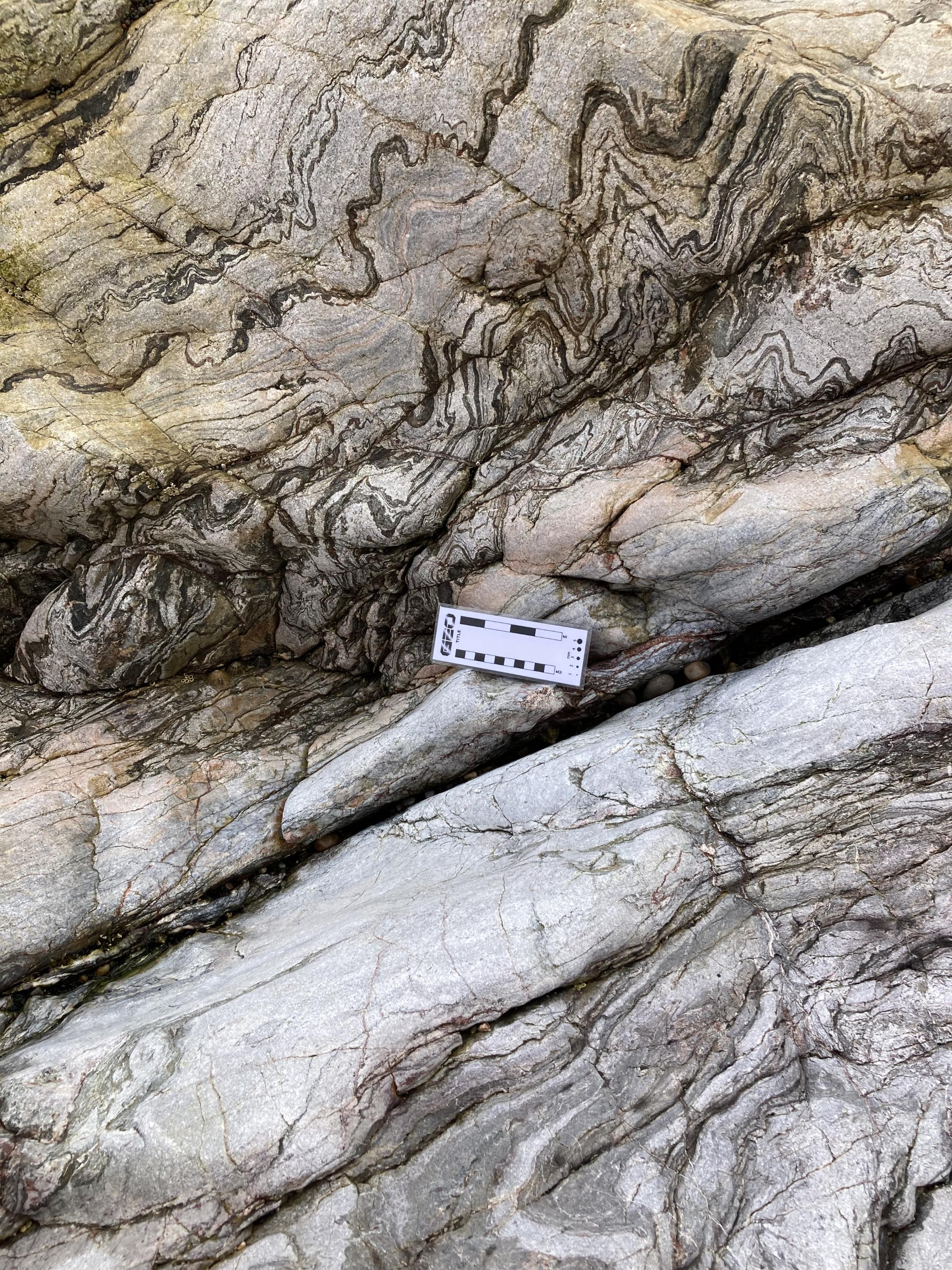
Beautiful folds in limestone. Card for scale. Old Hythe Bay, east of Portsoy.
Rowan Barnes
July 19, 2025
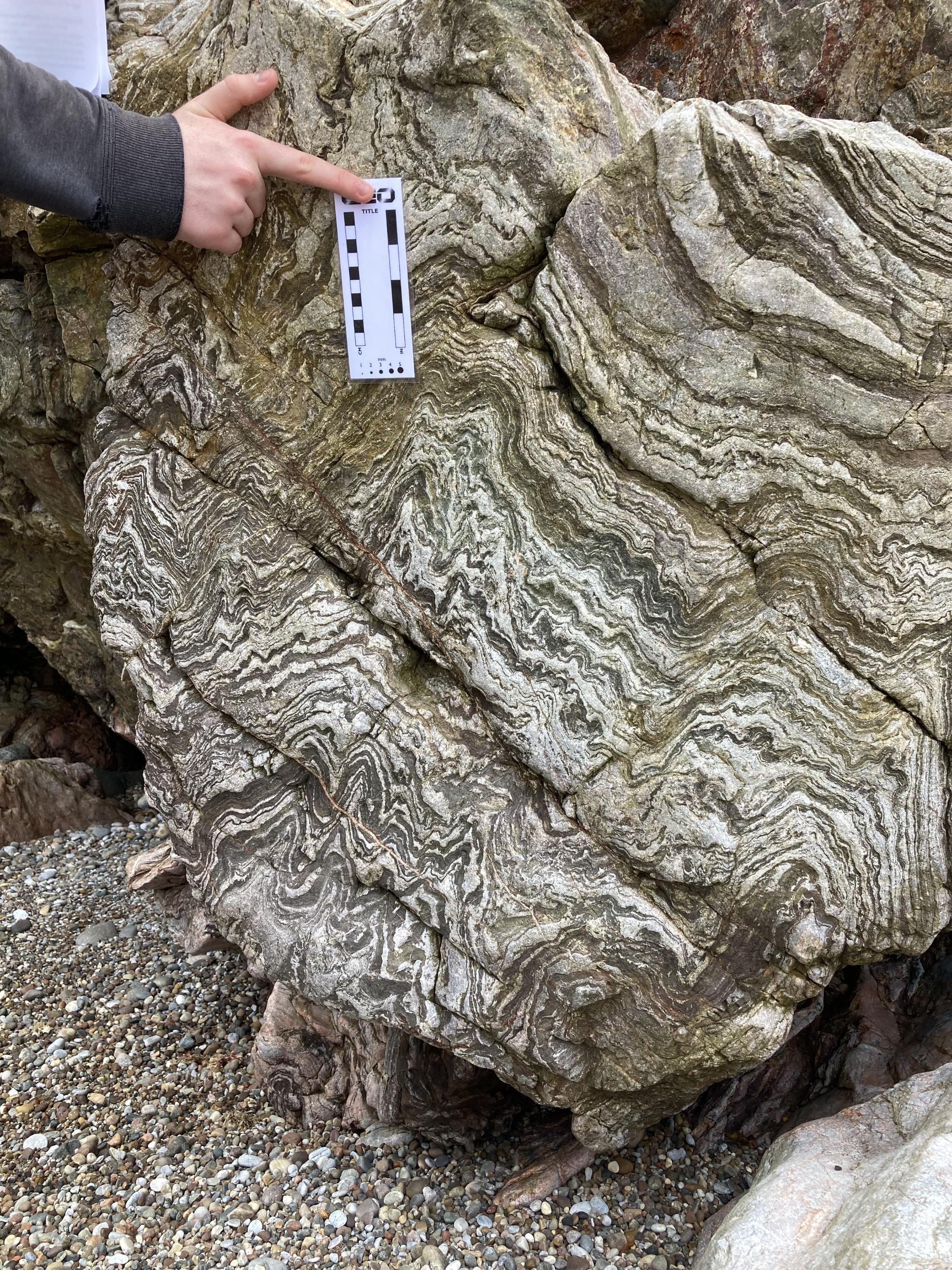
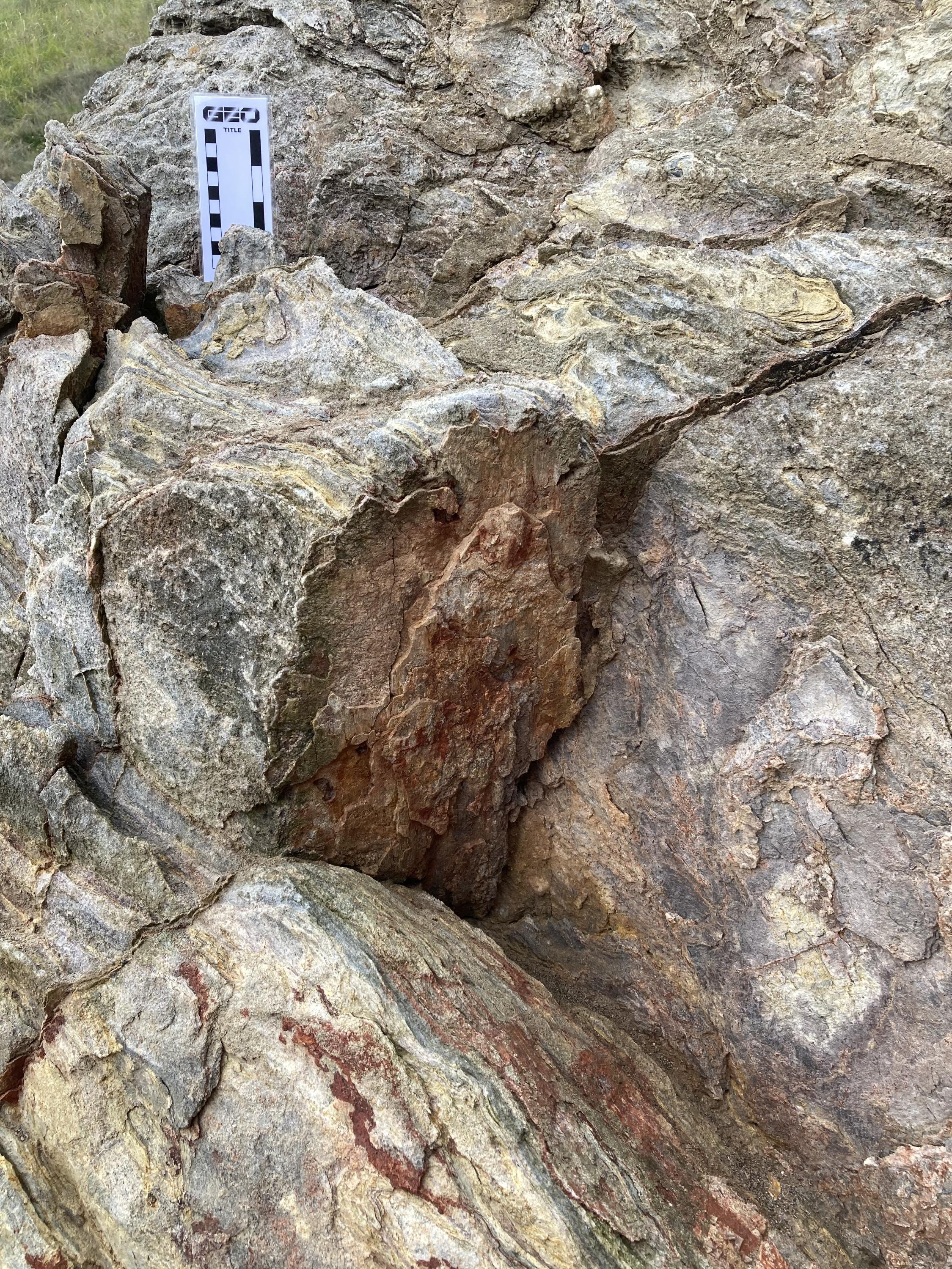
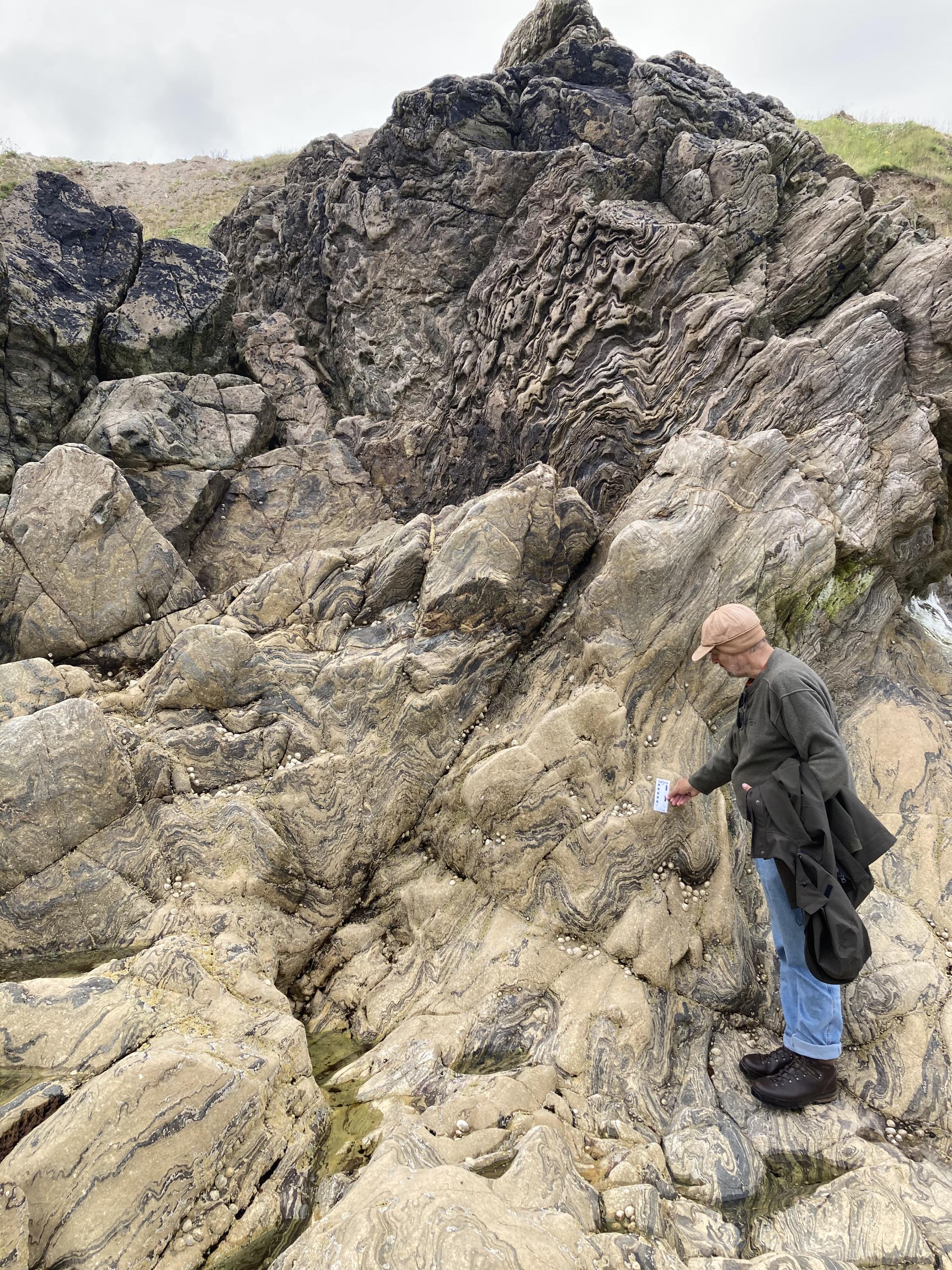
Lots of folds in country rock that jutted out like a boulder. Card for scale.
Rowan Barnes
July 19, 2025
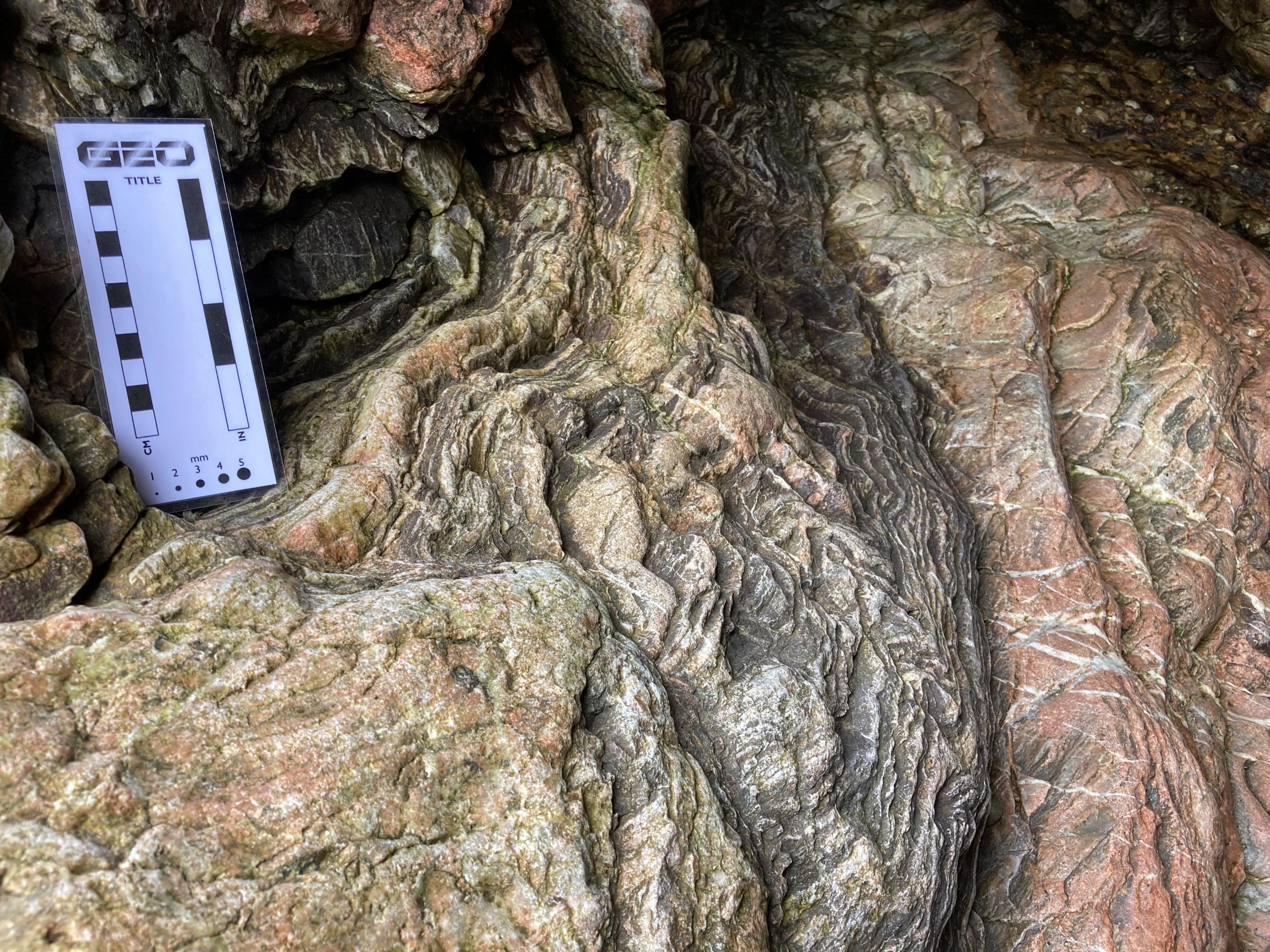
Shot near ground level, in a recessed inlet. East of Portsoy, in Old Hythe Bay, the south side. Card for scale.
Rowan Barnes
July 19, 2025
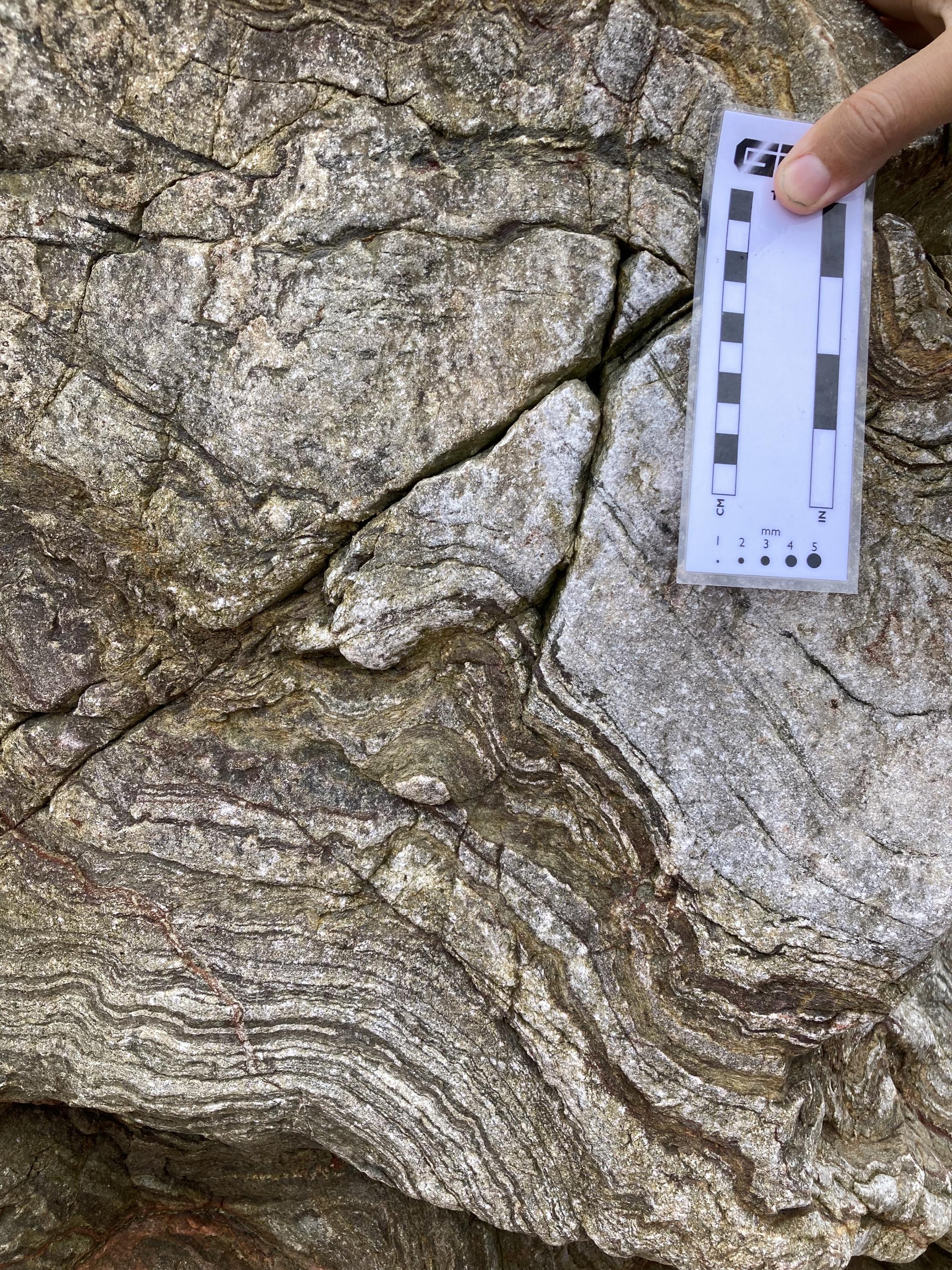
East of Portsoy, in Old Hythe Bay, the south east side. Close up of coarse grains and folds. This photo is about 5ft off the ground, above the inlet pictured above. Card for scale.
Rowan Barnes
July 19, 2025
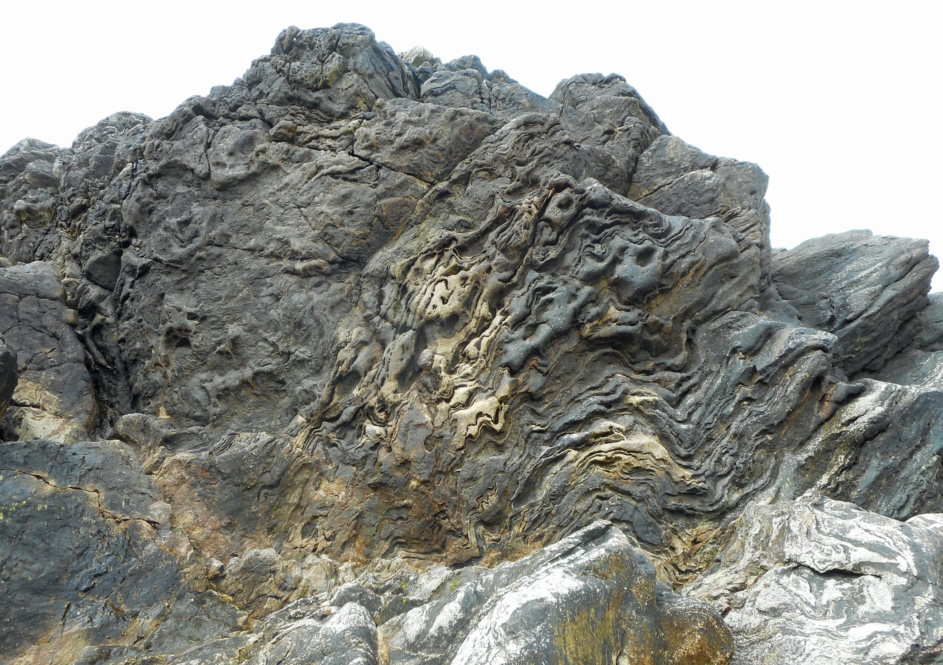
East of Portsoy, in Old Hythe Bay, the south east side.
Rowan Barnes
July 19, 2025
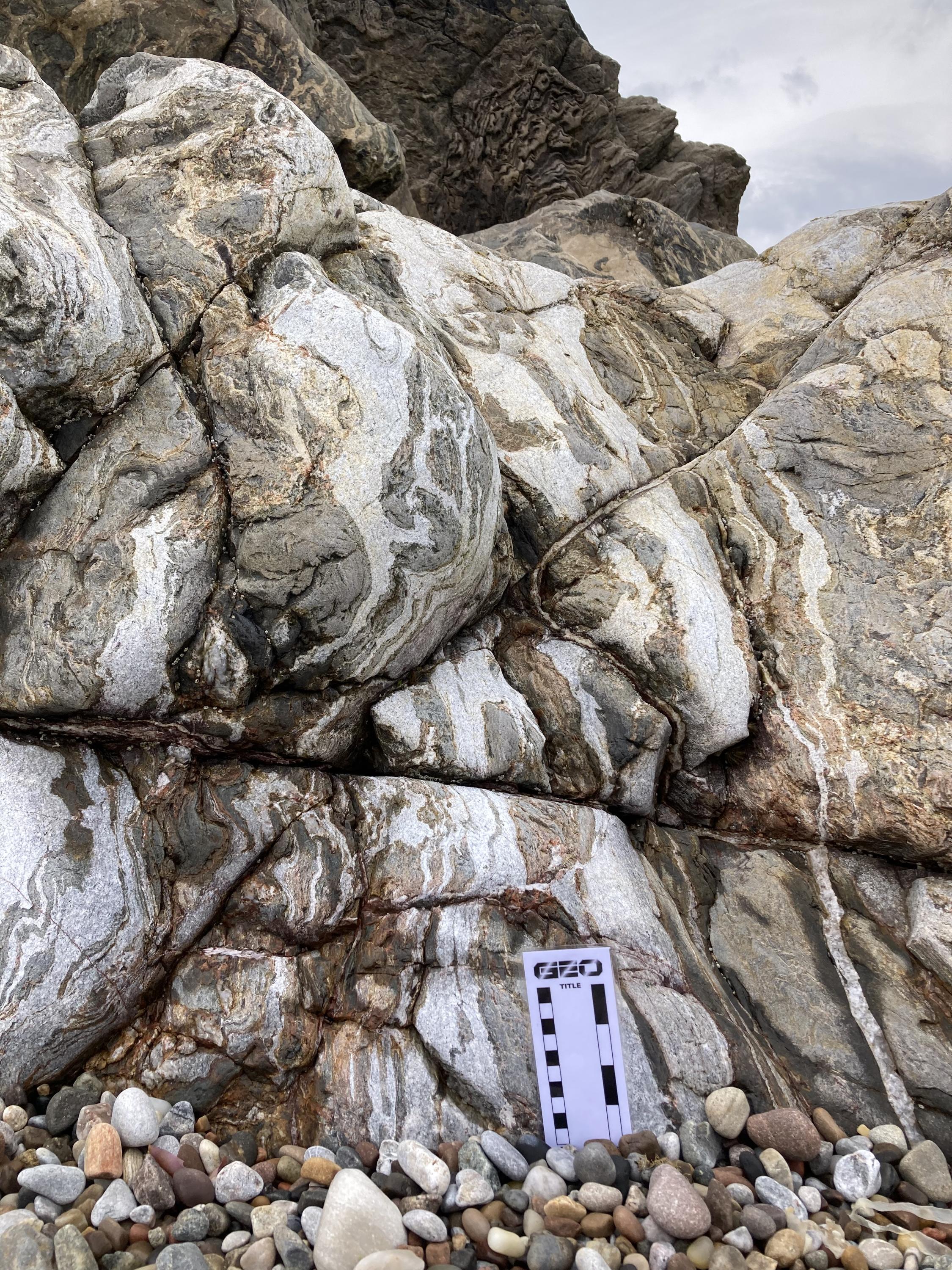
The north west end of Boyne Bay, east of Portsoy, with the quarry SW of this position. Card for scale.
Rowan Barnes
July 19, 2025
The north west end of Boyne Bay, east of Portsoy, with the quarry SW of this position. Card for scale.
Rowan Barnes
July 19, 2025
The north west end of Boyne Bay, east of Portsoy, with the quarry SW of this position. Card for scale.
Rowan Barnes
July 19, 2025
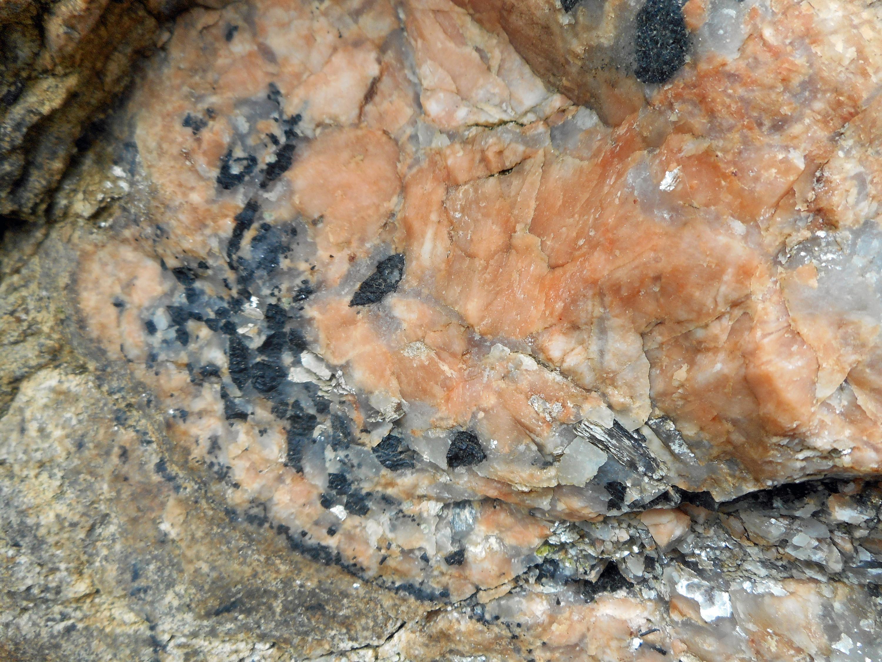
Tourmaline mineralisation in pegmatite. East Head, east of Portsoy.,
Dave Longstaff
Dec. 15, 2024

Dalradian aged pothole filled with ORS breccia.
Dave Longstaff
Dec. 16, 2024
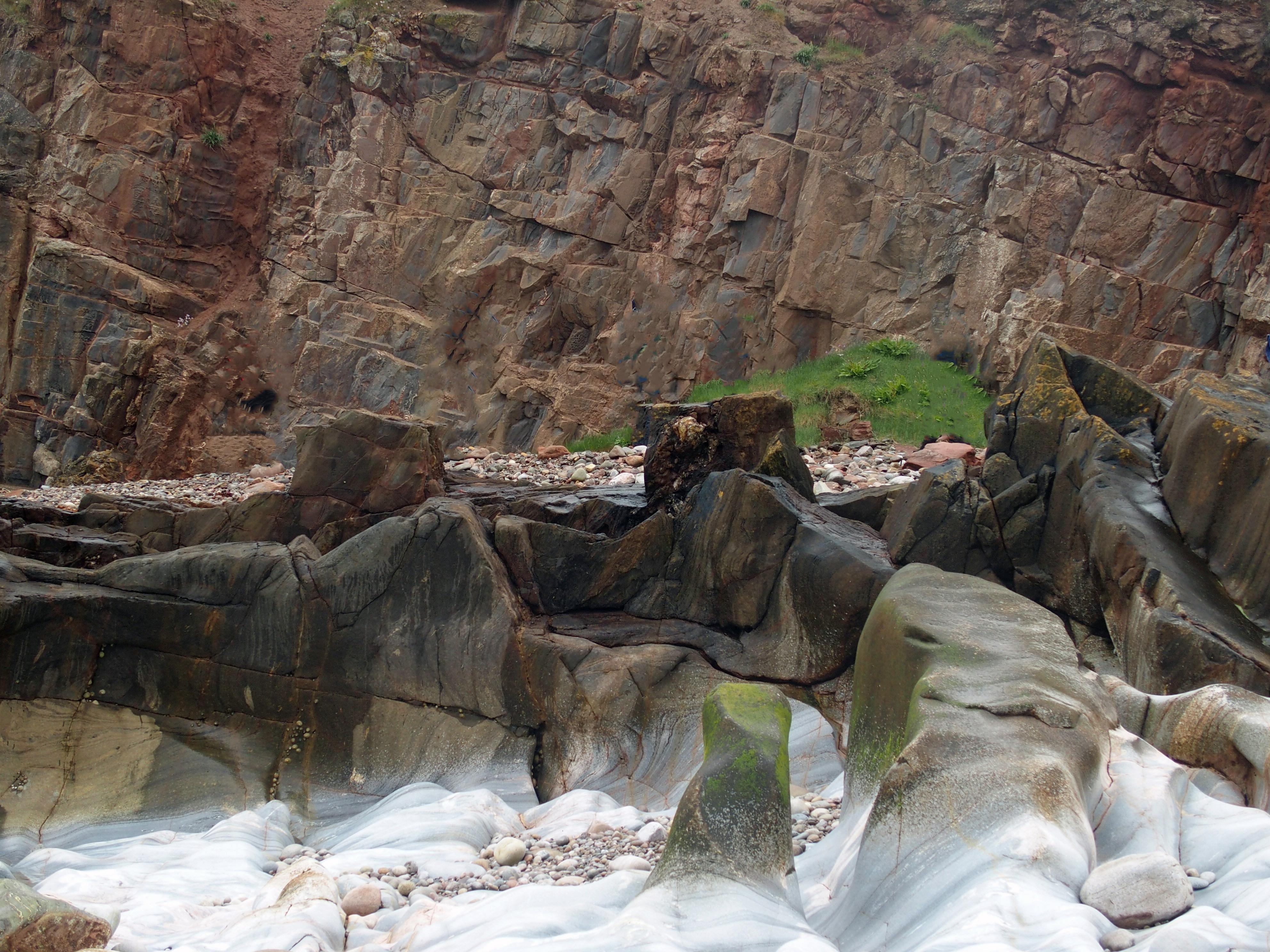
East side Sandend Bay, Red Haven. ORS unconformably sat on Fordyce Limestone Formation.
Dave Longstaff
June 9, 2016
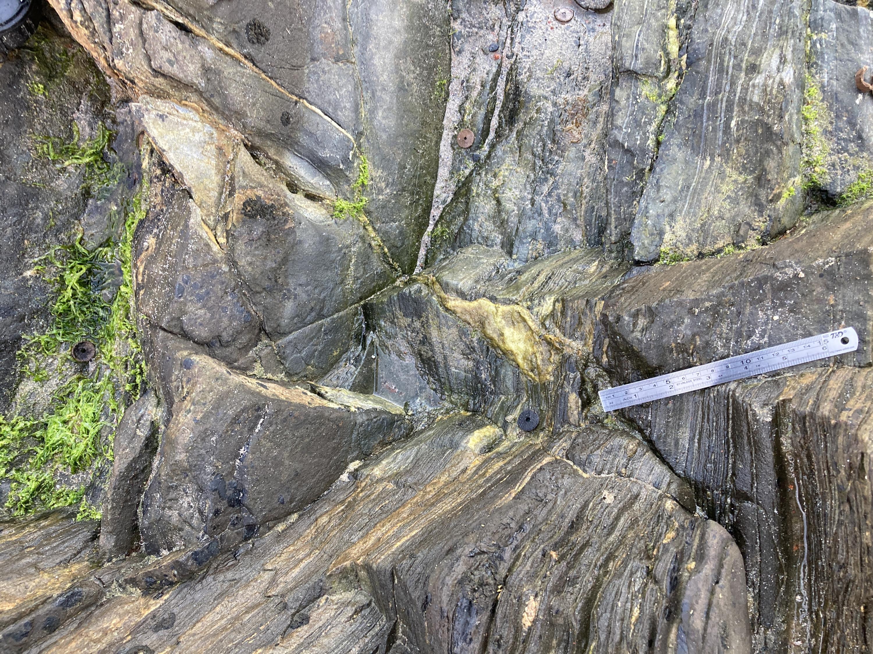
Folded and refolded metalimestones, calcareous semipelites and calc-silicate beds, Boyne Castle Limestone Member. SE side of Old Hythe Bay.
Dave Longstaff
June 9, 2016
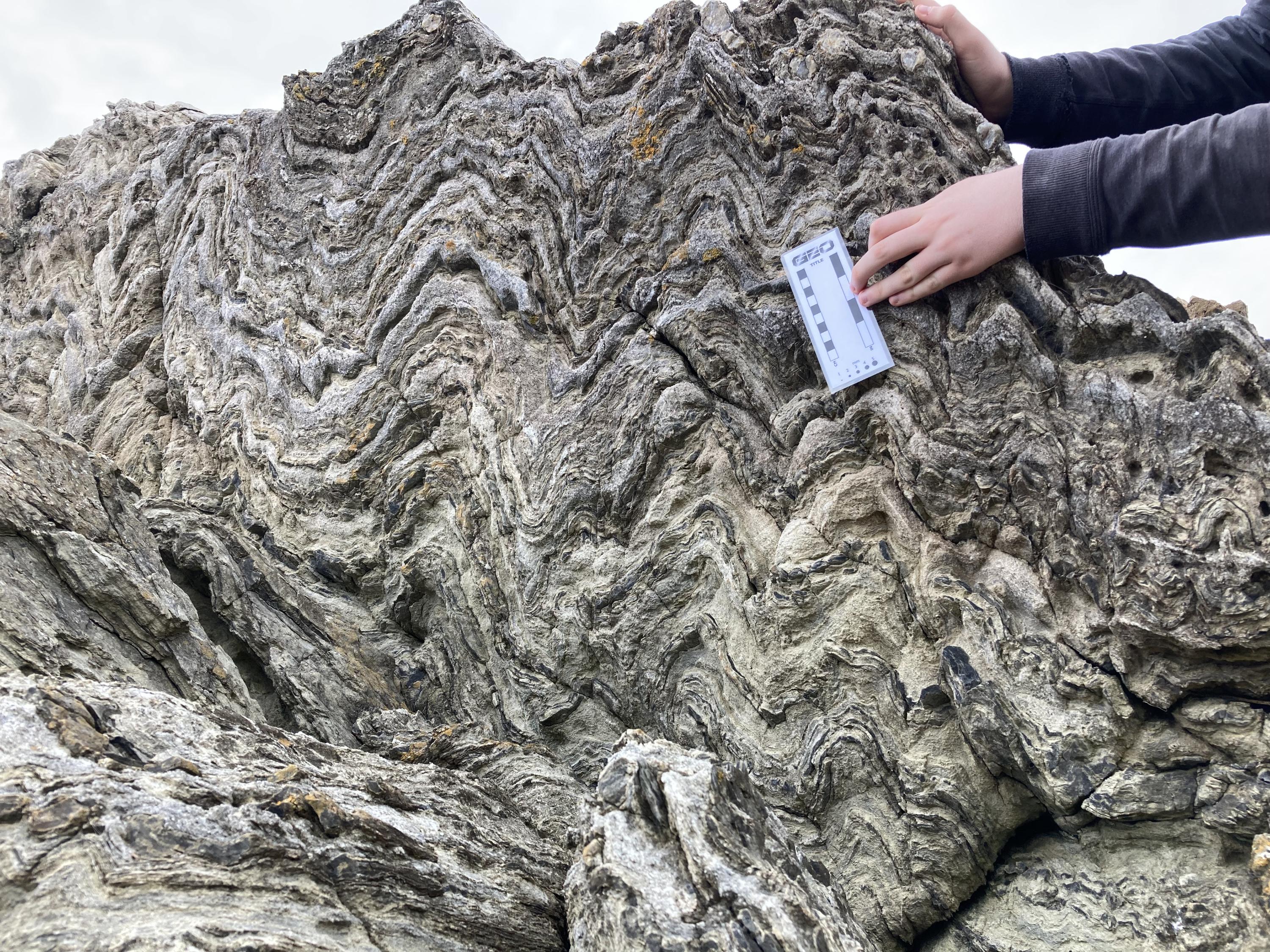
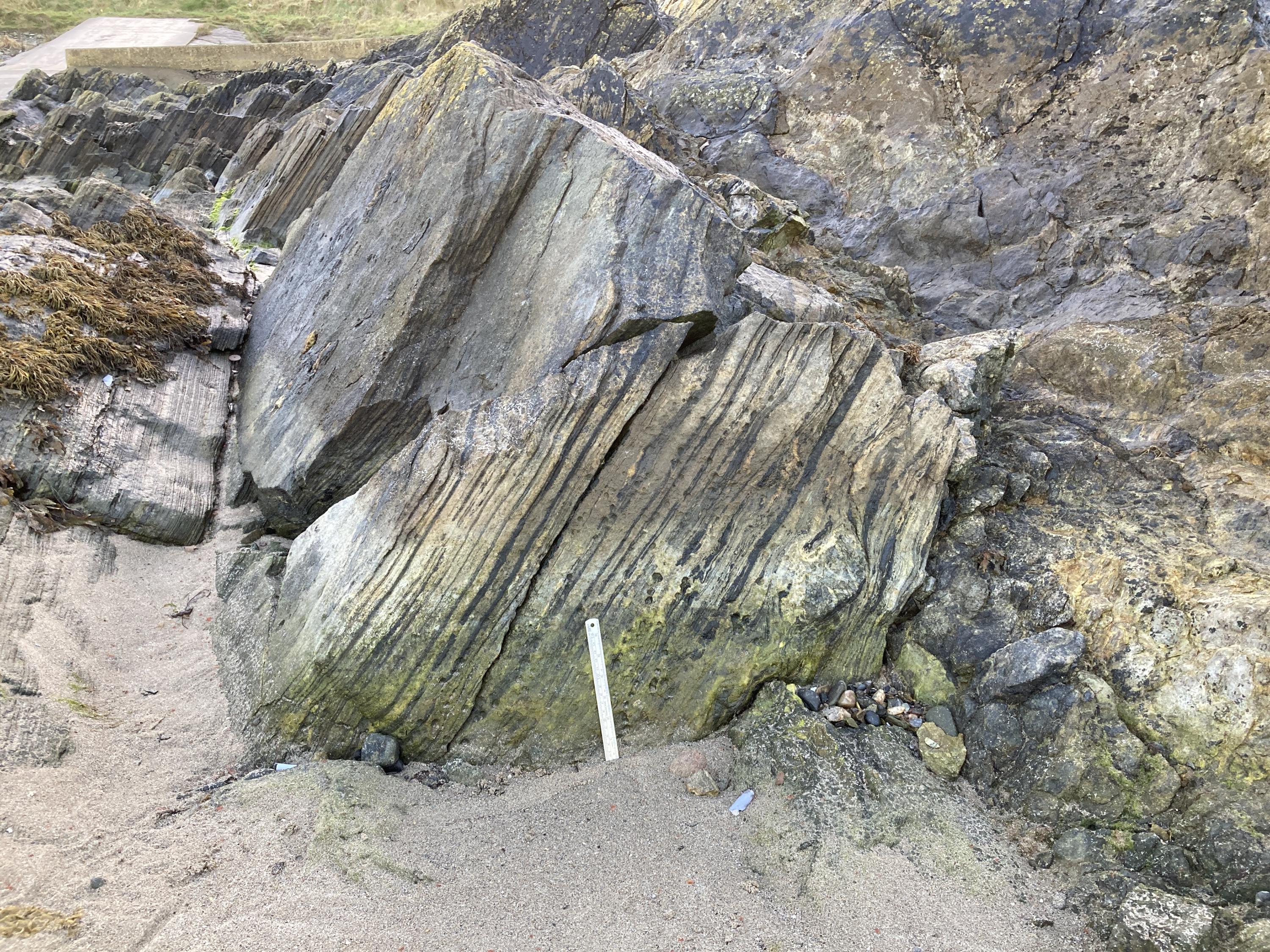
Wider shot of the "Cowhythe Psammite Formation, folded psammites and semipelites" image found below on this page. West side of Old Hythe Bay.
Rowan Barnes
July 19, 2025
Cowhythe Psammite Formation, folded psammites and semipelites. West side of Old Hythe Bay. Small amount of scrambling required.
Dave Longstaff
June 9, 2016

Closeup photograph of folded and refolded metalimestones, calcareous semipelites and calc-silicate beds, Boyne Castle Limestone Member. SE side of Old Hythe Bay.
Dave Longstaff
June 9, 2016
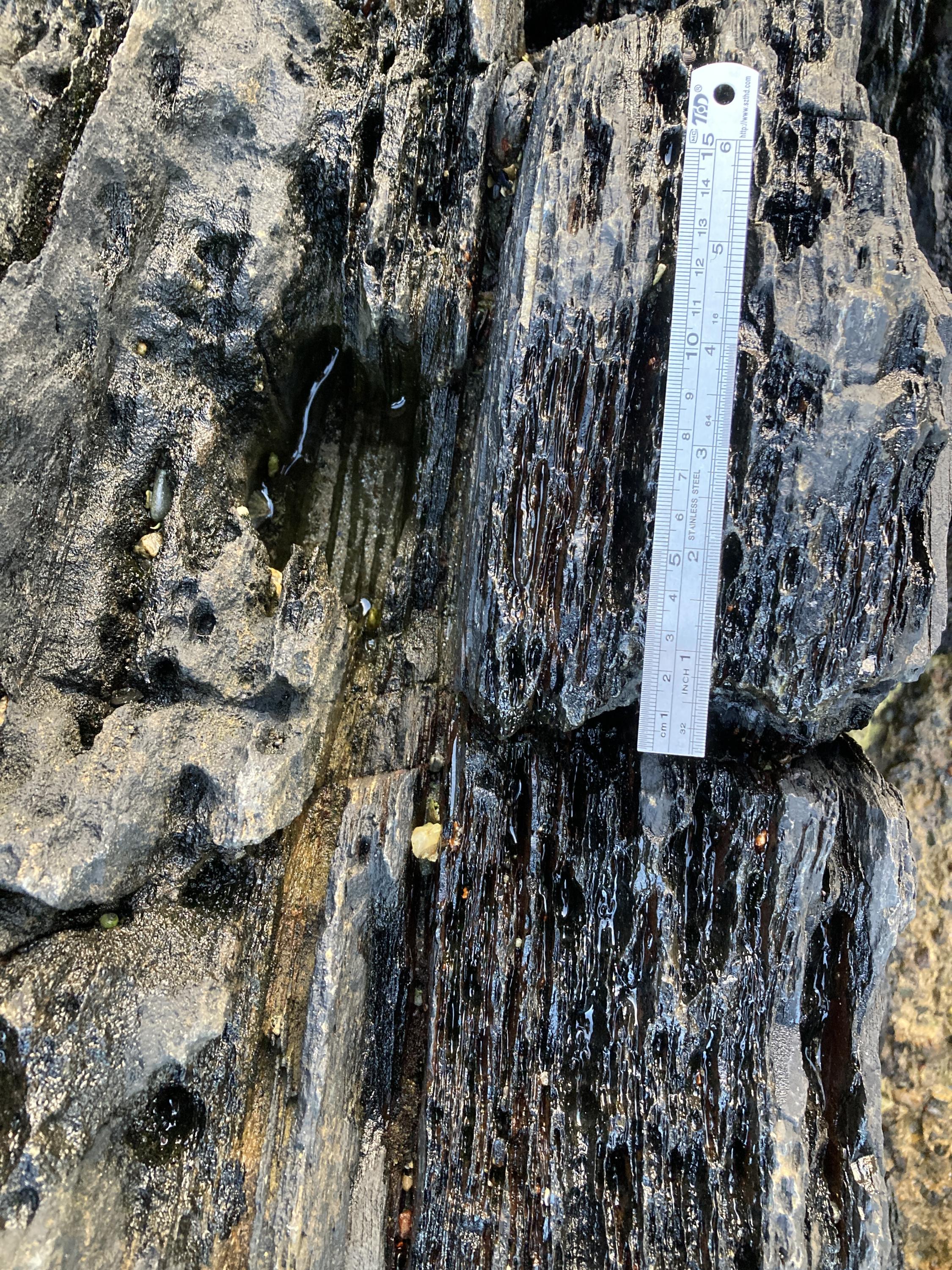
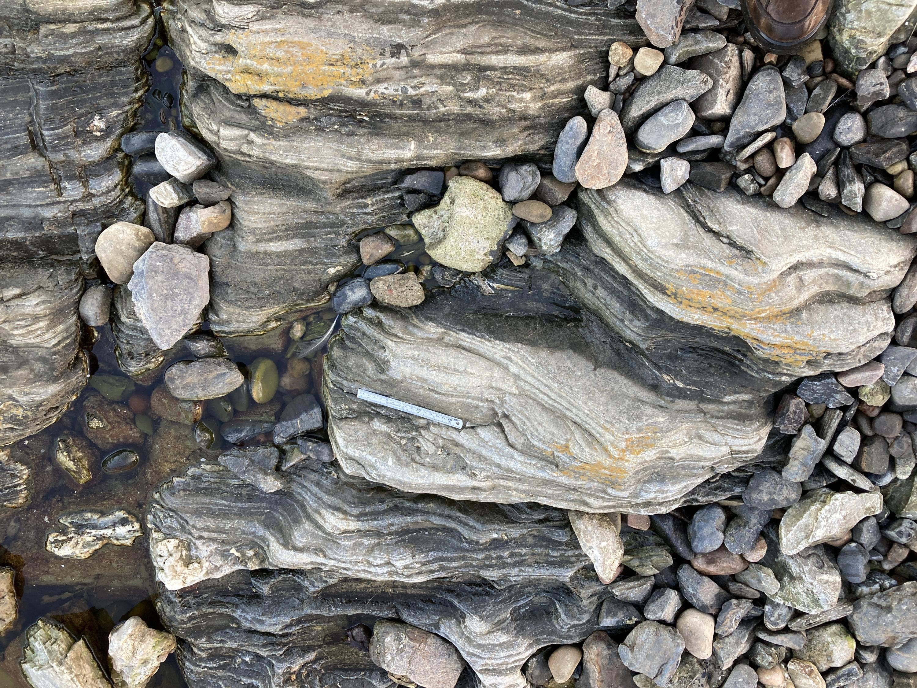
15 centimetre ruler for scale
Rowan Barnes
Nov. 10, 2024
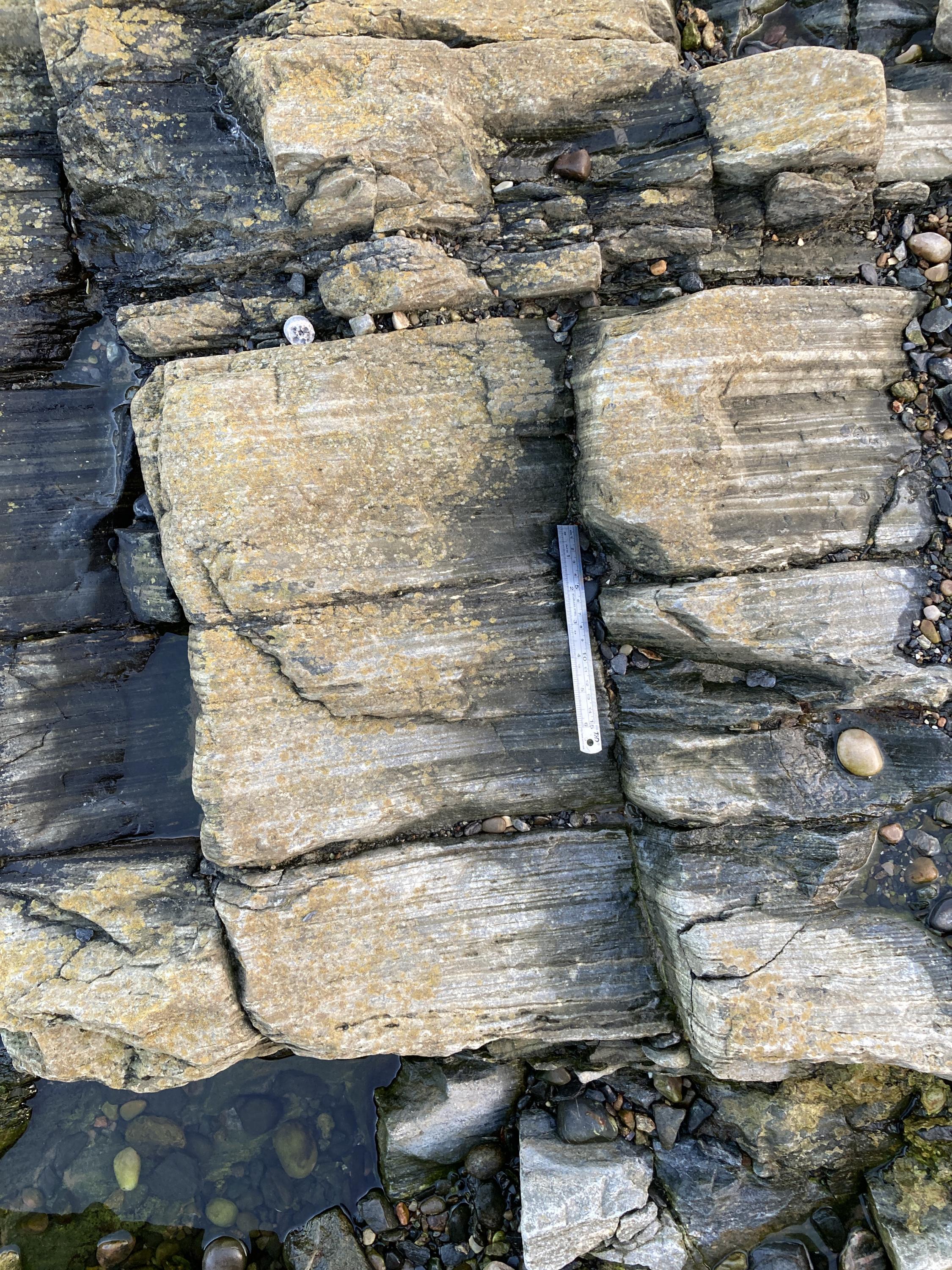
15 centimetre ruler for scale
Rowan Barnes
Nov. 10, 2024
Cliff face in the lido
Rowan Barnes
Nov. 10, 2024
Rock pool inside the lido
Rowan Barnes
Nov. 10, 2024
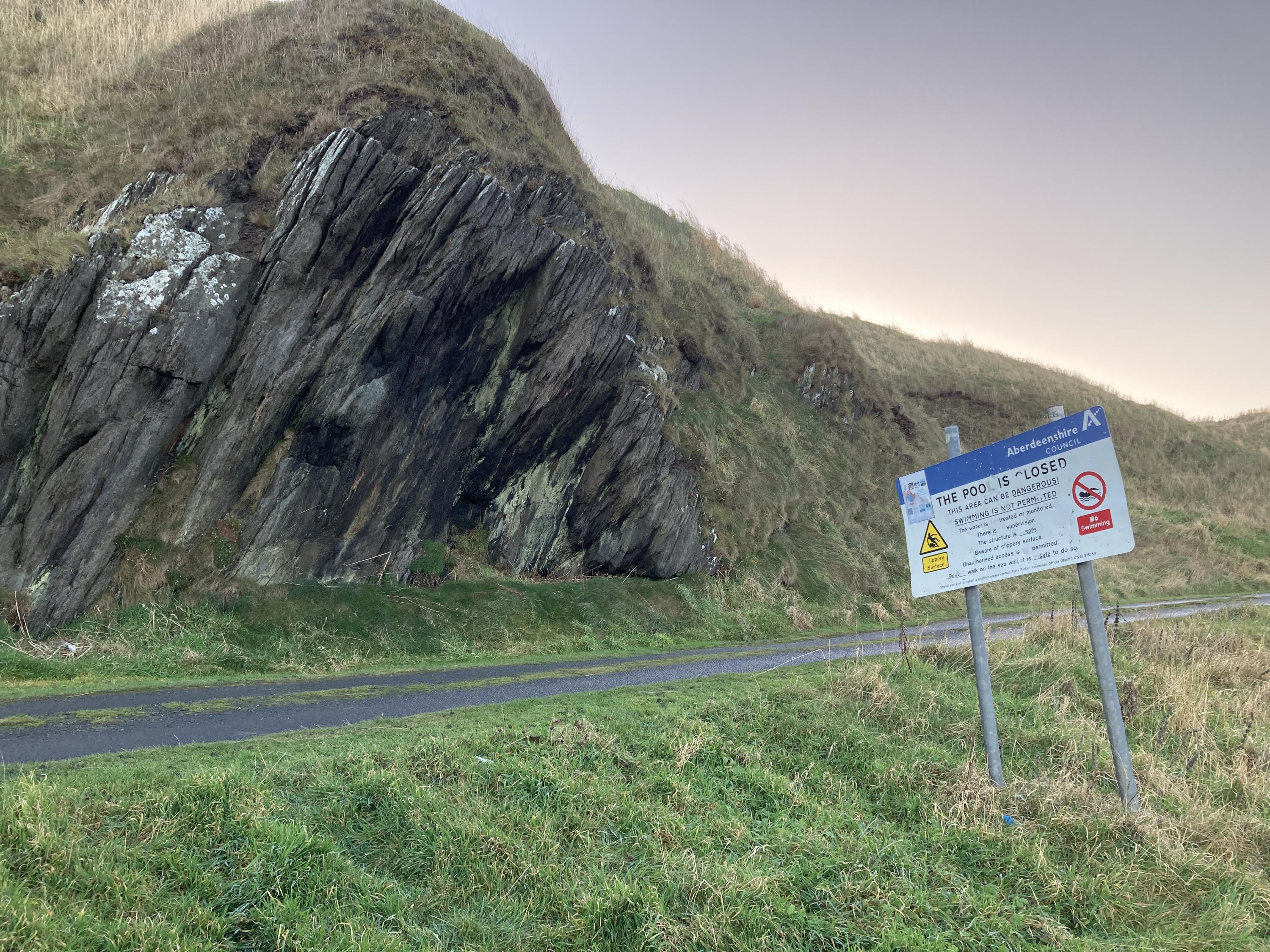
Cliff face on the beach
Rowan Barnes
Nov. 10, 2024
15 centimetre ruler for scale
Rowan Barnes
Nov. 10, 2024
15 centimetre ruler for scale
Rowan Barnes
Nov. 10, 2024
Road leading to the car park
Rowan Barnes
Nov. 10, 2024
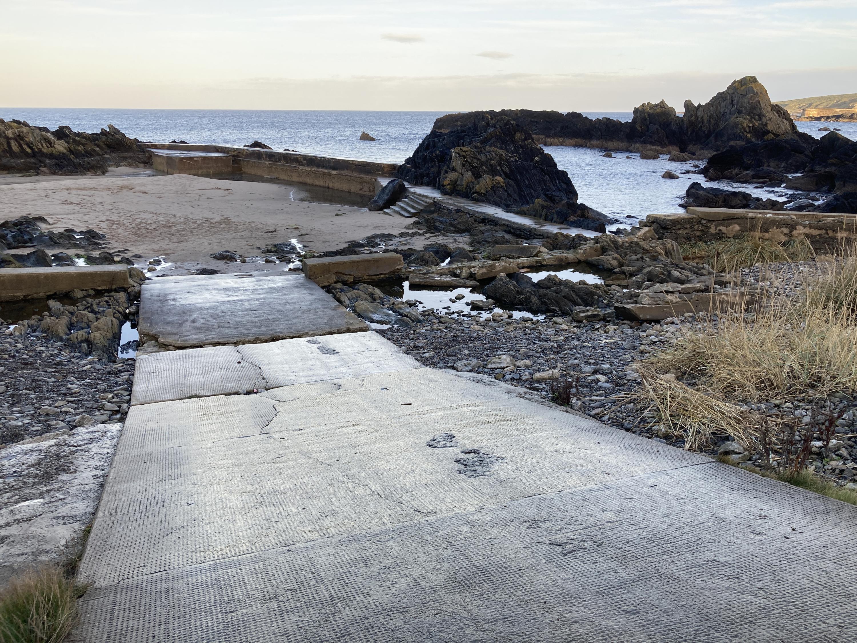
Disused lido
Rowan Barnes
Nov. 10, 2024
Path leading from the car park to the disused lido to the west of Portsoy.
Rowan Barnes
Nov. 10, 2024
View out from the shore
Rowan Barnes
Nov. 10, 2024