Cullen - Troup Head, Banffshire Coast
Geological Conservation Review site | GCR #2811 | Structural and Metamorphic Geology | Dalradian
Geological Conservation Review site | GCR #2811 | Structural and Metamorphic Geology | Dalradian
Scotland's geosites are chosen because of their local, national or international importance. Take only photos, leave only footprints: avoid causing any damage to this site. You can walk almost anywhere in Scotland without the need to ask permission or keep to paths, but you have a responsibility to care for your own safety, to respect people's privacy and peace of mind and to cause no damage.
This site is a Site of Special Scientific Interest (SSSI). It is an offence to intentionally or recklessly damage the protected natural features of a SSSI, and this includes unauthorised sample collection.
The right of access does not extend to quarries, building sites or any land where public access is prohibited, or to the collection of geological samples.
The classic section through Buchan metamorphism and a key locality of understanding the tectono-thermal evolution of the Grampian terrain.
This very large site extends for 32 km along the north coast of the north-east Grampian Highlands from Cullen Harbour in the west to Troup Head in the east. It comprises a near-complete succession from the Cullen Quartzite Formation at the top of the Grampian Group to the highest parts of the Macduff Formation of the Southern Highland Group. This apparently simple succession is cut by the Portsoy–Duchray Hill Lineament which forms a major stratigraphical, structural and metamorphic break in the middle of the section. The strata young overall from west to east, with only minor local reversals. To the west of the Portsoy–Duchray Hill Lineament, structures are comparable to those of the central Grampian Highlands and are dominated by tight NW-verging folds. Deformation increases dramatically eastwards towards the Portsoy–Duchray Hill Lineament, with most structures becoming largely coplanar and colinear. The wide shear-zone that here marks the lineament contains variably deformed mafic and ultramafic intrusive igneous rocks of the c. 474–470 Ma North-east Grampian Basic Suite. East of the lineament, in the so-called ‘Buchan Block’, the rocks show small- and medium-scale folding, in parts with interference patterns, but the regional outcrop pattern is dominated by the broad, open Turriff Syncline, whose axis plunges gently to the north-north-east. (from Stephenson et al. 2013).
Exposures of the Cullen Quartzite are easily accessible from a popular coastal path with parking near Cullen harbour. Path east of Cullen past Logie Head and Sunniside Bay allows easy access to view the Cullen Quarzite. East of Sunniside Bay the cliff top path becomes more difficult and access down into the bays eg. to see Findlater Castle, are steep and require great care. Some exposures are in exposed situations.
Cars can be parked at Barnyards of Findlater Farm for easier access to clfftops near Findlater Castle.
https://geoguide.scottishgeologytrust.org/p/ags/ags_03/ags_…
J. P. Carty and T. E. Johnson, 2018: The Dalradian of the Portsoy area
There are no safety notes yet.
There are no site highlights yet.
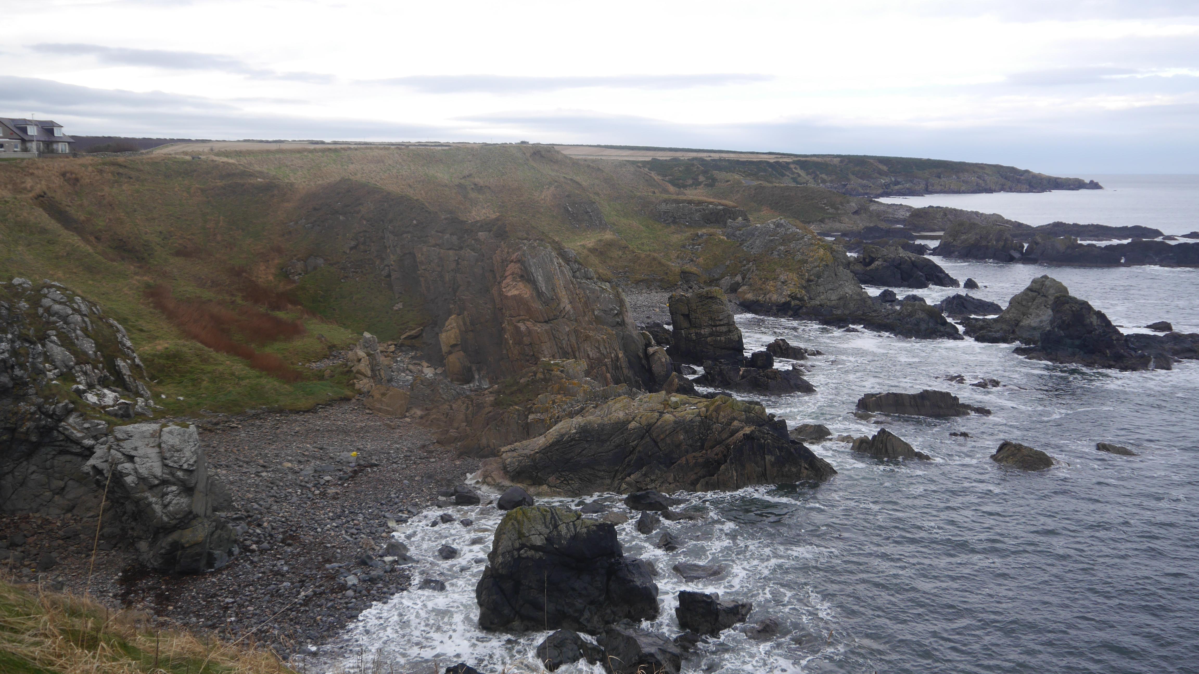
Overview of the coastline immediately to the west of Portsoy. The geology along this stretch of coast is complex. Stratigraphically the metasedimentary units appear to young from west to east (towards the camera). The pale crag to the left of the photograph is a body of anorthosite within the Portsoy Igneous Complex. The spur in the centre of the photograph comprises quartzite with a strong lineation (mullions). Beyond the quartzite, the igneous complex continues with a body of the 'Portsoy Marble' serpentinite, and then further metasediments of the Portsoy Limestone Formation. Beyond the swimming pool, the Castle Point Pelite and Durn Hill Quartzite formations are exposed. Beyond these are migmatitic rocks of the Arnbath Psammite Formation.
Daniel Burgess
Dec. 13, 2024
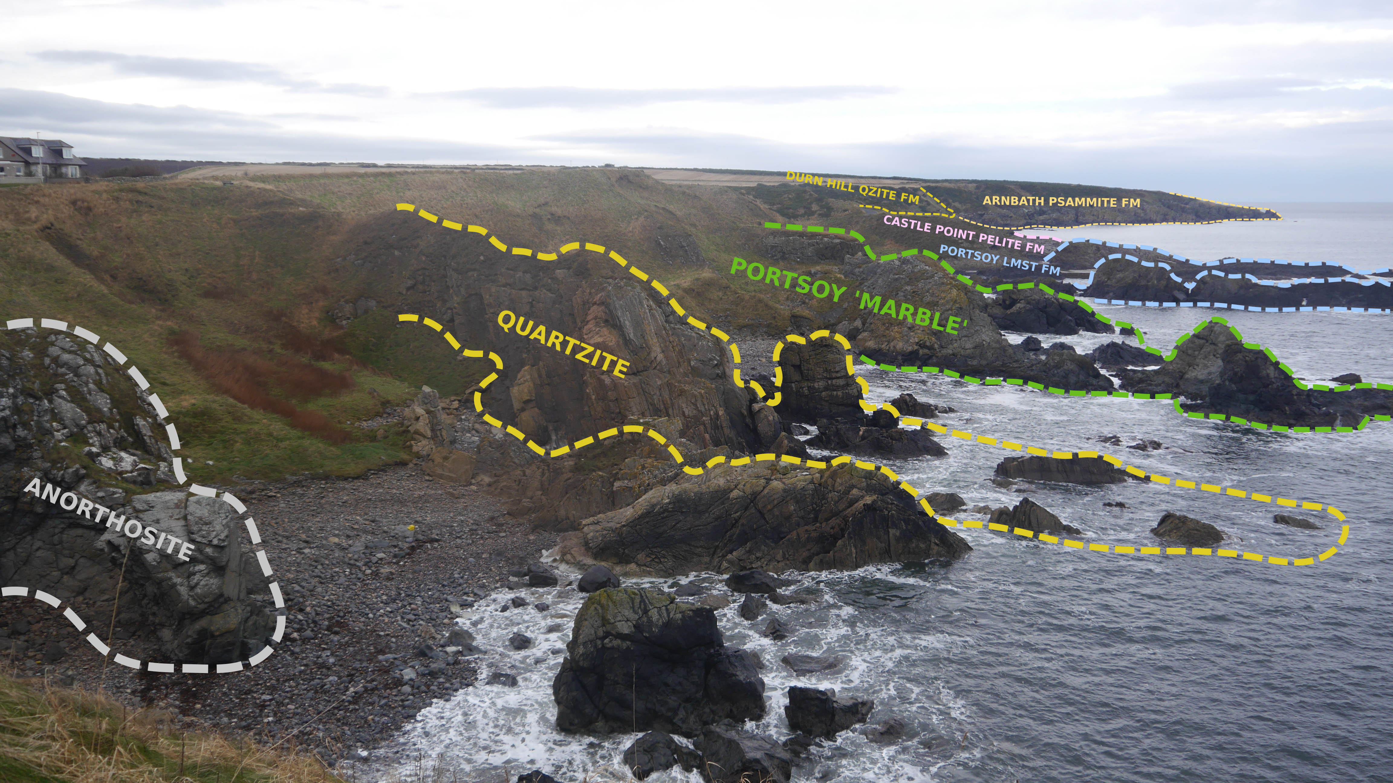
Same photograph as above, annotated to show some lithologies and units.
Daniel Burgess
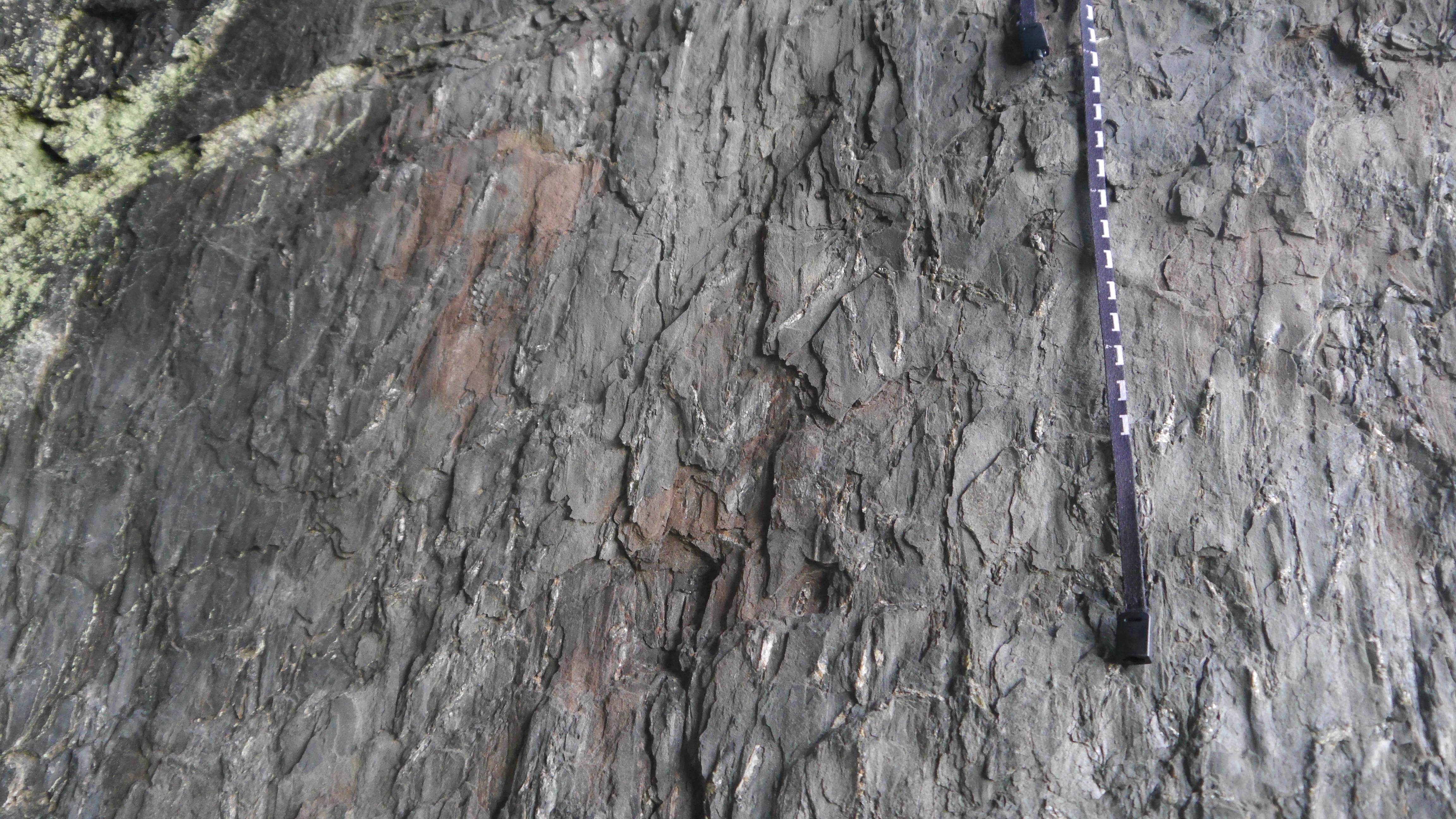
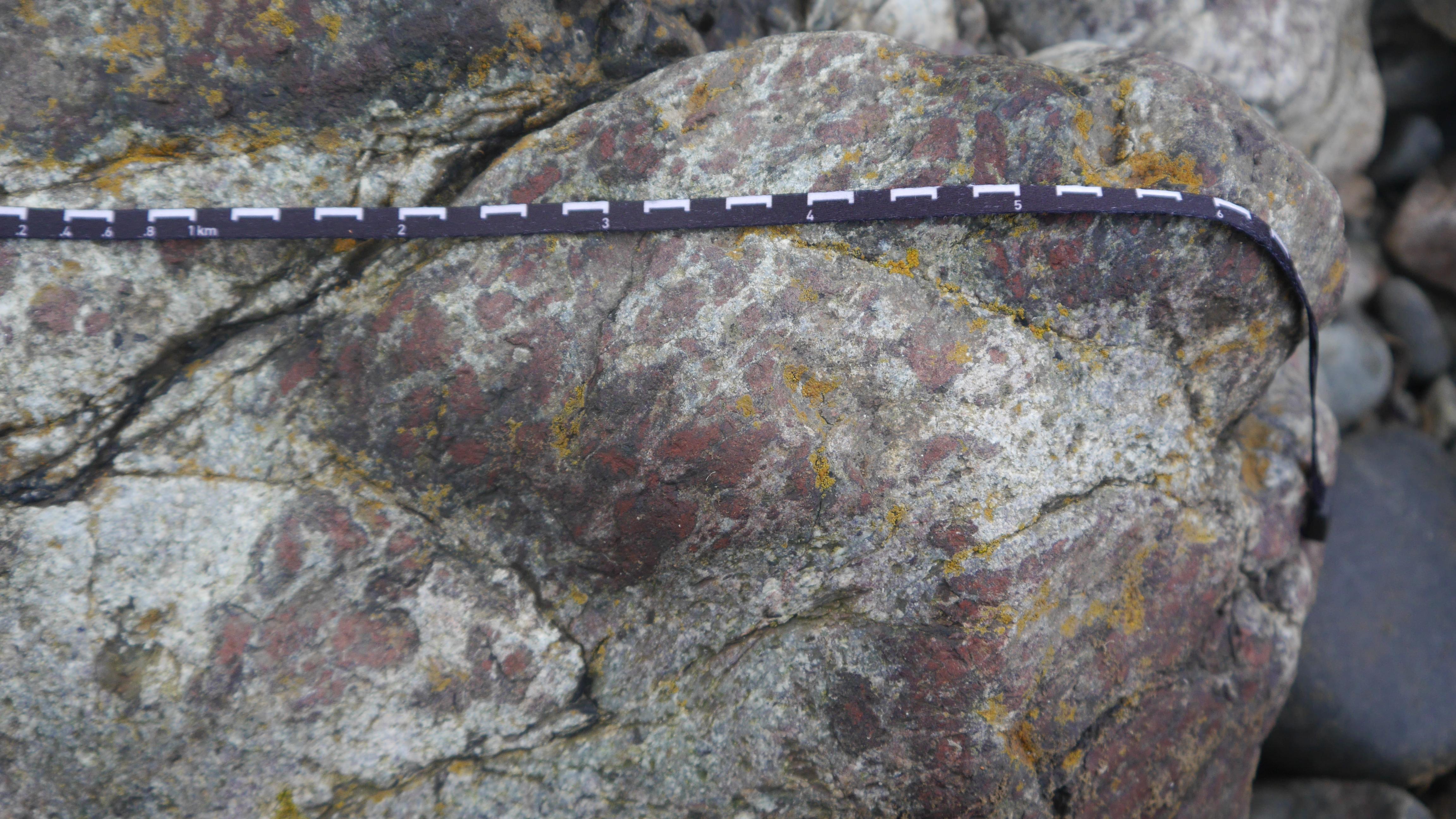
Pelitic unit within the Portsoy Limestone Formation exposed in a crag near the disused swimming pool. The pelite contains andalusite porphyroblasts which have been pseudomorphed by aggregrates of muscovite to varying degrees. The porphyroblasts show preferential alignment to a steeply plunging L2 lineation. Scale in centremetres. Locality 3 of Carty and Johnson (2018).
Daniel Burgess
Dec. 13, 2024
Detail of the pelitic unit within the Portsoy Limestone Formation.
Daniel Burgess
Dec. 13, 2024
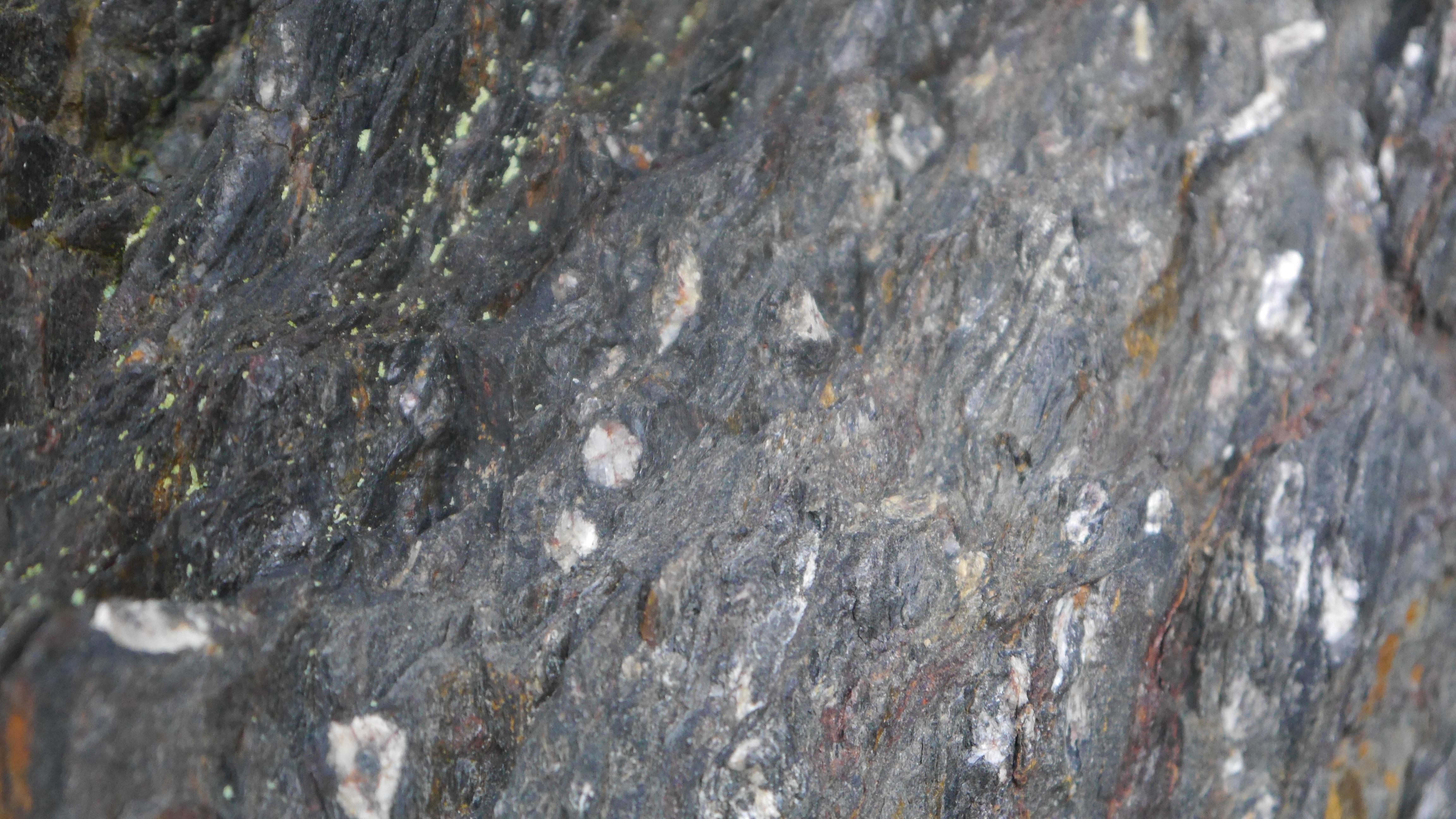
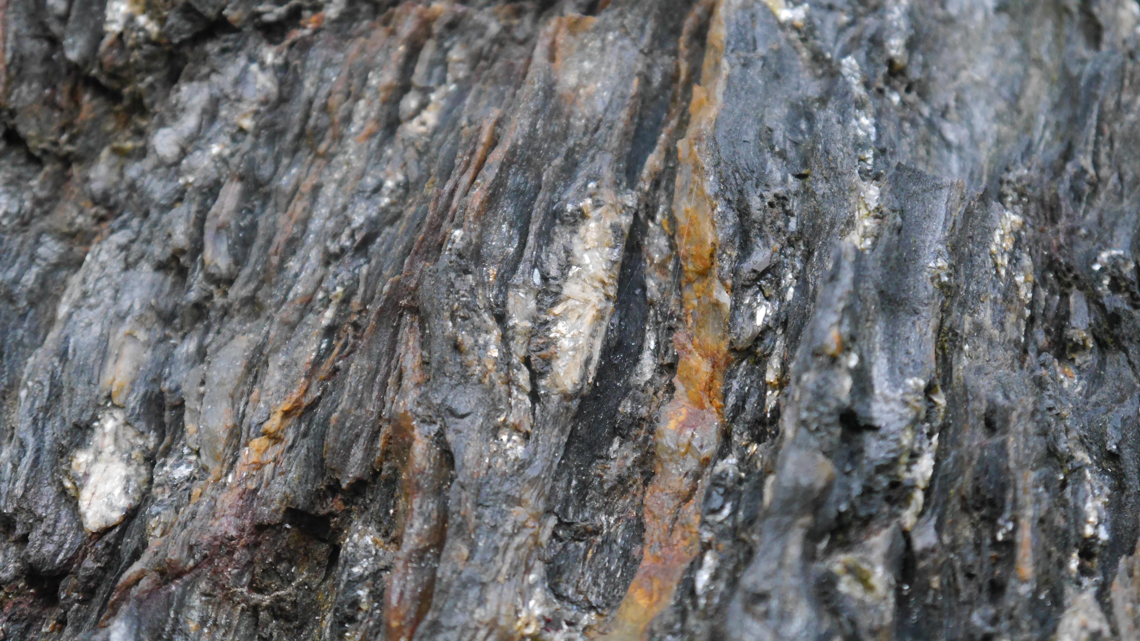
Detail of the pelitic unit within the Portsoy Limestone Formation. Relict chiastolite crosses are visible in some of the pseudomorphed porphyroblasts.
Daniel Burgess
Dec. 13, 2024

Anorthosite outcrop and close up
David Rae
May 23, 2026
Tight to isoclinal folding of the Portsoy Limestone Formation in exposures around the disused swimming pool. Locality 4 of Carty and Johnson (2018). Pole is approximately 1 m long.
Daniel Burgess
Dec. 13, 2024
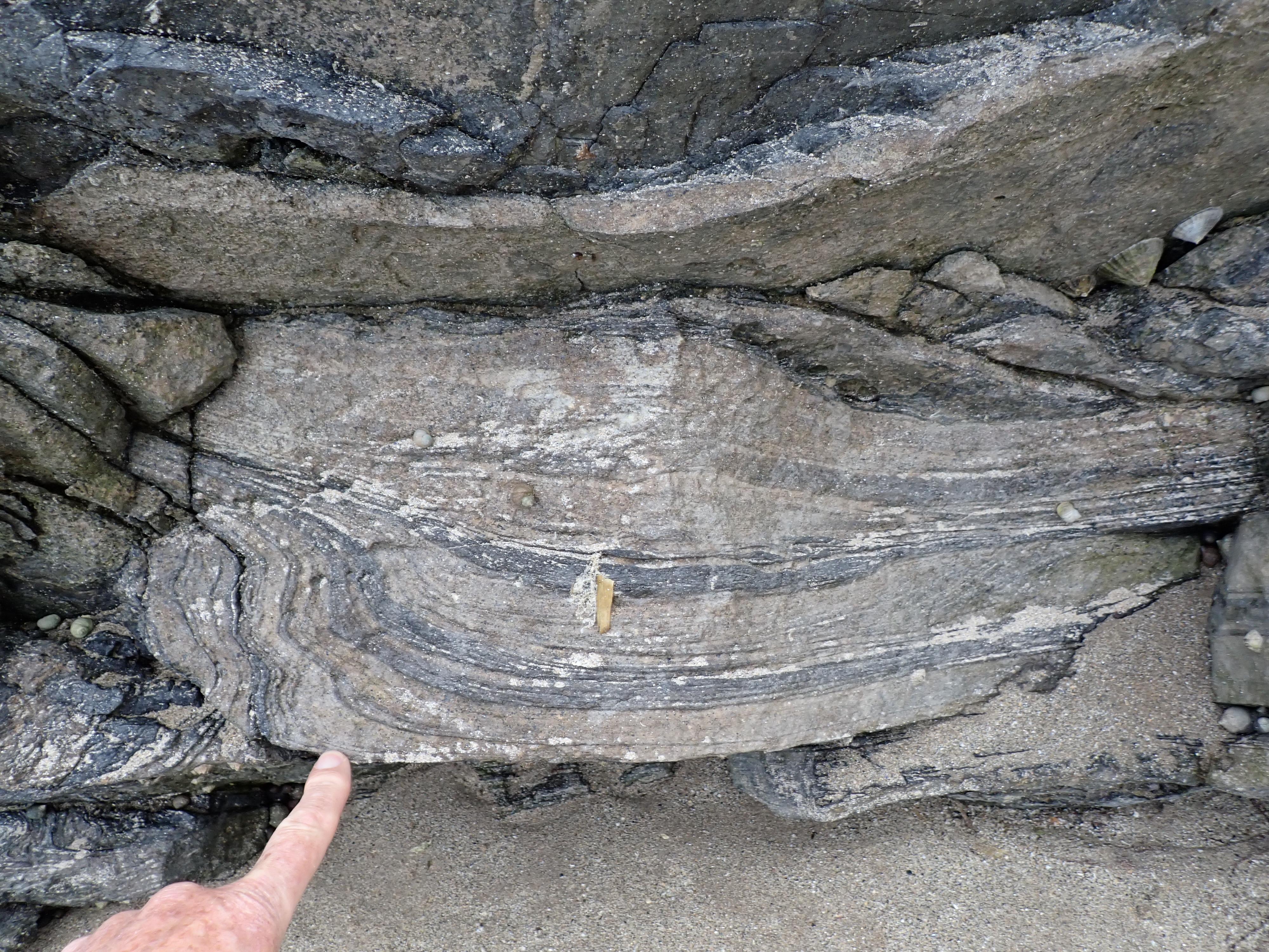
Refolded fold at old swimming pool, Portsoy
David Rae
May 23, 2026
'Portsoy Marble' serpentinite body, cut by a subvertical vein. Locality 6 of Carty and Johnson (2018). Pole is approximately 1 m long.
Daniel Burgess
Dec. 13, 2024
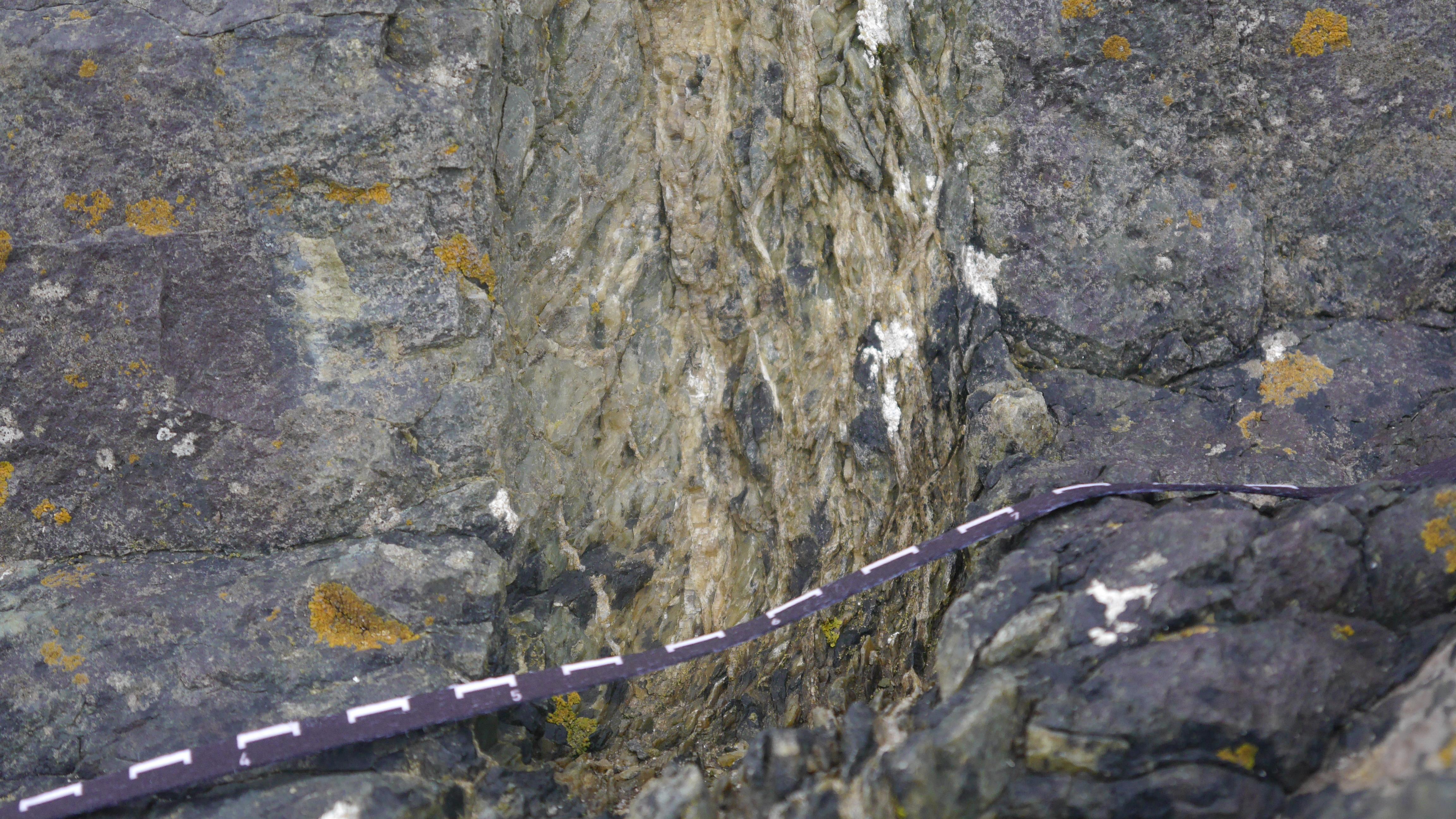
Detail of the 'Portsoy Marble' serpentinite. Carty and Johnson (2018) explain that the red mineral is iddingsite, pseudomorphing primary igneous olivine. Scale is in centimetres.
Daniel Burgess
Dec. 13, 2024
Detail of a talc-rich vein within the serpentinite body. Scale is in centimetres.
Daniel Burgess
Dec. 13, 2024
Steep, conjugate shear zones within gabbro exposed near the Old Harbour, Portsoy. Locality 9 of Carty and Johnson (2018). Poles are approximately 1 m long.
Daniel Burgess
Dec. 13, 2024
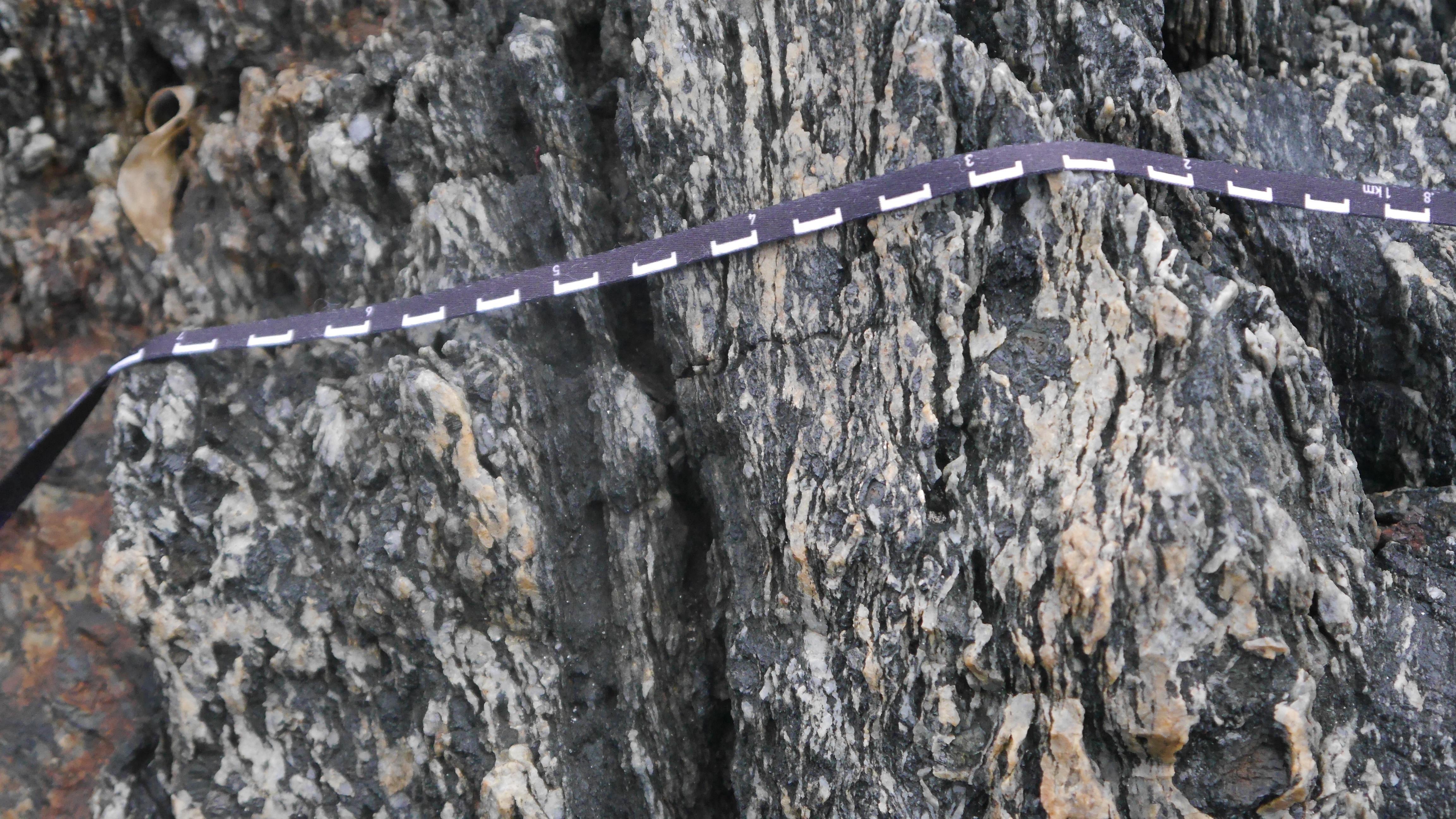
Detail of shear zones within the gabbro. Scale is in centimetres.
Daniel Burgess
Dec. 13, 2024
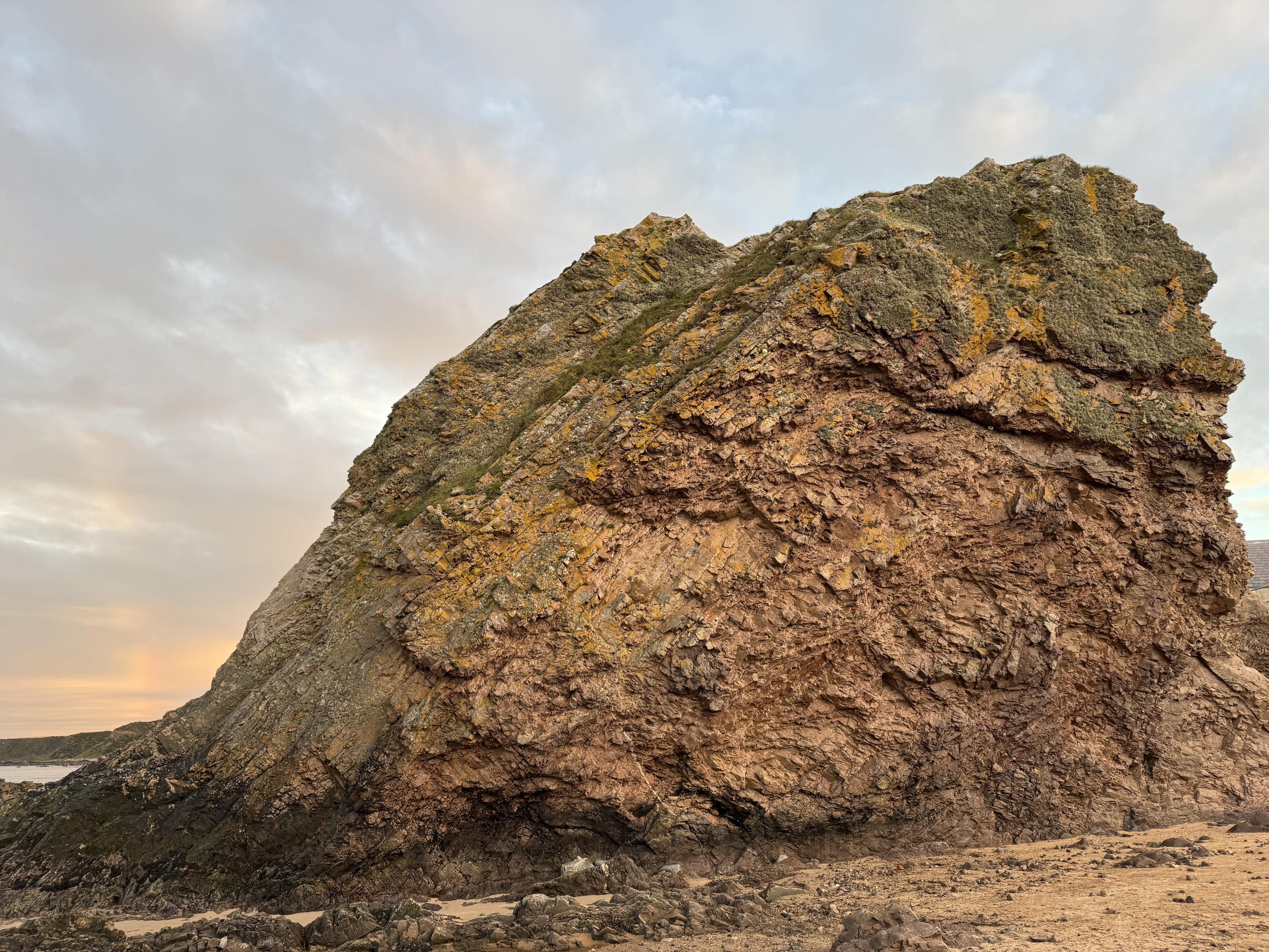
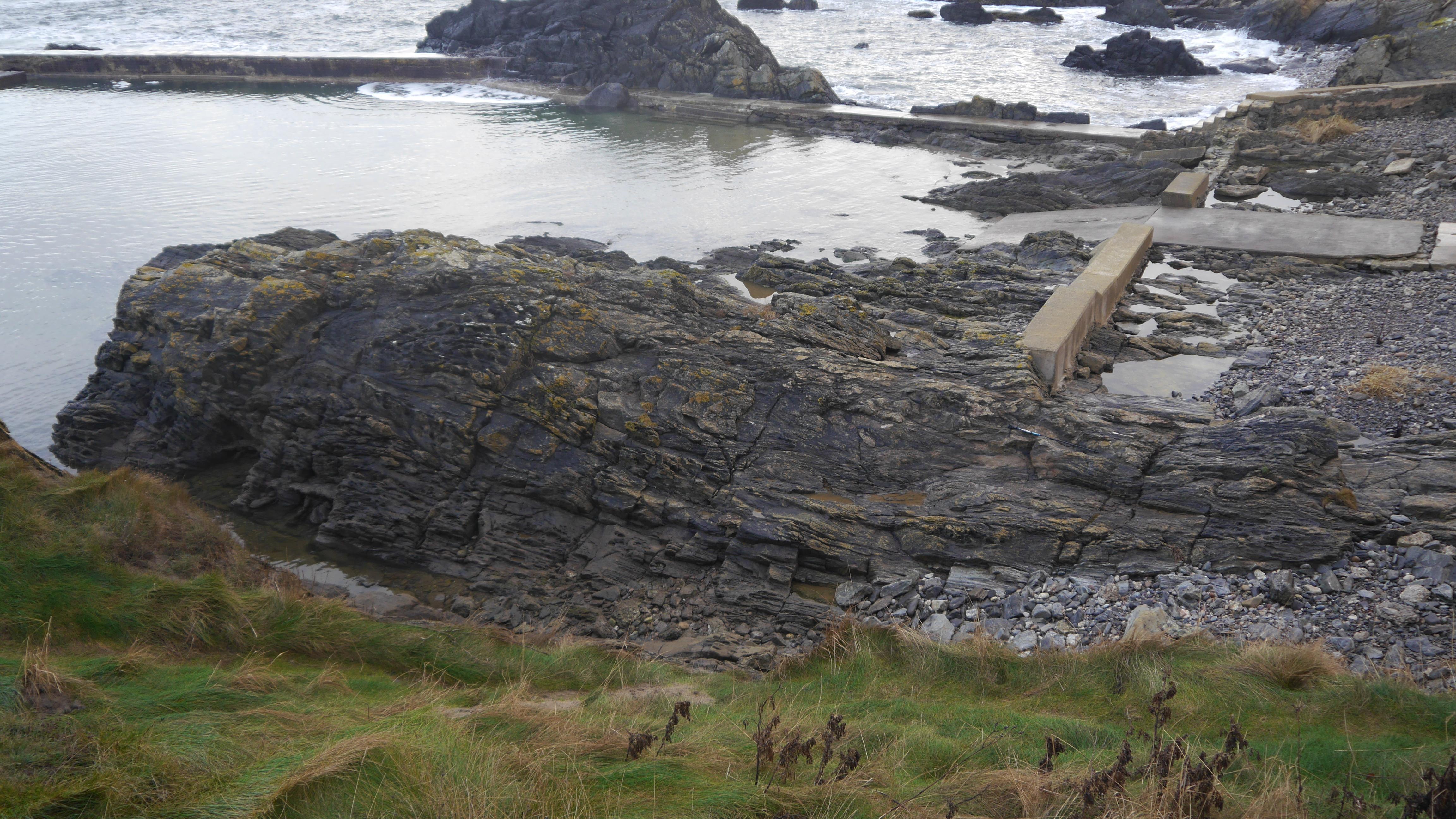
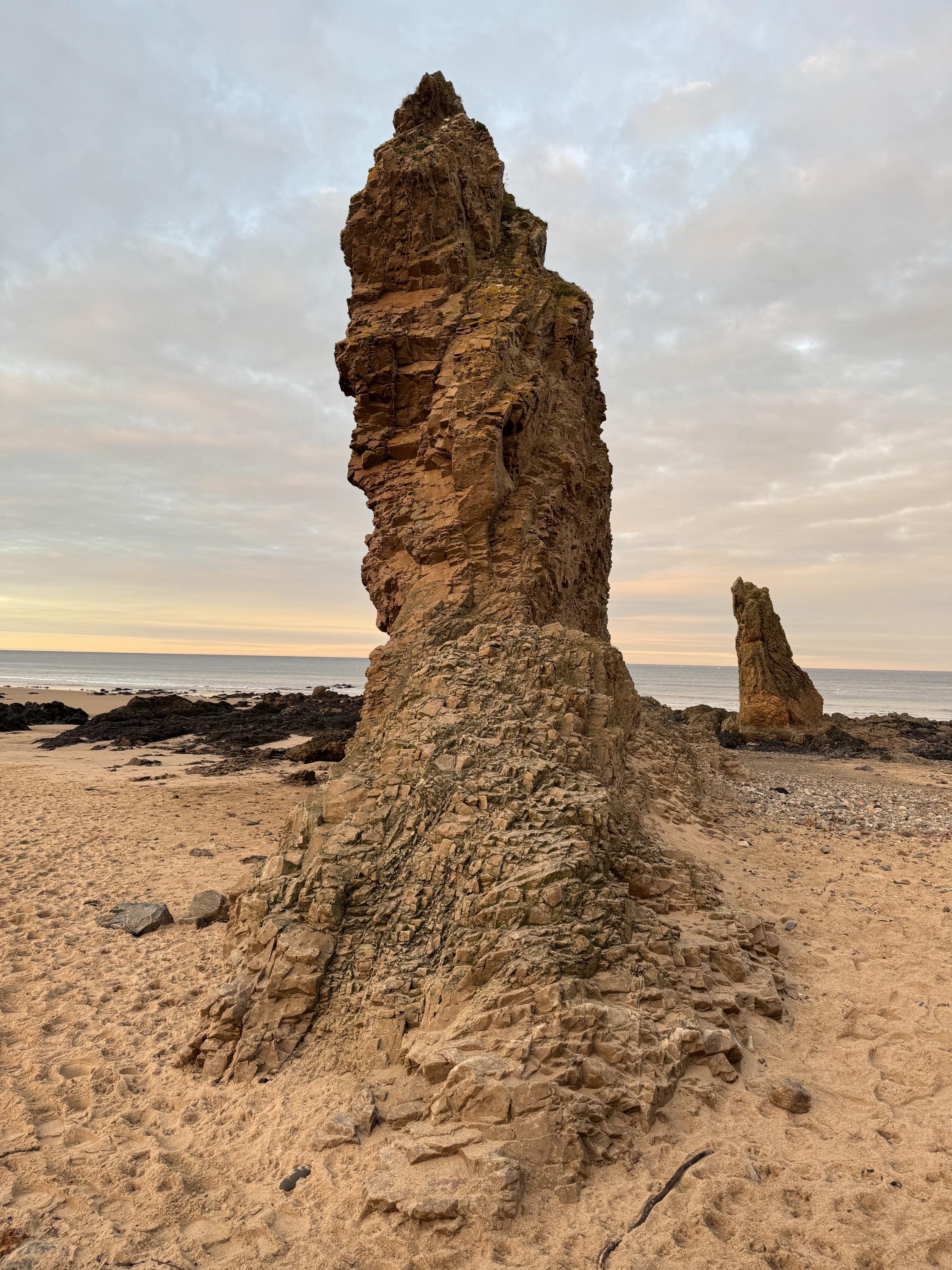
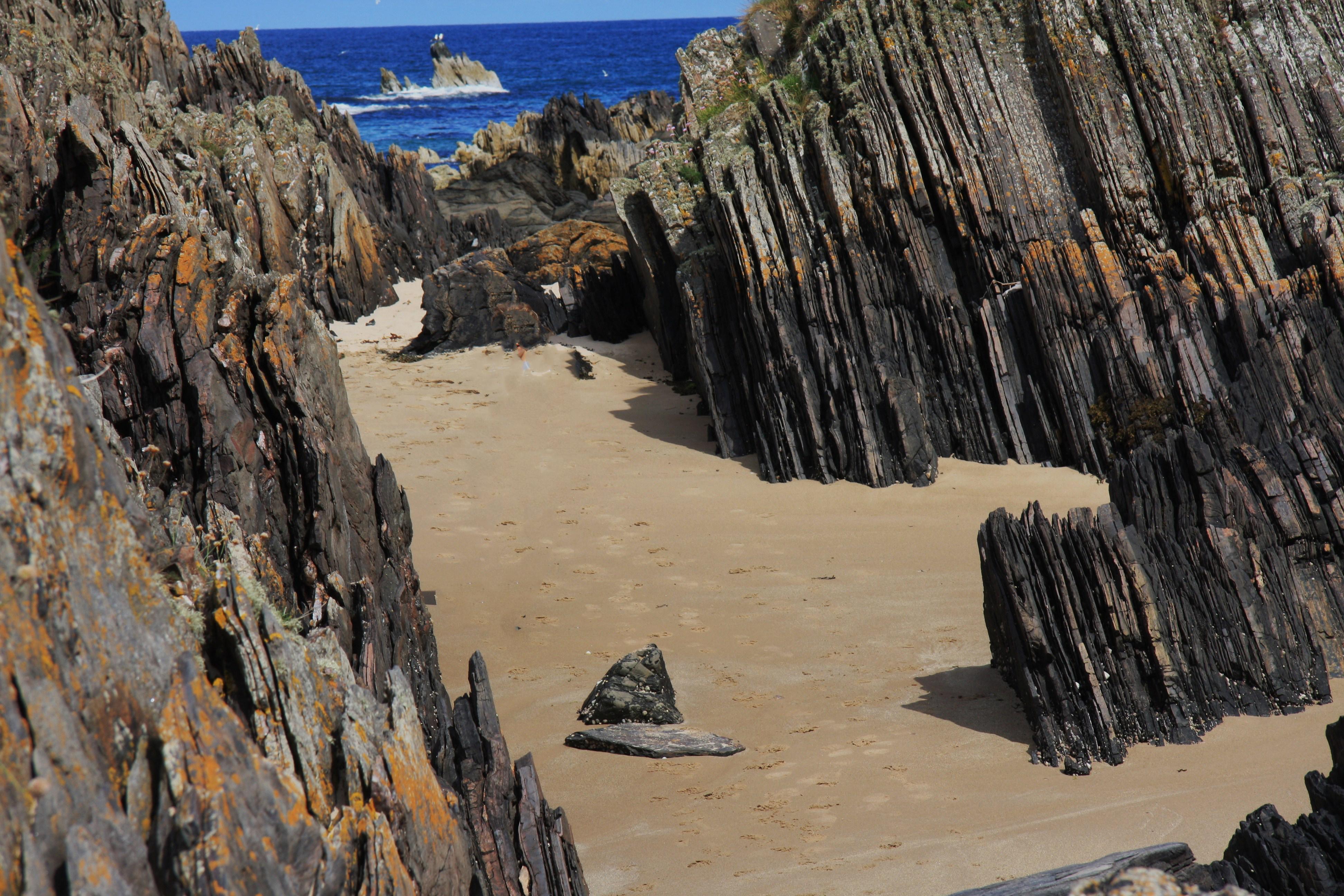
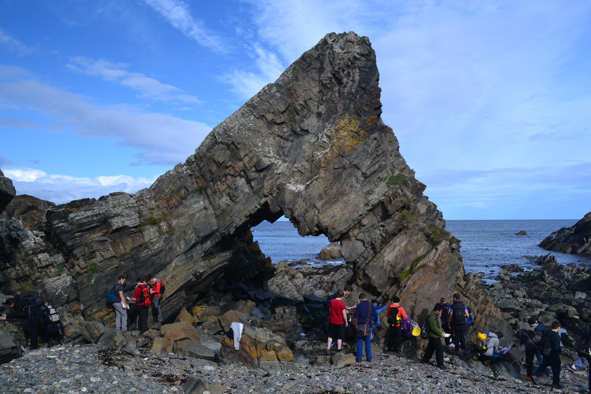
View of one of the Three Kings east side of Cullen Beach. Heavily fractured Cullen Quartzite dip to the NW.
Dave Longstaff
Dec. 11, 2024
Dave Longstaff
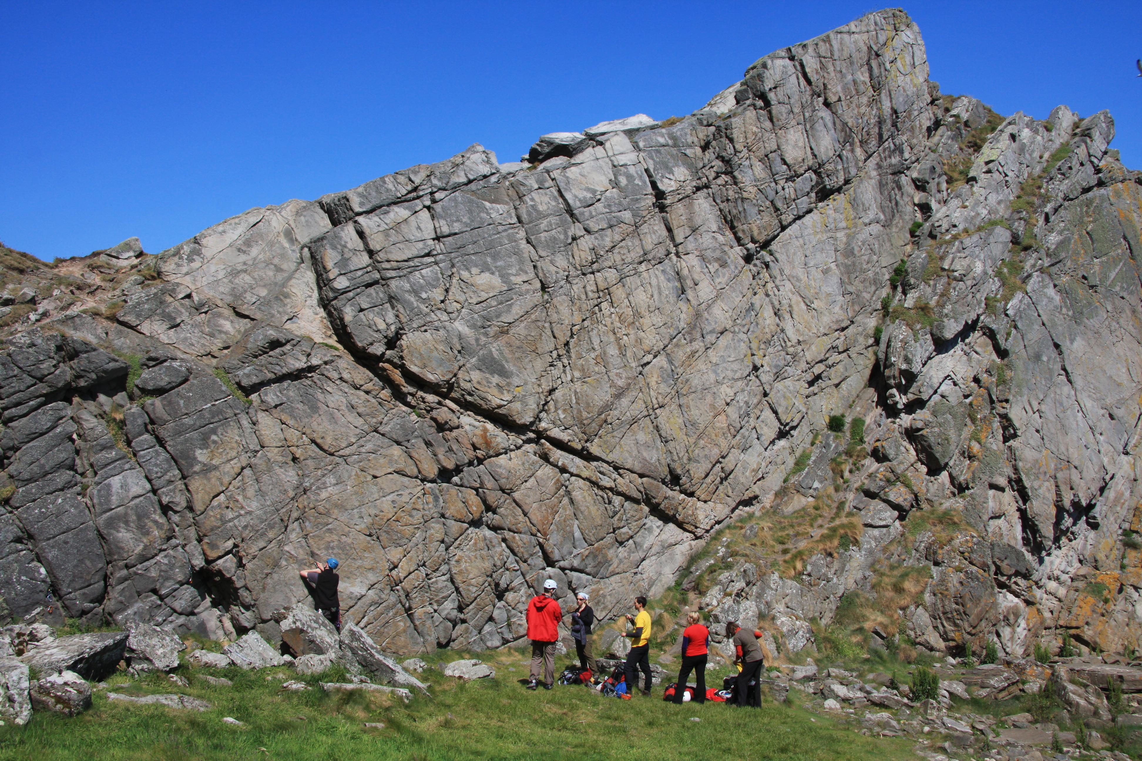
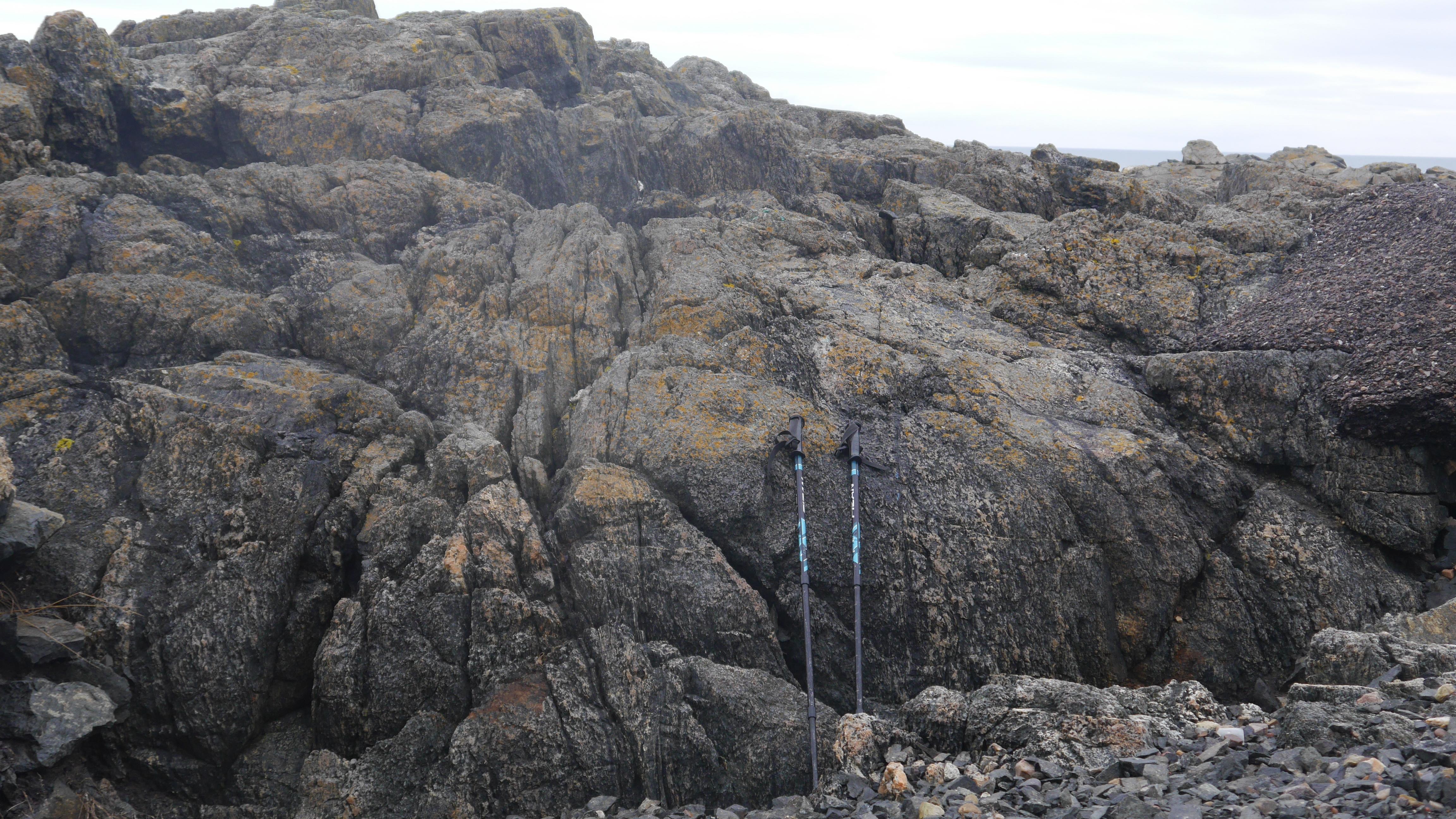
Logie Head, a famous climbing cliff. Cullen Quartzite
Dave Longstaff
June 11, 2011
Almost vertically dipping beds of Cullen Quartzite younging to the east.
Dave Longstaff
June 11, 2011
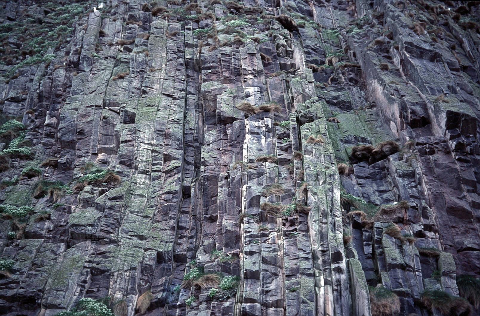
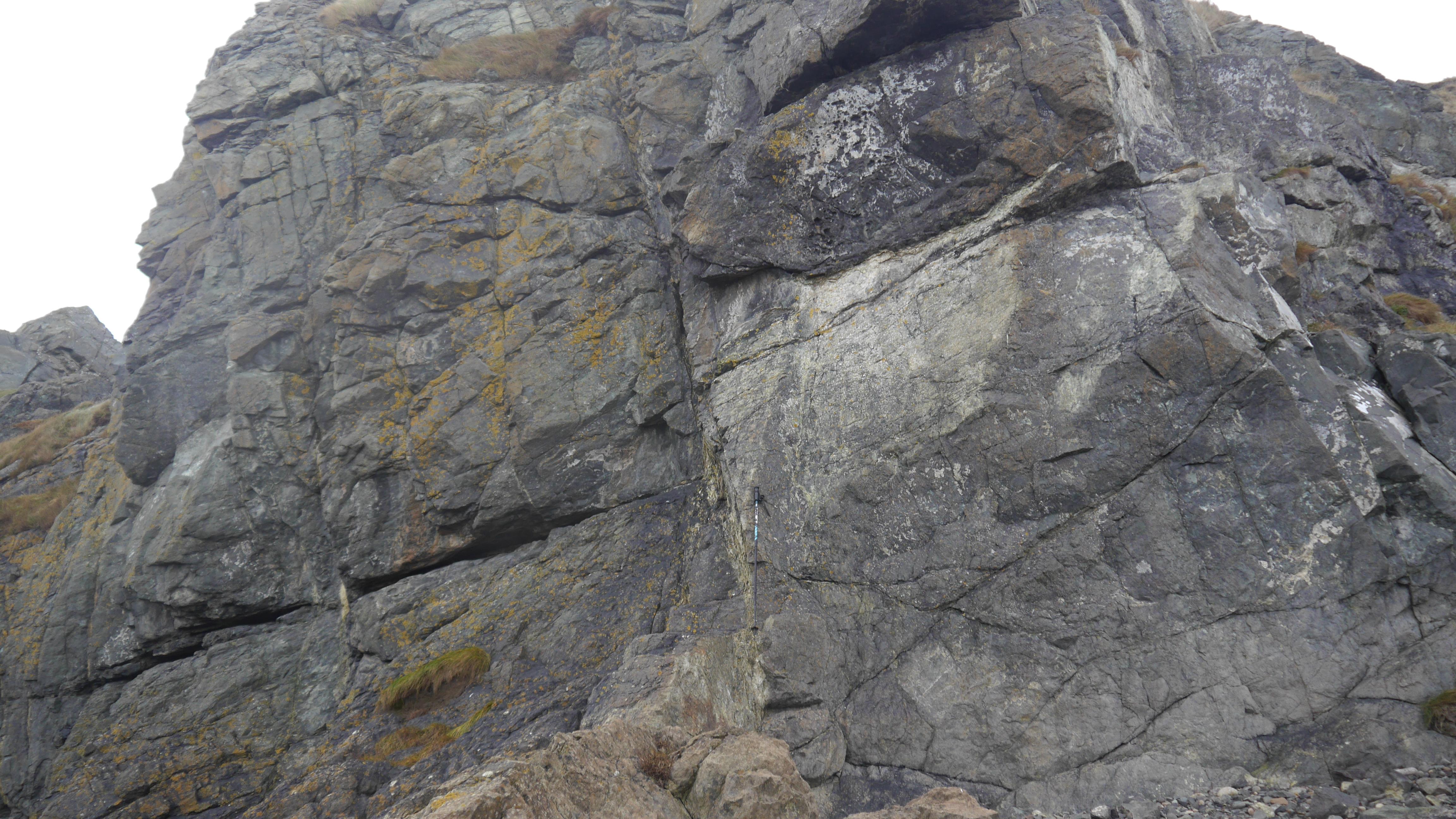
View vertically up cliff just to the east of Logie Head and metres away from the coastal path. Cullen Quartzite.
Dave Longstaff
June 11, 2011
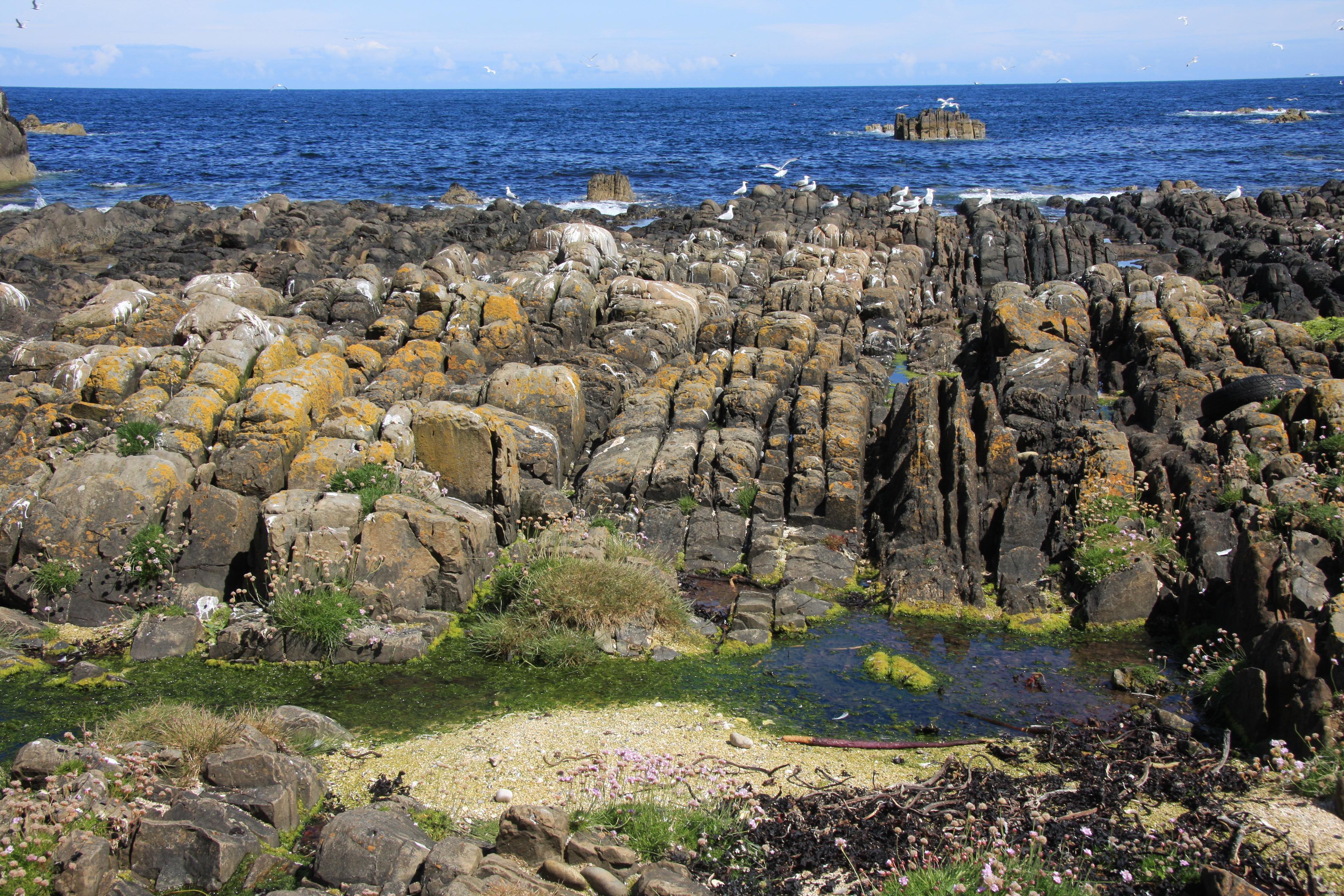
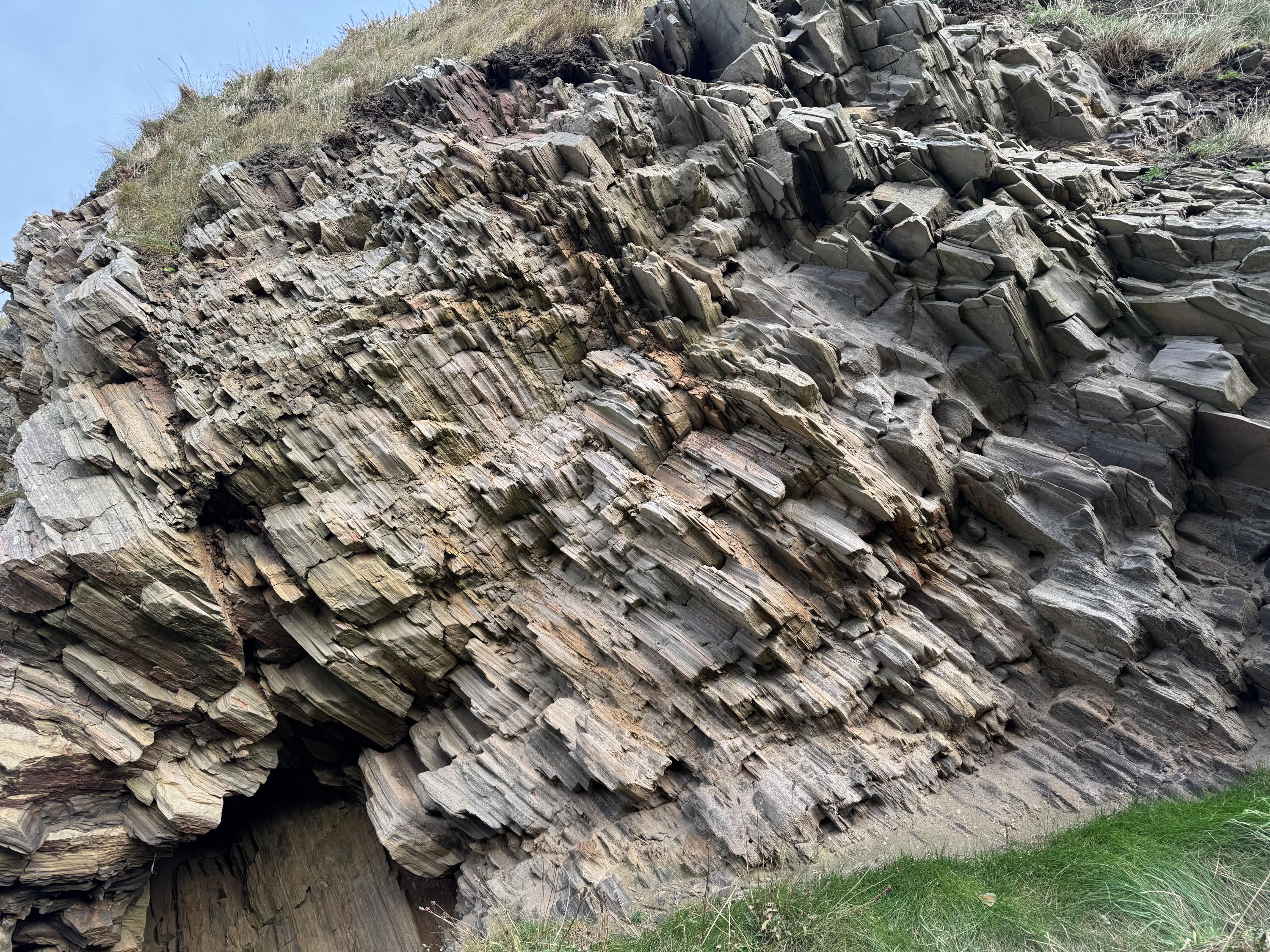
Sunniside Bay. Steeply dipping Findlater Flags. Semi-pelites and Psammites.
Dave Longstaff
Dec. 12, 2024
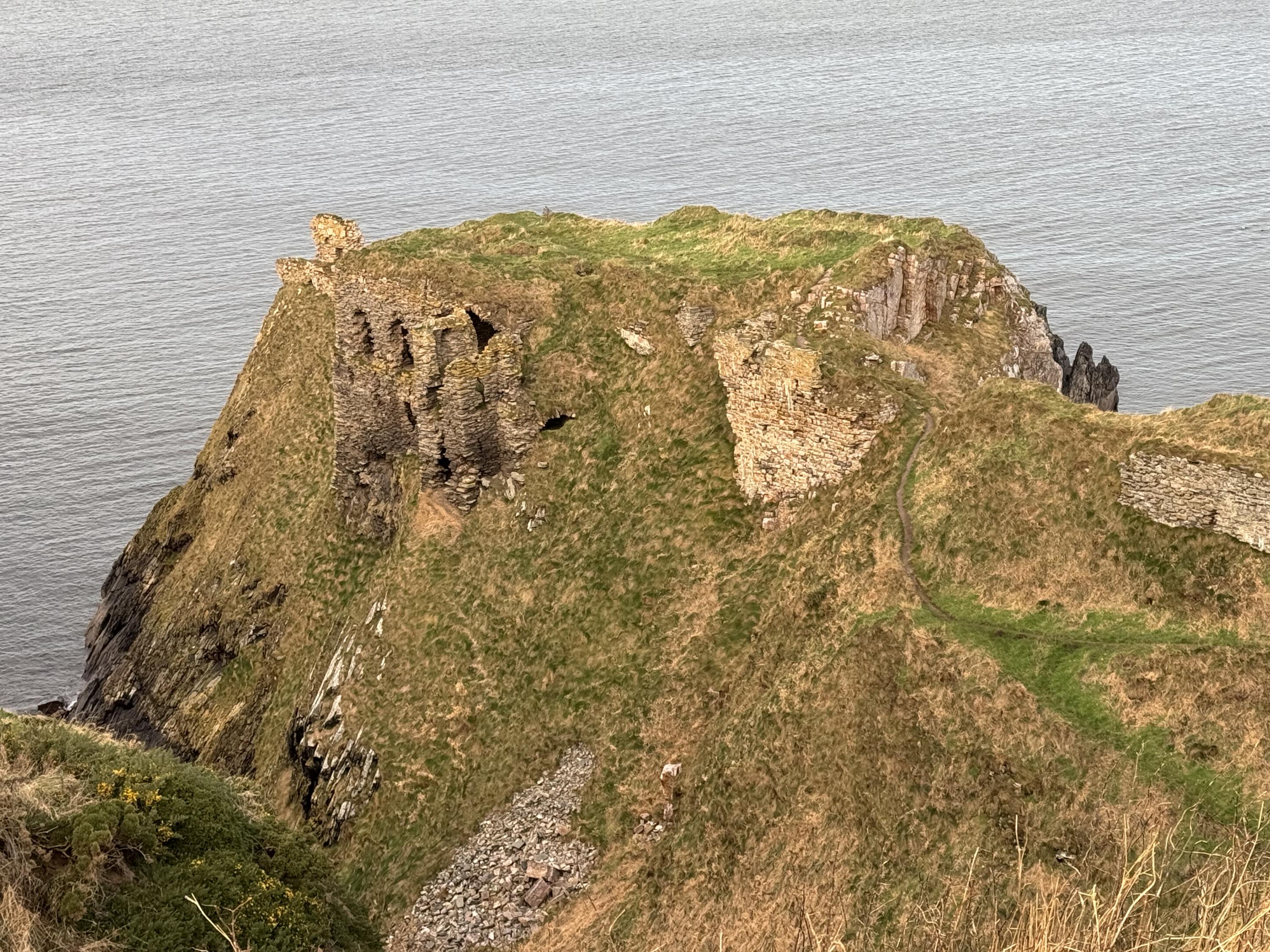
General view from clifftop path of Findlater Castle. Findlater Flags in centre, wave rippled Cullen Quartzite top right.
Access down is by steep slippery narrow paths, be careful!
Dave Longstaff
Dec. 11, 2024
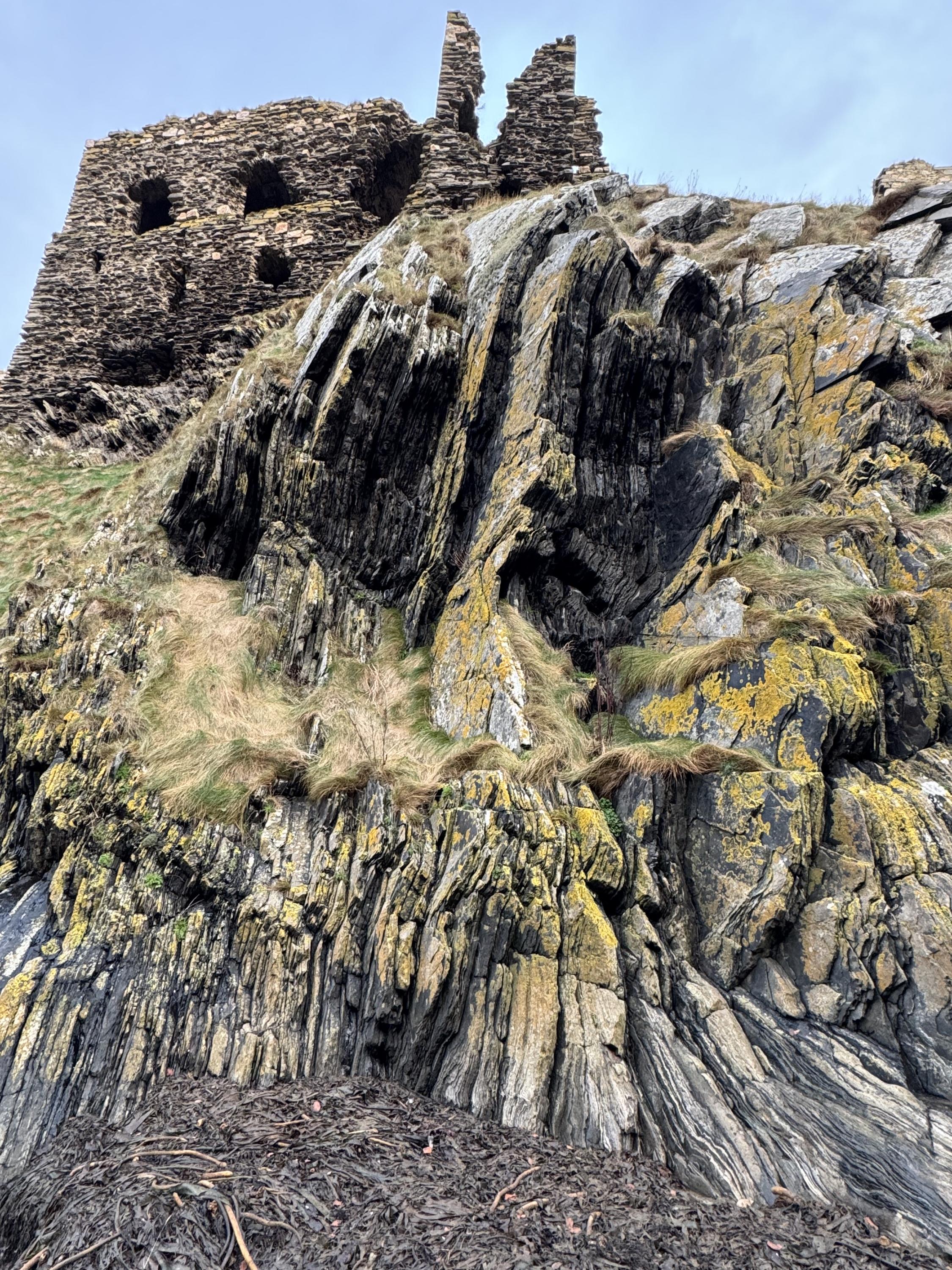
View from below Findlater Castle showing steeply dipping Findlater Flag formation. Access to this bay is down steep slippery grass slopes and needs care.
Dave Longstaff
Dec. 11, 2024
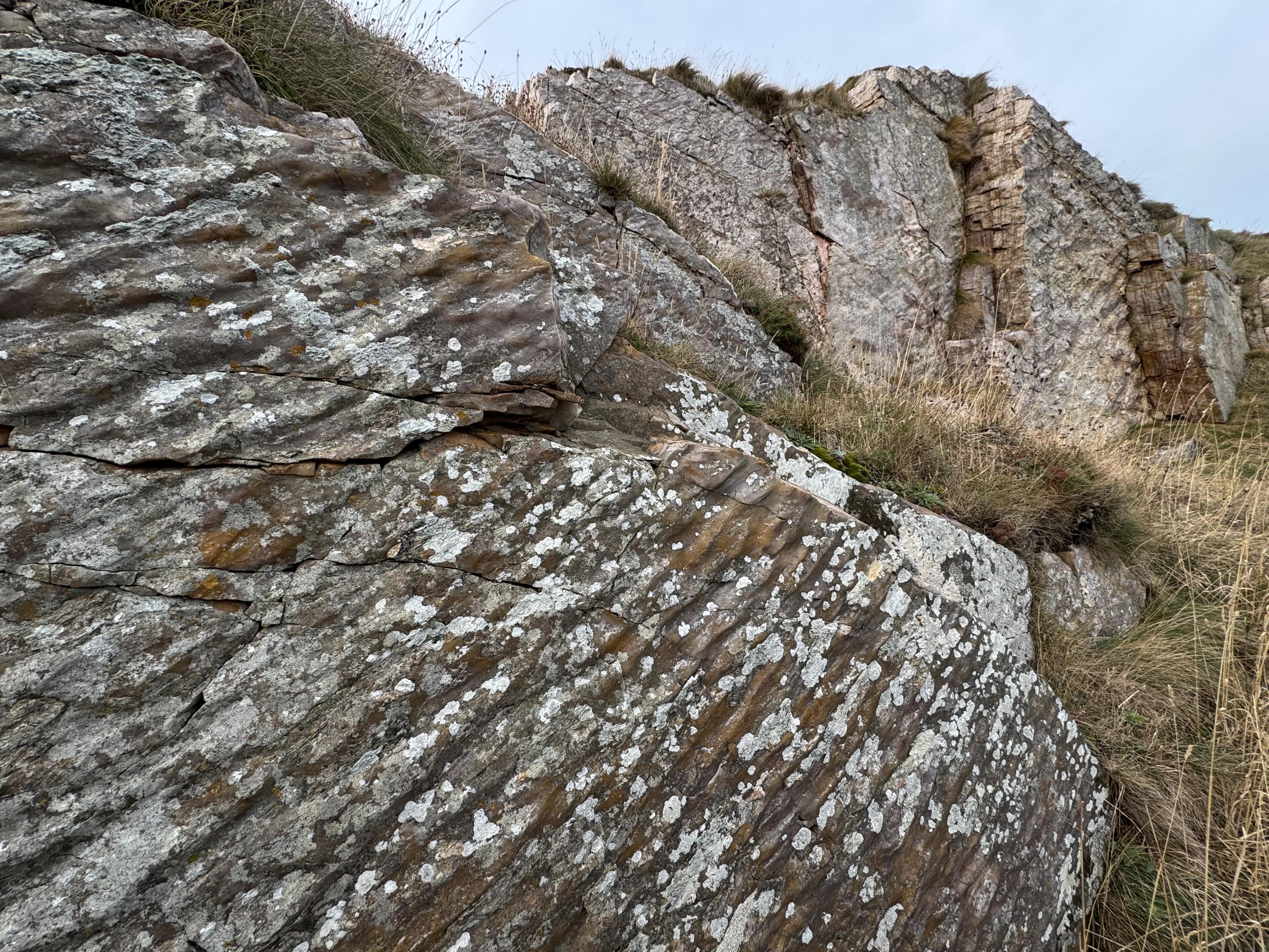
Wave rippled Cullen Quartzite at approach to Findlater Castle. Dip to the south. Beds in the distance also display wave rippled bedding planes.
Dave Longstaff
Dec. 11, 2024
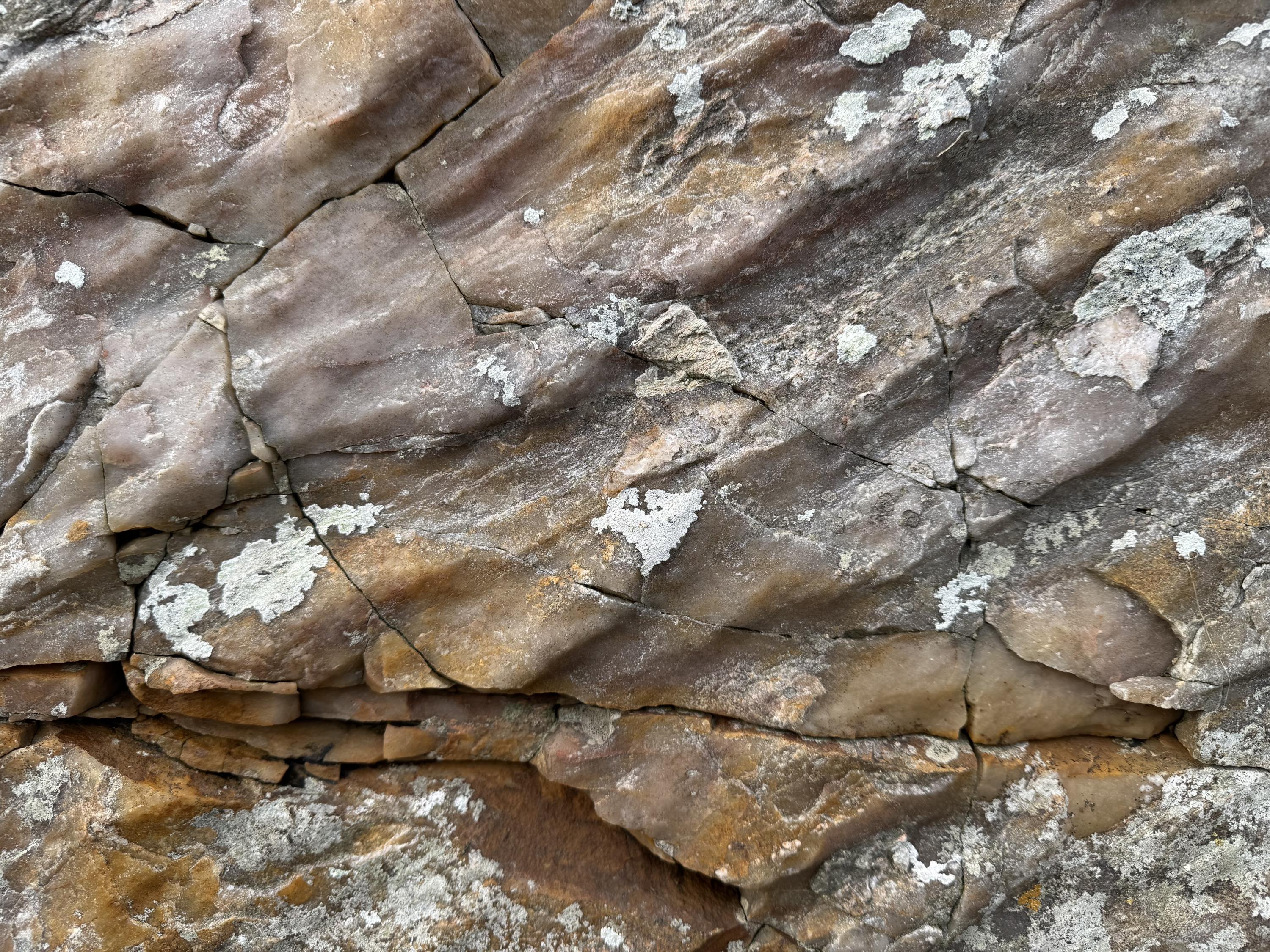
Close up of wave rippled bed of Cullen Quartzite.
Dave Longstaff
Dec. 11, 2024
Close up photograph of Findlater Flags by the path leading to Findlater Castle. Hard to tell if beds are inverted or not but from neareby exposures beds probably dip to the SE. Access to exposures from Cullen to Sunniside Bay are alongside a very popular coastal path. This exposure and those by Findlater Castle, just east of Sunniside Bay, are in extremely exposed locations with steep, narrow unsafe paths and steep drops all around. Findlater Castle, great geology, dangerous location!
Dave Longstaff
Dec. 11, 2024
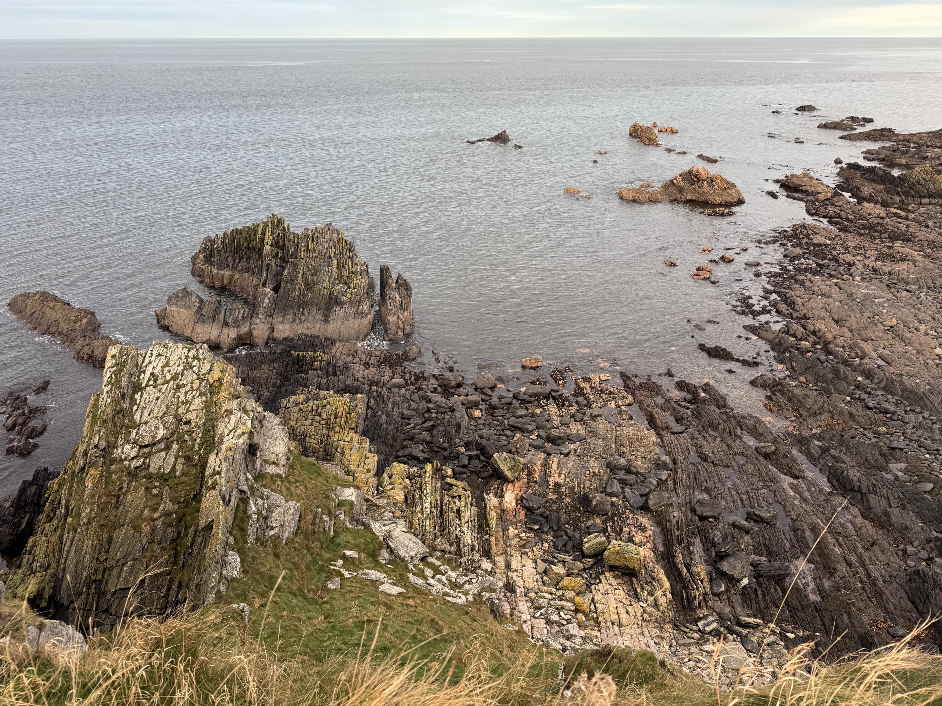
View from Findlater Castle looking east at steeply dipping Cullen Quartzite in near distance and Findlater Flags further east..
Dave Longstaff
Dec. 11, 2024
Tarlair - folded turbidies of the Southern Highland Group.
Rob Butler
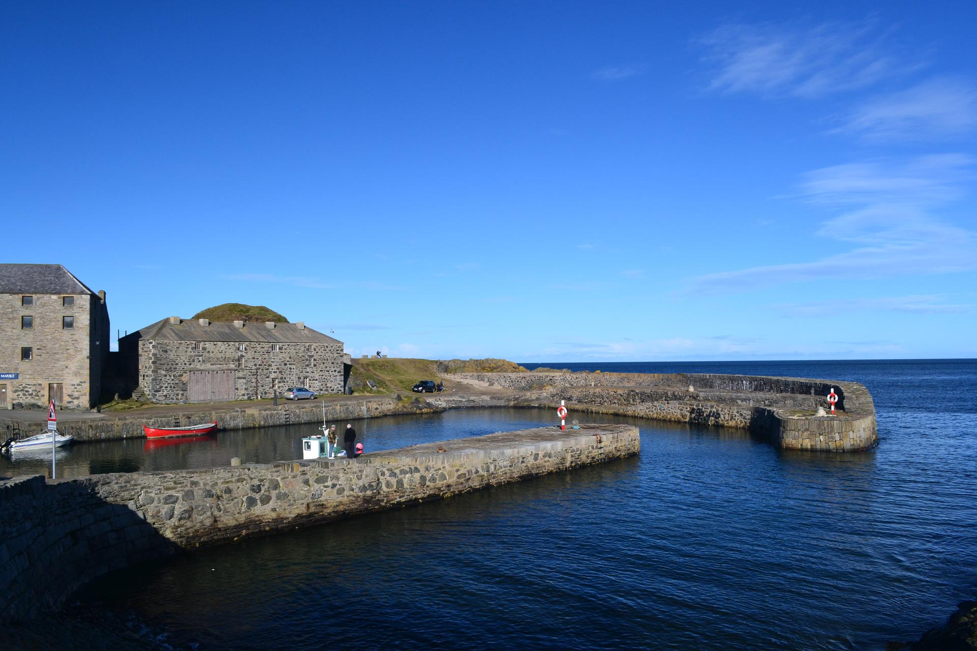
Portsoy harbour, at the heart of the coastal section.
Rob Butler