Durness
Geological Conservation Review site | GCR #1009 | Stratigraphy | Cambrian - Tremadoc
Geological Conservation Review site | GCR #1009 | Stratigraphy | Cambrian - Tremadoc
Scotland's geosites are chosen because of their local, national or international importance. Take only photos, leave only footprints: avoid causing any damage to this site. You can walk almost anywhere in Scotland without the need to ask permission or keep to paths, but you have a responsibility to care for your own safety, to respect people's privacy and peace of mind and to cause no damage.
This site is a Site of Special Scientific Interest (SSSI). It is an offence to intentionally or recklessly damage the protected natural features of a SSSI, and this includes unauthorised sample collection.
The right of access does not extend to quarries, building sites or any land where public access is prohibited, or to the collection of geological samples.
An important locality for Cambro-Ordovician stratigraphy and paleoenvironments
This extensive site covers parts of the shore of the Kyle of Durness, Balnakeil Bay and the area to the south and east of Durness. The sequence ranges from the unconformity at the base of the False- bedded Quartzite to the lower formations of the calcareous Durness Group, this being the type area for the Group. A Cambrian age for beds up to the top of the Eilean Dubh Formation is generally accepted, the overlying Sailmhor and Sangomore formations possibly being of Tremadoc age. The facies of both the arenaceous and the calcareous units have been the subject of much study. The close affinity of these carbonate rocks with those of Greenland and Spitzbergen has long been recognised; the sequence having been deposited on the opposite side of the Iapetus Ocean from the Cambrian sequences of Wales and England. Fissuring and erosion at the top of the Sailmhor Formation and new fossil discoveries have led to recent interpretations of the stratigraphy, which have wider implications in the correlation of these rocks with those elsewhere, and in the understanding of the palaeogeography of the region in Cambro-Ordovician times. A key stratigraphical locality with international implications for its bearing on continental drift and correlations.
https://largeimages.bgs.ac.uk/iip/mapsportal.html?id=1002509
Link to BGS 1:50k map of Loch Eriboll area, 2002.
https://earthwise.bgs.ac.uk/index.php/Loch_Borralie,_Smoo_C…
Link to Northwest Highlands excursion guide to Durness area.
Excursion 14B from: Goodenough, Kathryn M. and Krabbendam, Maartin (Editors) A geological excursion guide to the North-west Highlands of Scotland. Edinburgh : Edinburgh Geological Society in association with NMS Enterprises Limited, 2011.
There are no access notes yet.
There are no safety notes yet.
There are no site highlights yet.
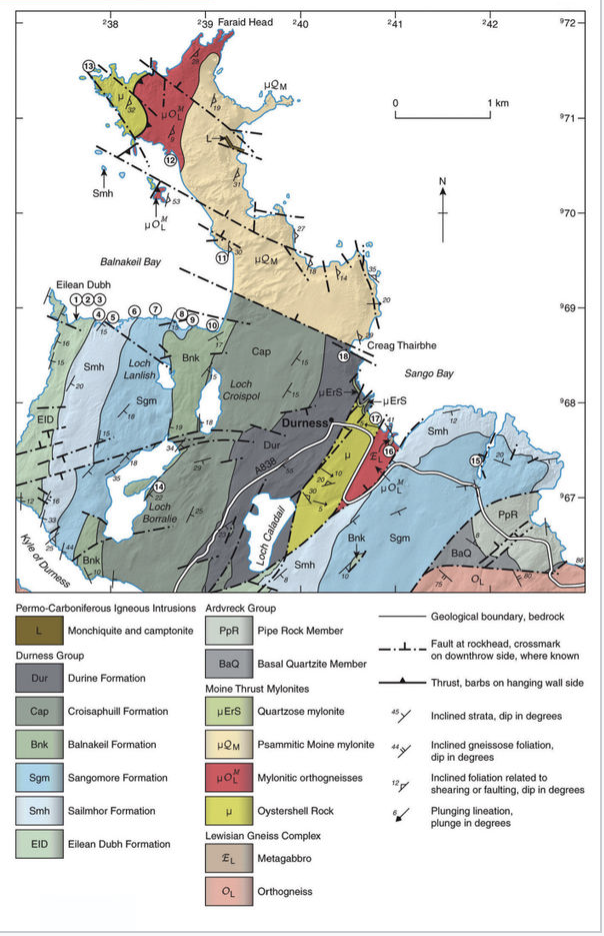
Locality map from Goodenough et. al 2011 excursion guide; map is based on BGS 1:50k solid geology sheet 114W, 2002 (link below).
Con Gillen
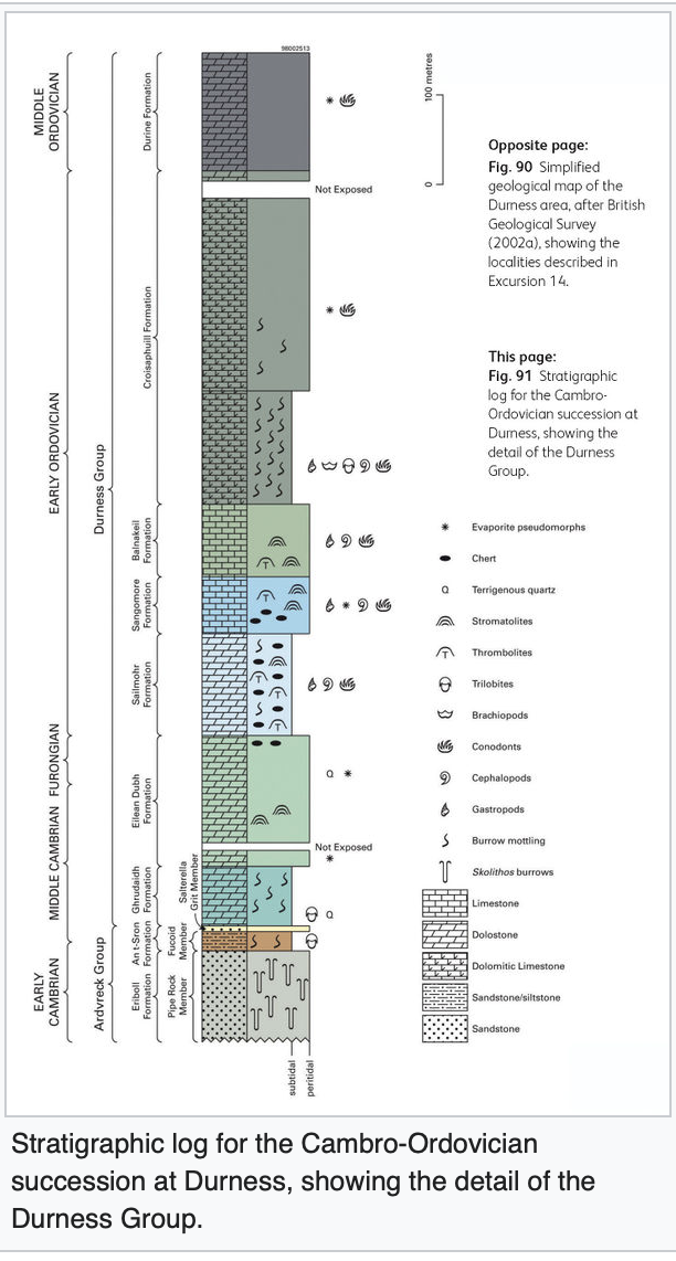
Stratigraphic section for succession at Durness, from Goodenough et al. 2011 excursion guide.
Con Gillen
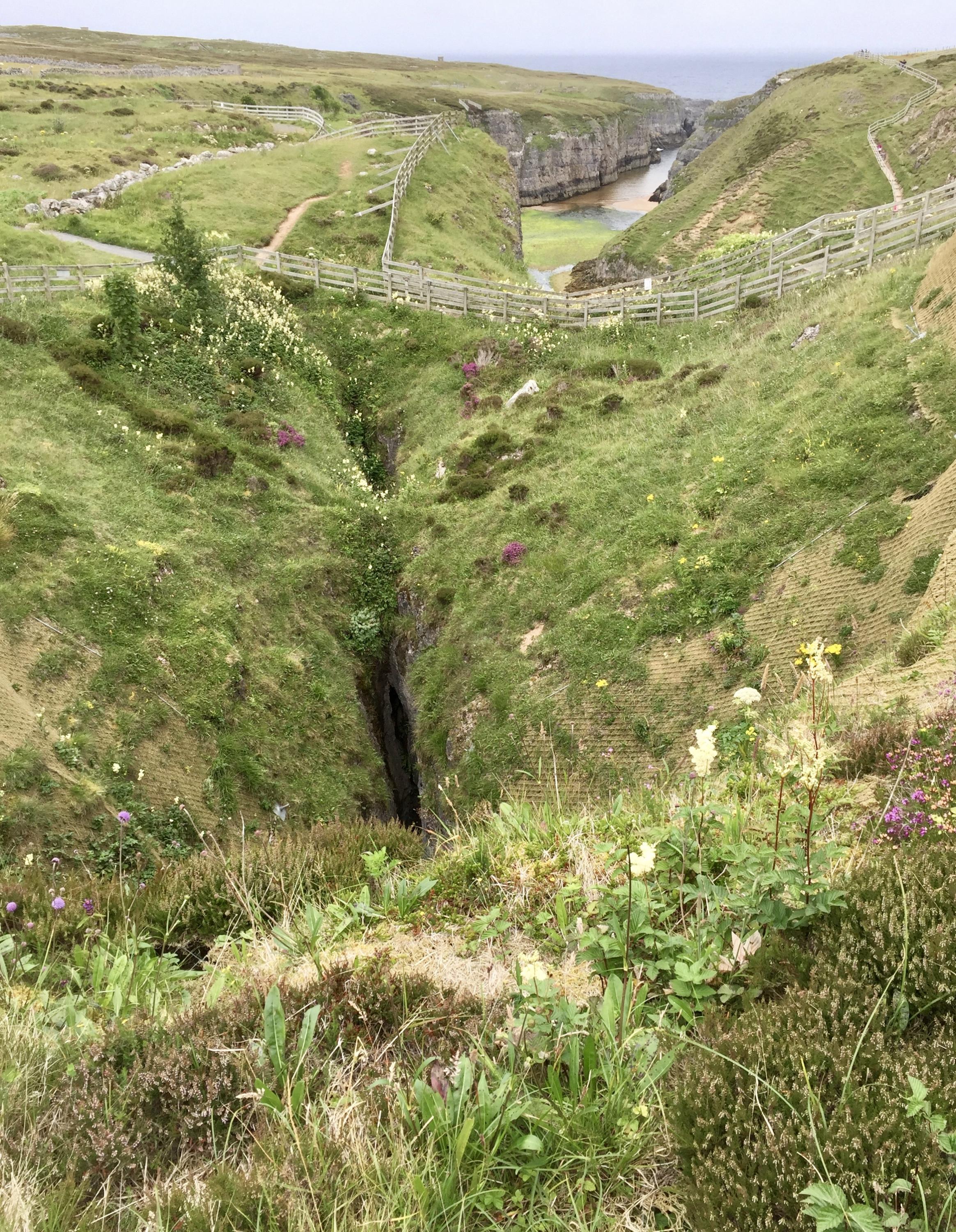
Swallow hole above Smoo Cave, Durness.
Con Gillen
July 23, 2017
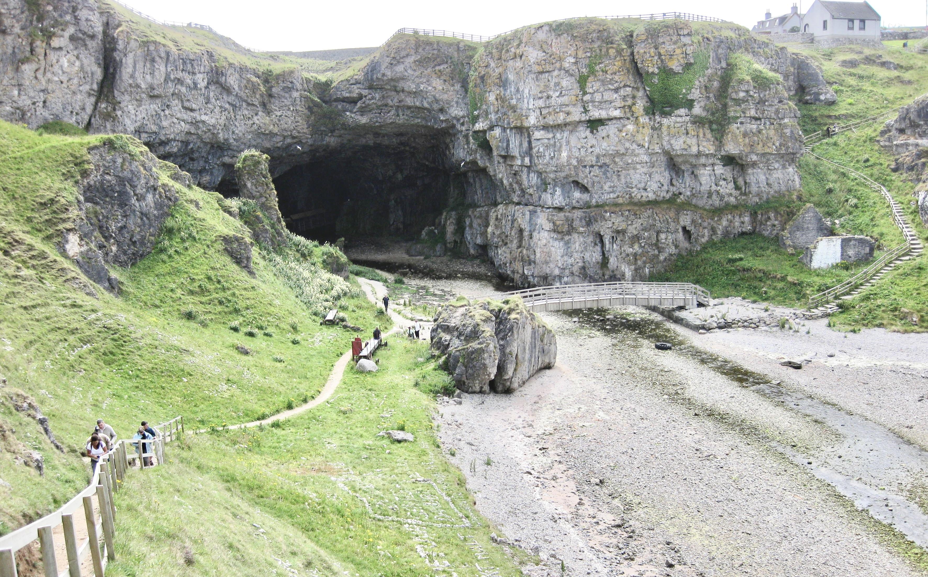
Entrance to Smoo Cave, Durness, showing Durness Group carbonates.
Con Gillen
July 12, 2009
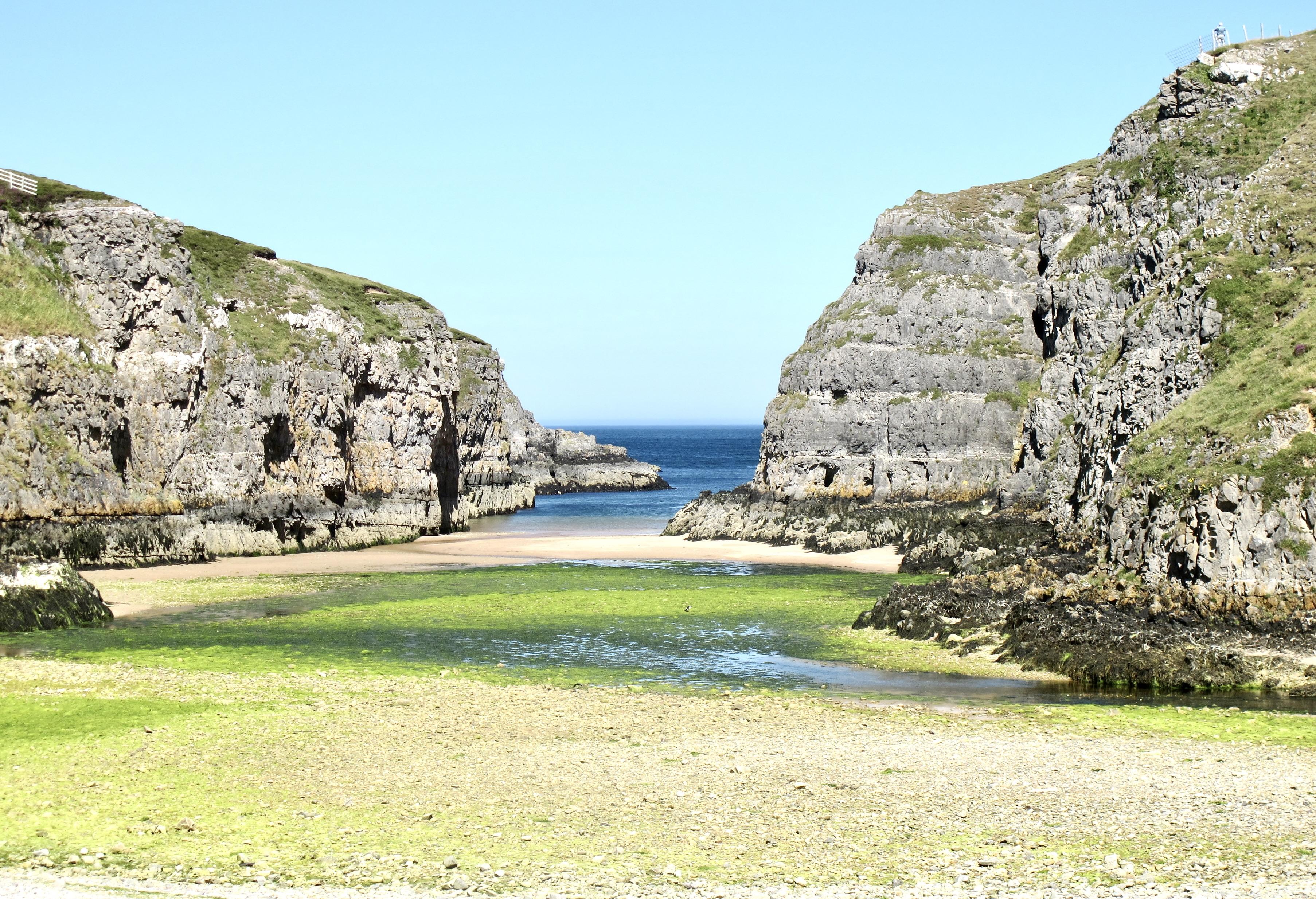
Durness Limestone, looking out from entrance to Smoo Cave. Sailmhor Formation overlain by Sangomore Formation.
Con Gillen
July 20, 2013
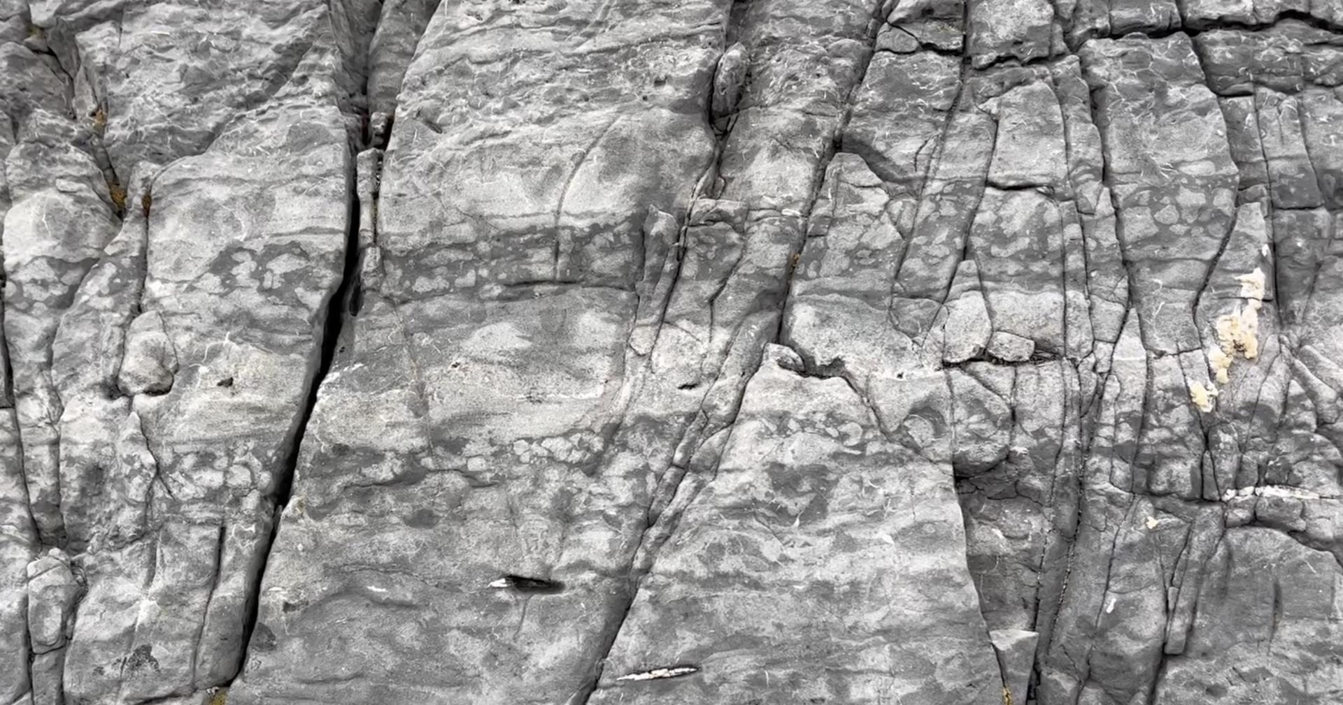
Chert nodules in Durness Group carbonate beds. Balnakiel Bay.
Con Gillen
Sept. 22, 2023
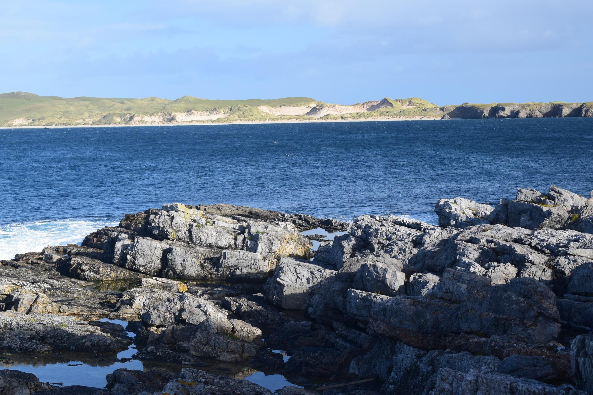
looking across the outcrops on the south side of Balnakeil Bay.
Rob Butler
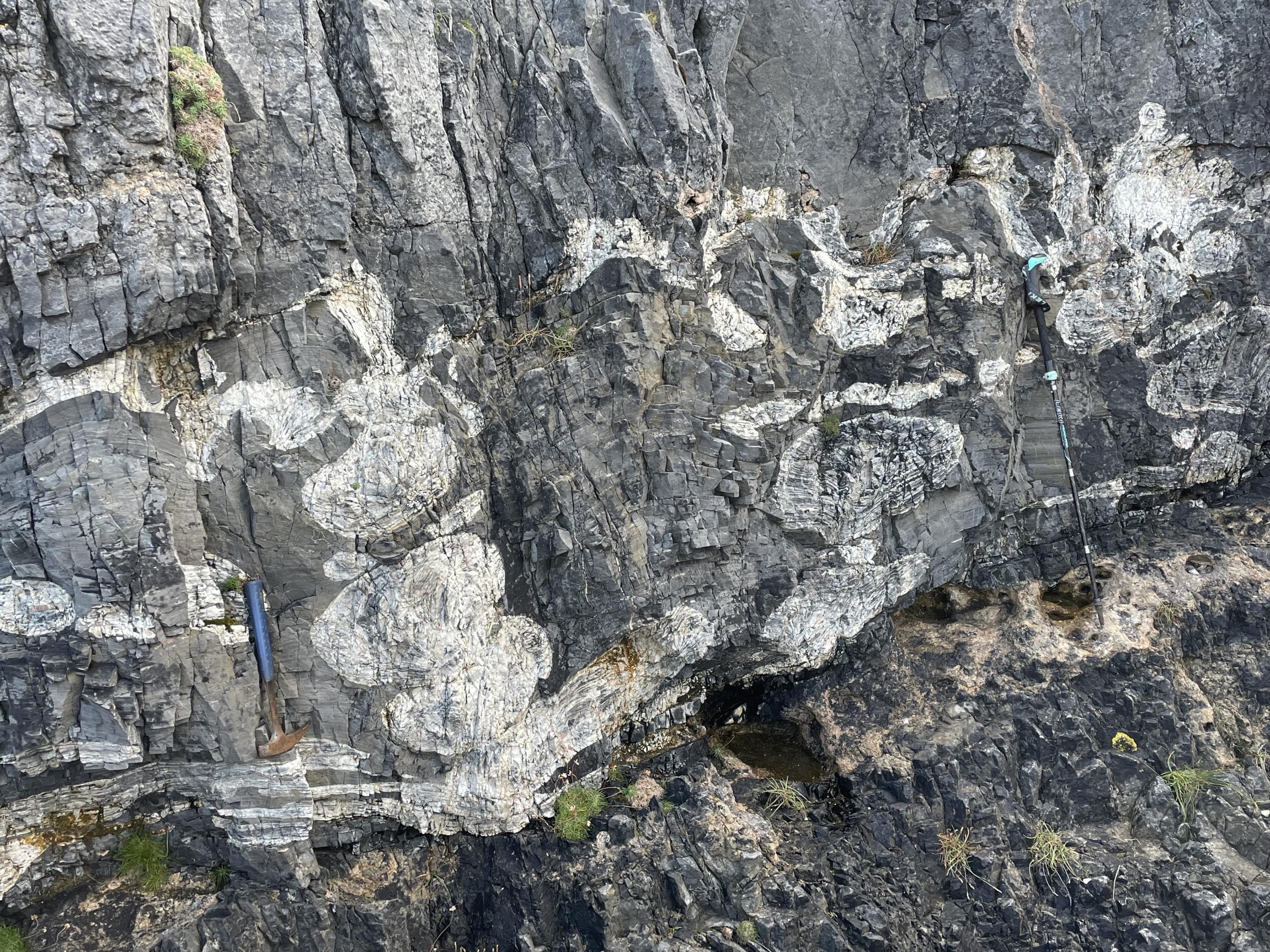
Tiers of burrows in the Sailmhor Formation at Smoo.
Rob Butler